


- News/Site Updates
- Wave Information
- Locations
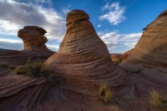
- Coyote Buttes Area
- Grand Staircase Escalante NM / Kanab
- Buckskin Gulch
- Cedar Wash Arch
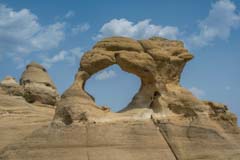
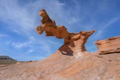
- Cobra Arch
- Collet Top Arch
- Coral Pink Sand Dunes
- Dance Hall Rock
- Edmaier's Secret
- Flag Point Track Site
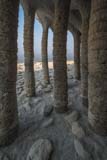
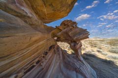
- Great Chamber
- Horizon Arch
- Inchworm Arch
- Narnia Slot Canyon
- Paria Movie Set
- Paria River
- Red Canyon
- Red Cave
- Sunset Arch
- The Nautilus
- The Rimrocks
- Twentymile Tracksite
- Wahweap Creek
- West Clark Bench
- White Rocks
- Yellow Rock
- Northern Arizona / Southern Utah
- Adeii Eichii Cliffs
- Alstrom Point
- Antelope Canyon
- Blue Canyon
- Coal Mine Canyon
- Eggshell Arch
- Grafton Ghost Town
- Grand Falls
- Horseshoe Bend
- Lake Powell
- Lees Ferry
- Little Colorado River
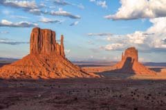
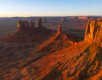
- Monument Valley
- Other Page Slot Canyons
- Page Balloon Regatta
- Paria Overlook
- Petrified Forest
- Sedona
- Studhorse Point
- The Confluence
- The New Wave
- Tuba City Tracksite
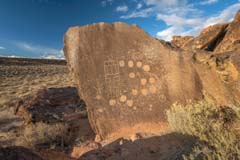
- Tutuveni Petroglyphs
- Two Guns
- Waterholes Canyon
- White Mesa Arch
- Wupatki NM
- Yant Flat
- Zion NP
- Other Southwest
- Ah-shi-sle-pah
- Arches NP
- Aztec NM
- Bisti Badlands
- Bryce Canyon
- Buffington Pockets
- Canyonlands NP
- Capitol Reef
- Eastern Arizona Badlands
- Hanksville Area
- Hope Arch
- Lake Mead NRA
- Little Finland
- Nelson Ghost Town
- Pedestal Alley
- Recapture Pockets
- Round Rock
- Royal Arch
- Saguaro NP
- Shiprock
- Southeast Arizona
- Southeast Nevada
- Southeast Utah
- Tucson
- Valley of Fire
- Vulture City
- Western Arizona
- White Sands NM
- Other US
- Alabama Hills
- Ancient Bristlecone Pine Forest
- Badlands NP
- Bishop, Area Petroglyphs
- Bodie, CA
- Cerro Gordo Mines
- Charleston, SC
- City of Rocks
- Crowley Lake
- Death Valley NP
- Denali NP
- Devils Tower
- Dinosaur NM
- Eastern Sierras
- Fantasy Canyon
- Grand Teton NP
- Joshua Tree NP
- Mono Lake NP
- Montana Ghost Towns
- Northern Alaska
- Northern California
- Oregon
- Rhyolite, NV
- The Palouse
- Theodore Roosevelt NP
- Thousand Springs
- Vermont
- Yellowstone
- Yosemite
- International
- Maps
- Using the Maps
- Coyote Buttes Area
- Grand Staircase Escalante NM / Kanab
- Buckskin Gulch
- Cedar Wash Arch
- Cobra Arch
- Collet Top Arch
- Coral Pink Sand Dunes
- Dance Hall Rock
- Edmaier's Secret
- Flag Point Track Site
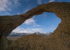
- Horizon Arch
- Inchworm Arch
- Paria Movie Set
- Paria River
- Red Canyon
- Red Cave
- Sunset Arch
- The Nautilus
- The Rimrocks
- Twentymile Tracksite
- Wahweap Creek
- West Clark Bench
- White Rocks
- Yellow Rock
- Northern Arizona / Southern Utah
- Adeii Eichii Cliffs
- Alstrom Point
- Antelope Canyon
- Blue Canyon
- Coal Mine Canyon
- Grafton Ghost Town
- Horseshoe Bend
- Lake Powell
- Lees Ferry
- Little Colorado River
- Monument Valley
- Other Page Slot Canyons
- Paria Overlook
- Petrified Forest
- Sedona
- Studhorse Point
- The Confluence
- The New Wave
- Tuba City Tracksite
- Tutuveni Petroglyphs
- Two Guns
- Waterholes Canyon
- White Mesa Arch
- Wupatki NM
- Yant Flat
- Zion NP
- Other Southwest
- Ah-shi-sle-pah
- Arches NP
- Aztec NM
- Bisti Badlands
- Bryce Canyon
- Buffington Pockets
- Canyonlands NP
- Capitol Reef
- Hanksville Area
- Hope Arch
- Lake Mead NRA
- Little Finland
- Nelson Ghost Town
- Pedestal Alley
- Recapture Pocket
- Round Rock
- Royal Arch
- Saguaro NP
- Shiprock
- Southeast Arizona
- Southeast Utah
- Tucson
- Valley of Fire
- Valley of Fire
- White Sands NM
- Other US
- Alabama Hills
- Ancient Bristlecone Pine Forest
- Badlands NP
- Bodie, CA
- Cerro Gordo Mines
- Charleston, SC
- City of Rocks
- Crowley Lake
- Death Valley NP
- Denali NP
- Devils Tower
- Dinosaur NM
- Fantasy Canyon
- Grand Teton NP
- Joshua Tree NP
- Mono Lake
- Montana Ghost Towns
- Northern California
- Oregon
- Rhyolite, NV
- The Palouse
- Theodore Roosevelt NP
- Thousand Springs
- Yellowstone
- Yosemite
- International
- Purchasing Prints
- Other
- About
Coyote Buttes and The Wave

A permit issued by the US Bureau of Land Management (BLM) is required to see The Wave. Only 64 people per day (48 permits granted three months in advance and 16 permits granted one day in advance) are allowed in the area, and demand far exceeds supply. During the most popular months (April, May, September, October), an estimated 300 people apply for the sixteen daily permits. In the other months, you usually have less than a 50% chance of getting one at the daily lottery. Your chances are better if you're going alone or in December - February.
A six-mile round trip hike is required to get to The Wave. Since there is no trail to The Wave, you should be able to use a map and compass or GPS to help with navigation. The BLM provides a map with your permit and instructions on getting to The Wave, and a few cairns are on the way. Over the past five years, five people have died on the way to/from The Wave. If you are unsure about your navigation skills, I suggest you hike in with a guide or a friend who has these skills. Do not go alone. If you use a GPS, mark the Wirepass trailhead and other key points along the route. Stay with your party. Four of the five fatalities were heat-related, so if you go in the warmer months, bring plenty of water, at least four liters, and preferably more.
Permits
To visit The Wave, you need a permit for an area called Coyote Buttes North. You can obtain online permits and permit information from recreation.gov. At most 64 people, 16 groups are allowed into Coyote Buttes North, whichever comes first. Permits for 48 people, 12 groups maximum, are issued via an online lottery held three months in advance. Permits for another 16 people, four groups maximum, are awarded via an online lottery held two days in advance.
Advanced Permits
Advanced permits for Coyote Buttes North are difficult to obtain. Demand greatly exceeds supply. All Advanced Coyote Buttes North permits are awarded by lottery held on recreation.gov. The lottery opens up four months in advance of your trip date. You have the whole month to apply. For example, for a January 15 permit, you would open the Advanced Lottery page in September. The fee to enter the online lottery is $9 per group.
Wave permits are non-transferable except for up to three specific people you list when you apply for the lottery. These people are called "alternate permit holders." If you win a permit and your group is stopped by a ranger on the hike to The Wave, you or a listed alternate permit holder must be present with the group. If not, your group may be ticketed. Alternate permit holders must have an account on recreation.gov.
You may only apply once per month to the lottery. If you try to apply more than once at checkout, you will get the message, "You have excellent taste! However, you can only submit or be listed as an alternate permit holder on one lottery application or hold one active permit(s) reservation at a time." Note that if you list someone as an alternate permit holder, they also cannot apply for a permit that month. If several people are in your group, each can apply to the lottery separately, provided you do not list the other group members as alternate permit holders.
You can select up to three dates on each lottery application. The drawing is held the day following the close of the lottery (i.e., October 1 in our example). Shortly after the lottery closes, the BLM will notify you via email whether you were successful or not. If you do not receive a notification by the 2nd of the month, check your spam folder. If you still haven't received a notice, you likely mistyped your email address on the application. In this case, you should call the BLM at (435) 688-3200 or email them at blm_az_asdoweb@blm.gov for a status. If you win the lottery, you will have to pay an additional $7 per person fee for the North Coyote Buttes permit.
Coyote Buttes North Lottery Schedule
Apply between |
for a permit during |
January 1 - 31 |
May |
February 1 - 28 |
June |
March 1 - 31 |
July |
April 1- 30 |
August |
May 1 - 31 |
September |
June 1 - 30 |
October |
July 1 - 31 |
November |
August 1 - 31 |
December |
September 1 - 30 |
January |
October 1 - 31 |
February |
November 1 - 30 |
March |
December 1 - 31 |
April |
Daily permits
If you are unsuccessful in getting an "Advanced permit" for Coyote Buttes North and are in the Southern Utah / Northern Arizona area, consider getting a "Daily Permit." Daily permits are issued one day before you wish to hike to The Wave. You can apply for the daily lottery at https://www.recreation.gov/permits/4251909 two days in advance of your desired entry date. There is a $9 fee to try for a permit. You can only apply via your phone or connected mobile device (e.g., tablet). You cannot apply via a desktop computer. The GPS on your phone must be on. To apply, you must be within a "geofenced" area in Northern Arizona/Southern Utah. The area includes the towns of Kanab, Page, Big Water, Fredonia, Glendale, and Jacob Lake. You can download a full-resolution map of the geofenced area in a variety of geocoded formats below:
| GeoTiff - Avenza | KMZ - Google Earth | Rmap - Oruxmaps | SQLite - Locus | MBTiles - GaiaGPS | GeoPDF |
You can load this map onto your phone's GPS software to see whether you are in the geofenced area.
The procedure to apply for a daily permit is as follows:
- Applications for the Daily Lottery must be submitted from within the designated geofence according to the following schedule.
- Day 1 – Application: Apply between 6 AM and 6 PM two days ahead of the desired entry date on recreation.gov. Lottery results are sent out at 7:15 PM that evening. A window will open to accept winning lottery applications.
- Day 2 – Safety Briefing: Successful applicants must accept the permit, pay fees by 8 AM Utah time, and be onsite at a permit pickup location at 8:30 AM local time for a safety briefing. Local time may be different between pickup locations. During Daylight Savings, 9:30 in Utah is 8:30 in Arizona (except the Navajo Nation). There are two permit pickup locations, one in Page and one in Kanab. To pick up your permit in Kanab, go to The Kanab Center, 20 N 100 E, Kanab, UT 84741. To pick up your permit in Page, go to Page-Lake Powell HUB, 48 S Lake Powell Blvd, Page, AZ 86040.
- Day 3 – Permit date: Permit-holders have the day to explore Coyote Buttes North.
The new "Daily Permit" system is more user-friendly than the old walk-in lottery. You no longer need to be present in Kanab at 9:00 AM the day before you wish to hike to The Wave. You only need to be in the general area of Page and Kanab. You can go out for an early morning photoshoot or sleep-in if you wish. One downside is the $9 per group fee to enter the lottery. The old walk-in lottery was free.
Additional information about permits can be found on Coyote Buttes permits webpage.
When to Go / Climate
December - February
It is "relatively" easy to get permits in December, January, and early February, especially through the walk-in process. Permits are hard to get around the Christmas and New Year holidays, so avoid these times. There may be snow on the ground in the winter months. Snow makes hiking difficult, and photographing the patterns in the red rock chancy. If there is snow, you may be limited to shooting southern exposures such as The Boneyard and Sand Cove. Average cloud cover is also high in winter, and House Rock Road is often muddy and difficult or impossible to drive on. The South Buttes are even higher in elevation than the Wave, about 6,200 feet, or four degrees cooler. This makes snow even more likely in the South Buttes and will last longer. I have been to Cottonwood Cove when the north-facing exposures had over a foot of snow on them.
March - May
These are good months to visit, especially April and May when cloud cover is low and temperatures moderate. Getting a permit is very difficult. Wind speeds are highest in the Southwest in the Spring. The wind comes from the southwest in this area all year round, peaking in the afternoon. Sand Cove runs North-South and forms a natural wind tunnel. The high winds make good photography of Sand Cove and The Boneyard difficult in the Spring. Average cloud cover is low during May.
June
June is an excellent month to go to The Wave if you don't mind the heat. Cloud cover is low, as is precipitation. June is the best month for night photography as the Milky Way stretches across the sky.
July - August
I used to believe these were the worst months to go to The Wave. I now believe they are reasonably good if you are prepared and can stand the heat. The average daily high temperature at the Wave is 101° F in July, and there is little shade. If you go in July, do not plan to be out all day. Either go in the morning when temperatures and cloud cover are lower or go in mid-afternoon if the weather looks cooperative. In 2013, there were three heat-related fatalities at the Wave, and there was another heat-related death in 2018. Go prepared. If you plan to stay the whole day, you must find shade. A space blanket can help; you must elevate it with hiking sticks, rocks, bushes, etc. A good place to find natural shade is on Toprock at the Alcove. Finally bring at least one gallon of water per person in July and August. You will need it. I have seen recommendations of nine liters per person per day when temperatures are this high! Keep water inside your pack so it stays cooler, and bring some of it as ice. When freezing water in a bottle, leave some room for expansion. Water expands by nine percent when freezing. There is a good possibility of afternoon thunderstorms or even hail. Mornings are cooler, often clear, and have little wind. You can likely get a good photograph in the morning, and if the weather cooperates, you may get a great one in the afternoon! With luck, there will be water at the Wave or in the water pockets south of The Wave. However, water pockets won't last long, given the average July-August temperatures. If there are water pockets, look for tadpoles and fairy shrimp. If there's a lot of water, you may even hear toads croaking! (males calling for females). Though still difficult, permits are easier to get than during peak months.
September - November
Excellent months for visiting. Page and Kanab are less crowded than during summer vacation, and cloud cover and temperatures are reasonable. Permits are very difficult to get. The rest of the Southwest is also beautiful at this time of year, with the Aspens changing in late September/early October and the Cottonwoods in late October.
A good source of climate information based on the Page airport data can be found at Weatherspark.com.
Getting to The Wave
There are two entry points to Coyote Buttes North, Wirepass Trailhead (WP) and The Notch. The Notch is no longer actively publicized by the BLM. The trail from the Notch is poorly defined. I strongly recommend access from the Wirepass parking lot. To get to the Wirepass trailhead, take Highway 89 to House Rock Road. The House Rock Road turnoff is between mileposts 25 and 26 on Highway 89 in Utah. House Rock Road is normally passable by passenger cars. Do not take this road if it is wet. It is clay-based and impassable even to 4WD vehicles when wet. When the road is muddy, it is like driving on ice, and there are drop-offs. When dry, take House Rock Road 8.4 miles to the WP parking area on the right. You can dry camp at the Wirepass trailhead, and a toilet is present. Better camping with fire pits, tables, and pit toilets is available at the Stateline Campground, one mile south, just off House Rock Road.
Begin your hike to the Wave by signing the trailhead register and crossing House Rock Road. Follow the well-defined trail east for fifty yards until you enter the wash. Wirepass wash feeds into Buckskin Gulch, the longest slot canyon in North America. Continue walking down the wash. About .55 miles from the trailhead, you will see a sign marked Coyote Buttes on the right. Turn right and follow the good trail up the hill and across the sage field. At the end of the field, you will cross a wash. This wash also flows into the Wirepass slot canyon one-half mile downstream. The total distance across the sage field to the wash is about .65 miles. After crossing the wash, hike up the slickrock to a sometimes cairned saddle. If you have a GPS, mark this location. You are now in the permit area. From here, there may or may not be cairns, which may or may not be accurate. There are a small number of BLM signposts in the area at critical locations; one can be seen about 50 yards east of the saddle. Note its location. On your return this marker will tell you where to turn to the west. From the saddle, proceed south; after .35 miles you will see a twin butte with a downed barbed wire fence with a gate on its left (east) side. Either go through the gate (easy but slightly exposed) or walk around the buttes via their west side. Continue heading almost due south, aiming for the crack in the cliffs to the south. After another .8 miles, you will cross another small wash, continue heading towards the crack in the Wall, and go up the sand dune. Unless it was very windy overnight, there should be a clear trail up the dune. You will shortly arrive at The Wave. It is about 2.8 miles in total from the WP trailhead to The Wave.
Returning to the trailhead
It is fairly easy to get back to your car, even at dusk. The small signposts installed by the BLM will glow in the dark if a flashlight shines on them. When you return, avoid crossing the ridge too early after heading north. Look for the signpost referenced above; it will tell you when to turn to cross the ridge. It should be easy to cross over the small ridge; if not, you have turned west too early. Conversely, if you go too far north, you will end up in or overlooking Wirepass Slot Canyon. If so, turn around and try again. For an interesting story of someone who got lost on the return, see Trouble in Coyote Buttes. If you get lost or injured and need help, try to gain elevation. You may be able to get a cell signal. I have gotten service via Verizon and t-Mobile, and a friend via AT&T.
Your day at The Wave
Start at The Wave
So you've finally gotten a permit and want to use it best. There is a nice loop hike starting and ending at The Wave. It covers most of the best photo sites in Coyote Buttes North, and if you are willing to be out most of the day, you can hit all of them in good light. Being out all day is dangerous in the summer, so only do the loop from September through May. The loop does not include Top Rock. Unless you are a very strong hiker, save this for a second trip.
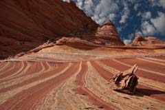
The first stop on the loop hike is The Wave. The Wave gets good light about an hour after sunrise; parts are in shadow before then. It takes about 90 minutes to hike from the Wirepass trailhead to The Wave. Most people start their hike very early in the day and leave when they run out of energy, often before best light. If you have the stamina to stay out ten hours or more or are hiking in summer, begin hiking at dawn; otherwise, I suggest you start your hike later. Do not start hiking too late, as shadows start to hit the south wall of The Wave before midday. After shooting The Wave, explore the area around it for an hour or two. There are usually some nice water pools 150 yards southeast of The Wave. Ginger Rock is a good subject mid-day. It can be found about 200 yards north of The Wave.
Best early morning

Best shot at mid-morning
Best late morning

Best in the afternoon
Dinosaur Tracks and The Boneyard
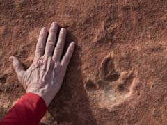
Leave The Wave by retracing your steps down the sand dune to the wash below. At the foot of the dune, turn west, cross the wash, and ascend to the area with the dinosaur tracks. The tracks are located in red stone, very close to the wall. If you are inexperienced in finding tracks, they can be hard to locate, even with GPS coordinates. The tracks are three-toed and hand-sized. They usually come in small clusters arranged in a line. I left a small circle of rocks around a pair of footprints about ten years ago; as of mid-2017, the circle was still there.
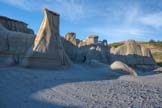
After visiting the dinosaur tracks, continue south about .3 miles till you reach an open area. Fifty yards to the west lies a small brown and yellow striped area with rocks that look like a tic-tac-toe board on the stripes. The area was named "The Boneyard" by photographer Michael Fatali. The loose rocks are called lace or box rocks. Please do not move them; they are fragile. Wait until the cliffs to the northwest of The Boneyard are in shadow before shooting; the dark background of the cliffs contrasts nicely with The Boneyard. Stay until the sun goes behind the cliffs to the west, and The Boneyard falls into shadow. The Boneyard is also very good at dawn; light hits it just after sunrise, with March and September being optimal times to shoot it at dawn.
Dinosaur Track
The Boneyard
Lace rock north of The Boneyard
Sand Cove
After leaving The Boneyard, head down the sandy wash which runs south-east. In .2 miles, turn south into Sand Cove Wash. Continue up Sand Cove Wash about 100 yards and hike up to the teepees to your east (left). This area contains beautiful sandstone curves and is called Sand Cove. Shoot until late afternoon before it goes into shadow. A wide-angle lens is needed. Sand Cove is largely in shadow in the morning. \
Sand Cove
Looking south from Sand Cove
The Second Wave
From Sand Cove, hike east-north-east and scramble up the cliff until you reach a flat area just before a much steeper cliff. The Second Wave is at the foot of this cliff. It is a great late afternoon location, but only fair the rest of the day. Shoot it from the small sand dune a few yards south or from the rocks to the southeast about ten feet above it. Make sure the cliffs to the west are in shadow. Shoot until the Second Wave goes into shadow. Leave earlier if you are concerned about hiking back to your car after sunset.
To return to the Wirepass parking lot, head north, passing back through The Wave. There should be many good photo-ops along the hike back, so wait to put your camera and tripod away. After leaving The Wave, head down the dune, cross the wash, and head north to retrace your steps to your car. "The Dive" and the North and South "Teepees" will be in good light on the way back. You will need a long lens to shoot them. If you hurry, you should be able to get back to your car 30-45 minutes after sunset. Warning - if you do not have good navigation skills or have a GPS and know how to use it, you should leave The Second Wave well before sunset.

Last light on The Second Wave
The Second Wave
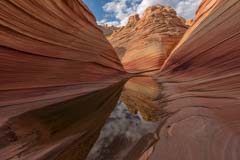
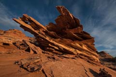
Photographing The Wave
About half of all visitors to Coyote Buttes North only explore a little beyond The Wave. This is especially true in the summer and winter when extreme temperatures, lightning, or snow cover tend to keep visits short. Given this, I've added some thoughts on photographing just The Wave. A gallery showing what I believe to be the classic images of The Wave is here.
The Wave opens up in three directions: to the north (the direction you came in on), to the east, and to the southwest. Each of these openings has a good photo associated with it. Below is a map showing the topography of The Wave.
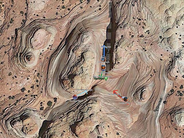
To view the map in Google Maps please click anywhere on the map above.
Permits to The Wave are so hard to get that I'd suggest you shoot from all three directions on your first trip. All can be shot in the morning in good light. In addition to these images, there are many other possibilities. See the main Wave gallery for more ideas.
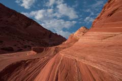
Facing West
This image is best mid-morning. By late morning, the wall on the left (the south wall) starts to go into shadow, especially in the winter. You'll need a wide or ultra-wide for best results. The image shown was shot at 14mm. The "Eye of The Wave" is shown on the right. It is a great example of soft-sediment deformation.
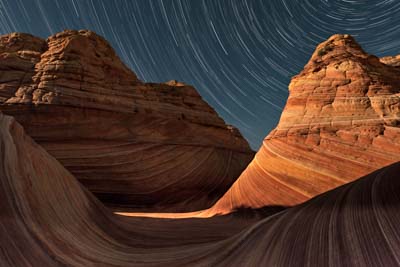
You can get great photos to the west at night, too. This image was taken at 24mm. The moon shining through the slot lit the center of The Wave and its north wall.
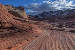
Facing South

This image is best about an hour after sunrise when the south wall is lit and the side walls are in shadow. A few hours later, the side walls are partially in light, and the image suffers. Water is often found at the entrance to The Wave, especially in summer. Only a little water is needed to get a good photo; even one inch will do. Shoot close to ground level to emphasize the little rocks in the water, with a wide angle to a normal lens. Both vertical and horizontal compositions work.
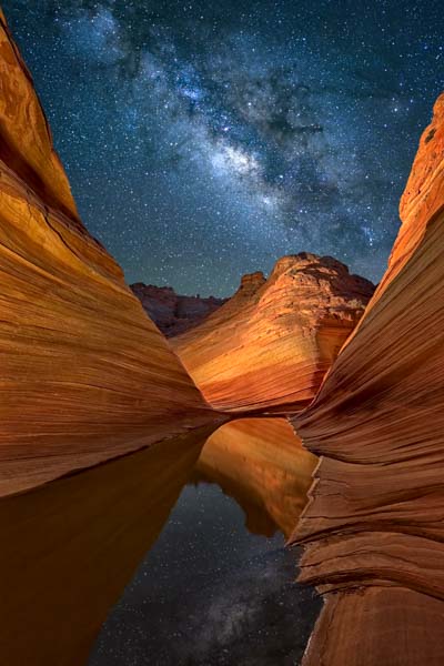
This is my favorite image of The Wave. It is best from May through August when the center of the Milky Way is in the southern sky. An LED panel lit the south wall, and the other two walls were light-painted with a warm-temperature flashlight.
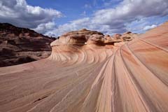
Facing North

This image shows the entrance to The Wave. It is best mid-day and in the afternoon when clouds are present.

This image was shot at dusk. A warm LED panel was used to light the walls. The image was shot at 14mm.
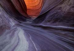
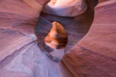
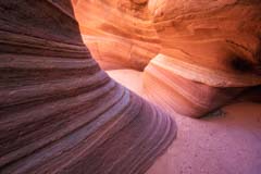
The Wave Slot Canyon
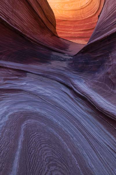
The last image is of a short slot canyon, which gets excellent reflected light in late morning. Watch your depth of field when shooting this. Before shooting, you may want to smooth out the sand in the slot using a cloth, jacket, or rain jacket. It is challenging to remove the footprints in this sand using Photoshop.

This image of the slot canyon wall shows a superb example of soft sediment deformation. This occurs during the early stages of sediment consolidation when the sediment is unsolidified or liquid-like.
Current Page, Arizona Weather
News and Site Updates
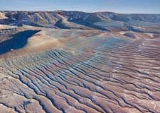

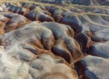
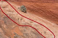
I've added many images of the blue badlands of Eastern Arizona. Eastern Arizona has many well-known badlands, such as those in Petrified Forest National Park, the Little Painted Desert, and the badlands near Round Rock. Some of these badlands, such as Blue Mesa in Petrified Forest National Park, have a blueish tint (i.e., blue-gray). Blue Mesa in Petrified Forest National Park features, among its diverse sedimentary layers, significant, vibrant, and bluish-colored mudstone, bentonite clay, and sandstone. The blue hue is a result of ancient, manganese- and iron-rich volcanic ash (bentonite) deposited during the Triassic period. The badlands I have shown are largely unknown and more difficult to access. They are largely blueish, covered in dried-up river and stream channels, and make excellent subjects for abstract landscape photography.

I've added many new locations around Hanksville, Utah to this site. Locations accessed from Goblin Valley and Wild Horse Road include aerial shots of spectacular Wild Horse Butte, the Wild Horse Window, and, further west, the photogenic badlands Near Muddy Creek. In the Labyrinth Canyon area, I've added aerial photos of Trin Alcove Bend and identified some other possible overlooks of the Green River. It's a long drive to Trin Alcove Bend and the other Green River overlooks so consider shooting Colonnade Arch while in the area. I've also added photos from the rarely seen northwest side of North Caineville Mesa, as well as more images of remote Painted Hills and the badlands along Cow Dung Road. The roads in the Painted Hills area (BLM Designated Routes 0157 and 1574) are strictly high-clearance 4x4 or ATV, have some washouts, and are very remote. You won't see anyone. A drone is needed to get the best perspective of these badlands. You can freely fly drones near Cow Dung Road and other areas south of Muddy Creek. Areas north of Muddy Creek are designated wilderness. If you wish to fly there, you must launch and operate your drone from Wild Horse Road. A drone permit is needed to fly within Goblin Valley State Park.
I've added images of the Mitten Henge, aerials of Stagecoach Butte, and photos of Goulding's Arch to the Monument Valley gallery. The Mitten Henge refers to the spectacular natural phenomenon in Monument Valley where, twice a year (around late March and mid-September), the setting sun aligns perfectly so the West Mitten Butte casts a distinct shadow onto the East Mitten Butte. I recommend shooting the Mitten Henge as a panorama, including Merrick Butte. A good place to shoot the panorama, including Merrick Buute, is from the main Monument Valley parking lot at 36.98331, -110.11185. The alignment occurs over several days; if the weather permits, choose the day when the shadow of the West Mitten is centered on the East Mitten, as close to sunset as possible. Alternatively, you can shoot just the two Mittens as shown to the right. The View Campground at 36.98645, -110.11392 is a good place to shoot from. It's about 0.25 miles between the two spots, so if you rush or drive, you can get both shots in one night. Photopills or The Photographers Ephemeris can be used to plan the shots.
I've updated the map of The Rimrocks to show my track from the Lower Rimrocks to the Upper Rimrocks. I've also updated The Rimrocks gallery to include new drone shots and some of the hoodoos I found during the hike.


I've added a gallery of images of Hope Arch and Round Rock Mesa. Hope Arch is 20 minutes west-northwest of Chinle, Arizona. If you're in the Canyon de Chelly area, you should definitely stop there. Hope is a stunning natural arch in an area comprised of towering red and yellow sandstone cliffs, buttes, spires, and fins. Composed of yellow De Chelly sandstone, its elegant shape makes it a top-ten arch. It's best at dawn and as foreground for the Milky Way. It's good at dusk. Round Rock Mesa is located in the Navajo Nation, twenty minutes north of Chinle. It's visible for many miles along US 191 and is an excellent aerial subject by plane. The chinle badlands surrounding the mesa make excellent foreground, and a large arch and several spires emanate from the mesa. It's good at both dawn and dusk. I've updated my Northeast Arizona map to include shooting recommendations and directions to both.


I've added images of some additional arches northeast of Aztec, New Mexico to this site. The Aztec sandstone's yellow, gold and tan colors complement the blue skies well. The arches are easily accessible via the numerous dirt roads and short hikes in the area. Two-wheel drive should suffice. There are partial social trails to Cox Canyon Arch, Arch Rock, and Rooftop Arch. The other arches I've shown are rarely visited and typically located within a half-mile off-trail hike from the parking area. You'll probably have these arches to yourself. The many gas wells seldom intrude on your images. Do not park on gas well property. If you smell hydrogen sulfide ("rotten eggs"), leave the area immediately. H2S can be deadly.
My favorite arches are Rooftop, Cox Canyon, Caballo Triple Arch, and Graceful Arch. You'll need a drone to get good shots of some of the other arches.
I've also updated the Aztec map to include directions to the arches.


I've updated the Tucson gallery with some images taken at Dano Grayson's ranch and pond near Elephant Head. Dano runs a bird and wildlife sanctuary and makes it available to other photographers on a fee basis. He provides hides and flash setups and waters and feeds the birds and bats in the area. This makes photography relatively easy. He also leads tours in the area. I highly recommend the Pond at Elephant Head if you're a bird photographer or need a break from shooting landscapes. For more information see https://www.instagram.com/danograyson/.


I've updated The Bisti Badlands and Ah-Shi-Sle-Pah galleries with new images and locations. The Bisti gallery now includes the Egg Garden, a photogenic location near its western border. The Egg garden is accessible via an off-trail hike of .25 miles. On the hike, you'll also pass the unique Double-Headed Hoodoo. The Bisti Badlands map has been updated to include these locations as well.
The Ah-Shi-Sle-Pah map has been updated to reflect the closure of the road to Valley of Dreams East. Best access to the Valley of Dreams and the Alien Throne is now from the original trailhead at 36.13394, -107.97179. The Alien Throne is NNW two off-trail miles from the trailhead. You'll pass some nice hoodoos, including the Three Wise Men, the Mushroom Seat, and Hourglass Hoodoo. The Three Wise Men are good foreground for the Milky Way. I also added locations and images of several hoodoos to the Ah-Shi-Sle-Pah map. The Yellow Gang Hoodoos are exceptionally photogenic and should be seen.


I've added images from two areas of northern Italy to this site. Venice's labyrinth of canals, narrow streets, and historic churches make it one of the most popular photographic destinations in the world. We shot in the early morning to avoid crowds, starting a few hours before sunrise when the streets were empty except for street cleaners, delivery boats, and barges. Favorite locations in Venice include the Rialto Bridge, Ponte dell' Accademia, Saint Mark's Square, and San Zaccaria Church. We used exposure times of 30 seconds or more to smooth the water in the canals and to add drama to the skies.
The Dolomites, a stunning mountain range in northern Italy, are renowned for their dramatic peaks, rugged cliffs, and breathtaking landscapes. Part of the Southern Alps, they are a UNESCO World Heritage Site. Favorite locations include the Seceda Ridgeline, Church of San Giovanni, St. Magdalene Church, The Alpe Siusi, Lake Federa, and Tre Cime. Mid-October is a good time to visit the Dolomites. The larch trees typically change color in mid to late October. The exact timing can vary slightly depending on the weather and altitude, but this vibrant transformation usually starts in early October, especially at higher elevations. Crowds will be minimal. There were some downsides of traveling then. Many services, such as restaurants, cable cars, gas stations, and refugios, will be closed. Since cable cars are closed, getting to some locations involves long road hikes or hiring a mountain taxi. There's also a significant chance of early snow closing trails or making them treacherous.


I've added images from and maps of two ghost towns in the southwest. Both are near major airports and are much more convenient to visit than the most famous US ghost town in Bodie, California. Nelson ghost town is 40 minutes from the Las Vegas Airport. Vulture City ghost town is an hour and 15 minutes from the Phoenix International Airport, or just 20 minutes from the town of Wickenburg in Arizona. Both ghost towns were formerly gold mining towns. Vulture City is still being mined. My map of Vulture City contains the locations of all the significant buildings in the town and is probably the only map on the web which shows them.
The BLM has proposed increasing fees at The Wave, Coyote Buttes South, Paria Canyon, and adding a fee for visits to The White Pocket. More information can be found at the BLM Press Release site.
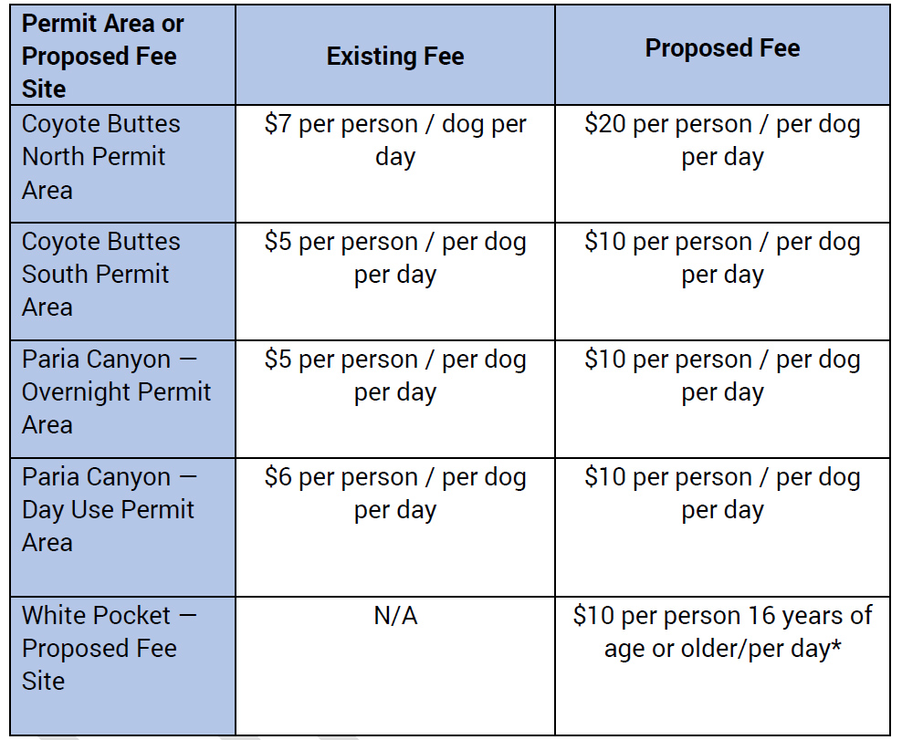
Current and Proposed Fees

Grand Falls in northern Arizona is a testament to nature's raw beauty. Aptly nicknamed Chocolate Falls due to its rich, brownish hue caused by sedimentation, this natural wonder captivates visitors with its striking appearance. Carved out by the Little Colorado River, Grand Falls cascades over a series of rocky ledges, creating a breathtaking spectacle.
In March of last year, it was widely reported that the falls were closed until further notice. Though not widely reported, last August the Leupp Chapter of the Navajo Nation passed a resolution making this closure permanent. In light of this, the Leupp Chapter recently asked that I remove travel directions to the falls, and I have done so.
Once again, the actions of a few have ruined it for the many.
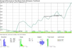
I've added trail profiles to many of the maps on this website. Trail profiles are graphical representations of the elevation changes along a hiking, biking, or running trail. These profiles help users understand the terrain and difficulty of the trail by providing information about elevation gain, loss, and overall topography. Here's a general breakdown of key components often found in trail profiles:
- Elevation Axis: The vertical axis on the graph represents the elevation in feet or meters above sea level. This axis visually depicts how the trail's elevation changes over its length.
- Distance Axis: The horizontal axis shows the distance along the trail, usually measured in miles or kilometers.
- Trail Path: The line or curve on the graph represents the actual path of the trail. Peaks and valleys in this line indicate elevation changes.
- Markers: Trail profiles include markers or annotations highlighting key points such as trailheads, turnoffs, scenic viewpoints, water sources, or campsites.
- Gradient Indicators: Some profiles use shading or color to indicate the trail's steepness. On the profiles I've provided steeper sections are highlighted in dark green, yellow, or orange to warn users of challenging terrain.
- Elevation Gain/Loss: Trail profiles often include numerical values for total elevation gain and loss. This information helps hikers and other outdoor enthusiasts assess the trail's difficulty.
Trail profiles can be used to estimate the calories burned while hiking. A good calorie calculator can be found at omnicalculator.com. Here's an example of how to use the calculator for an out-and-back trail like that to The Wave (profile shown above). I've assumed a 170-pound man with a 15-pound backpack in the example. Consider the trail as two pieces: an out piece and a back piece. For the out segment, the profile above shows the one-way distance is 2.7 miles, and the total elevation gain is 607 feet. From this data, omnicalculator computes the average grade (elevation change/distance = 4.3%) and the total calories burned (394). For the return piece, only the elevation gain changes; it is now 279 feet. Calories burned on the return are 334. The total calories burned during the hike are 728 calories. Note that when entering the elevation change, you enter the sum of the uphills over the trail and do not count downhills. Hiking uphill burns considerably more calories than hiking on a flat trail (gaining 500 feet of vertical elevation is nearly equal to hiking a mile). There is almost no savings in calories when hiking downhill. Oxygen intake studies done on treadmills show only six percent fewer calories are used on downhill trails than on level ones.

19-year-old Jonathan Fielding fell to his death at Moonscape Overlook after the sandstone he was standing on gave way. Jonathan's sister Rebecca wrote on Facebook, "It was a tragic accident, but Jonathan should be a cautionary tale to anyone who hikes or does photography.
Never trust the ground on the edge of a cliff. The rocks may look solid, and the ground might seem like it will hold, but it's still an eroding, ticking time bomb. All it takes is one wrong step to dislodge rocks, one moment of unbalance, a trip over a rock, and you can plummet to your death. No view is worth your life. No view is worth the suffering that your family and friends will go through. No view is worth the risk that rescuers face when trying to save people and recover bodies."
In an article on rockmont.com, Michael Murphy discusses safety near cliff edges. "In the exam for the American Mountain Guides Association Single Pitch Instructor certification, you are docked points for being too close to a cliff's edge without some sort of tether — and we're the professionals. On a flat ledge (no slope), you can be one (1) body length away from the edge without losing points on your exam. On a sloping ledge, you have to be at least two (2) body lengths away from the edge to be considered safe during the exam. And this is while we're in technical climbing shoes, wearing harnesses, and being cautious because of our proximity to the cliff."
I have been to Moonscape Overlook many times and will go back again, but I will not get quite as close to cliff's edge as in the past. I suggest you do the same.

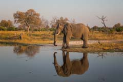
Botswana teems with an incredible array of wildlife, earning it a well-deserved reputation as one of Africa's top safari destinations. Renowned for its diverse ecosystems, from the Kalahari Desert's vast expanses to the Okavango Delta's lush waterways, Botswana boasts an astonishing variety of animal species. The country is home to iconic African wildlife such as elephants, lions, leopards, buffalo, and rhinoceroses, collectively known as the "Big Five." Botswana's commitment to conservation and sustainable tourism has played a pivotal role in preserving its natural heritage, making it a sanctuary for wildlife enthusiasts and nature lovers.
If you enjoy photographing wildlife, Botswana is a must-see destination. I've added a gallery of images to this site.
Drones are revolutionizing the field of landscape photography. They enable photographers to capture breathtaking aerial shots that showcase the earth from a bird's-eye view. One of the most compelling aspects of using drones is the ability to reach remote or inaccessible areas. Drones can navigate rugged terrains, hover over bodies of water, and ascend to considerable heights. Drones allow photographers to capture images of landscapes that would otherwise be challenging or dangerous to access. Whether it's an inaccessible arch or ruin, a cascading waterfall, or a sprawling coastline, drones empower photographers to portray their beauty with unparalleled detail and perspective.
Drones are not allowed in designated wilderness areas or in U.S. National Parks. Drones cannot be flown at The Wave, Coyote Buttes North, or Coyote Buttes South. These areas are in the Paria Canyon-Vermilion Cliffs Wilderness Area. Drones can be flown at the White Pocket.
I have added information about drones to this site and have updated the Hanksville gallery, map, and sunrise/sunset pages to be more drone friendly. The Hanksville gallery was updated to include the New Bentonite Hills, the Painted Hills, and W Factory Road locations. Some images taken with my DJI Mini Pro 4 drone appear below.


If you are driving through the Cameron or Tuba City area stops at the Tuba City dinosaur tracks and Hopi Clan Petroglyphs are worthwhile. Both locations have limited photographic appeal but have archeological and educational significance. The two locations are within 10 minutes of the intersection of Highways 89 and 160 and each can be visited in an hour or two.
I have added a gallery of images and a map with travel directions and information about the area to this site.
The Wave will be open to permit holders if there is a government shutdown tomorrow. Coyote Buttes South and The White Pocket will also be open, as will parking areas. Restrooms may not be available. Law enforcement is considered an essential function and will be present. Coyote Buttes North safety patrols will be there as well.
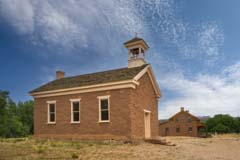
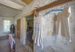
Grafton is an abandoned Mormon town about seven miles west of Springdale, Utah. It is worth a quick visit if you are visiting or passing through Zion National Park. Grafton was settled in 1862 and abandoned due to flooding in the early 1920s. The six remaining buildings in Grafton are not furnished. You could enter three of the buildings when I was there. The church/schoolhouse is normally closed. The Grafton Cemetery is about .25 miles south of the town.
Several movies have been shot in Grafton, including parts of Butch Cassidy and the Sundance Kid. Butch, Sundance, and Etta sought refuge in Grafton, and the bicycle scene with Paul Newman and Katherine Ross was filmed in Grafton. The movie In Old Arizona, the first talkie filmed entirely outdoors, was also shot in Grafton. The film, released in 1929, advertised its authentic settings and the natural sounds of the outdoors. Star Warner Baxter won the second-ever Oscar for Best Actor for his portrayal of The Cisco Kid.
I have added a gallery of images and a map showing the names of the remaining buildings in Grafton to this site.
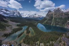
The Canadian Rockies' pristine lakes, untamed rivers, and abundant wildlife are a must-do destination for landscape and wildlife photographers. I have added a gallery of images taken over several trips to Banff, Jasper, and Yoho National Parks to this site. My favorite locations include the Lake Louise area, Moraine Lake, and Waterfall Alley in Banff, Beauty Creek and Mount Edith Cavell in Jasper, and Lake O'hara and Takakkaw Falls in Yoho National Park. The parks are crowded. Go out before sunrise, hike mid-day, take an early dinner, and shoot again at sunset. Make hotel and campground reservations well in advance.
There are over one hundred ghost towns in Montana. Most are in bad disrepair or overly commercial, but a few stand out. I recently stopped at two of these driving home from Canada: Bannack State Park and Garnet ghost town. My Montana Ghost Town gallery contains images of Bannack State Park and the Garnet Ghost Town. I've also added a map with travel directions and the locations of some of the more photogenic houses in each town.
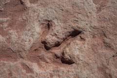
There is a well-preserved collection of dinosaur tracks less than 200 feet from the "trail" to The Wave. The tracks are easy to find, and most guides include them on tours to The Wave. Although uninteresting photographically, if you've never seen dinosaur tracks, stop by them on your hike to The Wave. Guides have been telling people Giant Sloths made the tracks. This is incorrect; Grallators probably made them. See the Dinosaur Tracks page for information on these and other tracks in the area, and see the Dinosaur Track Gallery for more images.
I have added images of the De-Na-Zin wilderness and new images of the Bisti Wilderness to the Bisti Badlands gallery. The Bisti map has also been updated. I have also added improved information about the climate in the area, including percent cloudy and wind speed by month.
Over the last few days, two fatalities were reported, and twelve people were rescued in Buckskin Gulch. A group of three hikers backpacking from Wire Pass to Lees Ferry was reported overdue on Monday. Two helicopters were dispatched to search for them. While searching, eleven other people were spotted who also needed rescue. Infrared cameras were used to spot hikers. Rescues were carried out by hoist from the helicopters. More information and a video showing the infrared search can be found on Salt Lake's KSLTV website. CBSNews has a video of a man being hoisted out of the canyon. Buckskin Gulch is currently flooded due to recent "atmospheric river" storms and early snowmelt. It will be some weeks before the waters recede.
Climb-Utah has another example of how two very experienced hikers barely survived Buckskin in February of 2012.
On March 1st, Grand Falls, aka Chocolate Falls, temporarily closed with no anticipated reopening date. The closure is due to the impact of tourism on the Leupp community. The popularity of the falls has led to trash overflow, deterioration of existing roads, ATV offroading, and drones scaring cattle. The timing couldn't be worse as the falls are currently flowing. They often do in March following spring runoff from the White Mountains.
On October 14,2023 an annular eclipse will race across a narrow band of the US, running from Oregon to Texas. In the rest of the US, the eclipse will be partial. Good eclipse viewing locations include much of the Grand Staircase, Capitol Reef National Park, Monument Valley, the Bisti Badlands, and Albuquerque, NM. The eclipse will be a partial eclipse when viewed from The Wave. If you are lucky enough to have a Wave permit that day, don't let this stop you. The eclipse will be nearly annular at The Wave and should be spectacular, weather permitting.
At annularity, the eclipse will be high in the sky with an altitude of 30° to 35°, and the Sun will be to the southeast. The annular portion of the eclipse occurs at roughly 9:30 AM Arizona time or 10:30 AM in Utah and New Mexico.
More information about shooting solar eclipses can be found on my eclipse page.
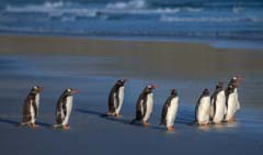
The Falkland Islands are a "holy grail" destination for birders, bird photographers, and wildlife devotees. One can find five species of penguins, sea lions, elephant seals, and 65% of all the black-browed albatross worldwide on the islands. For most, the Falklands are a one or two-day stopover on an Antarctic cruise. But, to fully appreciate the islands, you need to spend at least a week there, preferably two. I recently took an excellent two-week photo tour led by Denise Ippolito to the Falklands. I came away with almost 200 images of penguins, other birds, and marine mammals. Maps with the current locations of some of the penguin colonies and links to other information about the Falklands have also been added to this site.
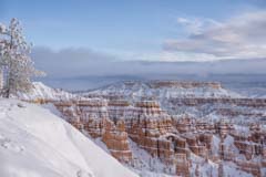

I've updated the Bryce Canyon gallery with many new images of the canyon in winter. Images were shot from the rim trail between Sunrise and Sunset Points. I've also included images of the Arches Trail near Losee Canyon just outside the park and of Tropic Ditch Falls. It runs year round. Tropic Ditch Falls is a man-made waterfall created when Mormon pioneers diverted water from the East Fork of the Sevier River to irrigate their fields near the town of Tropic. The colorful rocks surrounding the fall are magnificent, and there are several photogenic arches in the area. Be careful should you climb up to the arches. Small stones on the "trail" make the go treacherous.
I've updated the Bryce Canyon map to show these new locations, and the Sunrise-Sunset page now includes a point forecast at Sunset Point.
I have updated the Mono Lake, Crowley Lake, and Northern California galleries with new images taken in better conditions. Many thanks to Jessica Fridrich for finding the Hell's Beach formation near Mono Lake shown above. Locations added include the Point Arena lighthouse, Bowling Ball Beach, and Salt Point State Park.
I have added images of some of the spectacular waterfalls in Thousand Springs State Park, Idaho. I only had a sunset and sunrise in the area, bracketed by two 500 mile drives, so only two locations in the park were visited. I will revisit Thousand Springs next spring as there are many other waterfalls and attractions in the area. I have added a map showing the locations of the major ones.
On November 1, 2022, the Bureau of Land Management will implement a new mobile based geofence system for obtaining daily lottery permits to hike in Coyote Buttes South. This is the same system currently in use for Coyote Buttes North / The Wave. More details and links will be added to this site as they become available. See the BLM Press Release for additional information about the geofence system.
An accurate weather forecast can be crucial when deciding on a spur-of-the-moment trip. Unfortunately, all too often forecasts are not available for wilderness locations. For example, I recently wanted a forecast for Ward Terrace/Adeii Eichii Cliffs before heading there for a two-day trip. The nearest towns to Ward Terrace are Cameron, AZ and Tuba City, AZ. My usual source of weather forecasts is Weather Underground. Unfortunately, Weather Underground does not have a listing for Cameron, and when you look up Tuba City, you get the forecast for Flagstaff. Flagstaff is much higher in elevation than Ward Terrace and tends to get more precipitation. Fortunately, the National Weather Service provides point forecasts on a 2.5 km grid. NWS forecasts are available for seven days on an hourly basis in either graphical or tabular form. Some of the elements forecast include Temperature, surface wind speed, wind direction, sky cover, precipitation potential, rain, thunder, snow, fog, and many others. Unfortunately, getting a point forecast is awkward because you must specify the latitude and longitude in the calling URL. For example, to get the point weather forecast at The Wave you enter a URL with over 60 characters.
Since there is no way I would ever remember the URL, I am adding point forecasts to this site's Sunrise/Sunset pages. To get a point forecast at one of the predefined locations on the Sunrise/Sunset page click on the weather icon right of the links to The Photographers Ephemeris.
As an aside, Skyfire, an app that predicts how good a sunrise/sunset will be a given location, is now integrated in TPE Web Pro. The cost is $20 per year in addition to the cost of TPE Web Pro.

The Capitol Reef Gallery has been updated to include some locations east of the park. These include Pedestal Alley, Burro Wash Arch, and the Notom Twin Rocks. These are easy to visit and great places at which to find some solitude in the otherwise busy park.The Capitol Reef map has been updated to include these locations.
I've added images and videos of some the spectacular waterfalls in northern California. Waterfalls shown include Burney Falls, considered the most beautiful in the state, Mossbrae Falls - a close runnerup, and Hedge Creek Falls. Visitation to the falls is light from December through early May as this is the rainy season in the area, and the closest major towns of Reno, Sacramento, and Eugene are over two hours away. Summer attracts crowds, especially to Burney Falls. Burney Falls and Hedge Creek Falls are easy to visit. The best route to Mossbrae Falls is currently closed for safety reasons. To facilitate travel, I have included on this site a map of the major waterfalls in the area and also points of interest along the northern California coast.

East of Las Vegas there are hundreds of small arches, some of which are very photogenic. I've already covered many of those in Buffington Pockets and the Valley of Fire. This time I have included some of those in the Lake Mead area. I've added a gallery of images taken just north of Lake Mead to the site. I've also added a map showing the locations of some of the arches in the area. More information about the arches can be found in the World Arch Database. Access to the database requires an annual subscription.
I have not revealed the locations of a few of the more photogenic arches as their supports are thin, occassionally cracked, and very fragile. Windstone Arch in the Valley of Fire collapsed last year. Whether the collapse was natural or caused by vandalism is unknown. The collapse brings home the point that some protection is needed even for lesser known difficult-to-access natural landmarks.
Finally I've addded a small gallery of images of Scorpion Arch to the site. Scorpion Arch sits in a spectacular setting in the middle of "Nothing" and gets minimal visitation. For now, I hope it will remain that way and have not disclosed the location.
Effective March 15, 2022 the walk-in lottery system will be replaced by an online "Daily Lottery" system run by recreation.gov. You will no longer need to be in Kanab to apply for a next day permit. Instead, you can apply online two days before your desired entry date. A maximum of four groups / 16 people will be granted permits each day by lottery; no change from current practice. $9 is charged to apply to the lottery. You can only apply once each day. You must be in the general area of Page, Arizona, and Kanab, Utah to apply for the new daily lottery. You must apply by phone or mobile device with GPS enabled; desktop computers cannot apply. A detailed map showing the boundaries of the area in which you can apply can be found on my permits webpage. Apply on recreation.gov between 6 AM and 6 PM Utah time two days before your desired entry date to The Wave. Lottery results will be sent out at 7:15 PM that day. If you win, pay for your permit by 8 AM Utah time the next day. The day before you hike to the Wave pick up your permit in Page, Arizona, or Kanab, Utah at 8:30 AM local time. Permit pickup locations can be found on the Permits page
.The new "Daily Permit" system is more user-friendly than the old walk-in lottery. You no longer need to be present in Kanab at 9:00 AM the day before you wish to hike to The Wave. You only need to be in the general area of Page and Kanab. You can go out for an early morning photoshoot or sleep-in if you wish. There is one downside; there is now a $9 per group fee to enter the lottery. It used to be free.
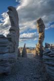
I have added some images from the incredible stone columns on the shore of Crowley Lake and from the Ancient Bristlecone Pine Forest to the Eastern Sierras album. The images from Crowley Lake were mostly shot at dawn when the columns were in shadow. An ultrawide lens or a panorama rig is needed if you wish to shoot the columns from behind. If you bring a panorama rig be sure to mount the lens at its nodal point on the rail. If you fail to do this the images will not stitch together correctly. I also added a map with travel directions to both.
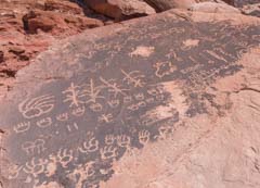
I have also added some images of the "Sky Rock" and "13 Moons" petroglyphs in the Bishop area. The 13 Moons petroglyph is quite unique. There are 13 full moons in a year.
In 2012 petroglyphs from a sacred Piute site in the Bishop area were stolen and some were defaced. Chain or concrete saws, ladders, and hammers were used to remove the panels. While the petroglyphs were recovered the thieves have not been apprehended. To protect the Sky Rock and 13 Moons petroglyphs I have not disclosed their location.

I have updated the Arches National Park section of the site with images and maps from Dome Plateau Overlook, Cavern Arch, and Winter Camp Arch. All of these are in the Highlands area north of Arches and can be visited in a single day. The view of the Colorado River from Dome Plateau rivals that of the view from Horseshoe Bend but without the crowds. The overlook is outside the national park so you can camp overnight in the area. A high clearance 4x4 is needed to visit Dome Plateau overlook, a crossover could get to the trailheads for Winter Camp and Cavern arches.
According to Lake Powell Life you will soon be able to apply for a next day permit via your phone or mobile device. The number of people allowed in via the next day lottery will not change under the proposed system; it remains the smaller of four groups or 16 people. The change does not require review under the National Environmental Policy Act and will be effective February 1st.
Under the new system, you will be able to apply to the walk-in lottery via your phone provided you are within a set distance of a designated location in Kanab, Utah or Page, Arizona. The distances and designated locations are yet to be specified. Applicants will register for the lottery using a "geofence" system developed by recreation.gov. Geofence systems are fairly new but the technology is well understood. Geofences are currently used to keep drones out of "no-fly" zones. More details about the boundaries of the geofence system will be made available in January. Hopefully, details about how the change will impact the Coyote Buttes South lottery will become available at that time as well.
Currently it is free to apply for the walk-in lottery. This may change under the new system as recreation.gov generally charges an administrative fee.
The walk-in lottery was last revised in 2021. At that time the number of walk-in permits issued was changed from ten people per day to the more restrictive of four groups or 16 people. I've been told that the average group size during the past year was about two people per group. On average then only eight people were given permits via the walk-in lottery each day under the new system, down from ten. While the number of online permits increased substantially as a result of the 2021 change, the walk-in lottery became more restrictive. Under the proposed geofence system I suspect even more people will apply for next-day permits making the walk-in lottery even less attractive.
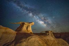
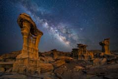
I have added some new images from the Ah-Shi-Sle-Pah wilderness and the Bisti Badlands. My best images (seen to the right) were shot at night with the Move-Shoot-Move tracker. A tracker allows for long exposures times without creating star-trails. By using 3 to 5 minute exposures I was able to use ISOs as low as 200 to 400 and still get sharp stars with good color. The Move-Shoot-Move tracker only weights about one pound and is small enough to carry with you on hikes.

I have added information on three arches I visited on a recent trip to the Aztec, New Mexico area. The first arch, Rooftop Arch, also known as Little Delicate Arch, is small but quite spectacular. Rooftop Arch is best shot mid-afternoon.
Nearby Boulder Arch is very photogenic but difficult to access. I was unable to get to its base but did get a good image from above.
Arch Rock is best at sunset and is also excellent at night when the Milky Way frames it nicely.
The Navajo Nation Parks reopened today. Parks reopened include Monument Valley, Canyon de Chelly, and Lower and Upper Antelope Canyons. Parks have been reopened at reduced (50%) capacity. See the Farmington Daily Times for more information.
I have added images of magnificent Poncho House Cliff Dwelling in Southeast Utah. Poncho House consists of three distinct groupings of dwellings. The upper two are inaccessible. The ruins sit high above a bend in Chinle Creek and are best visited in the fall when the Cottonwoods along the creek are changing color. To visit Poncho House it is mandatory that you go with a Navajo Guide. Guides willing to go to Poncho House are hard to find. I suggest you start with guides who go to Monument Valley or Canyon de Chelly. The Navajo Nation parks are currently closed due to Covid concerns. I have been told that Navajo Nation lands will not be open to outsiders until 70% of the Navajo Nation has been vaccinated.

I have added images of the Ghost Town Trail near Tombstone, Arizona. I have also added a map with trails and photogenic locations in Southeast Arizona including the Ghost Town Trail, Chiricahua National Monument, Kartchner Caverns, Fort Bowie, and many others.
I have added new images taken in Vermilion Cliffs National Monument. Most of the new images were taken east of The White Pocket or along the Loop Road. Both areas are very isolated and the roads are sandy; a 4x4 high clearance vehicle is necessary. My thanks to Dave Coppedge who has extensively explored Vermilion Cliffs and generously shared photogenic locations. He also named the various features he found. The area Dave refers to as the Blimp Hangar is especially pristine. I've been there twice and saw no human footprints on the hike or vehicle tracks on Wrather Arch Road. I saw Bighorn Sheep on both occasions. Unlike the area surrounding The Wave the rock fins were largely unbroken. Please tread lightly here.
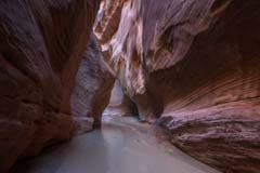
I have added a gallery with images taken in the Narnia Slot Canyon. Narnia is a short slot canyon in the Grand Staircase Escalante National Monument which, for now, is all I'll say about its location. Narnia gets good light around 10AM in the morning. The opening to the slot is narrow and tortuous and some people have been unable to access the slot. Knowing this we hiked in carrying an eight foot telescoping ladder. The ladder allowed us to easily enter the canyon. Narnia was named by Dreamland Tours of Kanab, Utah. Both Dreamland Tours and Action Photo Tours lead trips to Narnia. Only small groups can be accommodated and participants must be physically fit.
I've updated the Death Valley gallery with images taken in Butte Valley. The Geologist's Cabin and spectacular Striped Butte are definitely worth a visit. I have also added new images shot at the Ibex dunefield. Butte Valley is one of the more remote areas in the park and 4WD is needed to get there. The Geologist's Cabin in only six miles from Barker Ranch where Charles Manson lived until his capture there. The road between the Geologist's Cabin and the Barker Ranch is very rough and a lifted 4x4 may be needed to traverse it. On the way to Butte Valley you're likely to see both Big Horn sheep near the Warm Springs Talc Mine and burros within Butte Valley. I have also updated the Death Valley map to show the locations of the various cabins within Butte Valley and the location of the Barker Ranch.
I've updated the Alabama Hills gallery with new images of Boot Arch, Whitney Portal Arch, and Eagle Eye Arch. The new images added are identified by white stars in the upper right corner of the thumbnail, or you can use the search search facility in the sidebar. New images are those shot in the last 60 days. An eight foot telescoping ladder was carried to the base of Whitney Portal Arch so that Lone Pine Peak and Mount Whitney could be framed by the arch. I've also updated the Alabama Hills map to show the hike to Whitney Portal Arch and the locations of sixty dispersed camping sites in the hills. The BLM recently issued a revised management plan for the Alabama Hills area with fewer campsites so now might be a good time to visit the area. The plan is not yet in effect. Now is also an excellent time to shoot the The Milky Way over the Trona Pinnacles.
I've added a gallery of images from three areas in Southeast Nevada. The areas covered include Valley of Fire State Park, nearby Buffington Pockets, and Little Finland. If you are in the Las Vegas area or traveling from Las Vegas to southern Utah all three are worth visiting. I have also included maps and travel directions to each. The maps include travel directions and trails, free campsites, and the locations of some of the spectacular rock formations in the area.
On Friday January 8th the Bureau of Land Management approved an increase in allowed visitation to The Wave. Up to 64 people or 16 groups will be allowed to visit each day, whichever comes first. The online lottery will grant permits for up to 48 people or 12 groups, whichever comes first, and the walk-in lottery for up to 16 people or 4 groups, whichever comes first.
Here is the information I received from the BLM:
The Bureau of Land Management (BLM) has approved a proposal to expand visitor access to the world-famous geologic feature known as the Wave, located in the Paria Canyon – Vermilion Cliffs Wilderness in the Vermilion Cliffs National Monument. The Environmental Assessment (EA) went through an interdisciplinary resource specialist and public review process. A Finding of No Significant Impact (FONSI) along with three Decision Records (DR) were signed on January 8, 2021.
One DR authorizes the increase in permit numbers, up to 96 people per day and up to 16 groups per day which, ever comes first. Under this new decision, implementation of the number of hiking permits issued for the Wave will increase from 20 to 64 people per day and up to 16 groups per day, whichever comes first. The BLM could implement further increases or decreases in the future based on monitoring of resources and social conditions.
A second DR authorizes the proposed improvements at Lone Tree, Cottonwood Cove, Paw Hole, and White Pocket trailheads and the VCNM Administrative Site within the Arizona Strip Field Office. A third DR authorizes the proposed improvements at Wire Pass and Buckskin Gulch trailheads and additional route markers as described in Alternative A of the EA within the Kanab Field Office.
The EA, FONSI, and the three DRs can be found at the BLM’s NEPA Registrar ePlanning: https://go.usa.gov/xyxtK. The approval of these Decision Records constitutes the final decision of the Department of the Interior and, in accordance with the regulations at 43 CFR 4.410(a)(3), is not subject to appeal under departmental regulations at 43 CFR 4. Any challenge to this decision as approved by these Decision Records must be brought in the Federal District Court.
Implementation for the permit increase will begin February 1, with the majority of additional permits being available to the online lottery. Distribution of permits will be as follows:
- Online Lottery: Up to 48 people and / or 12 groups, whichever comes first.
- Walk-in Lottery: Up to 16 people and / or 4 groups, whichever comes first.
The BLM will work closely with Arizona and Utah county governments to discuss implementation details and practices, including exploring potential opportunities for regional economic development.
This is the abridged title of a must read article by Matt Kloskowski, a photography educator based in Tampa, Florida. Photo Collecting works as follows: you see or find a photo you like and then make the effort to go to that spot and take that photo. There's nothing wrong with this. I've done it many times and will continue to do so. And I know many well known landscape photographers who do the same.
The Peach Rock image to the right is a good example of an image I "collected". It's very similar to one by Laurent Martres. When I first saw his image I was struck by how the soft light on the ground drew your attention to Peach Rock. Of course I also wanted to come away with something more my own. I thought the entire area was gorgeous so I shot the Peach Rock Panorama image above as well.
By the way if you love the southwest and don't own Laurent's books Photographing the Southwest Volume 1 -- Southern Utah and Photographing the Southwest Volume 2 -- Arizona do yourself a favor and buy them. They are filled with great locations and advice.
The process of making a photo is different in that you make the effort to avoid preconceived compositions or locations. Last summer I went to Badlands National Park which seems to lack iconic images. I still came away from some very good images but the trip was not as productive as most of my trips. I will need to revisit Badlands and spend a lot more time there to come back with great images. Making photos in new locations takes more field time than "collecting" them.
Finally I've added a gallery of images taken in Joshua Tree National Park with the locations of many "icons" taken under varied conditions. Feel free to "collect" them or to go one step further and make them your own.
Most Death Valley services including ranger programs, lodging in the park, campgrounds, and backcountry campgrounds are currently closed due to California's "Stay at Home" order. Trails, viewpoints, and roads are open, crowds are non-existent, and winter temperatures are moderate. This makes it a great time to visit the park if you are willing to do some driving each day. All four major Death Valley dune fields are accessible from just outside the park if you camp, and there are motels within 35 minutes of Mesquite Dunes and the Panamint Dunes. I've added some images taken on a recent trip to the Panamint Dunes and have updated the Death Valley maps to include some camping opportunities just outside the park. I've also added locations and travel directions to the Barker Ranch where Charles Manson was captured and the photogenic "Geologists Cabin" and "Striped Butte" in Butte Valley.
Hiking through Buckskin Gulch and Paria Canyon's tall Navajo sandstone walls is the ultimate southwest backpack. It should be on all desert rats bucket list. I have added a gallery of images of Buckskin Gulch and the Paria River to this site. Images were taken during a recent three day backpack covering lower Buckskin Gulch and the Paria River from the White House Trailhead to Wall Spring. I have also added a map suggesting shooting locations and covering some of the logistics of backpacking in Paria Canyon.
Effective this Friday November 20 the Kanab office of the BLM is moving to winter hours. The Kanab BLM office will be closed on weekends until mid-March. Saturday, Sunday, and Monday permits will be issued on the preceding Friday. In the past there have been nearly three times as many lottery applications on Fridays so there is little advantage to applying on a Friday.
The BLM office will be closed on Thanksgiving so a two day drawing will be held on the Wednesday before. The BLM office is open the day after Thanksgiving and a three day drawing will be held then.
For Christmas a five day drawing will be held on December 23rd. For New Years a five day drawing will be held on December 30th.
The walk-in lottery is held at 9AM MST at the Kanab Center at 180 E 100 N in Kanab, Utah. Plan to arrive at 8:30 to give you time to complete the application.
Cedar Wash Arch is a spectacular arch in the Grand Staircase Escalante National Monument. It is ten miles from the town of Escalante. The arch has a span of 24 feet. The arch is made of Entrada sandstone and is white in color. Most people photograph the arch from the top of the surrounding cliffs but the arch photographs much better from below. The cliffs surrounding the arch are finely detailed and contain many surface pockets / tafoni. The tafoni make excellent foreground, as do the pine trees in the area. I have added a small gallery of images of Cedar Wash Arch to this site. I have also added a map suggesting shooting locations and showing the short hike to the arch. The maps page includes a link to a Caltopo map of the area as well as a Google map.
I have added a small gallery of images of the North and South Units of Theodore Roosevelt National Park to this site. I have also added a map suggesting shooting locations and hikes . The maps page includes a link to a Caltopo map of the area as well as a Google map.
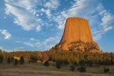
Devils Tower is a butte in northeast Wyoming high above the Belle Fourche River. It is perhaps best known as the site of the climatic scenes in Spielberg's movie "Close Encounters of the Third Kind". I have added a small gallery of images and a map suggesting shooting locations to this site. The maps page includes a link to a Caltopo map of the area as well as a Google map. Caltopo maps have several advantages over Google Maps.
I've added images of and travel directions to Fantasy Canyon and Dinosaur National Monument in Utah. Fantasy Canyon is a small area of incredibly shaped sandstone figures about 40 miles south of Vernal, Utah. Fantasy Canyon is best known as the home of Teapot Rock made famous by Michael Fatali in his image "Back Of Beyond". Unfortunately Teapot Rock was damaged in 2006, probably by vandals, and Fantasy Canyon is no longer the attraction it once was. It is still worth visiting if you are in the area.

Dinosaur National Monument contains two visitor centers separated by 30 minutes of driving. The westernmost visitor center is the Quarry Visitor Center near the small town of Jensen Utah. If you want to see dinosaur fossils start your visit here at the Quarry Exhibit Hall where there is a wall of naturally embedded fossils on display.
The Canyon Visitor Center in Dinosaur, Colorado is the gateway to the eastern side of the park. Highlights of the eastern side include Harpers Corner and Echo Park. Close to Echo Park there is an overlook of the Green River as it wraps around Steamboat Rock that rivals the overlook at Horseshoe Bend. Steamboat Rock overlook is not well known and you'll probably have it to yourself. Highly recommended.
The Wave has reopened and the walk-in lottery is being held again. House Rock Road is open again.
St George News reports that the Pine Hollow wildfire has forced another closure of The Wave. The fire is now largely contained and it is hoped The Wave will reopen within the next week. House Rock Road is closed from its north end and also from the south just above the Lone Tree trailhead. Both Coyote Buttes South and The White Pocket are open but you need to access them from Highway 89A.
The Wire Pass and Magnum fires are now largely contained. The Wave and the North Rim of the Grand Canyon are open. The walk-in lottery is being held as normal in its new location. Both US 89A and UT 67 are open. The southern part of House Rock Valley Road is still closed. Since this is the only way to access Coyote Buttes South and The White Pocket both are still closed.
St George News reports that a wildfire near the Wirepass trailhead started at 11PM on Friday night. Due to the fire the Wirepass and Buckskin trails and The Wave are closed as is House Rock Road from both its north and south ends. The Wirepass fire is very close to the Magnum Fire and high winds are expected tomorrow and Monday.

I've added images and travel directions for two groups of small arches near Factory Butte. The first grouping is well known and frames Factory Butte nicely. There are four arches in total, all are photogenic. The arches are best shot near sunset. These arches are about 400 feet east of parking 2.2 miles down Coal Mine Road.
The second grouping consists of more than 100 tiny arches near the old Factory Butte Coal Mine. They are in a small area of wildly eroded rocks reminiscent of Little Finland but with the colors of the Bisti Badlands. The area can be accessed by taking Coal Mine Road 9.7 miles and making a right. Continue 0.7 miles and park, the arches and eroded rocks are just to the west. You are unlikely to see anyone at either set of arches.
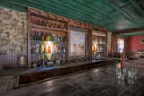
On Monday June 15 the American Hotel burned to the ground, as did the nearby Ice House and the Crapo House. The American Hotel was 149 years old when it burned down. The probable cause was 100 year old electrical wiring insulated with paper. The American Hotel was the premier site for photographers at Cerro Gordo, and will be missed. Fortunately plans for the hotel exist and it is expected it will be rebuilt though of course it will never be the same. Friends of Cerro Gordo has set up a tax deductible GoFundMe to help with the rebuilding. Please donate if you can.
Both The White Pocket and Coyote Buttes South are currently closed due to the Magnum Fire which is now 33% contained. Firefighters are working to contain the fire west of House Rock Road. Coyote Buttes North is currently open. Maps showing the progression of the fire can be found at https://inciweb.nwcg.gov/incident/maps/6748/ , and a smoke forecast at https://inciweb.nwcg.gov/incident/map/6748/1/98428.
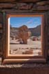
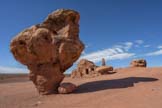
The Cliff Dwellers Stone House, aka the Blanche Russell House, in on US 89A which runs between Jacob Lake and Bitter Springs in Arizona. The unique house is built around a large fallen boulder. In good conditions, which are rare, the house is quite photogenic and worth an early morning stopover on your way to the North Rim of the Grand Canyon, or Coyote Buttes South.
I used to believe the house was built by the Navajo, but the truth is more interesting. In 1927 Blanche Russell's husband was diagnosed with tuberculosis and the two decided to move west from New York seeking drier climate. Blanche was reportedly a Ziegfield Follies dancer. About nine miles west of Lees Ferry their car broke down and they decided to camp amongst the boulders at Cliff Dwellers. Blanche loved the area and they decided to buy the land and build a house there, using a boulder as a start. They operated a roadside trading post where they sold food and gasoline and operated a restaurant. The trading post was quite successful and the area became known as House Rock Valley. It may well be that House Rock Road is named after the house Blanche built with her husband. They ran the trading post for about ten years and sold the property to Jack Church who three years later sold to the Greene family. The Greene's started the first guided trips down the Colorado, and built the Cliff Dwellers Lodge and restaurant.
The best side of the Stone House faces east so morning is the best time to photograph it. Normally there are Navajo craft stands interspersed among the balanced rocks so I suggest you arrive as early as possible before the stands are set up. Navajo businesses are currently closed due to the Covid-19 pandemic so now is a good time to visit. You will need to clone out graffiti and a porta potty from your images if you want a more natural look.
The walk-in lottery for next day permits resumed on June 15 in Kanab at a new location. The lottery was moved to the Kanab Center at 20 North 100 East on US 89 two blocks east of the Best Western Red Hills. Visitors are asked to park on the east side of the building in the rear parking lot. Applicants should bring their own pencil/pen to complete the application and should wear masks. There is no cost to enter the lottery. If you win there is a $7 per person fee to hike to The Wave. There were 90 people applying for the ten available slots on Tuesday June 16th.
Effective June 1 several changes were made to the on-line lottery for Wave permits. Here's a brief recap:
- The lottery is now hosted by recreation.gov rather than the BLM. You can apply for the lottery at https://www.recreation.gov/permits/274309 . You will need to register on recreation.gov to apply.
- The fee to apply has been increased from $5 to $9 per group.
- When you apply you can list up to three persons as "Alternate permit holders". If your plans change and you cannot make the hike to The Wave any of the listed alternate permit holders can do so legally.
- You and the alternate permit holders can still only apply once each month.
- As of now the getting a Coyote Buttes North or Coyote Buttes South permit through the calendar option is still being managed by the BLM.
- More details can be found on the permits page.
The walk-in lottery is still suspended due to the Covid-19 pandemic. If the BLM can find a way to safely hold the walk-in lottery by July 1st the walk-in process will resume at that time. If not the ten permits will be added to the on-line lottery.
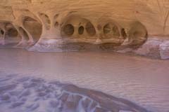

I've added new galleries covering Cobra Arch and the Paria Windows to the website, as well as travel directions and maps. Cobra is a scenic arch with a span of 35 feet. It is best shot from late morning to late-afternoon. The trail to Cobra Arch begins at the Middle Route trailhead on West Clark Bench. The hike is seven miles round trip and is best done in the cooler months. The Paria Windows are a group of tafoni on the east shore of the Paria River about two miles downstream from the White House trailhead. Tafoni, also called honeycomb weathering, refers to small rounded holes on slanted to vertical walls. The Paria Windows are best shot in shadow. Since the windows face west plan on being at them within a few hours of sunrise, the earlier the better.
I have also updated the Edmaier's Secret gallery with several new images including a hoodoo made of Lace Rock southwest of Teepee Dome, and an incredibly large expanse of crossbedded sandstone and fins centered at 37.036600,-111.995687.


I've updated the Coyote Buttes South Gallery with many new images. My favorites were taken at night at The Control Tower and The Witches Hat. I have also added several new locations to the gallery. The best of these is the Rainbow Cove area with its very colorful leading lines. Many thanks to #DrAdventure for generously suggesting this location and others. Rainbow Cove is best shot when totally in shadow either early or late in the day. Images of a nice alcove in the Pawhole area were also added, as were images of The Hydra and also The Olympic Torch. The last are best shot at dawn. The Coyote Buttes South maps page was updated with these new locations.
In April I made four separate trips to Coyote Buttes South and only saw two other hikers. There was no evidence of other daily visitors at either the Pawhole or Cottonwood trailheads. While permits for the current month are sold out, August permits are still available on the Coyote Buttes South permit calendar as of May 2nd.
The walk-in lottery for Wave permits is still closed. It was hoped that the walk-in permits would be added to the on-line calendar or on-line lottery. This has proven to be impossible due to the complexities of the current lottery system. The entire lottery system is being moved to Recreation.gov effective July 1. Should the Covid-19 closure still be in effect in July the walk-in permits will be added to the on-line lottery for November permits.
If this is as confusing to you as it is to me you may want to read the details at https://www.blm.gov/alert/az-covid-19-updates about 2/3 of the way down the web page.
Since I'm largely stuck at home I've taken the time to update some of the galleries with images from recent trips. I've updated the Death Valley Gallery with new images from the Badwater salt flats and the Mesquite Dunes Note that Death Valley and most California National and State Parks is currently closed to limit the spread of the Covid-19 virus.


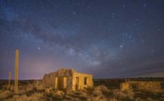
Two Guns is an underrated destination just off I40 thirty miles east of Flagstaff, Arizona. It has an incredibly rich history which includes an Apache Death Cave, Route 66, Billy the Kid, a train robbery, buried treasure, a Mountain Lion Zoo, and Russell Crowe, believed by some to be the current owner. A brief history can be found on my maps page, more details can be found on wikipedia. A gallery of images of Two Guns can be found here.

I've added a small number of images taken in the "semi" ghost town of Goldfield, Nevada. The International Car Forest is an unusual open air museum just south of Goldfield. Its many cars are buried on end so the car forest is best shot at night in late summer or fall when the Milky is largely vertical. The Subway to Nowhere in Goldfield is well worth a brief stop during the day. I have also updated the Rhyolite Nevada ghost town gallery with some new images taken at sunrise.
I've updated the Cerro Gordo Mine ghost town gallery with images from a recent trip. Cerro Gordo is more accessible than it used to be with on-line tickets available and you can freely wander the American hotel. Tripods are allowed. On weekdays Cerro Gordo still receives few visitors. I've also updated the Alabama Hills gallery with some images of Lathe Arch shot with a Laowa 10mm full frame lens. This ultrawide lens is just perfect for capturing unusual subjects and creating unique perspectives.
Preliminary - Effective today The Wave walk-in lottery has been suspended until further notice. The walk-in lottery will not be held tomorrow (Thursday 3/19). There are no plans to temporarily increase the number of permits available on-line at this time. I'll post more details as they becomes available.
All tours of the Navajo Nation slot canyons in Page (e.g. Upper and Lower Antelope Canyon, Canyon X, ...) has been temporarily suspended due to the COVID-19 pandemic. The Monument Valley Tribal Park is also closed. Other closed areas include the Four Corners Monument, the Little Colorado River Tribal Park, the Bisti Badlands, Coal Mine Canyon, Canyon de Chelly Campground, and others . You cannot visit any Navajo Nation park at this time. More information can be found in the Farmington Daily Times, the Phoenix New Times, and Fox 13 Salt Lake.
I've added a gallery of images from Mono Lake in California. I've also added a map with travel directions and photo site locations and photography tips.
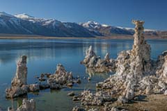
Mono Lake is an excellent three season destination. At 6,400 feet it normally gets snow in the winter so if you plan to visit then check snow cover levels in advance. Information on how to check snow depth levels in the US can be found on the Mono Lake maps page. There are two areas of photographic interest at Mono Lake. The first is called the "South Tufas". At sunrise and sunset you can often get nice reflections of limestone columns (known as Tufas) in the lake with the Eastern Sierra's in the background. Sunrise usually works better than sunset since winds are calmer then.
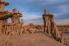
The second area is known as the "Sand Tufas". While the South Tufas are large and rock-like in appearance the Sand Tufas are delicate and have many branches. They form fantastic shapes are are best photographed up-close. If possible shoot at sunrise following a windy night so that the footprints around the tufas are filled in.


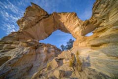
I've added new images from Red Canyon, Inchworm Arch, and the Kanab Hoodoos. Both Inchworm Arch and the Kanab Hoodoos are best photographed near sunrise. I would expect that at sunrise the shadow on the left side of Inchworm will disappear by March or April .

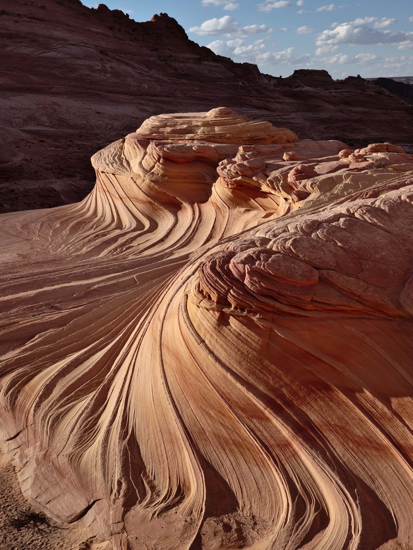
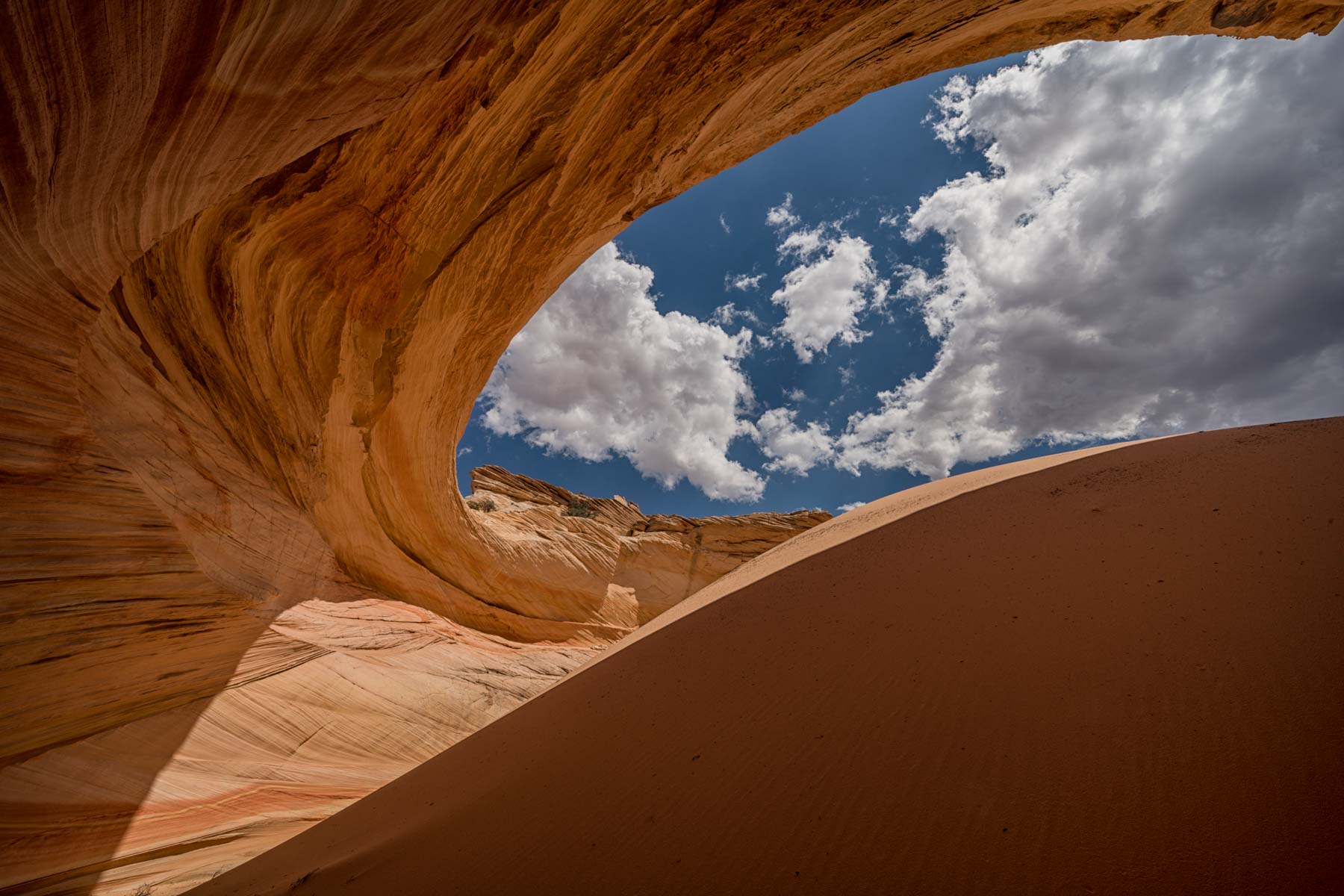
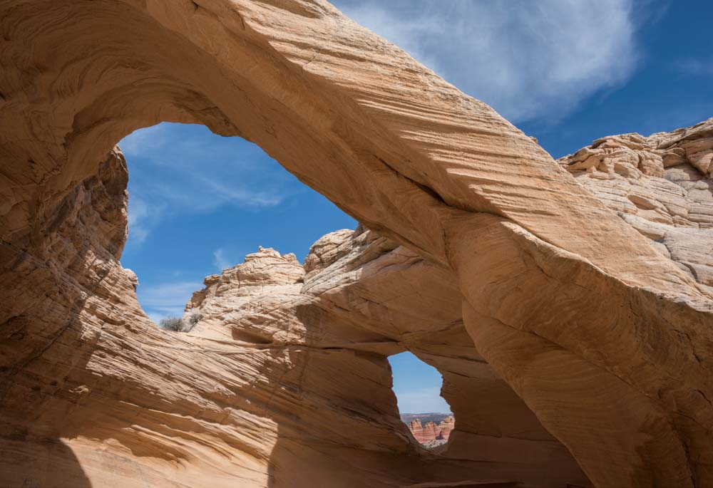


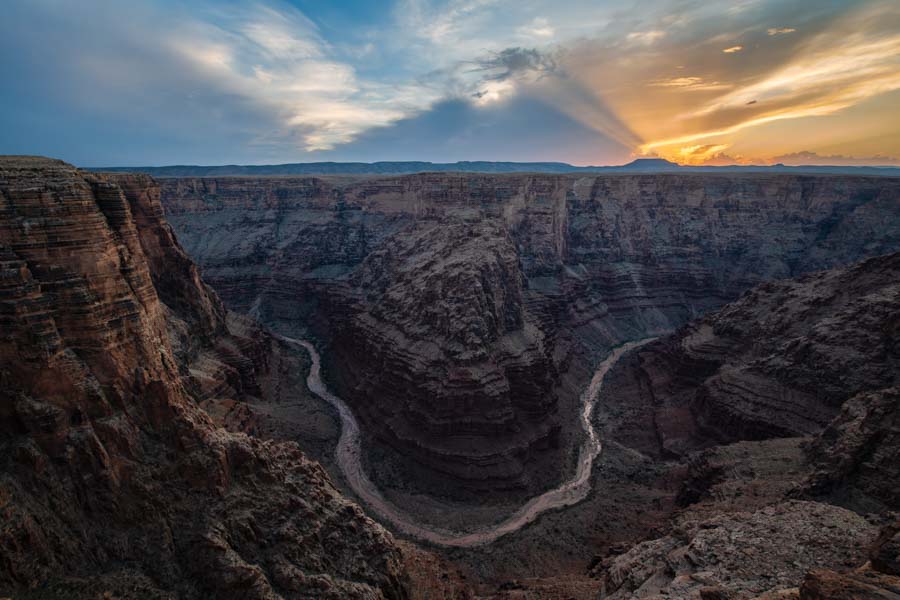
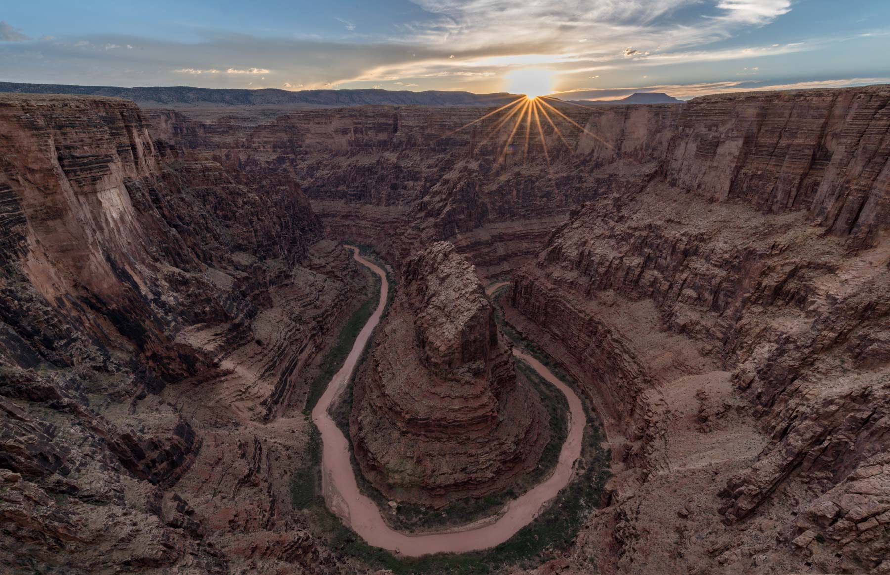
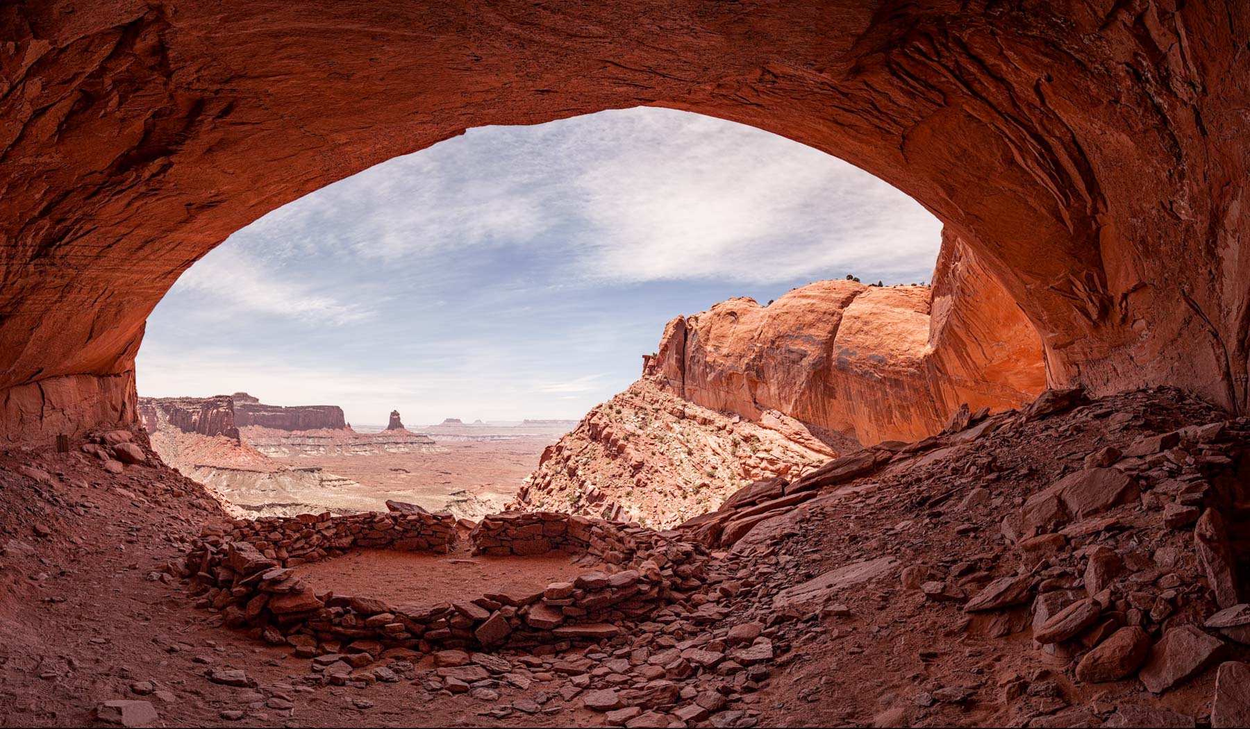


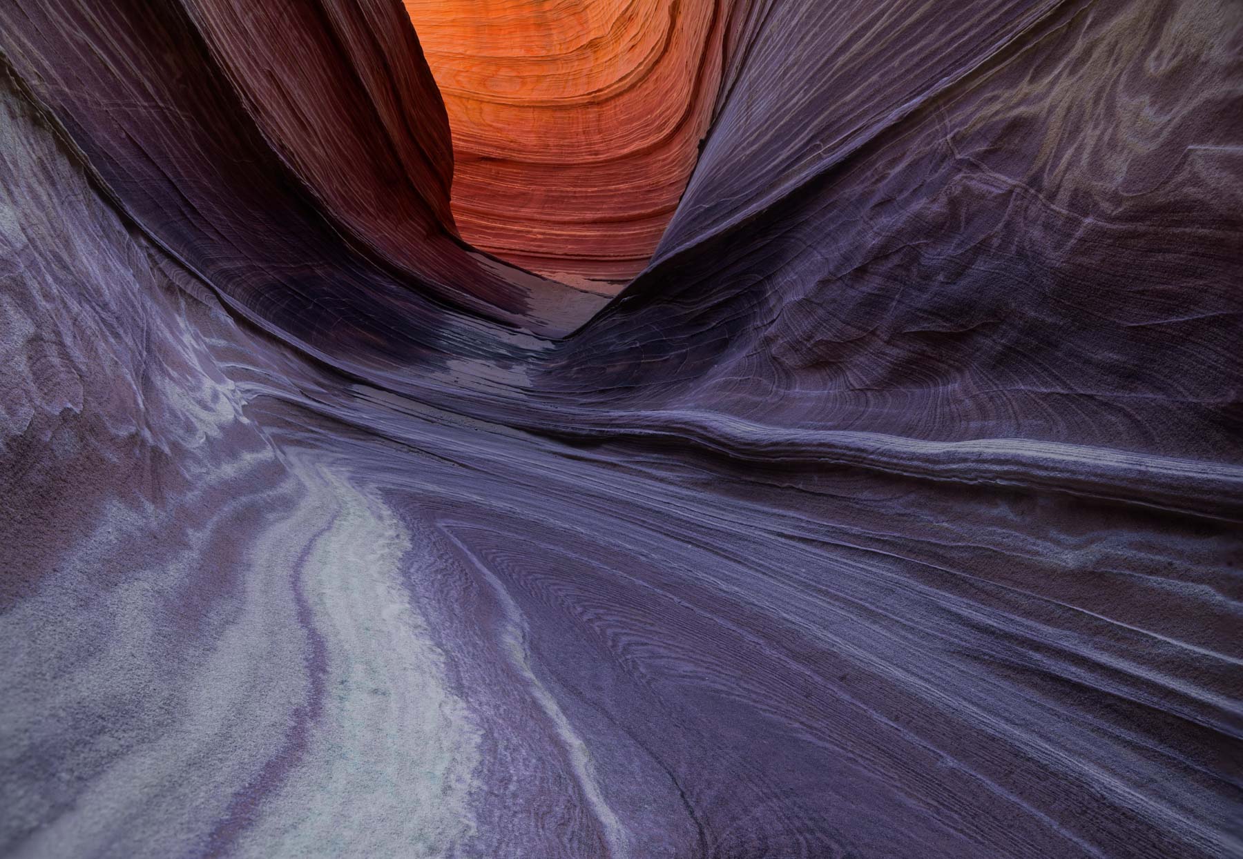

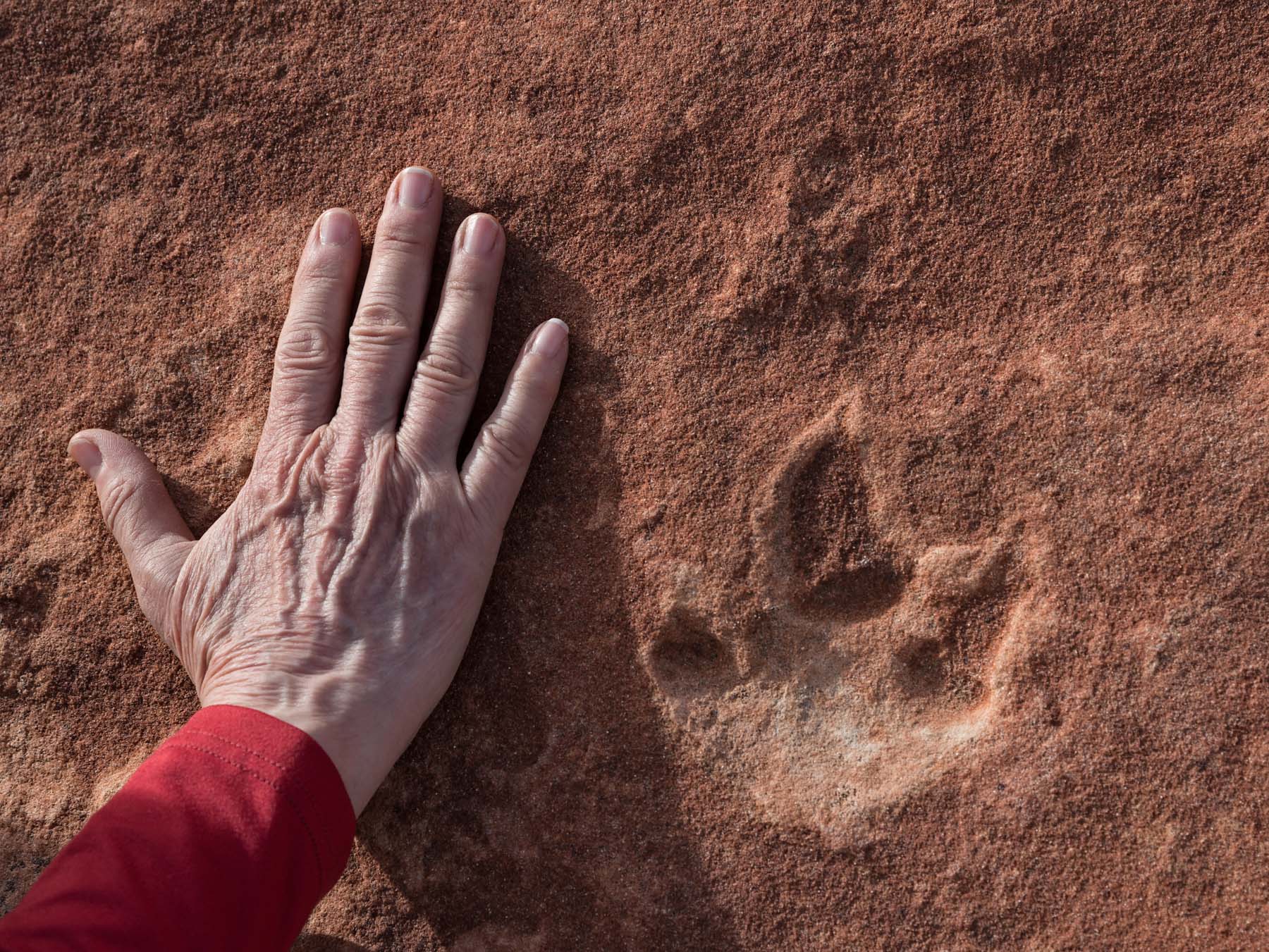
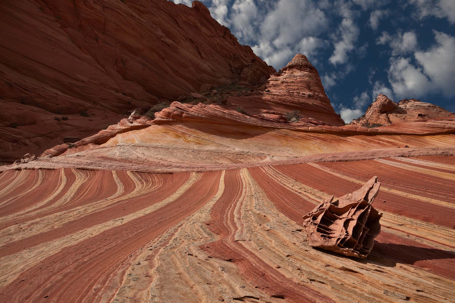
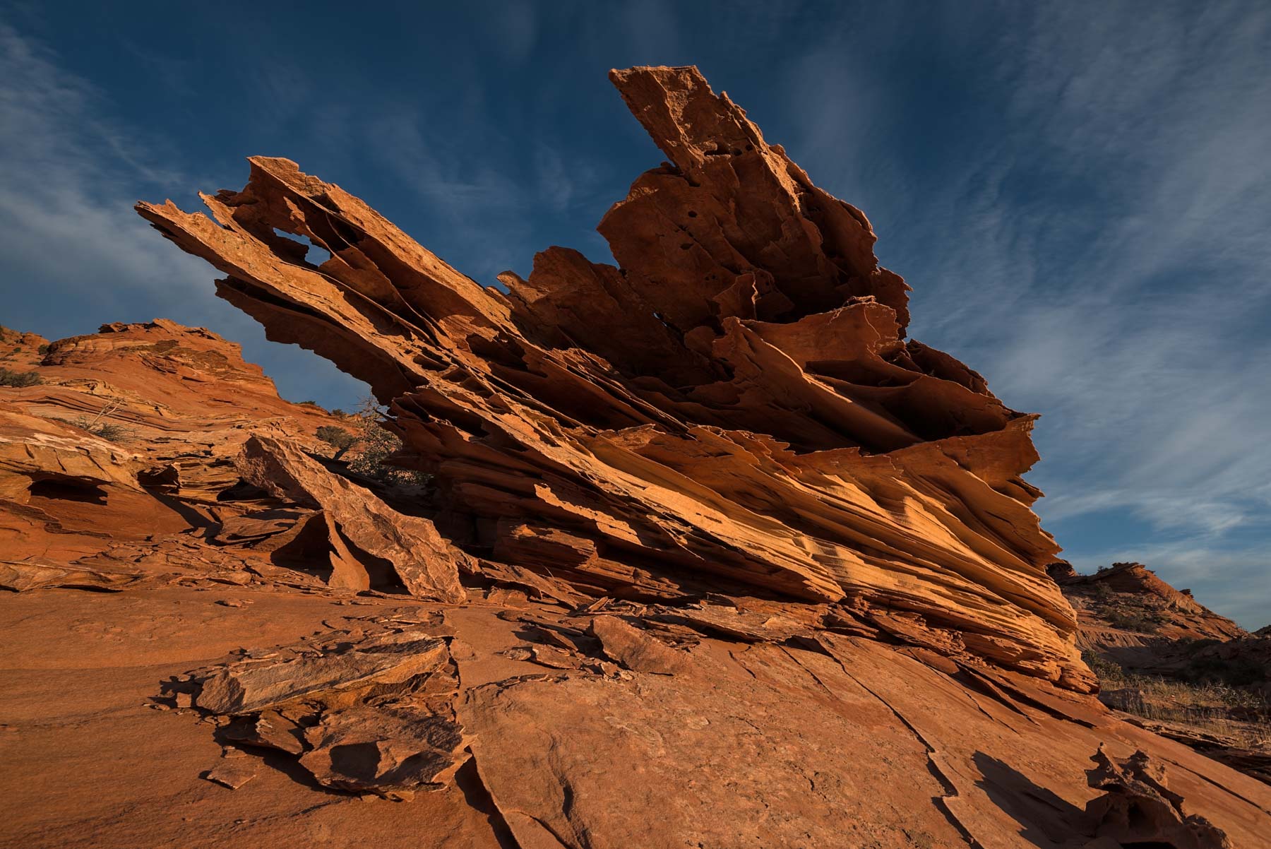
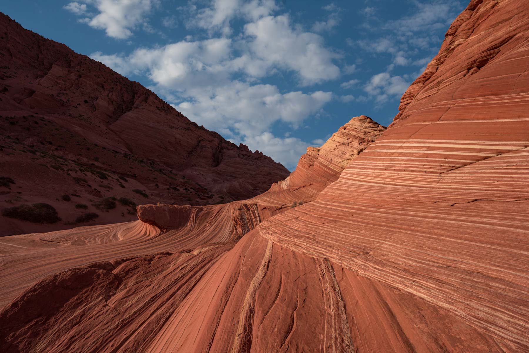
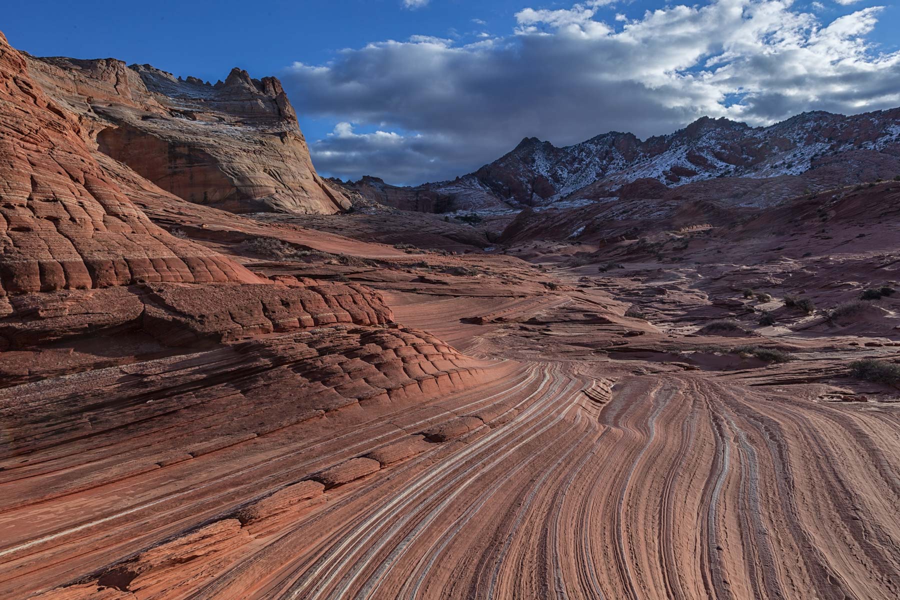
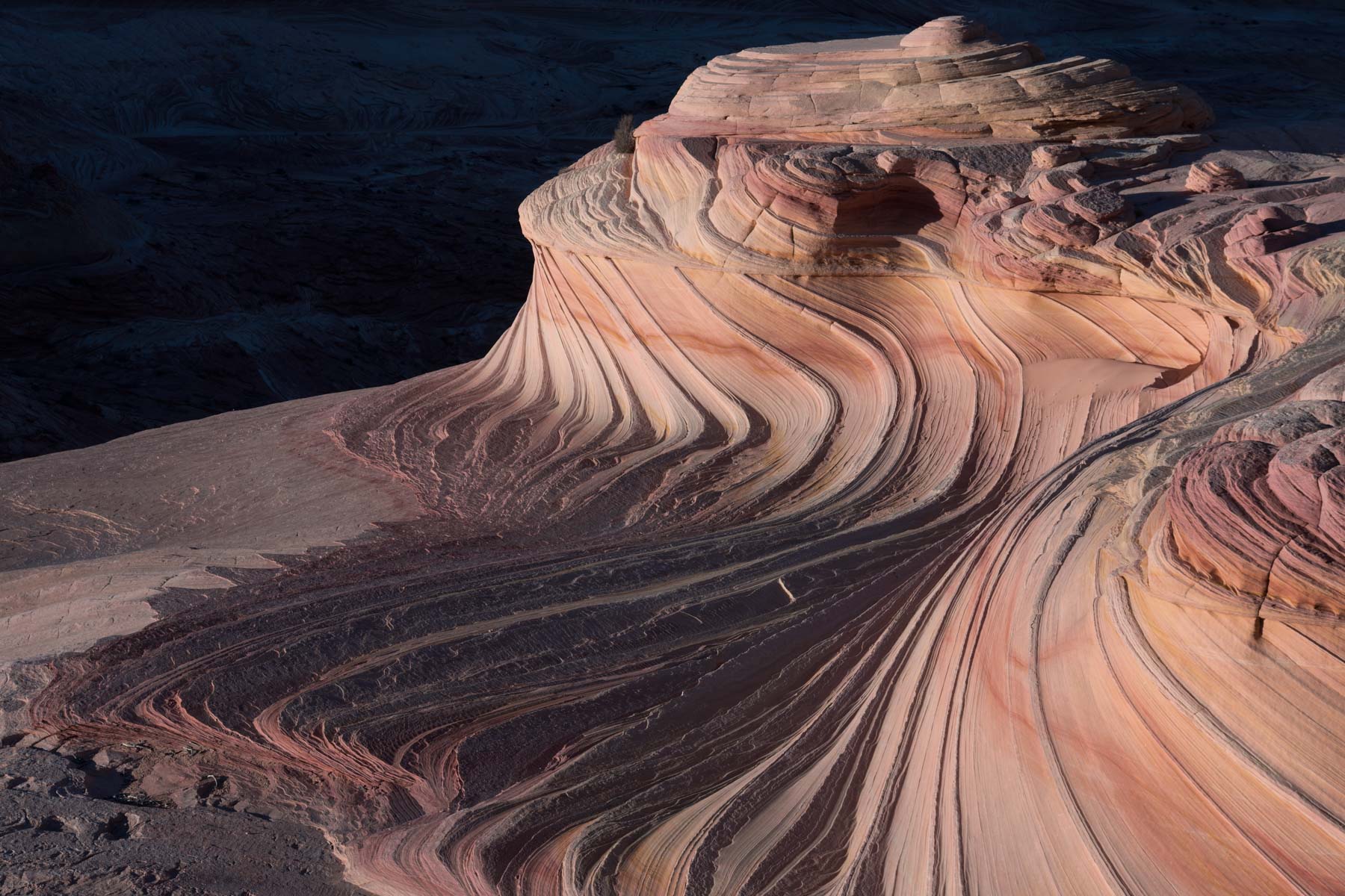
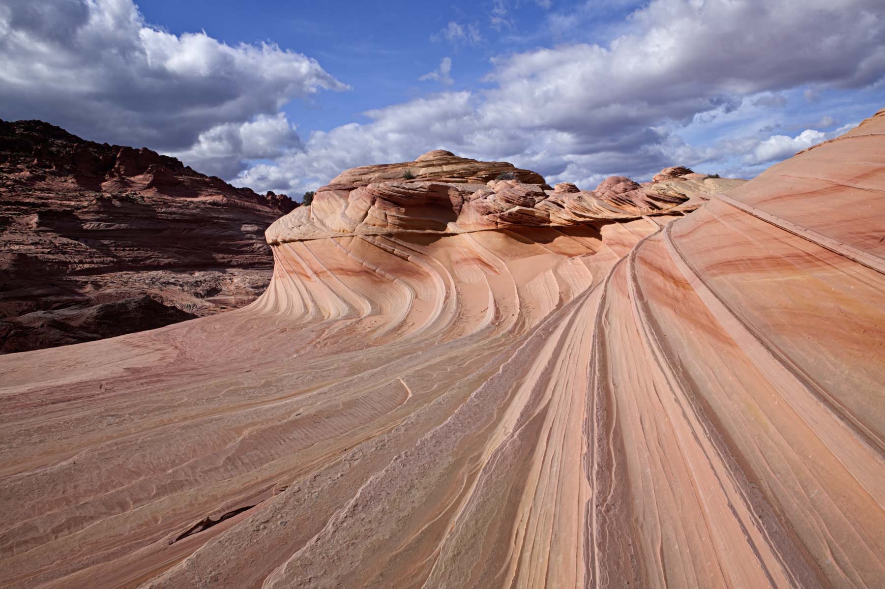
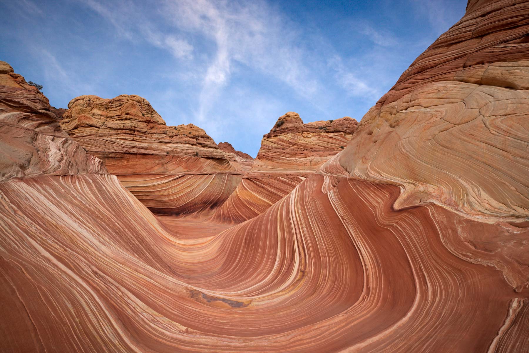

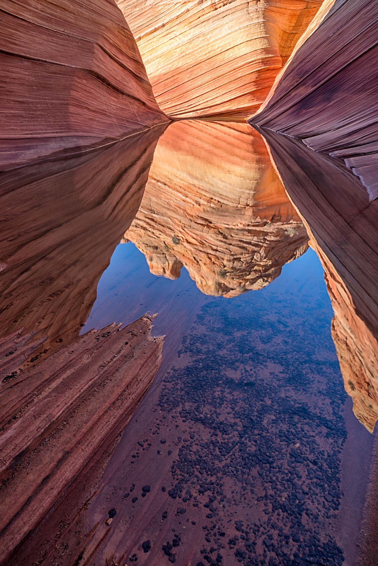

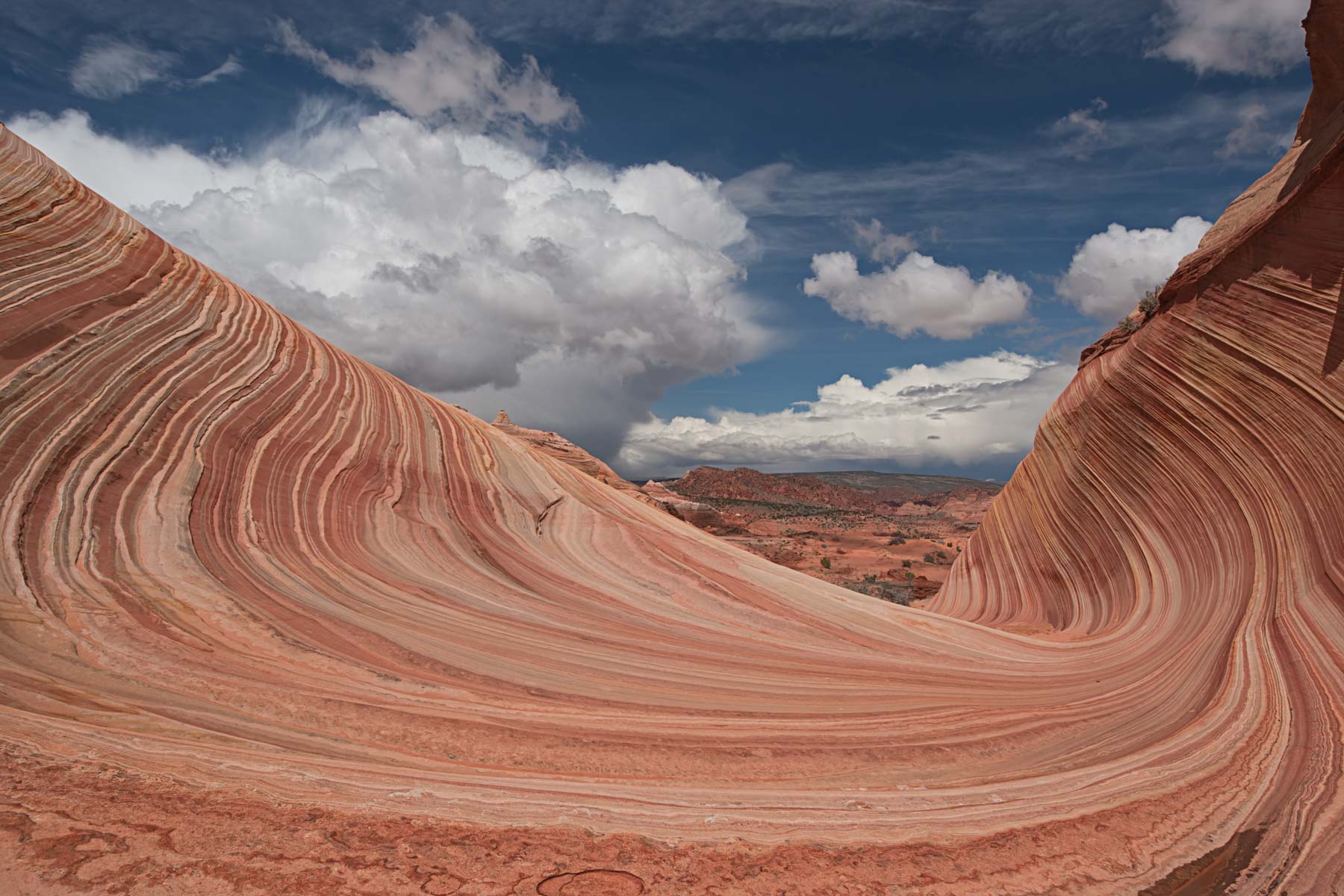
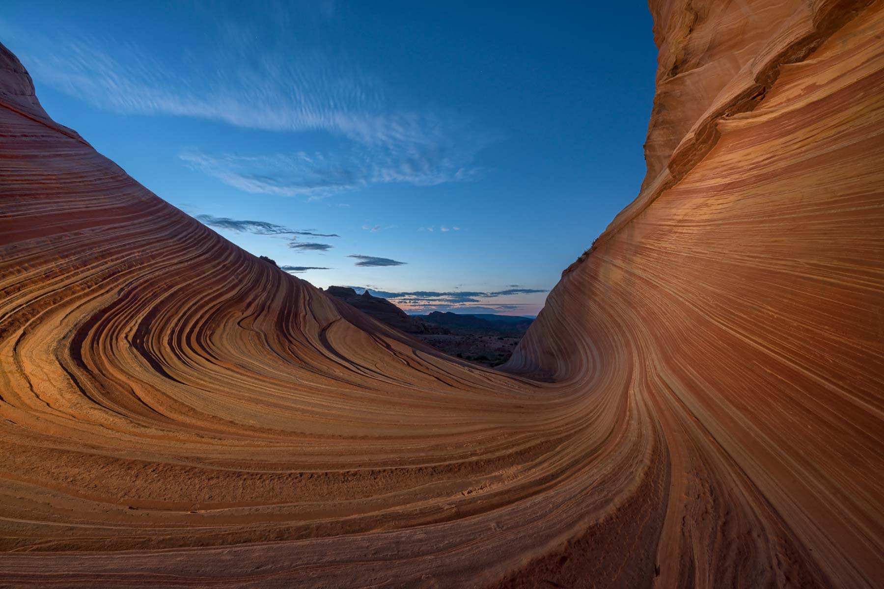

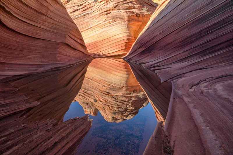


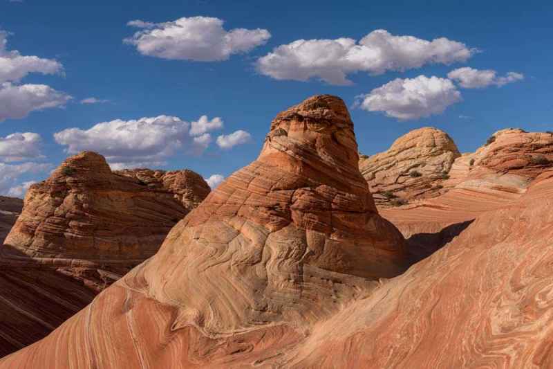
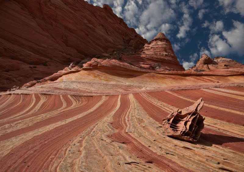
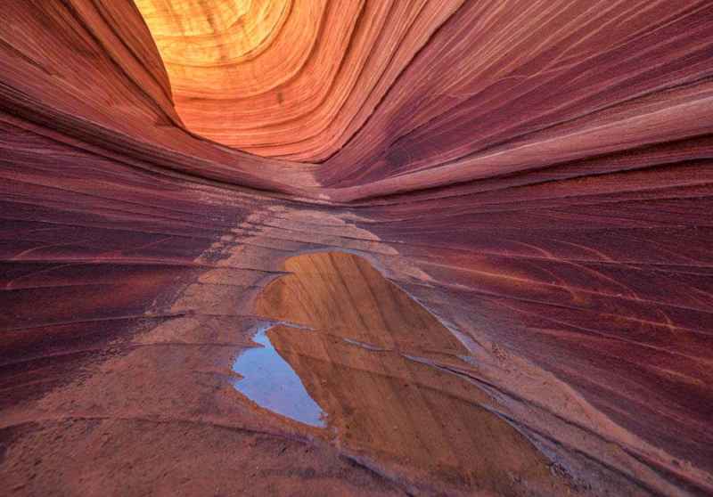

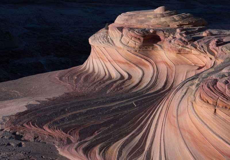
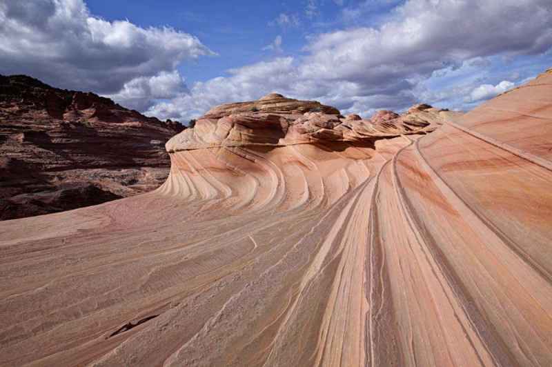
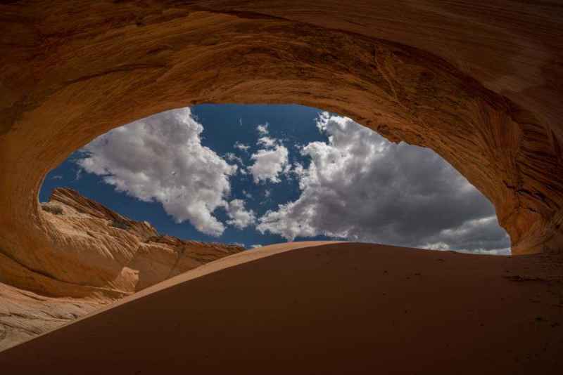
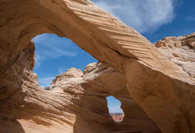
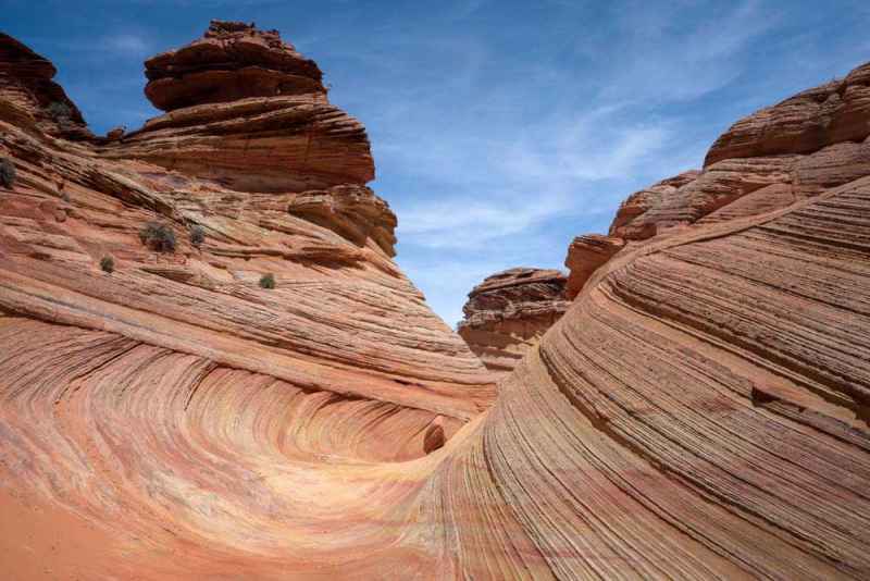
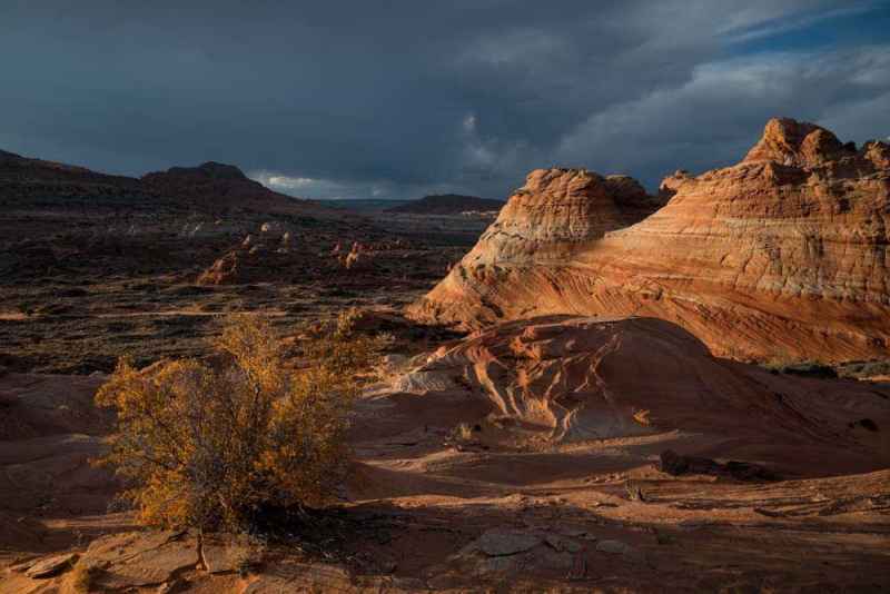
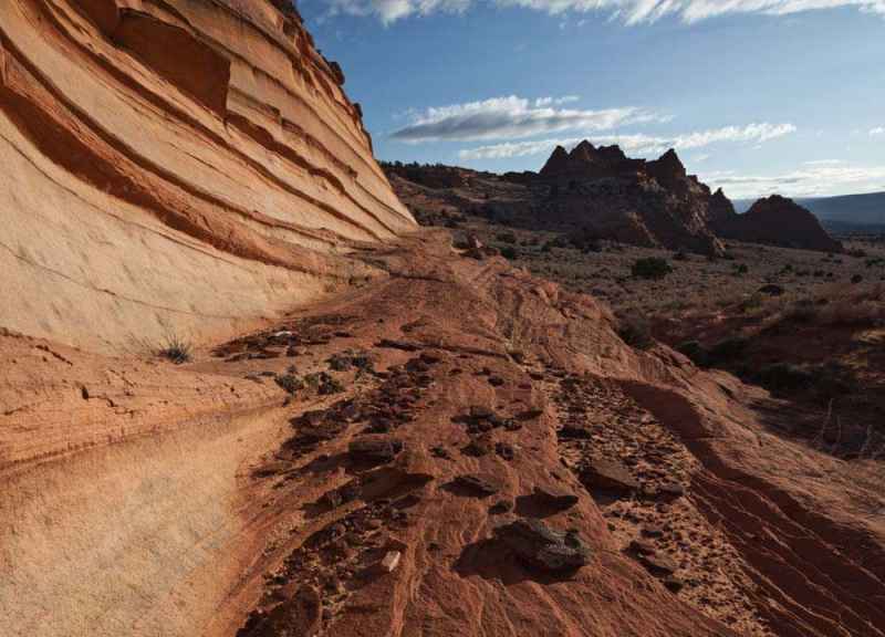
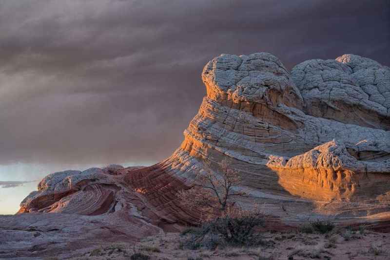
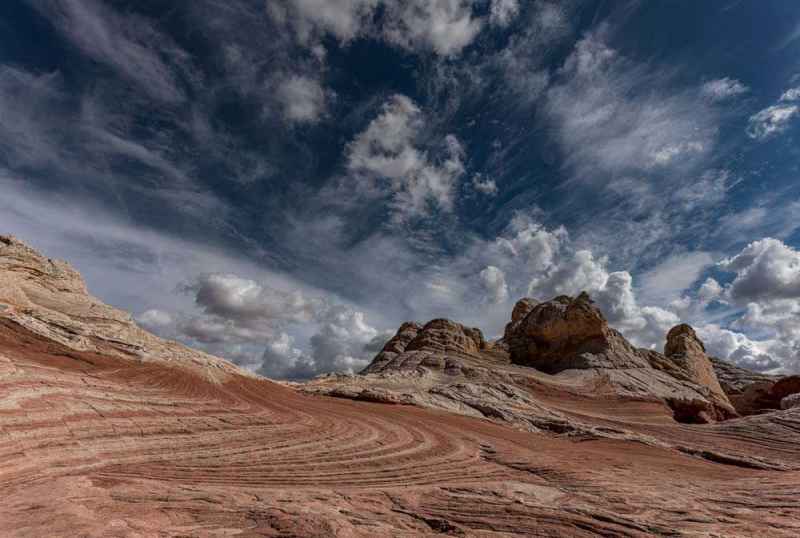
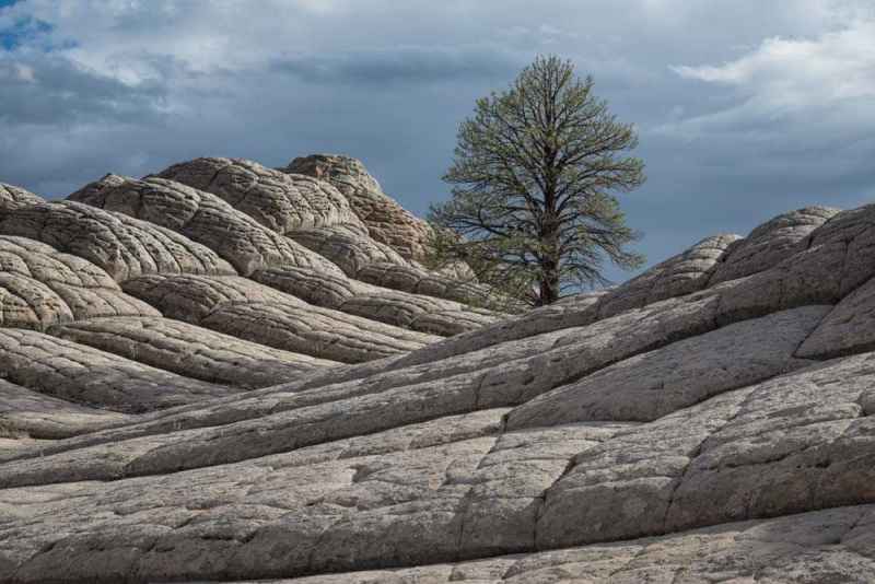
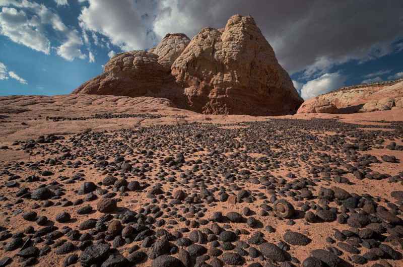
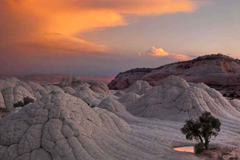
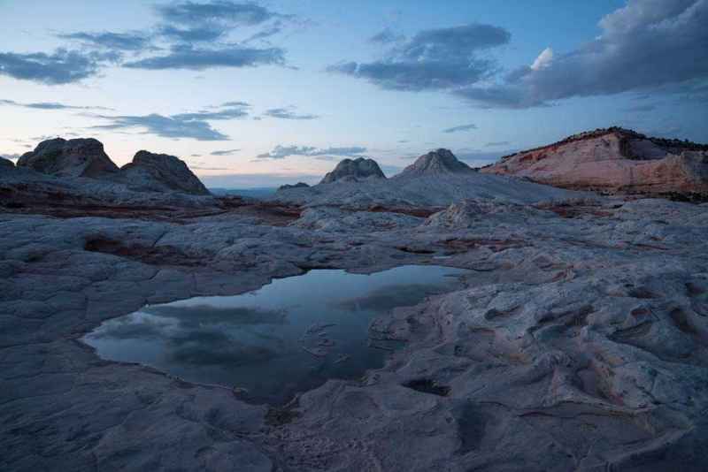
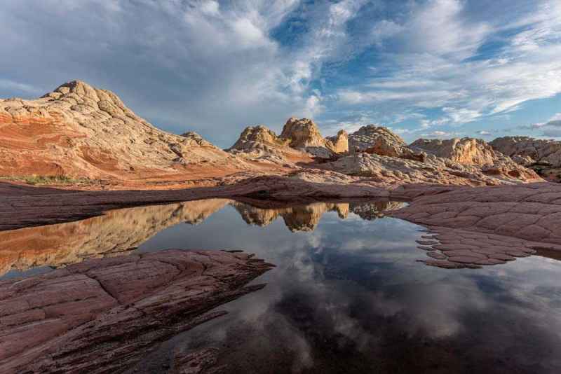
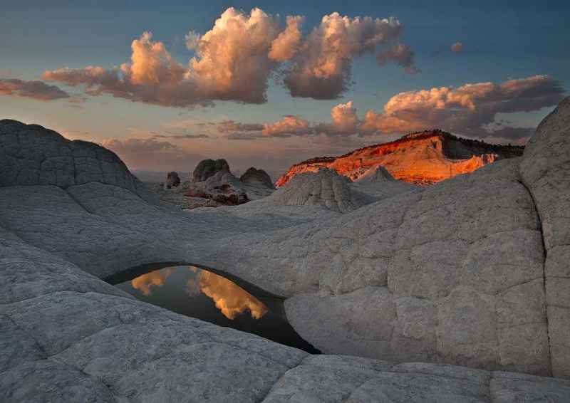
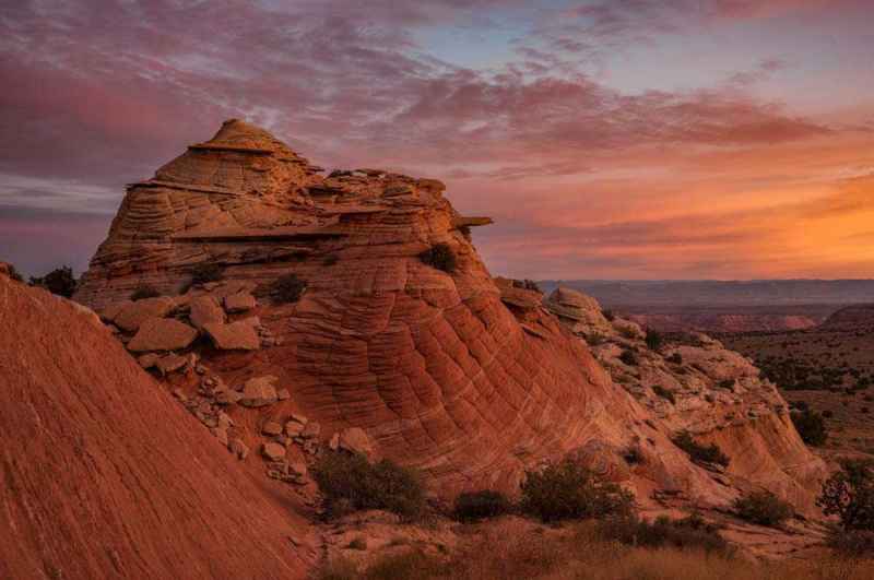

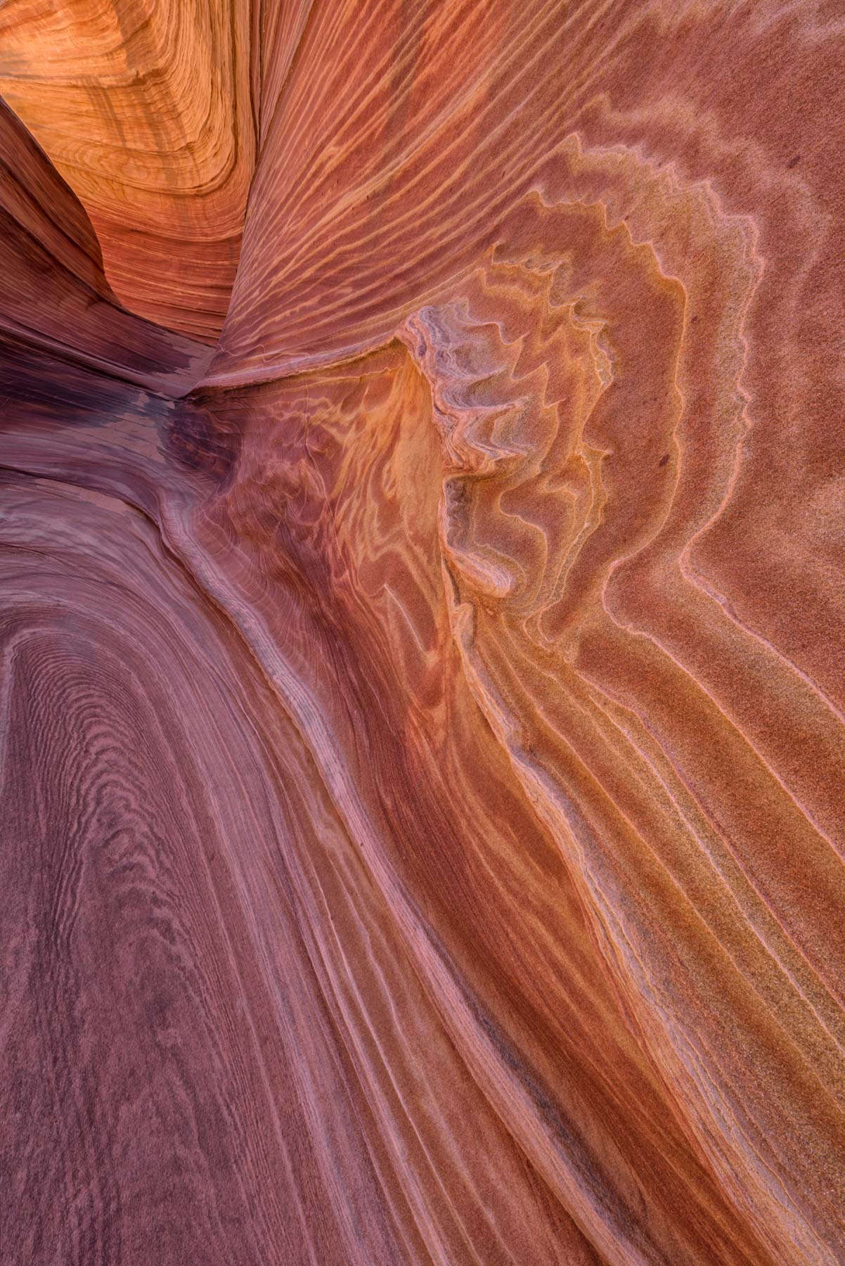
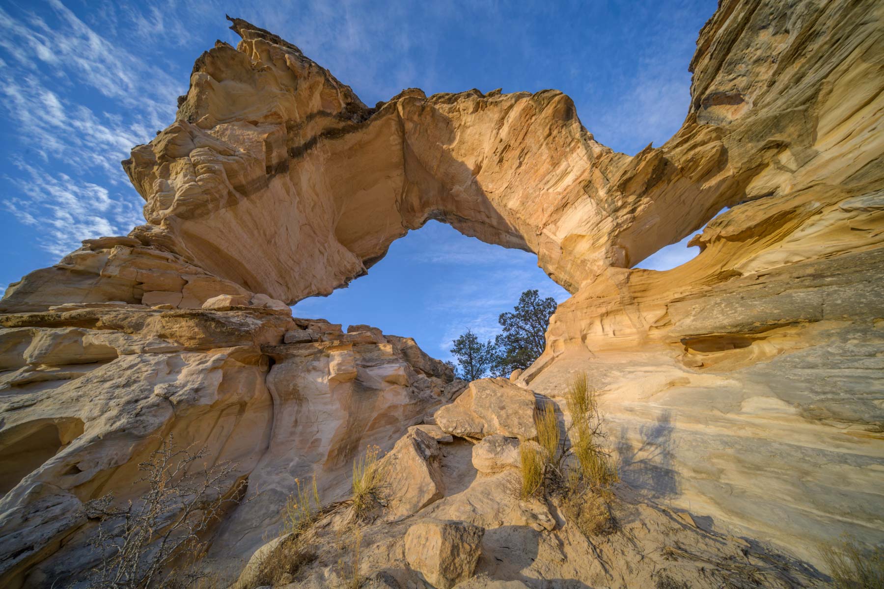
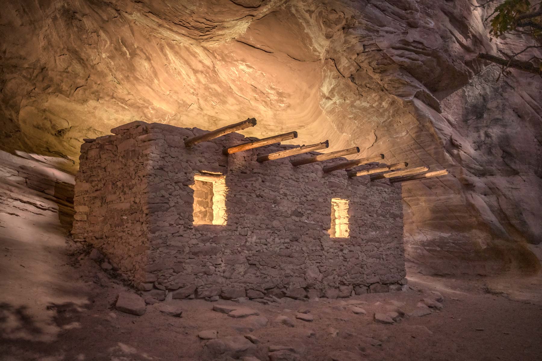
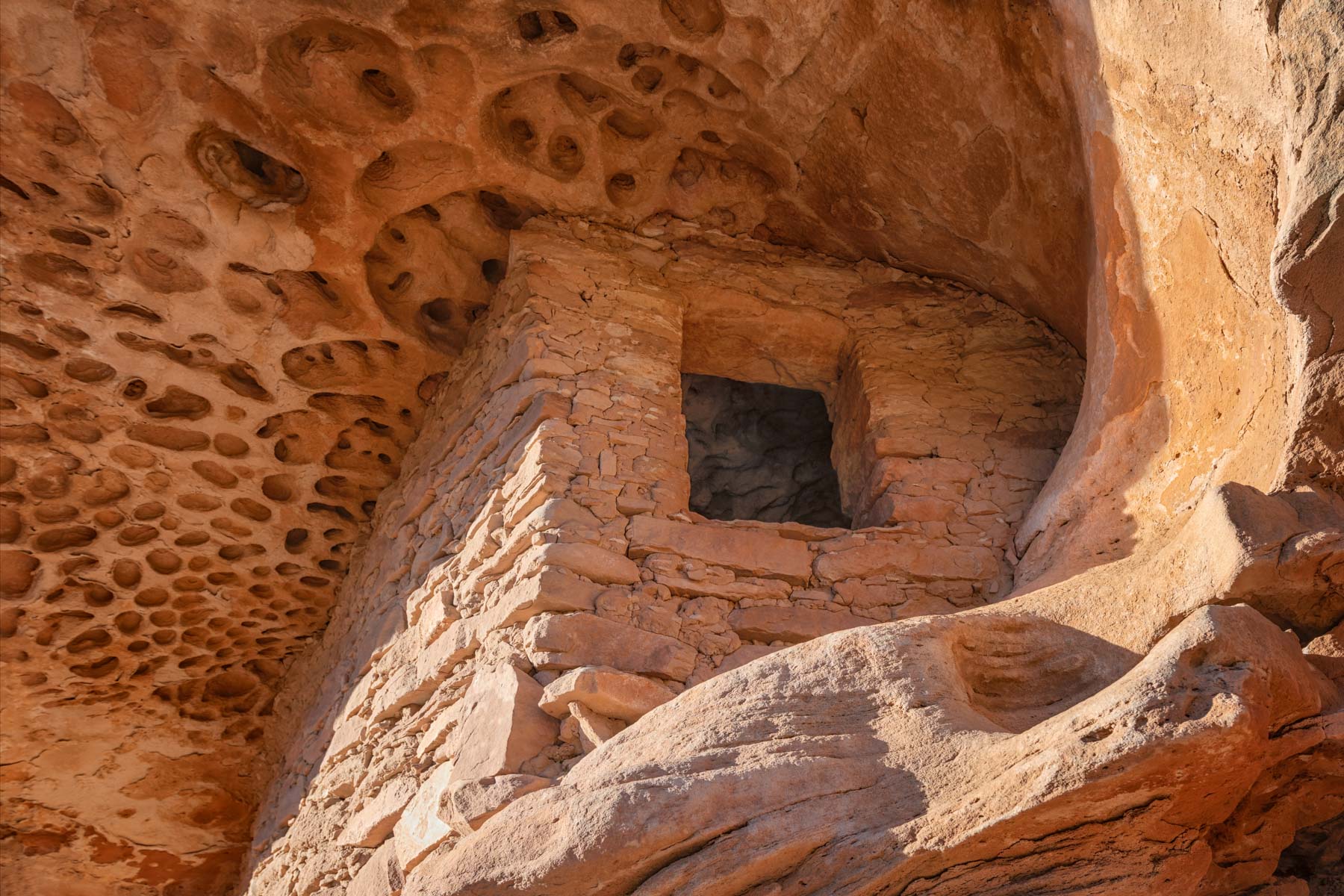
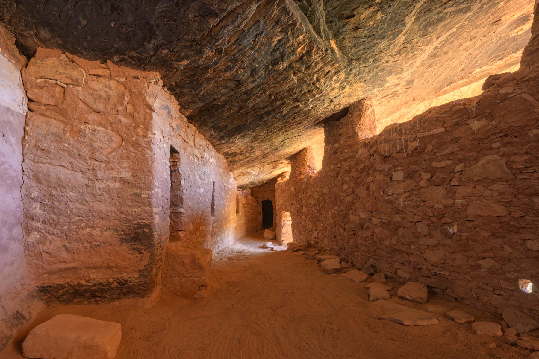
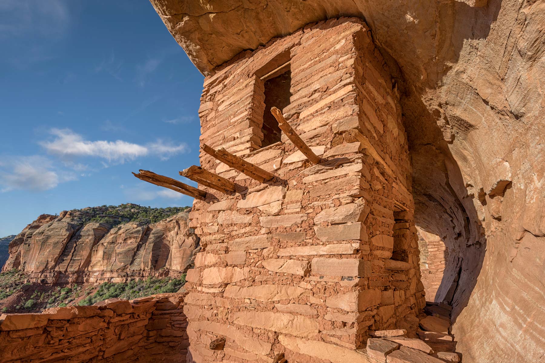
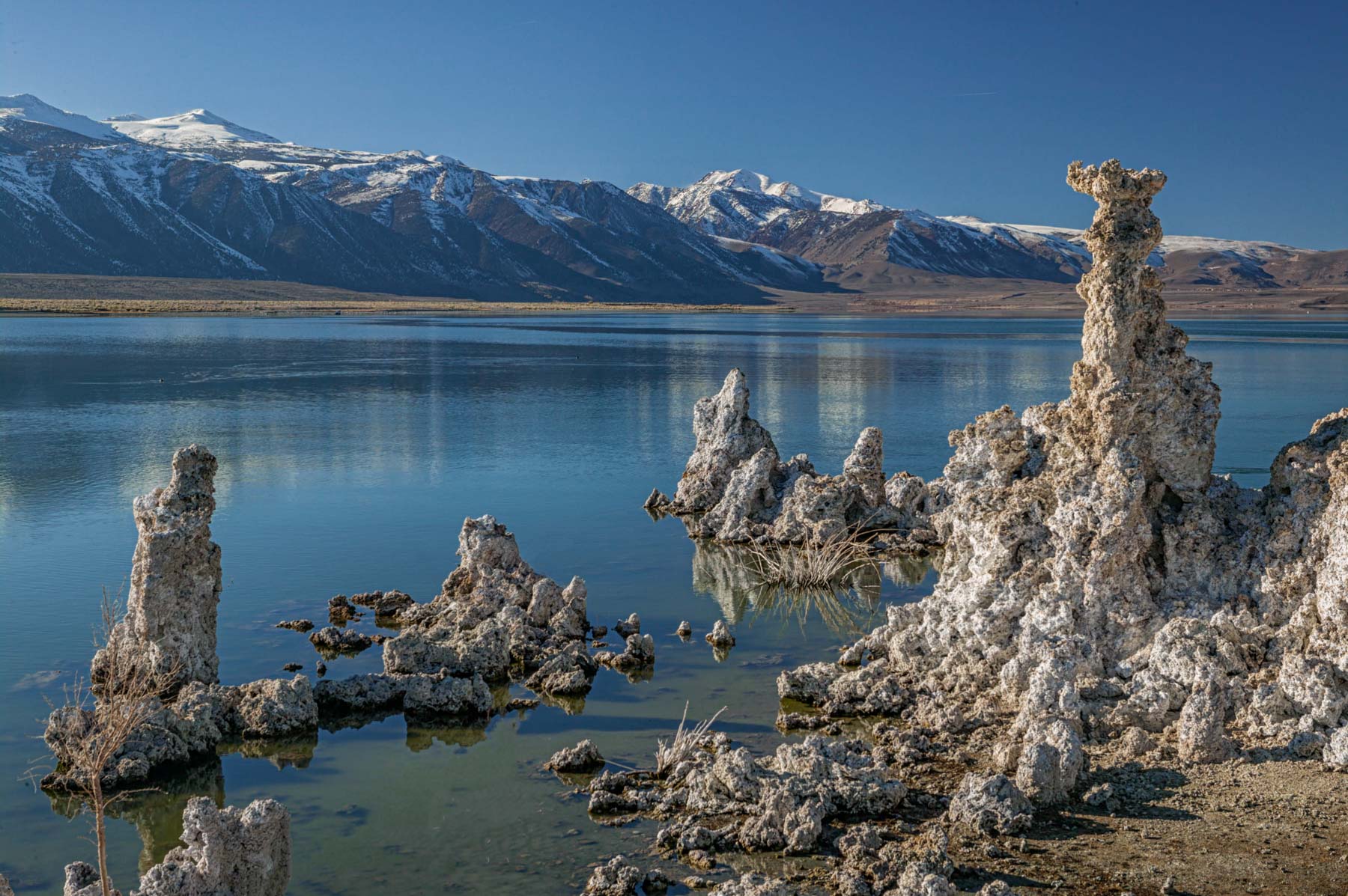
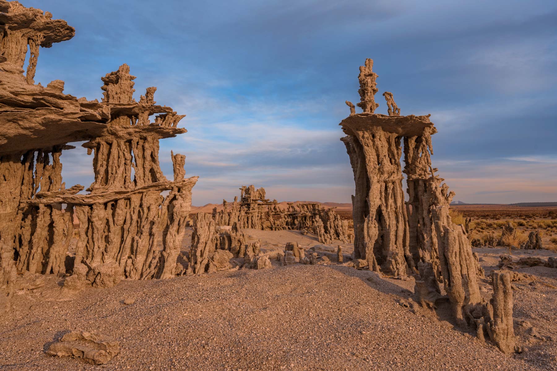
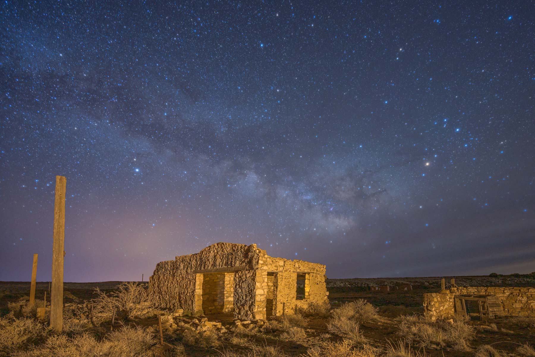
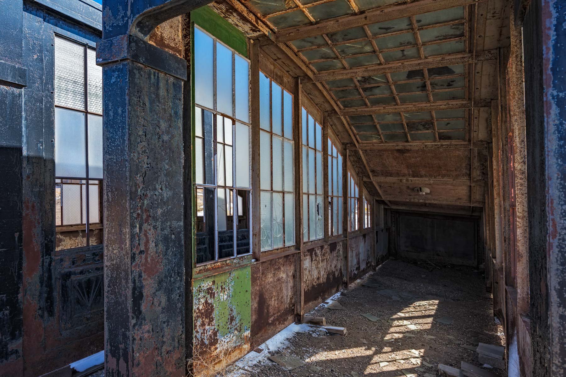
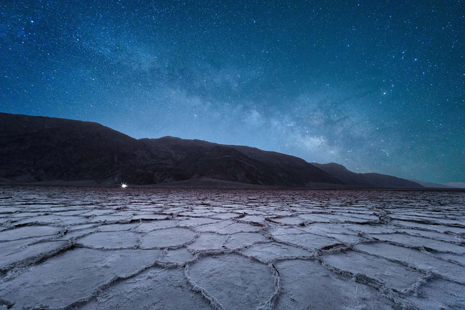
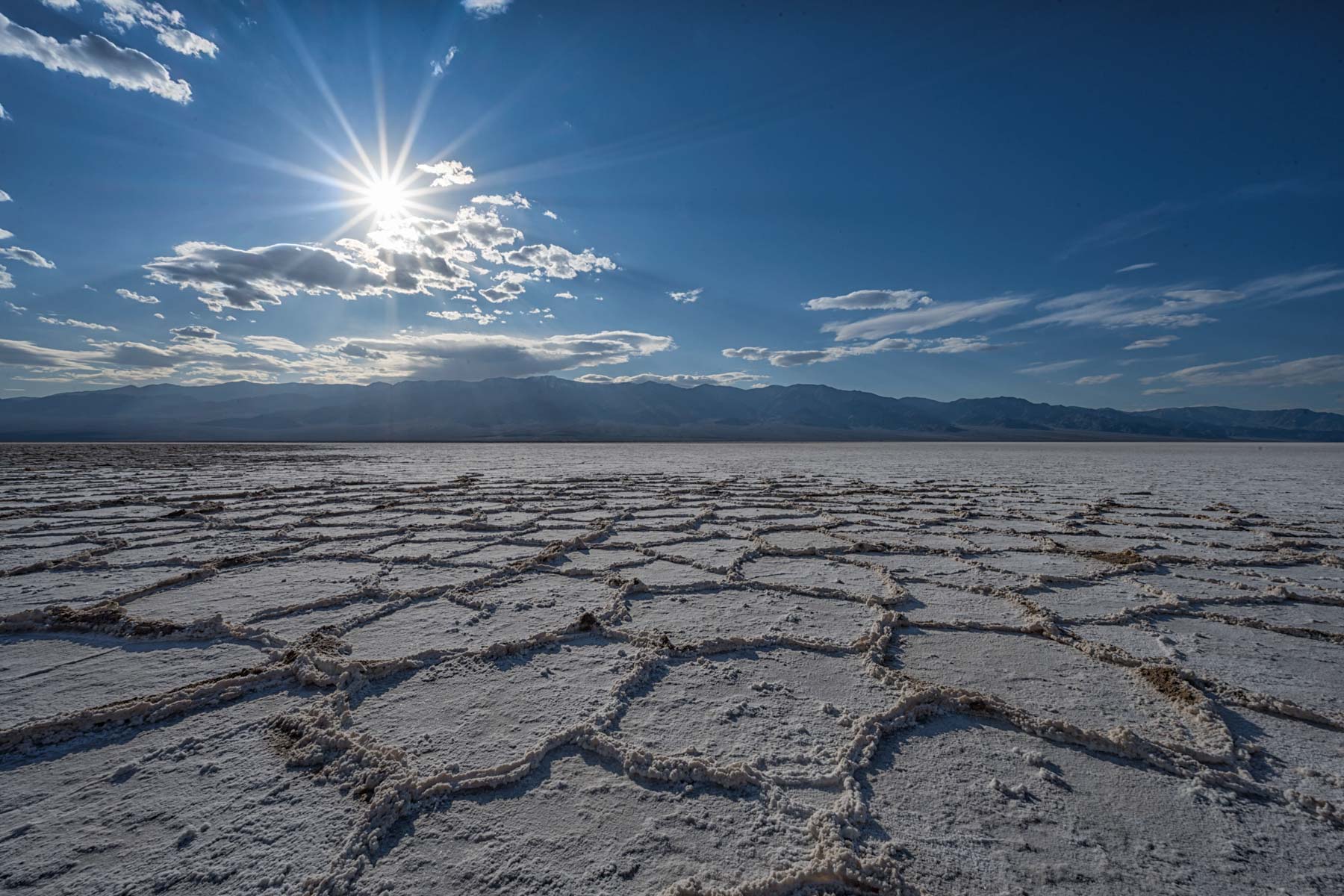
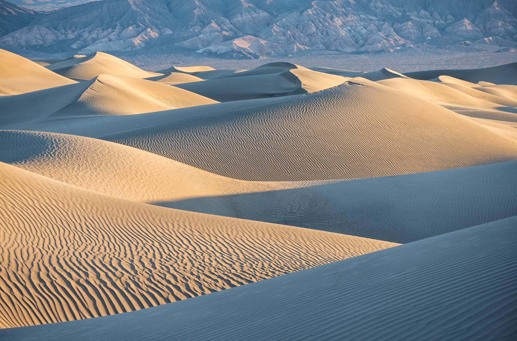
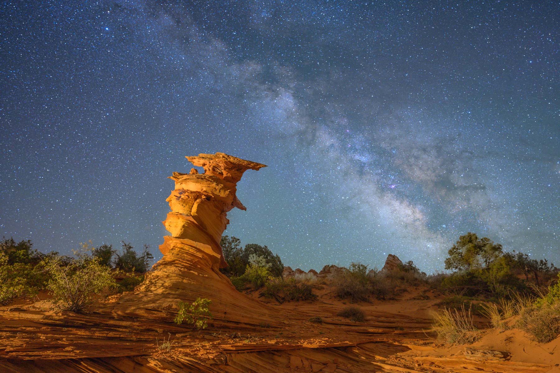
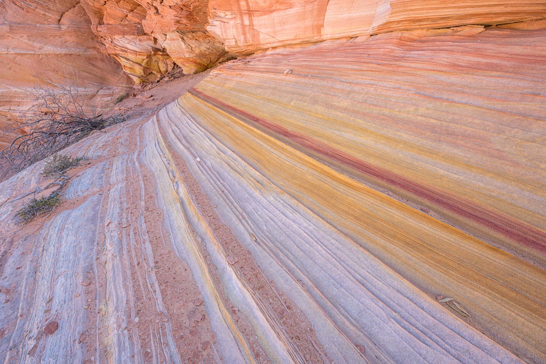
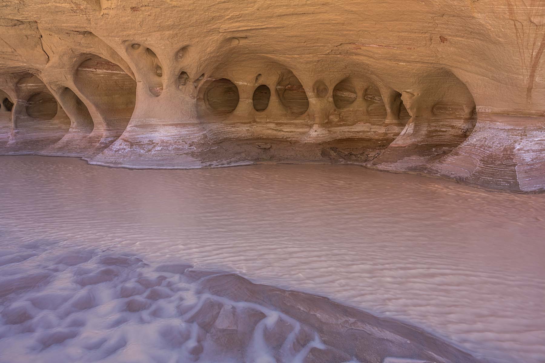
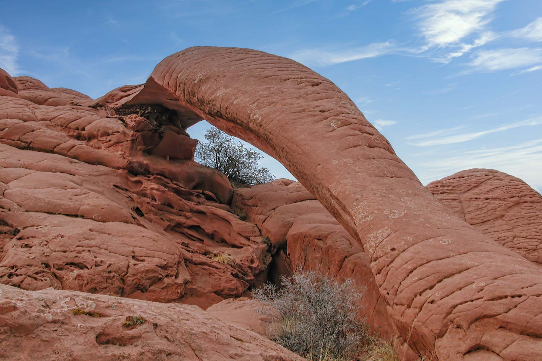

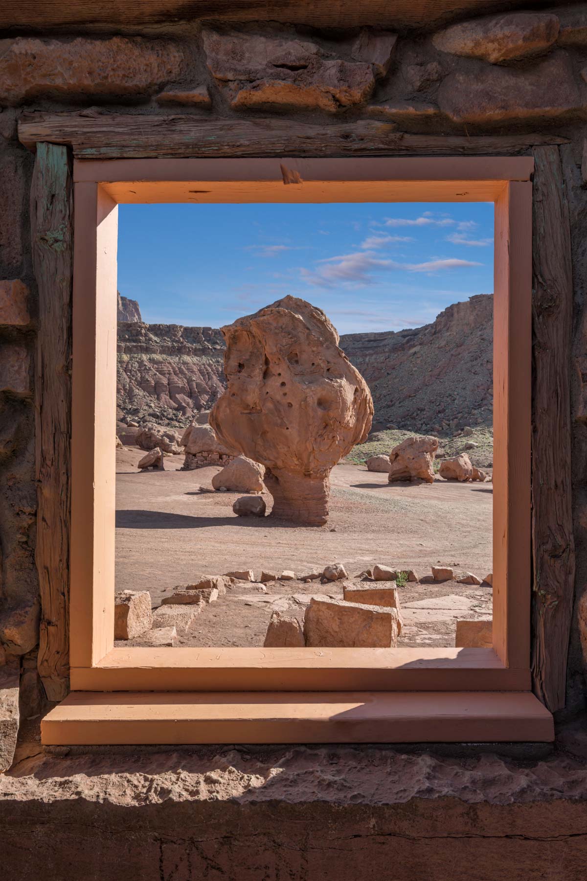
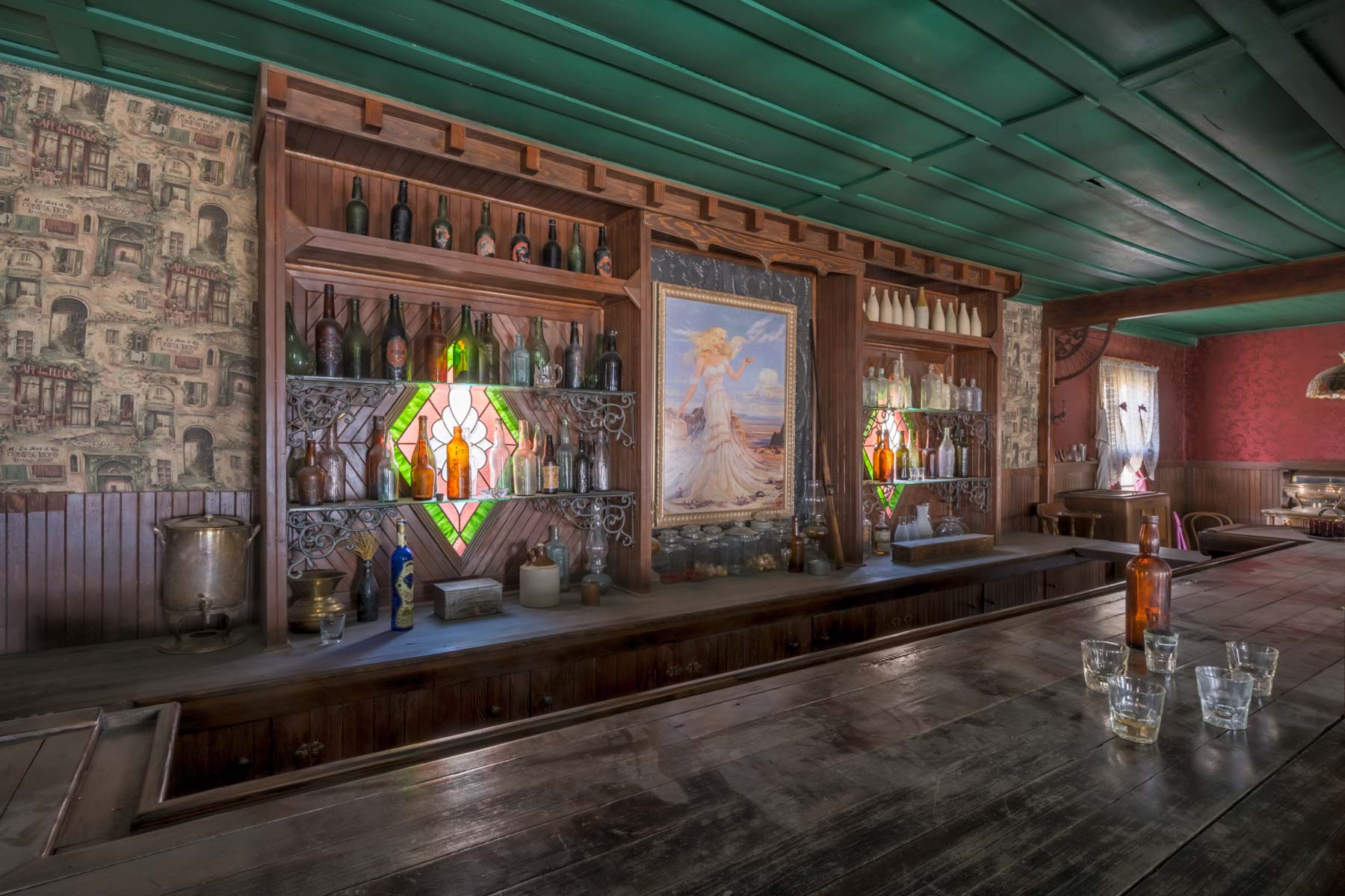
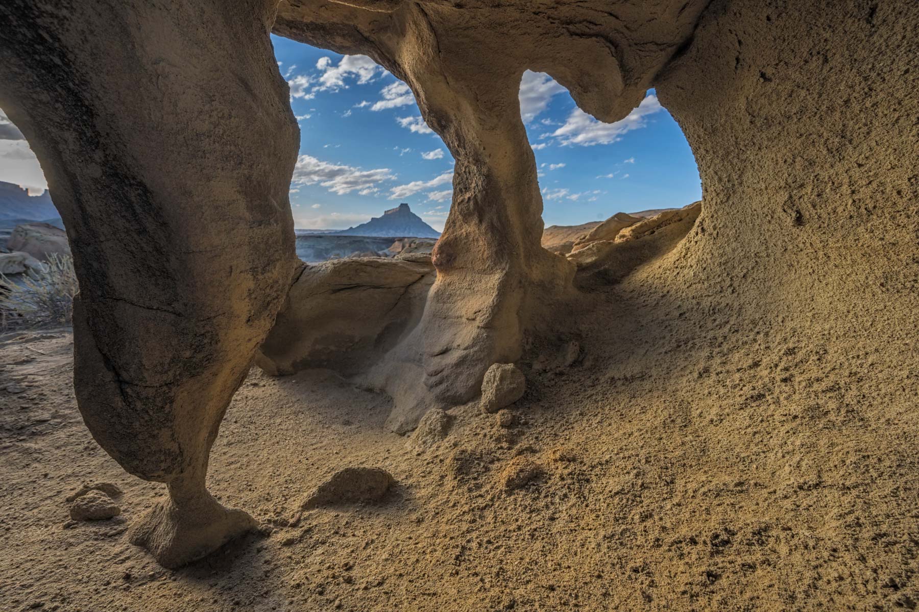
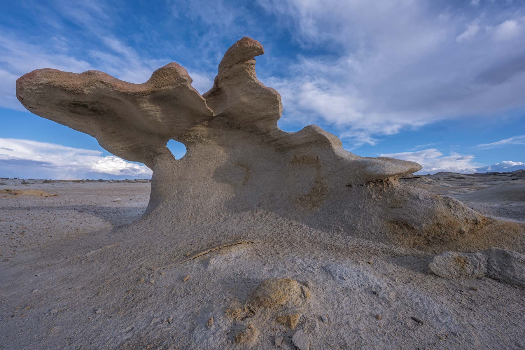

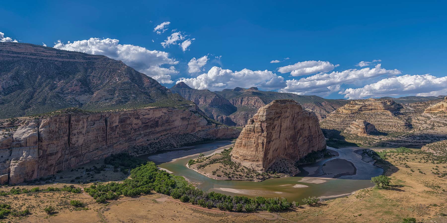

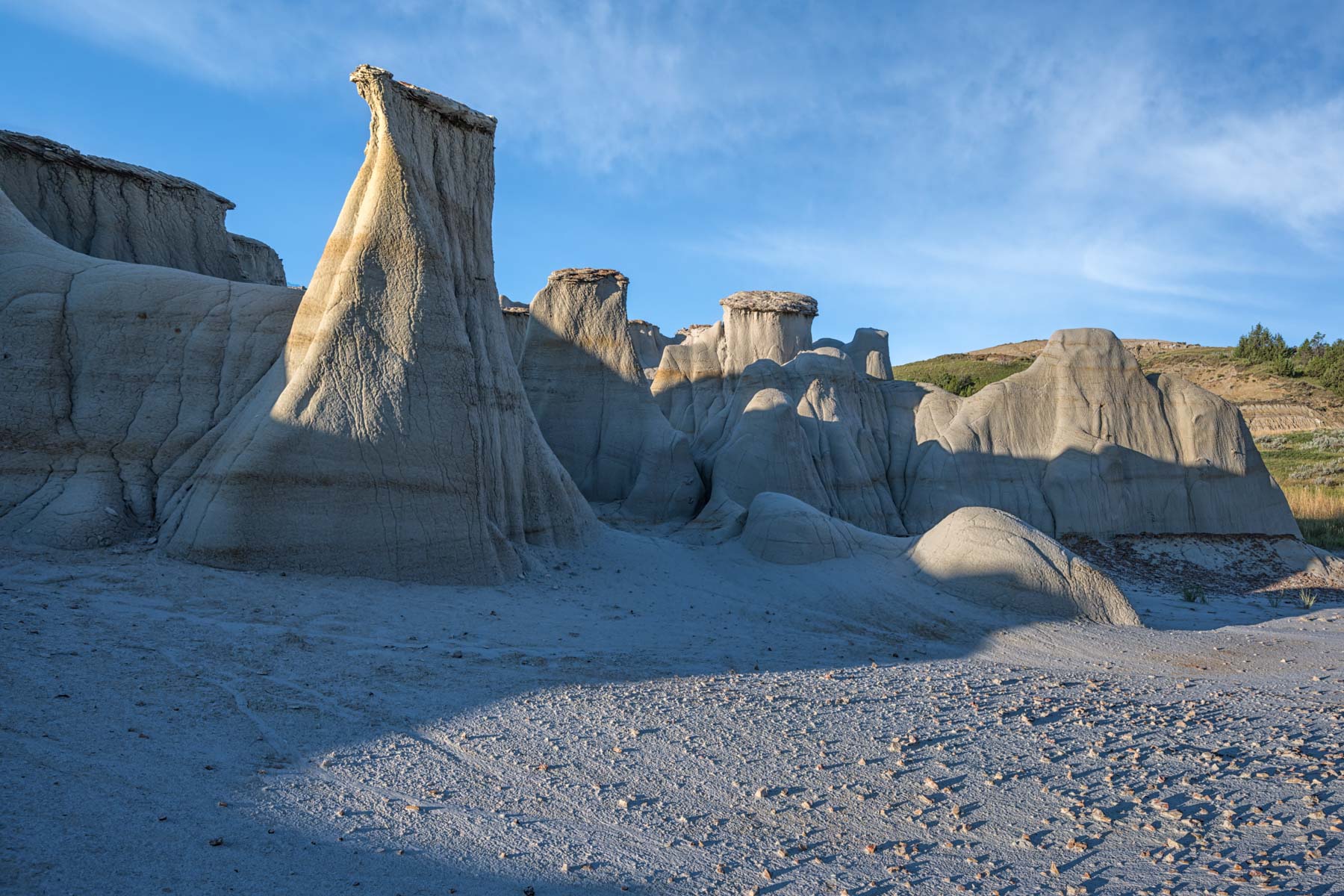
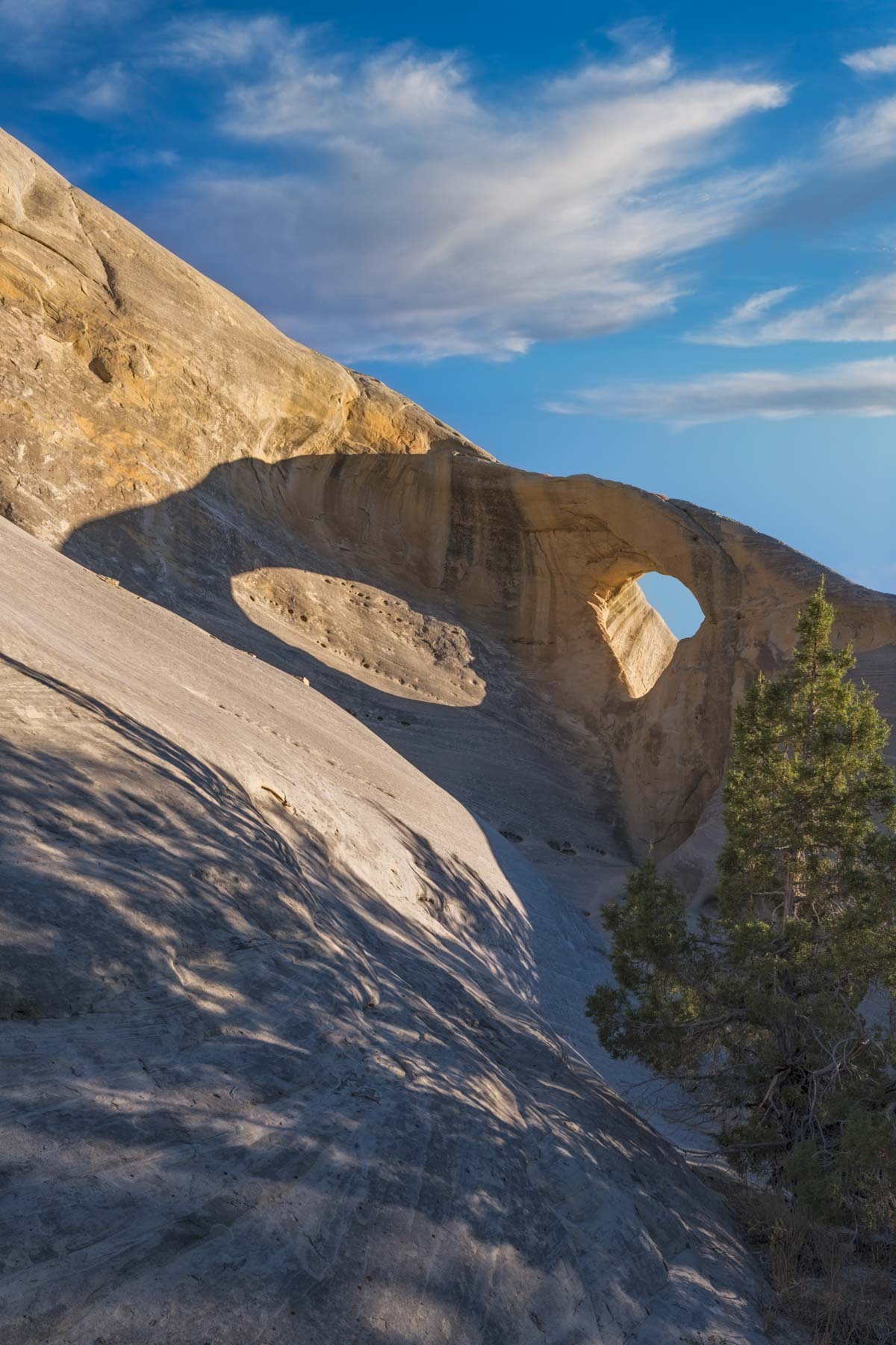

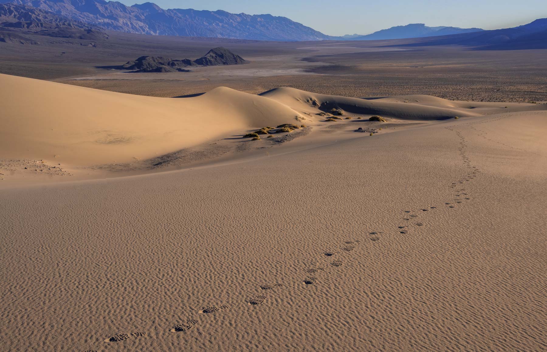


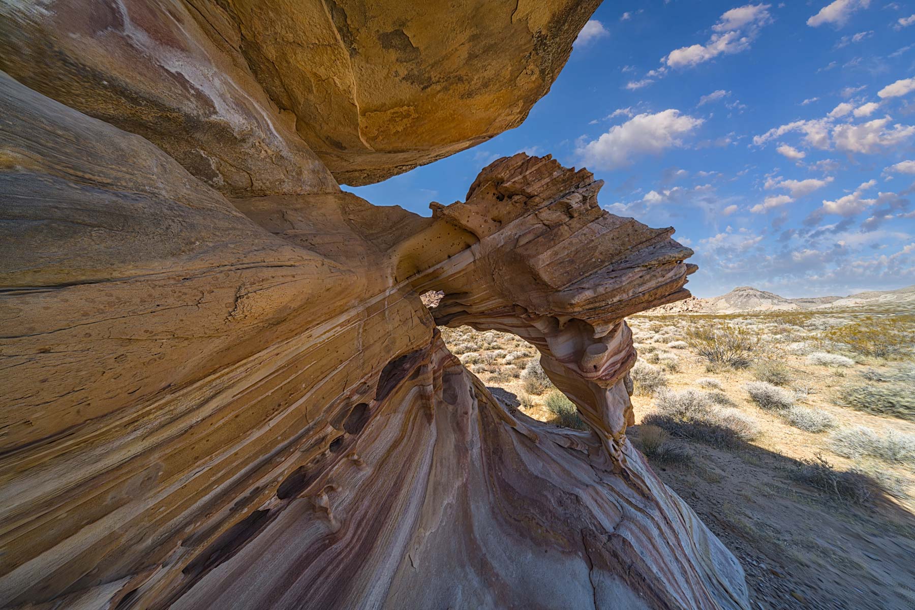
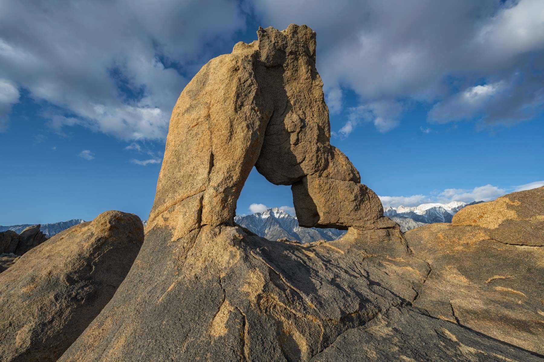

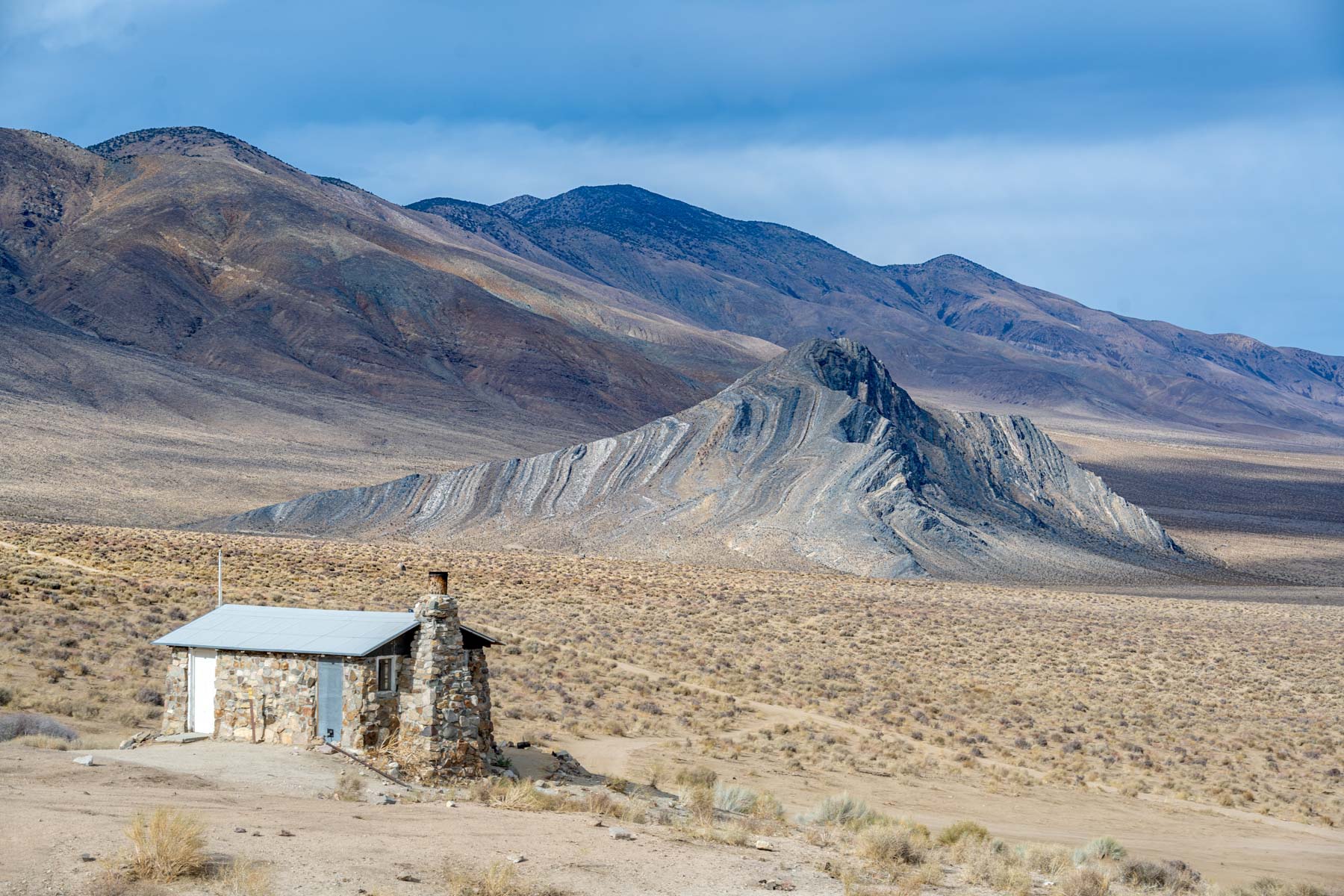


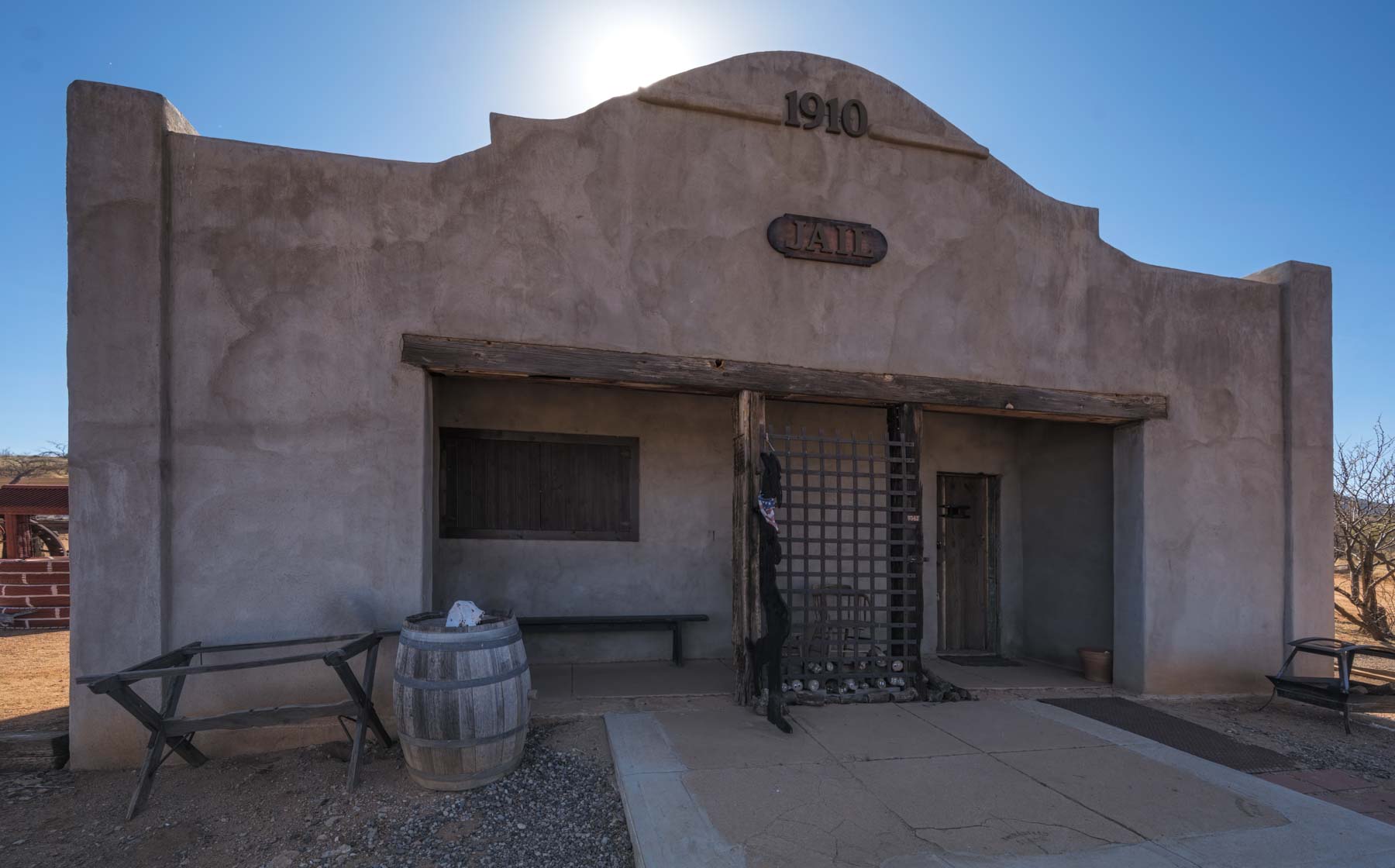
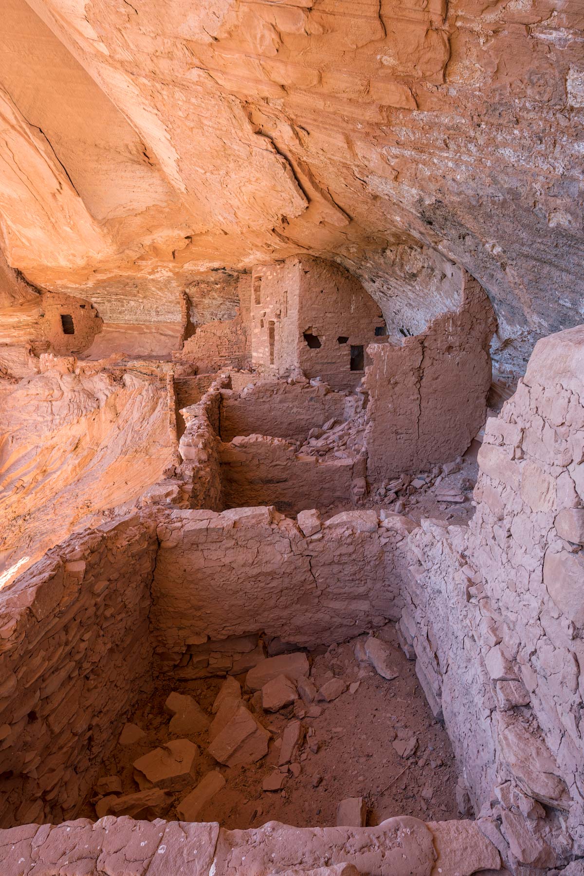

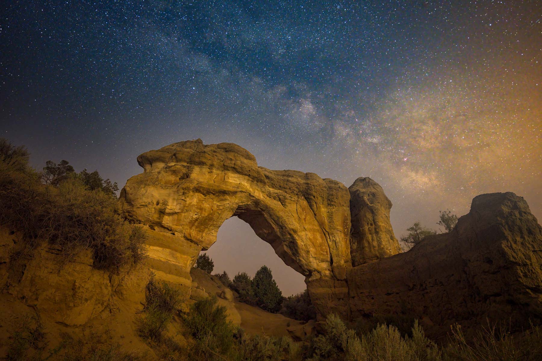
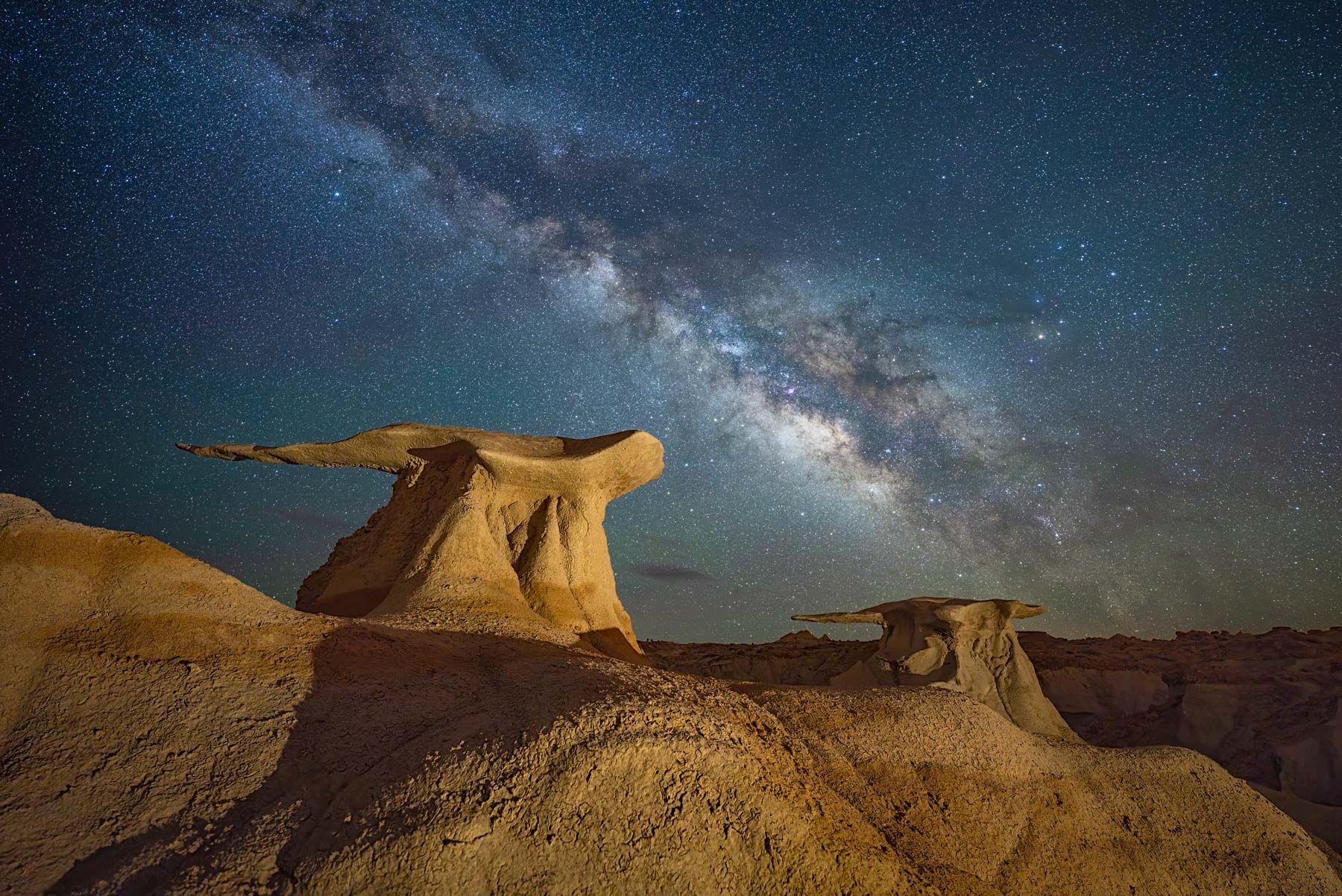
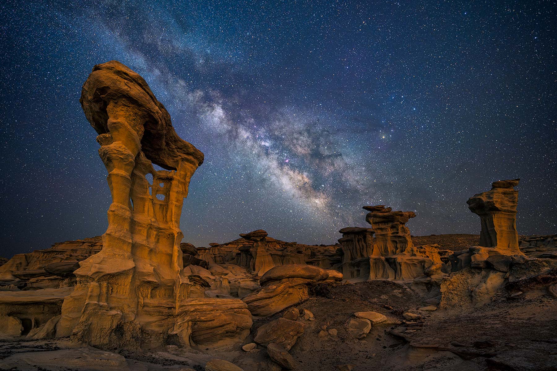
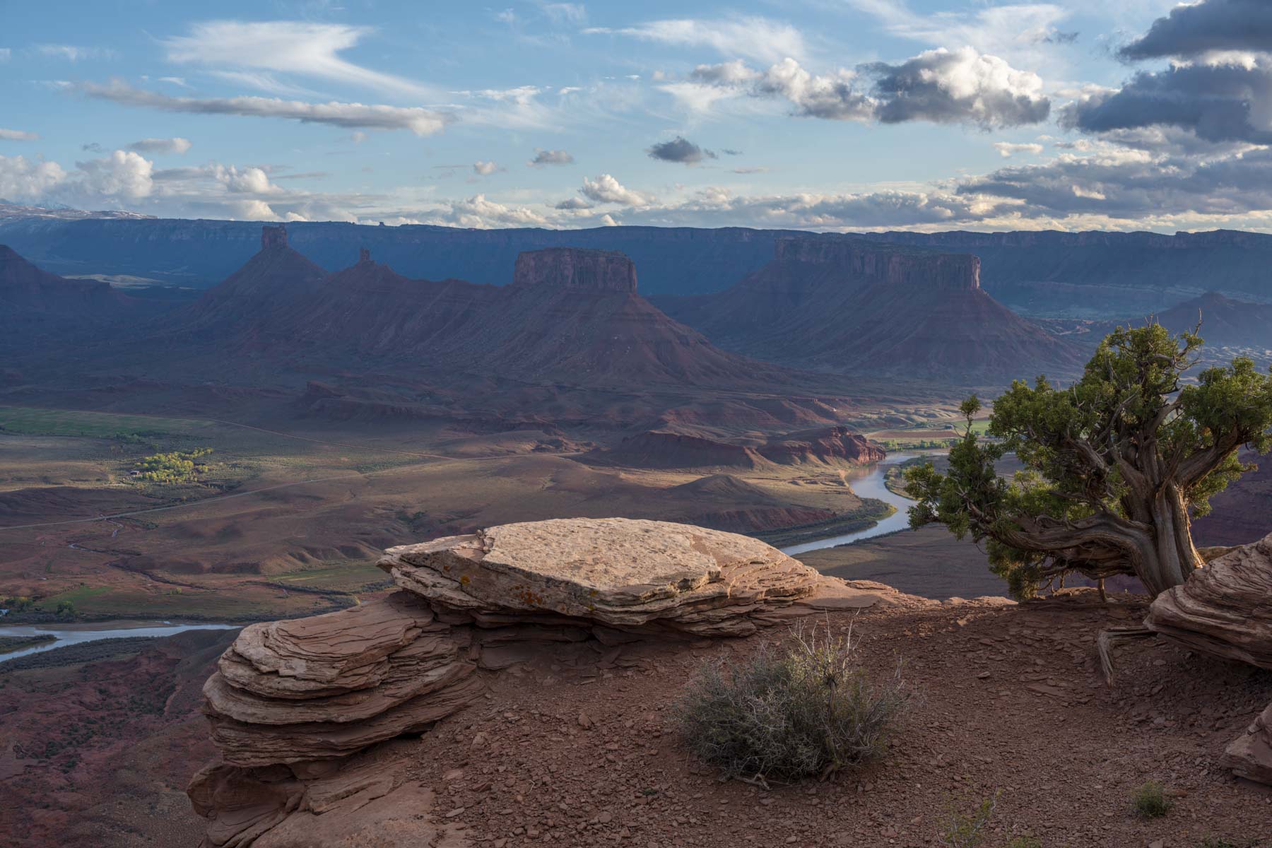
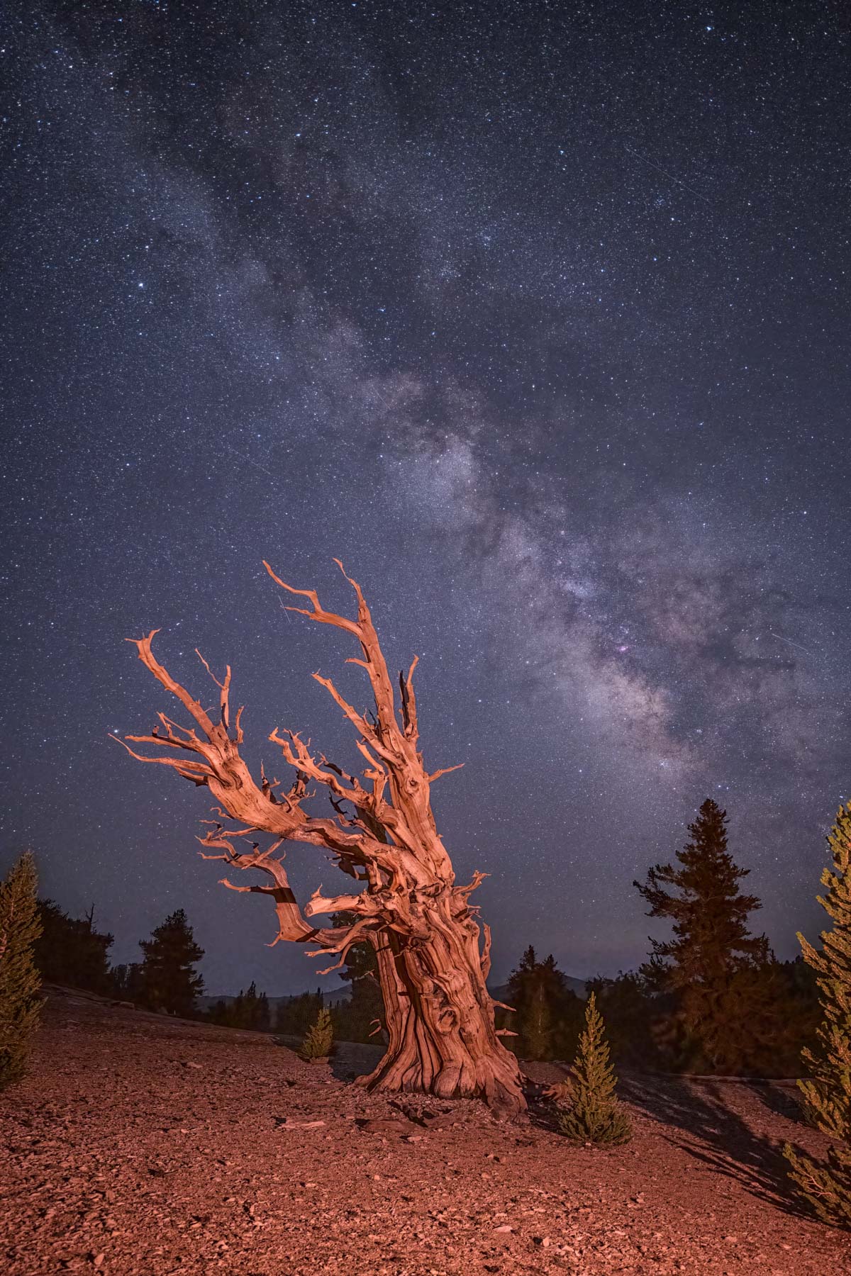
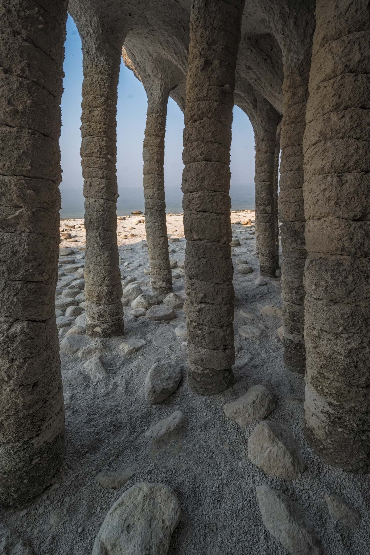

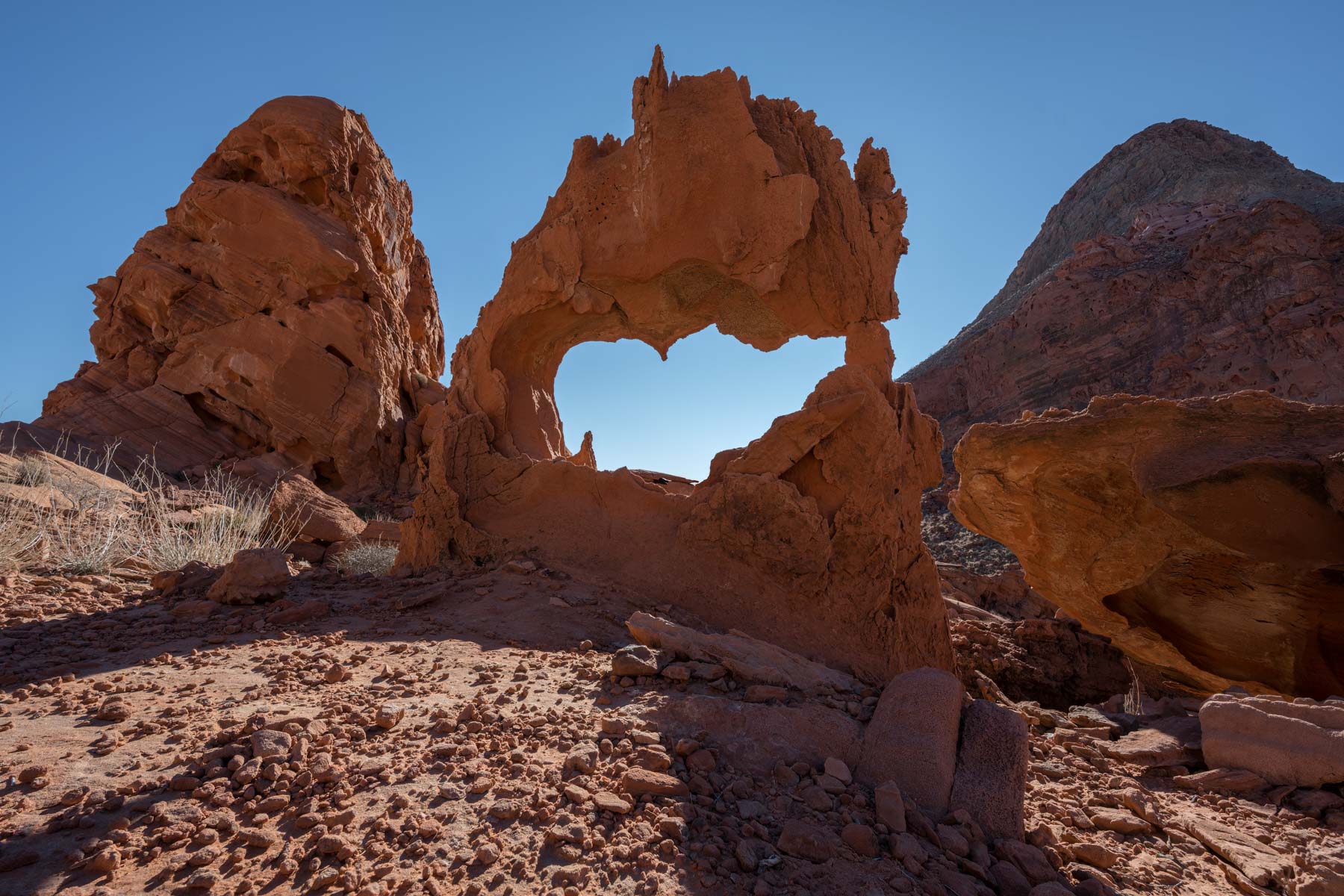

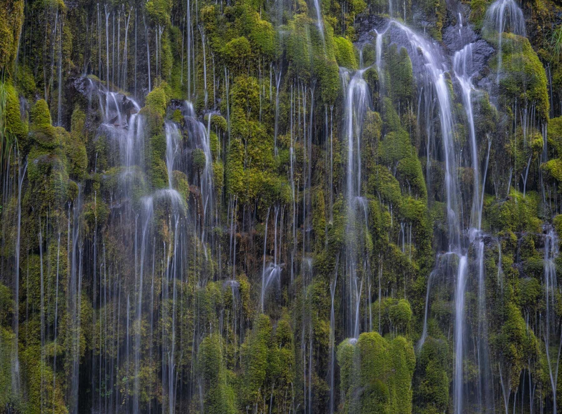
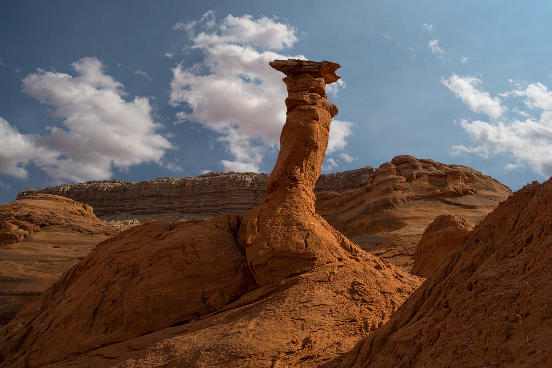
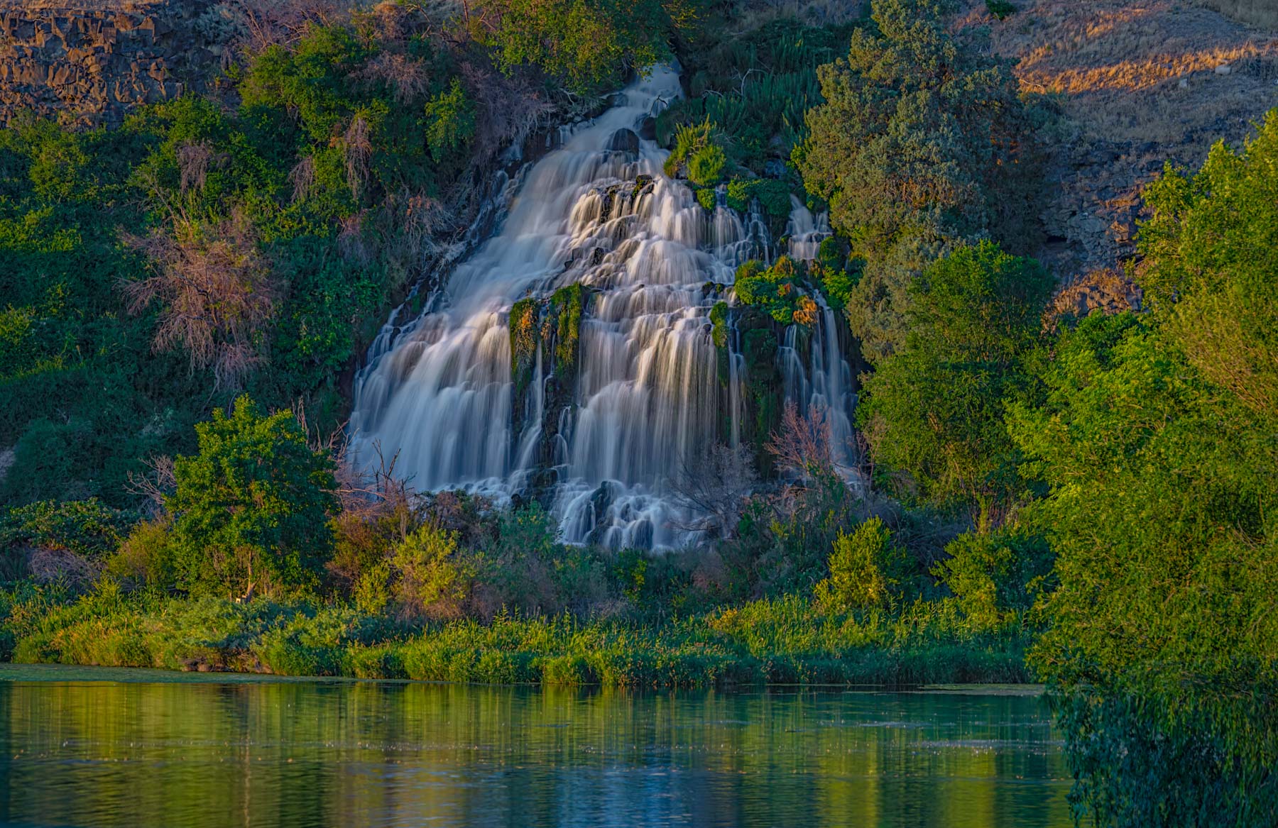
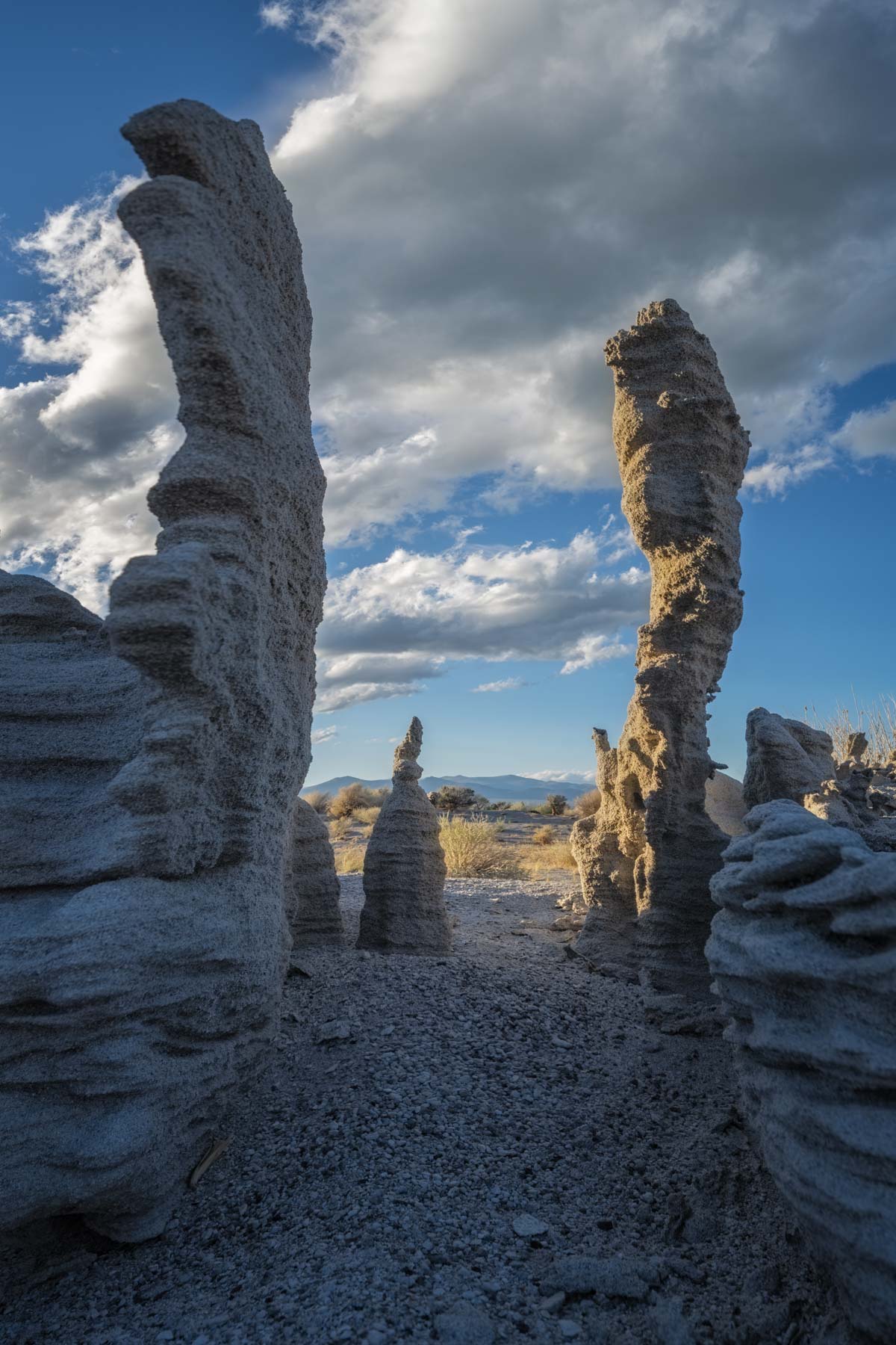

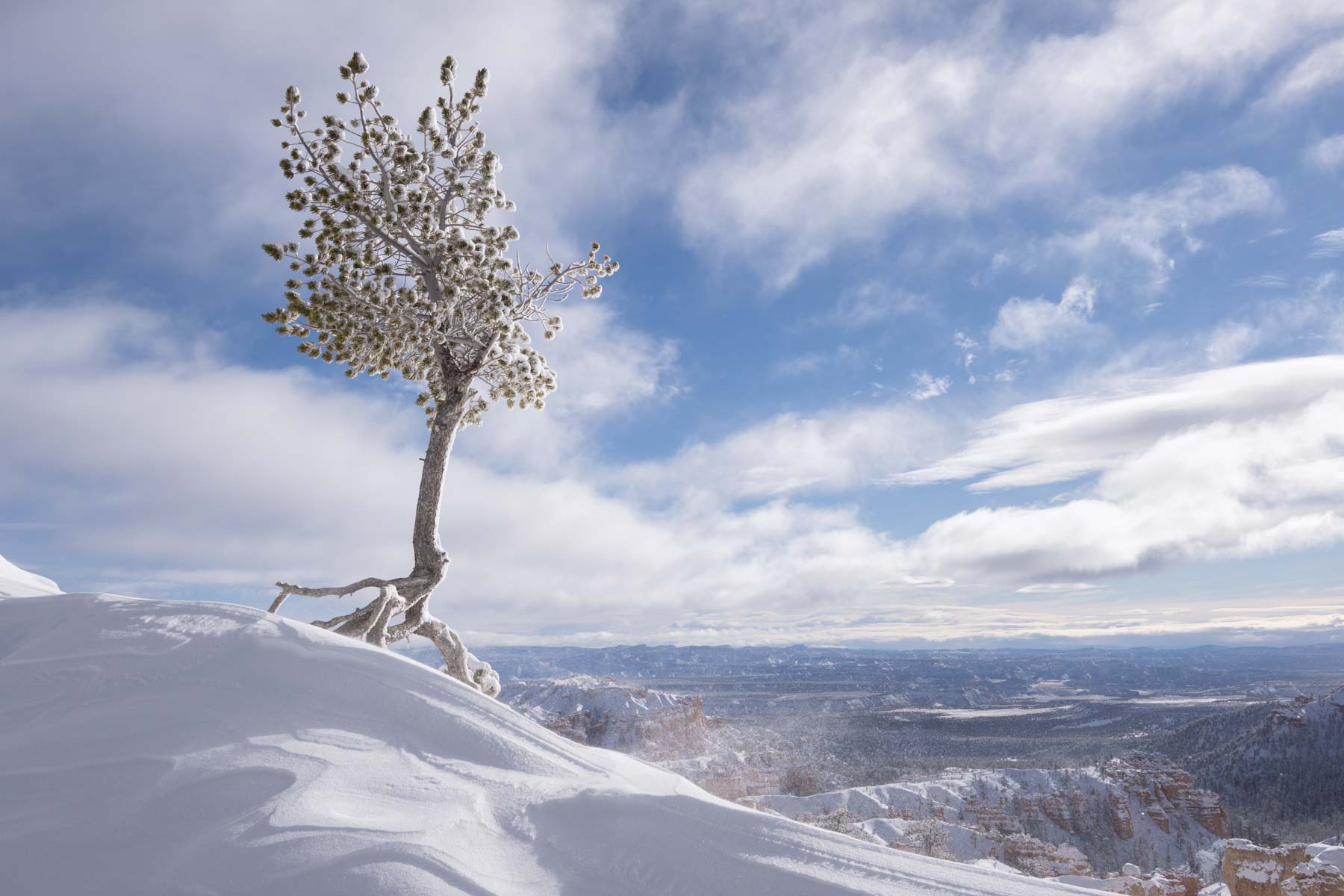
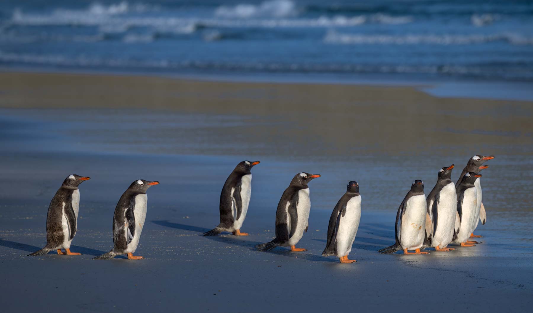
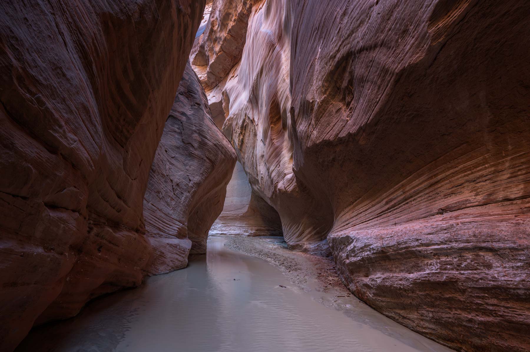

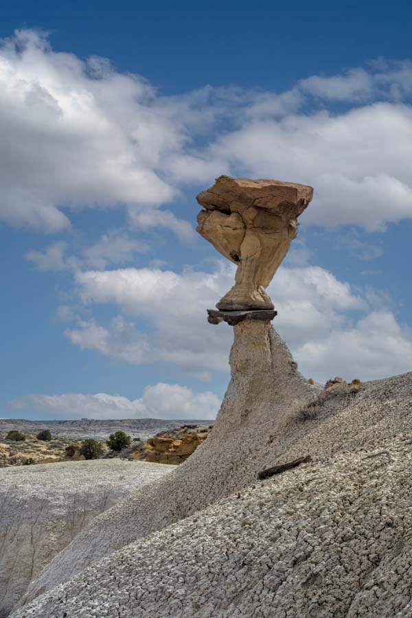
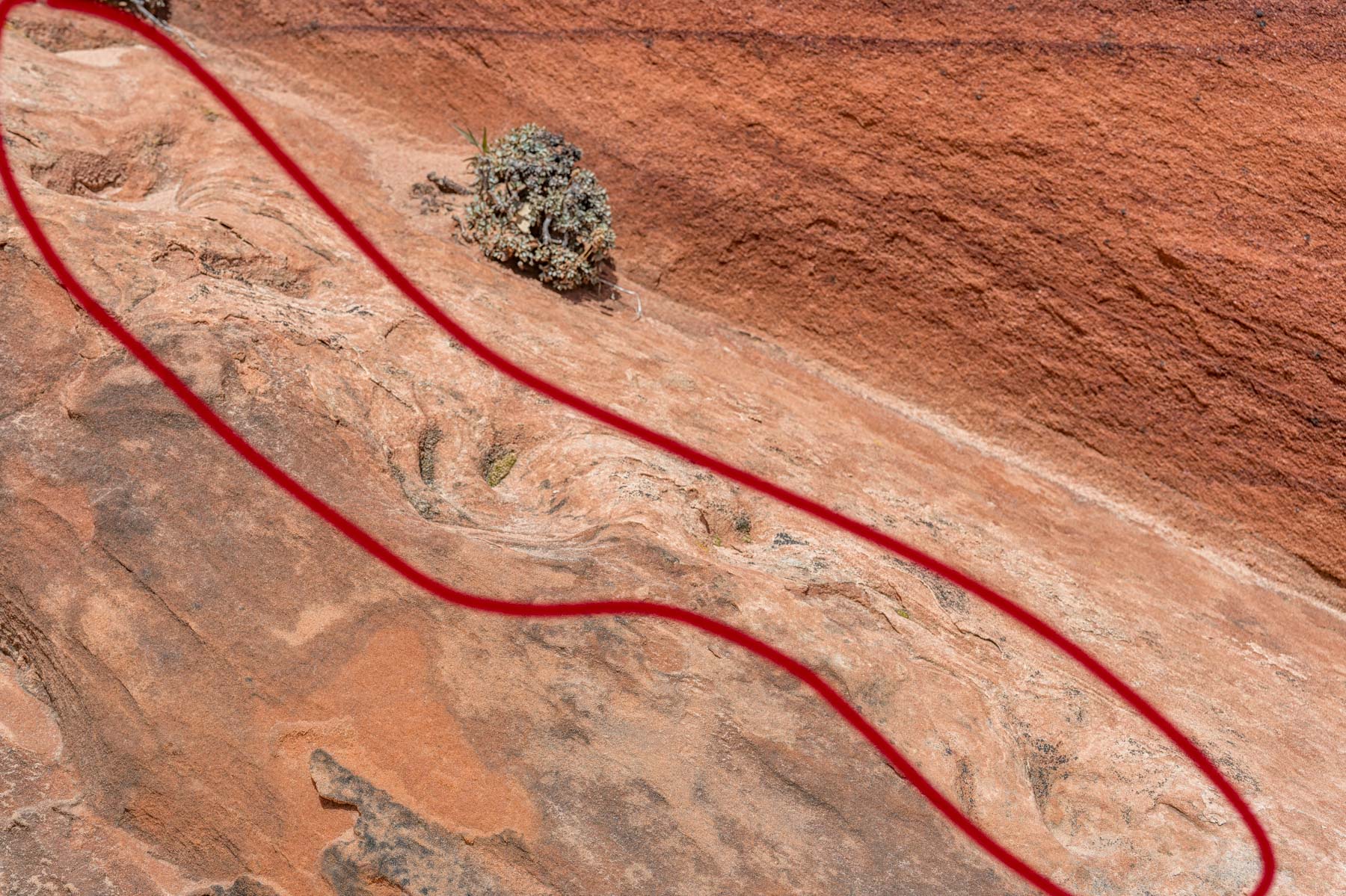
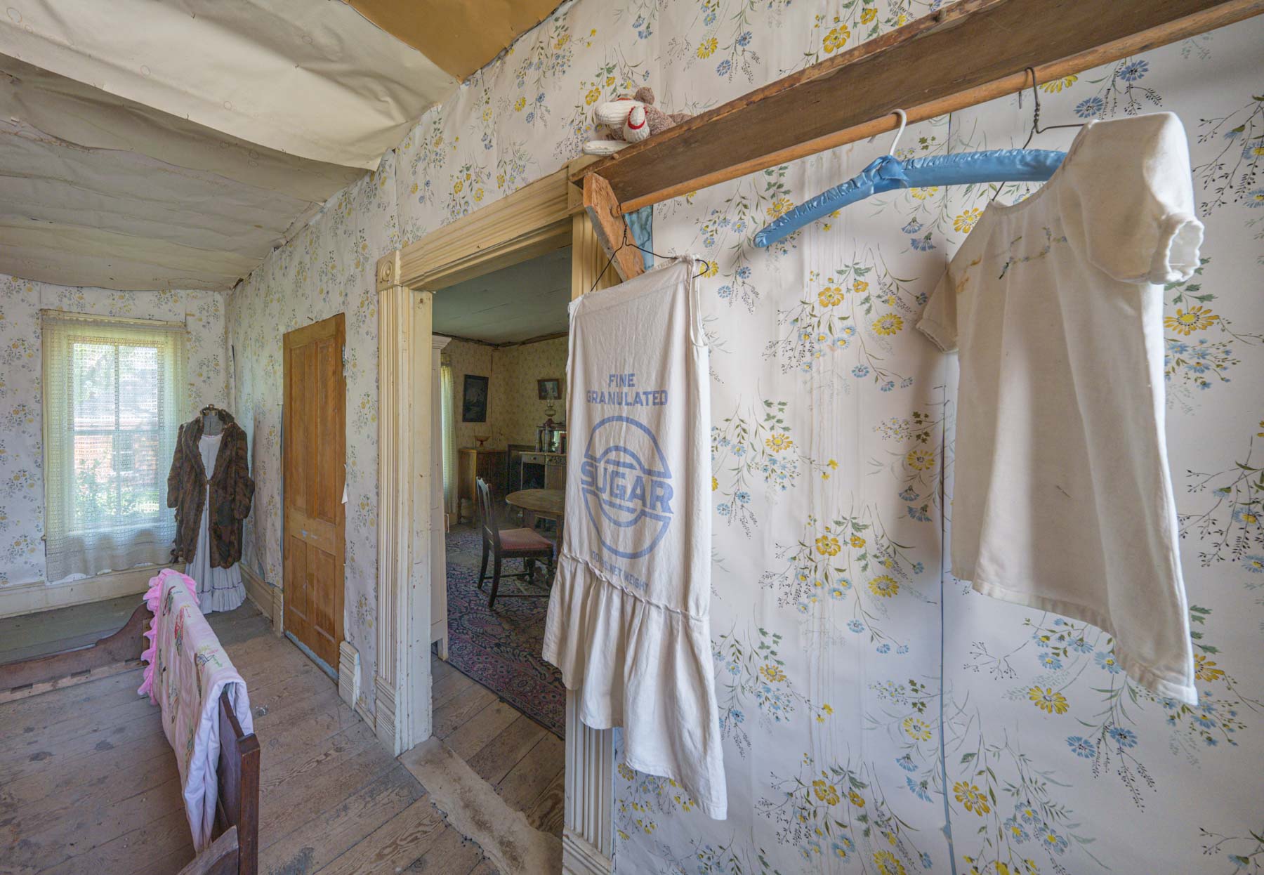

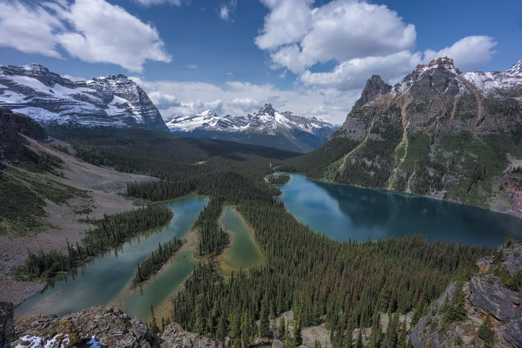
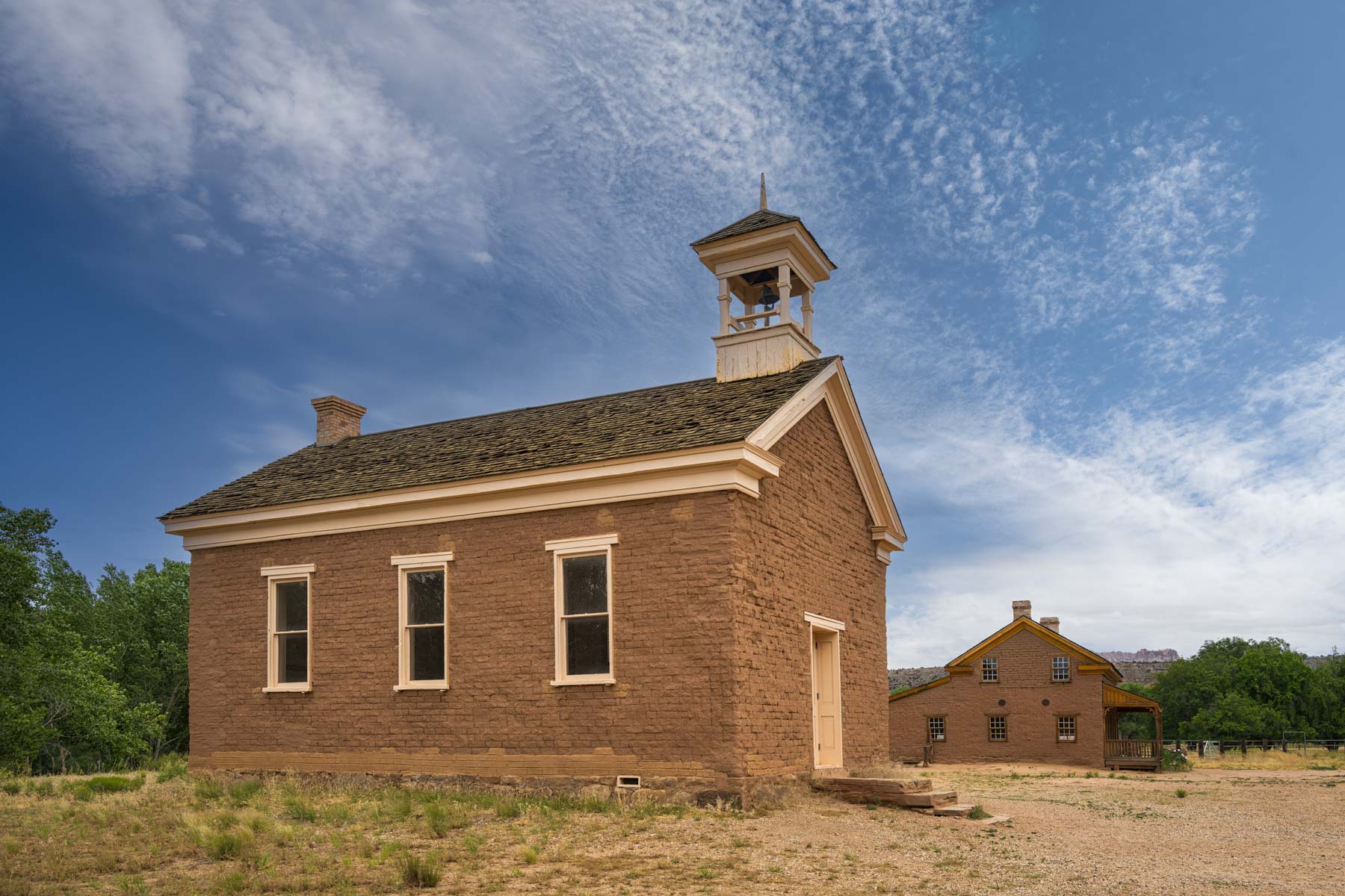

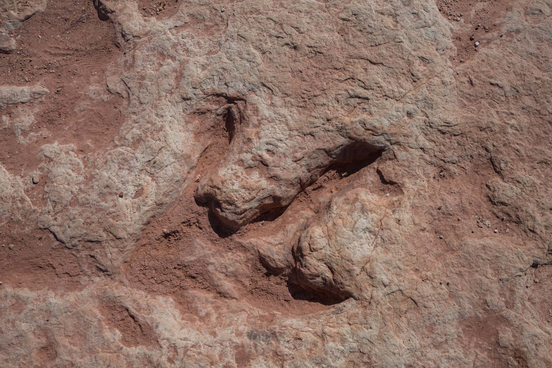
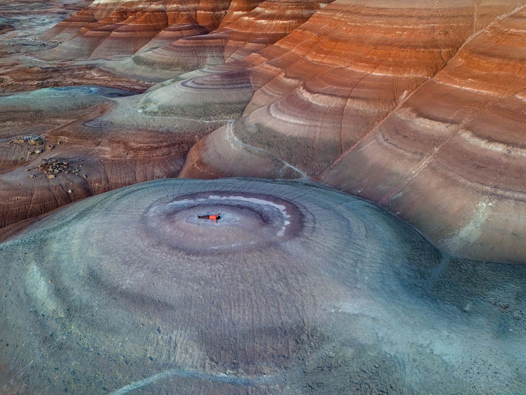
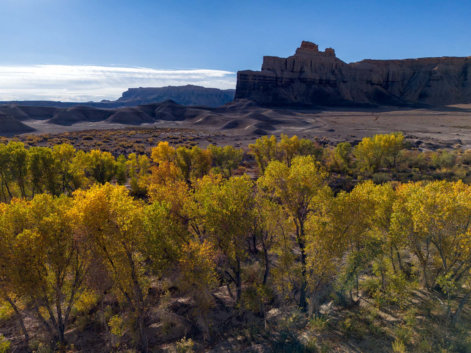
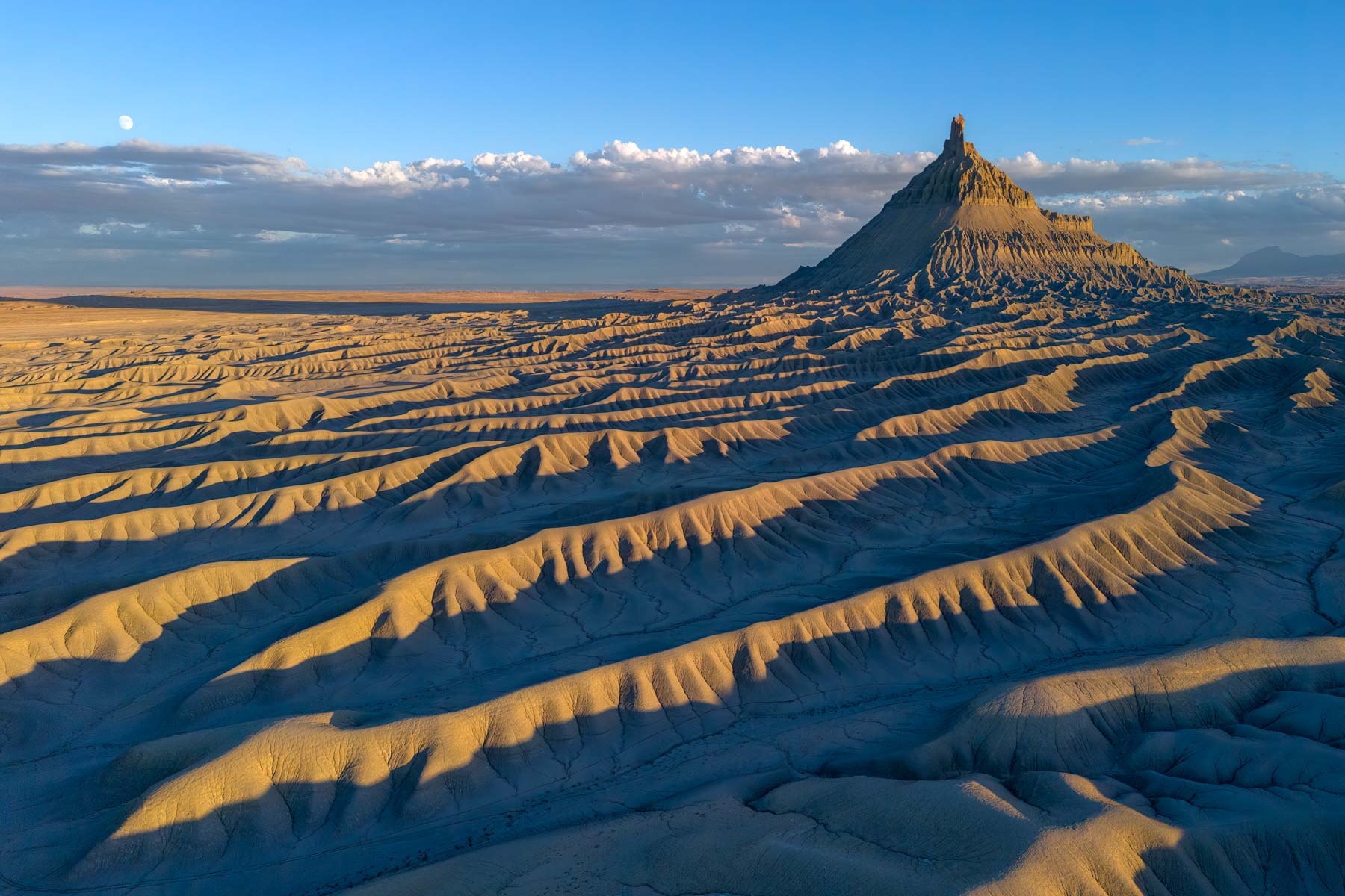
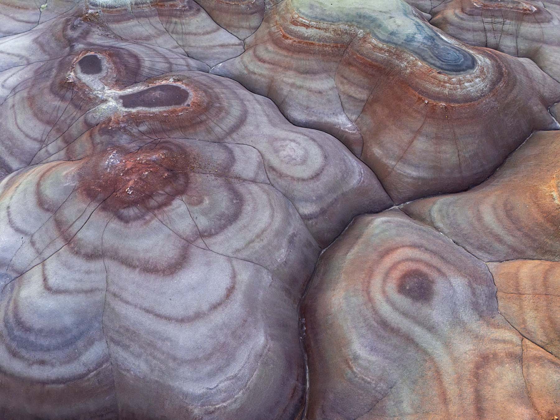
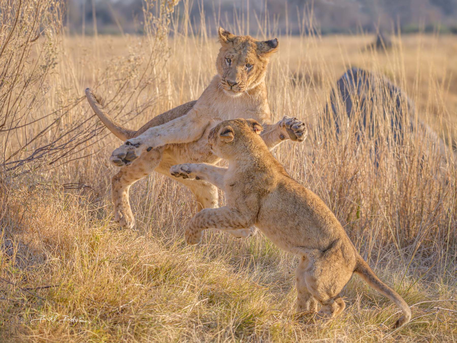

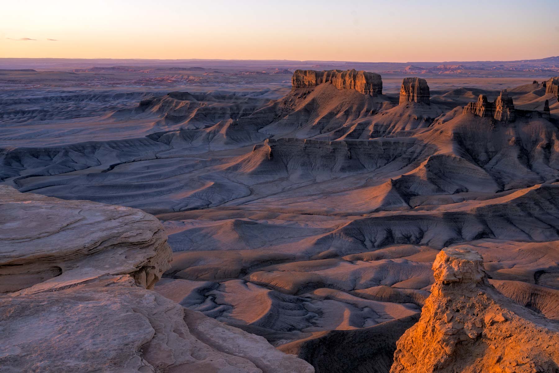
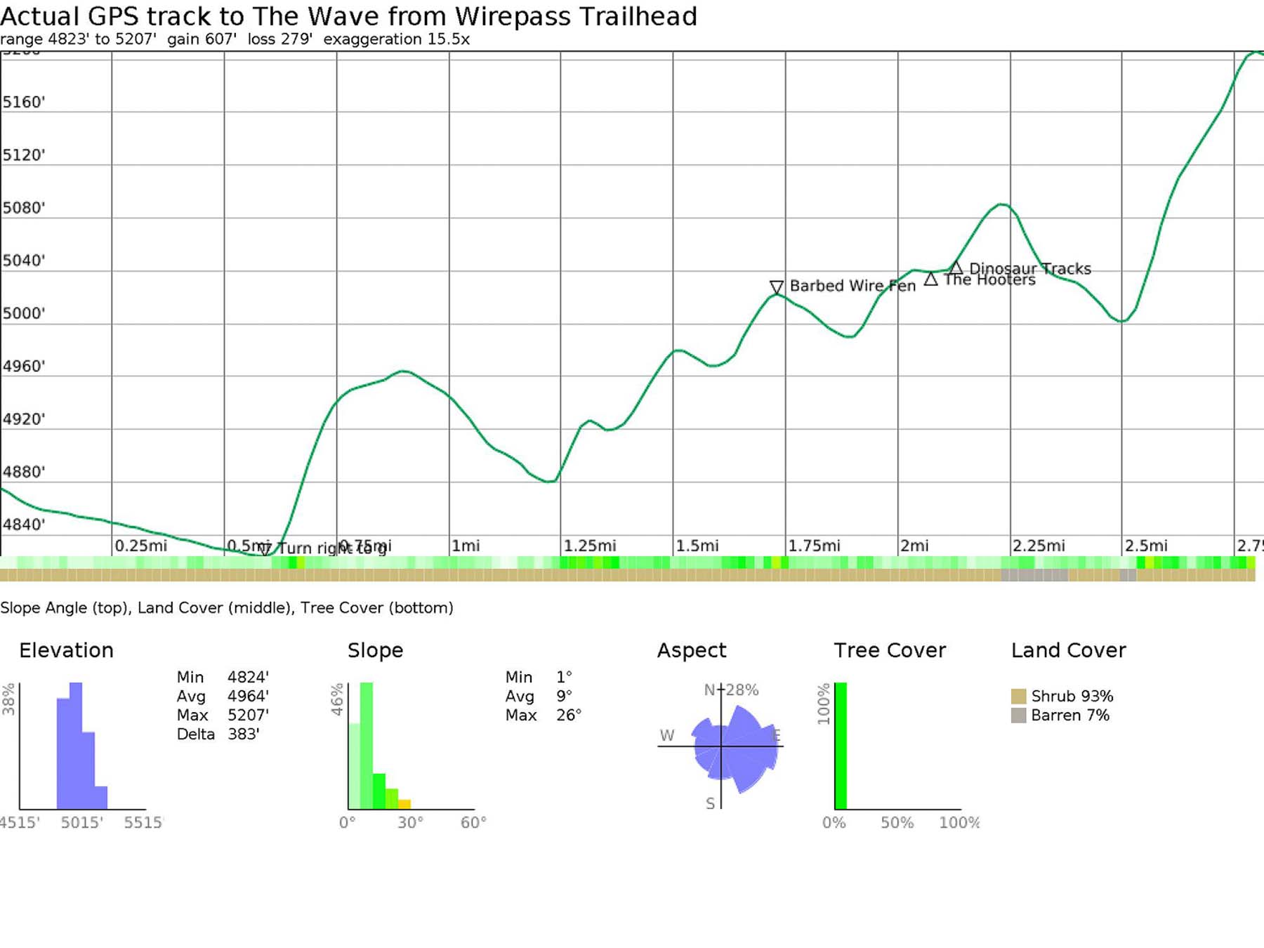
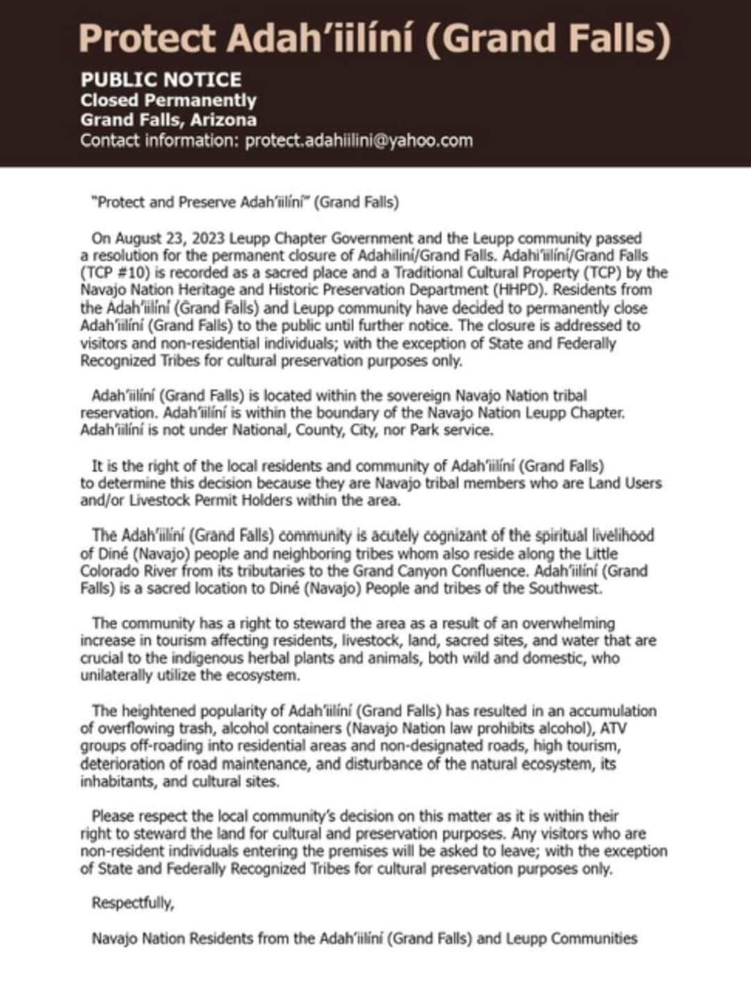
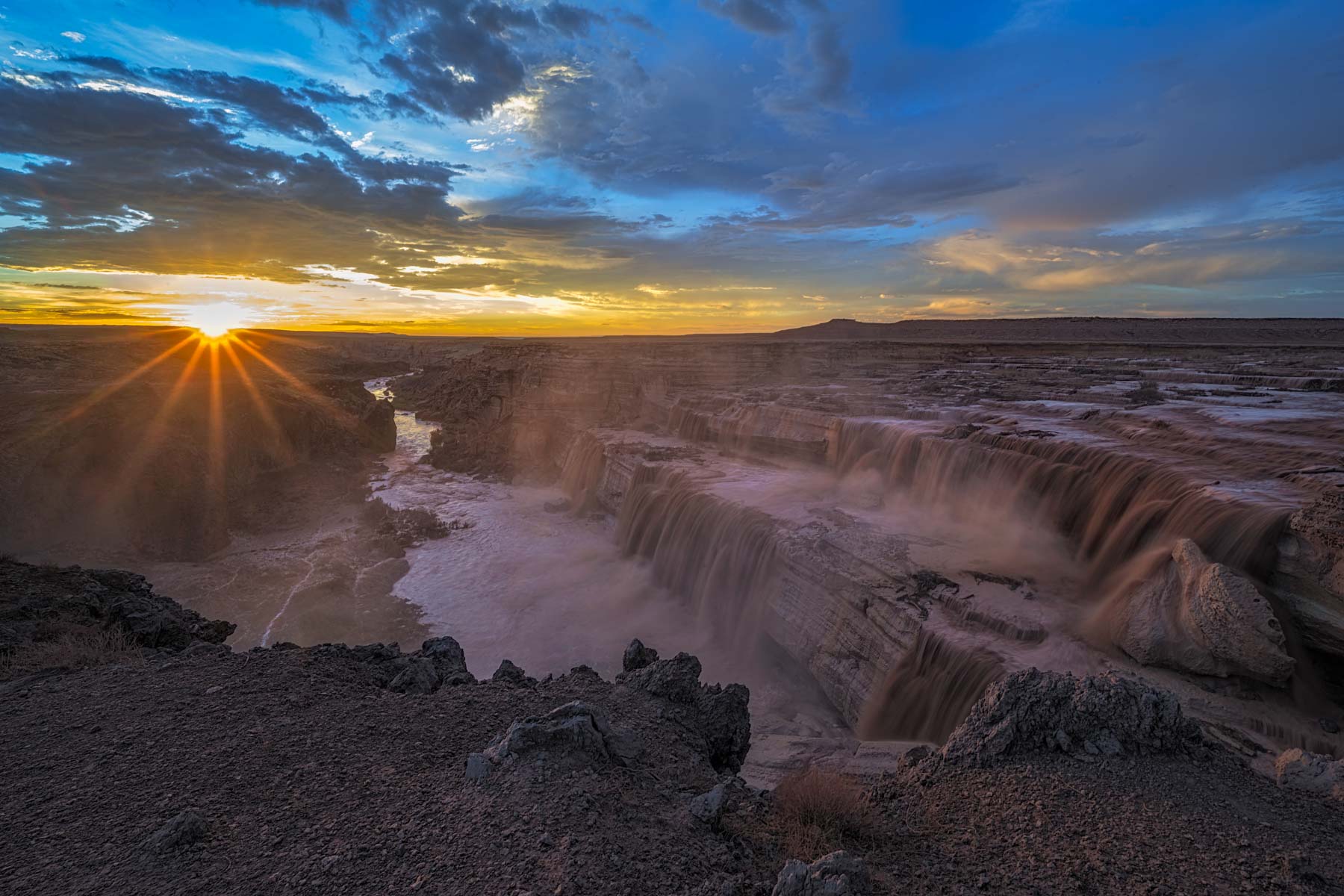


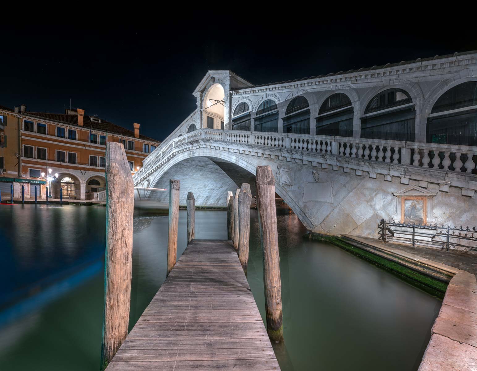


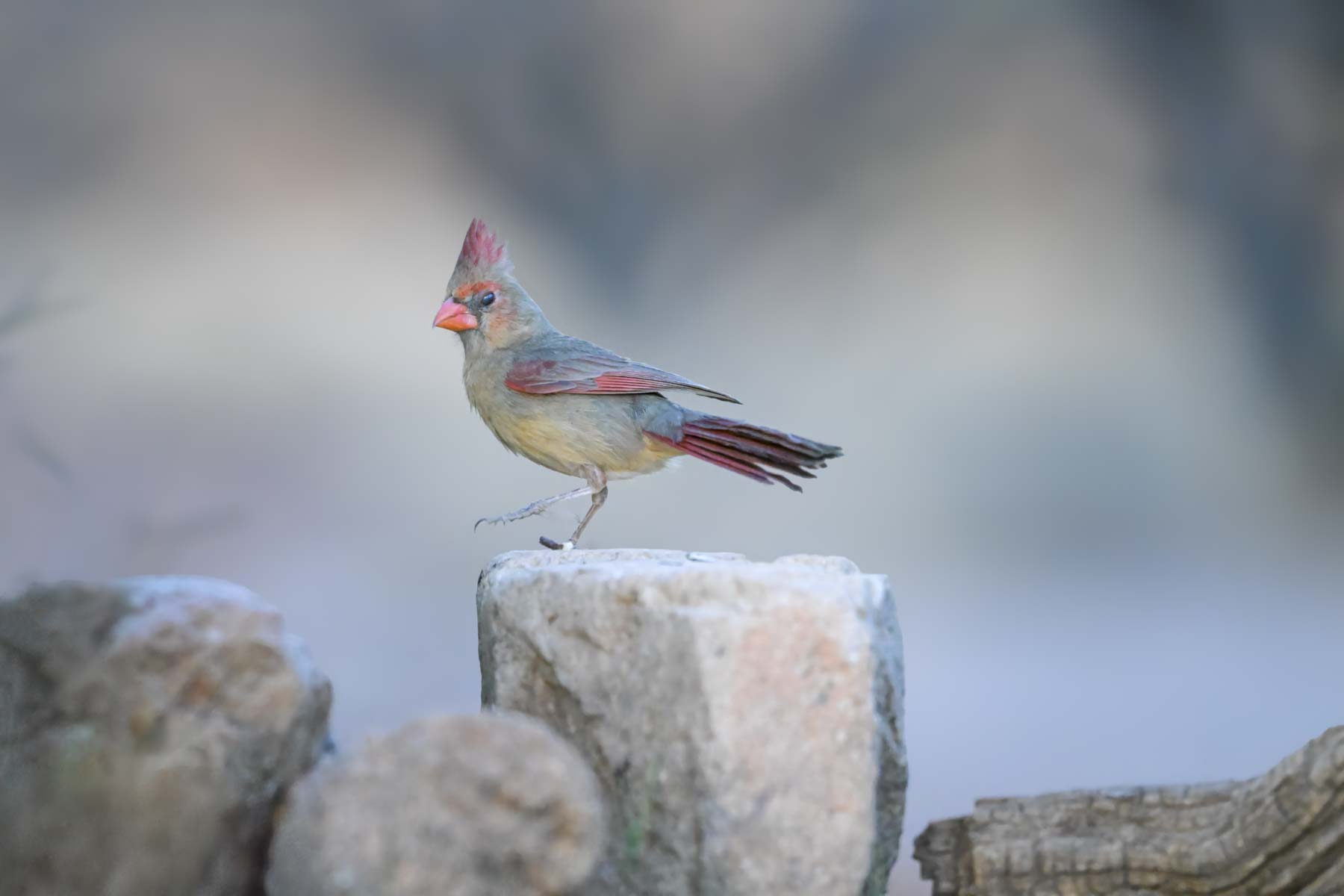

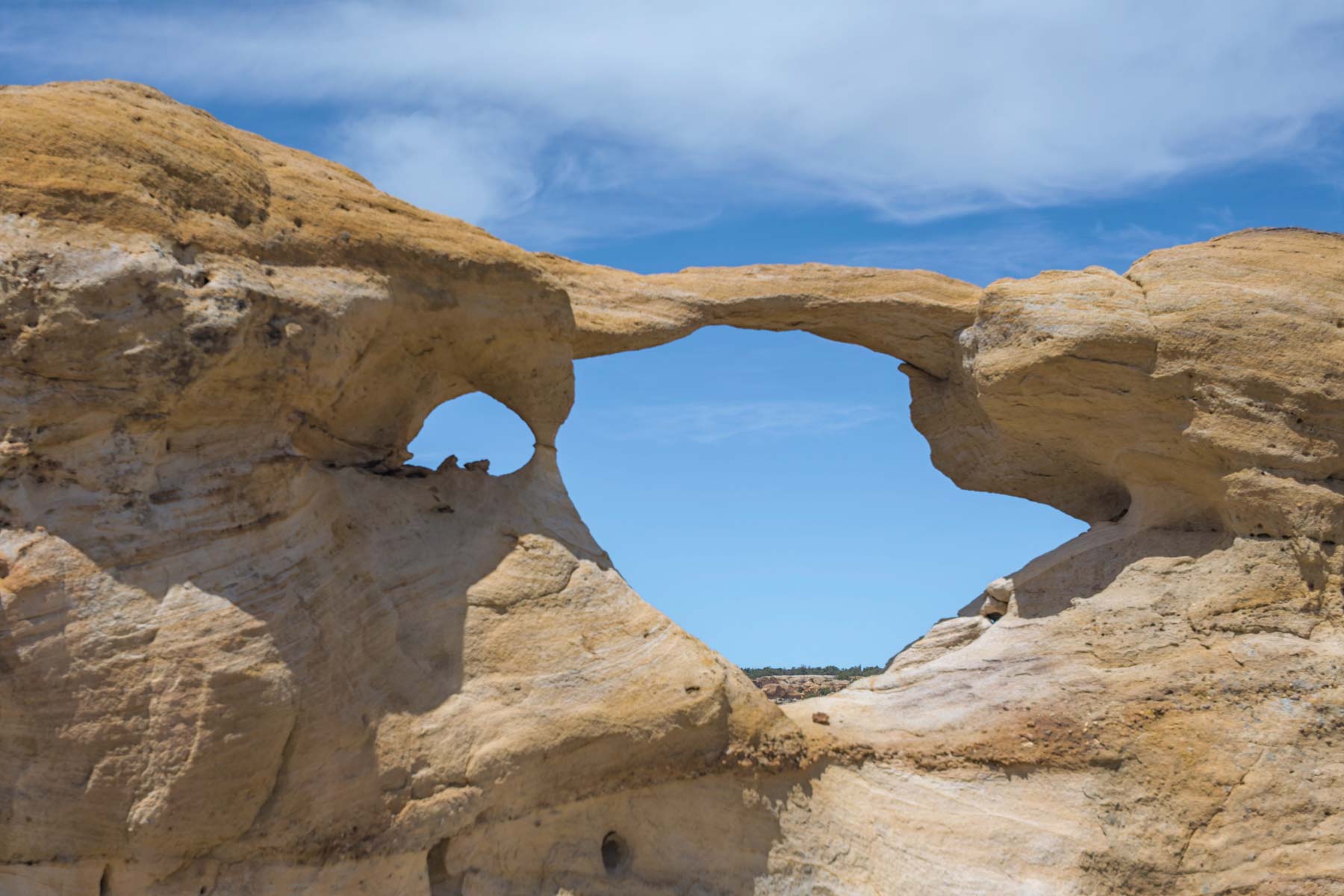


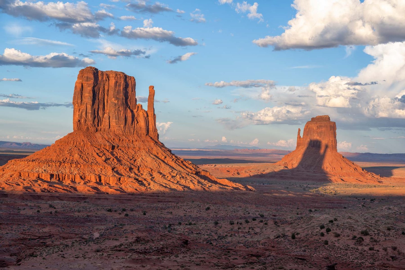
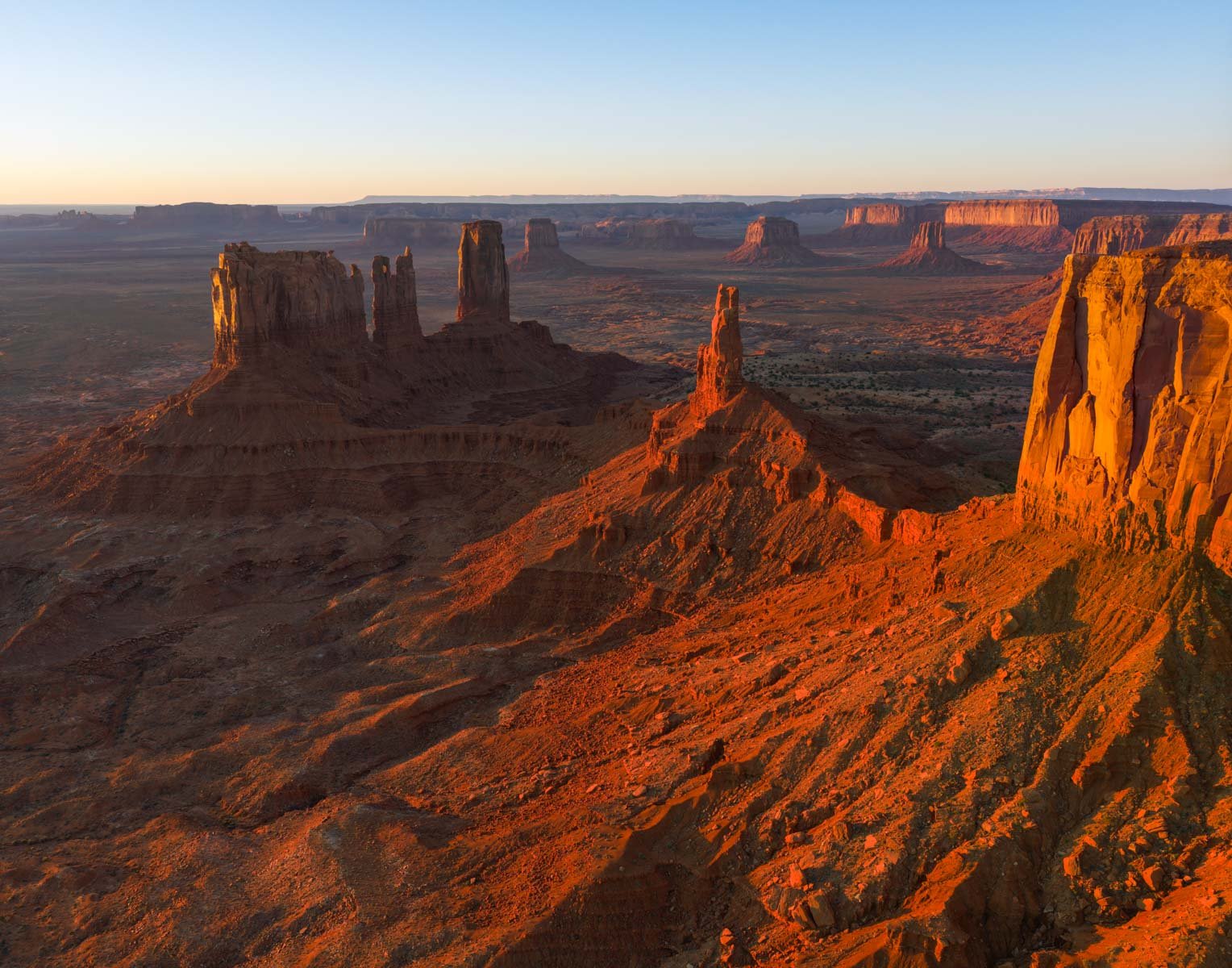
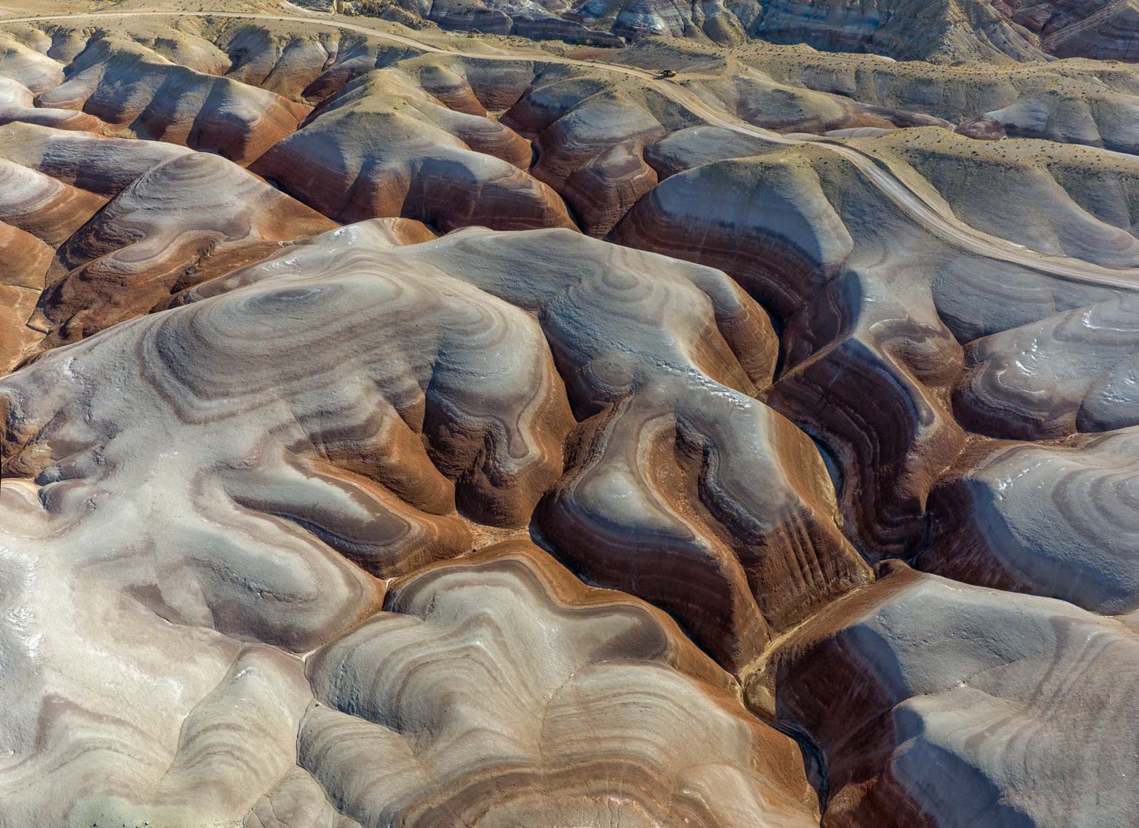
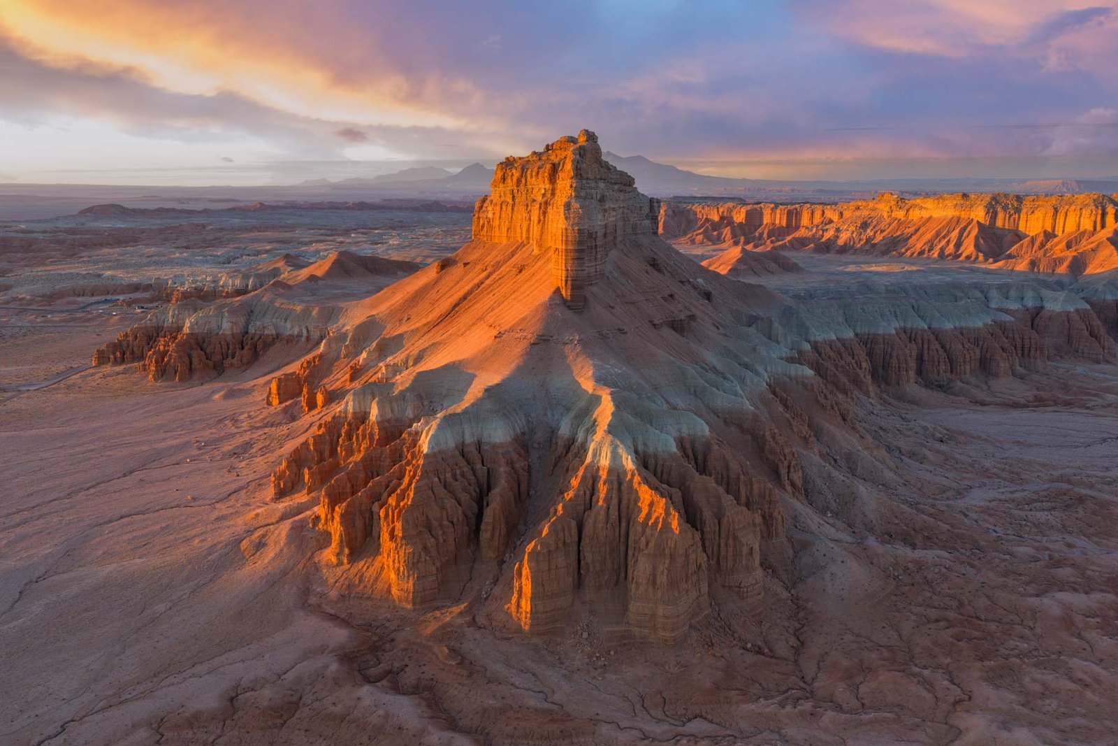

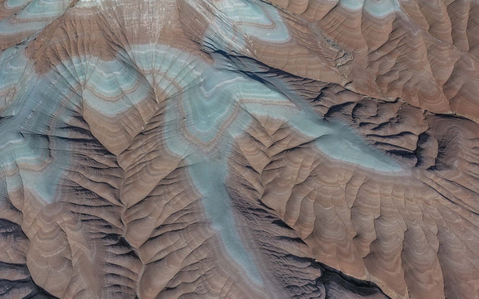
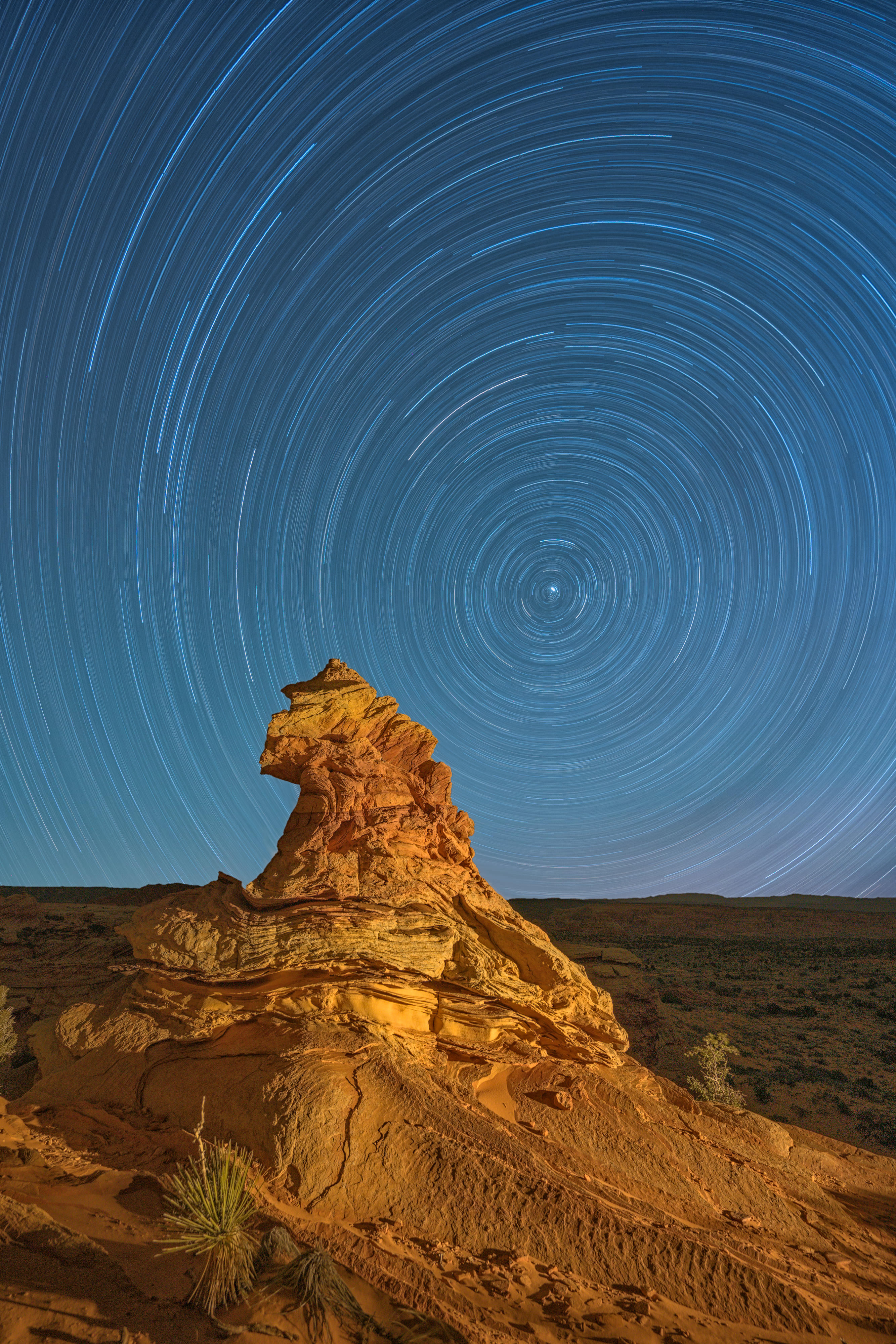
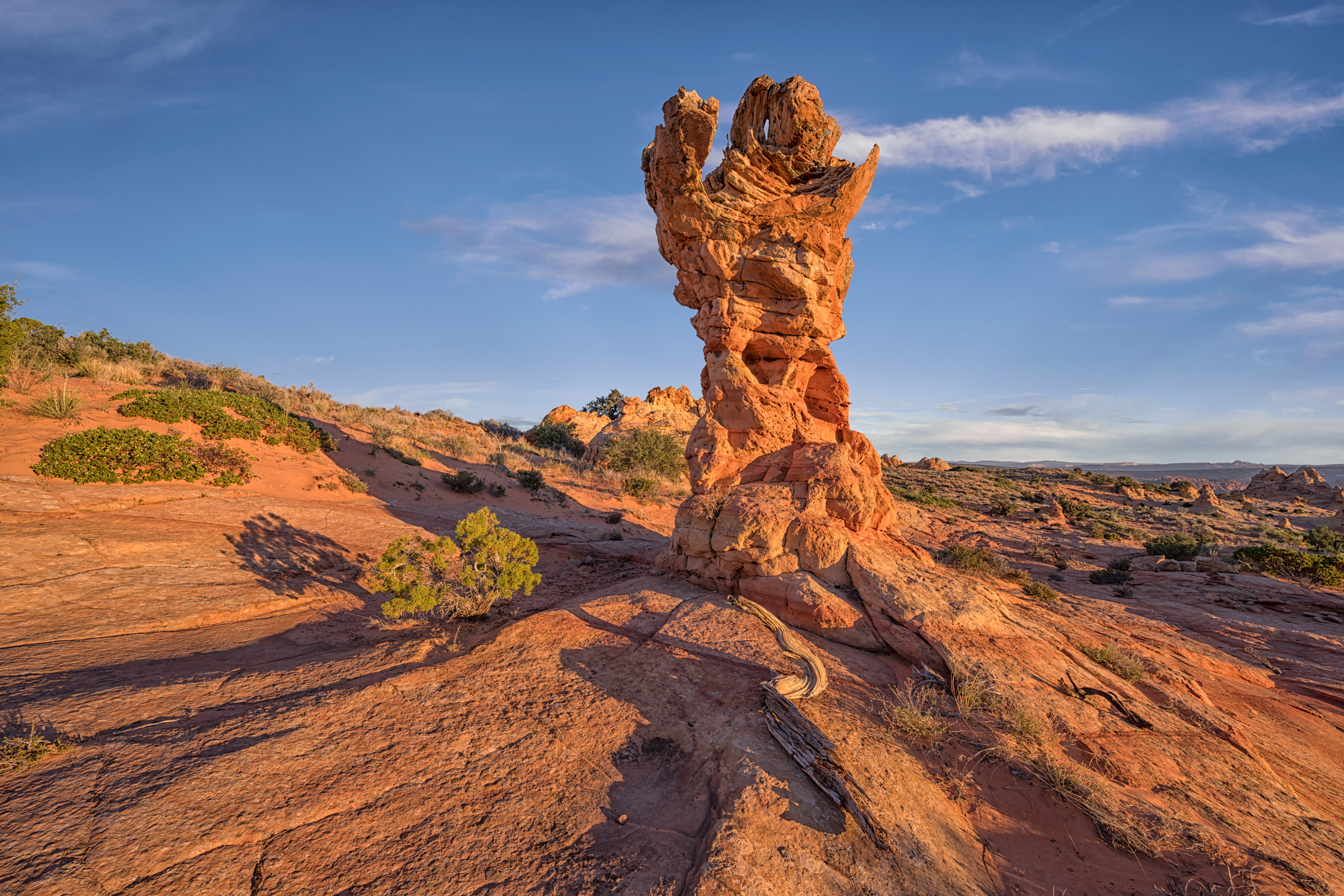