Lees Ferry
Lees Ferry, best known as the jump off point for Colorado River rafting, is a great destination in itself. Historically Lees Ferry was the only place to cross the Colorado River for hundreds of miles. In 1873 John D. Lee established a ferry service across the river, in 1929 the ferry was replaced by the Navajo Bridge four miles downstream. Lees Ferry sits at the confluence of the Colorado and Paria Rivers. To the east of the Colorado lies the Echo Cliffs on Navajo Lands, to the southwest Vermilion Cliffs National Monument, and to the north the unnamed cliffs above the northeast side of the Paria River. Lees Ferry is part of the Glen Canyon National Recreation Area and a $30 per vehicle entrance fee is charged.
Today Lees Ferry remains the only place in Glen Canyon where one can drive right down to the Colorado River.
Photographing the Lee's Ferry area
Lees Ferry is very scenic. Photogenic locations include:
- The Navajo Bridge - From the bridge there is a great view downstream of the Colorado River. Early mornings or late afternoons there is a good chance of seeing California Condors resting on the trusses beneath the bridge.
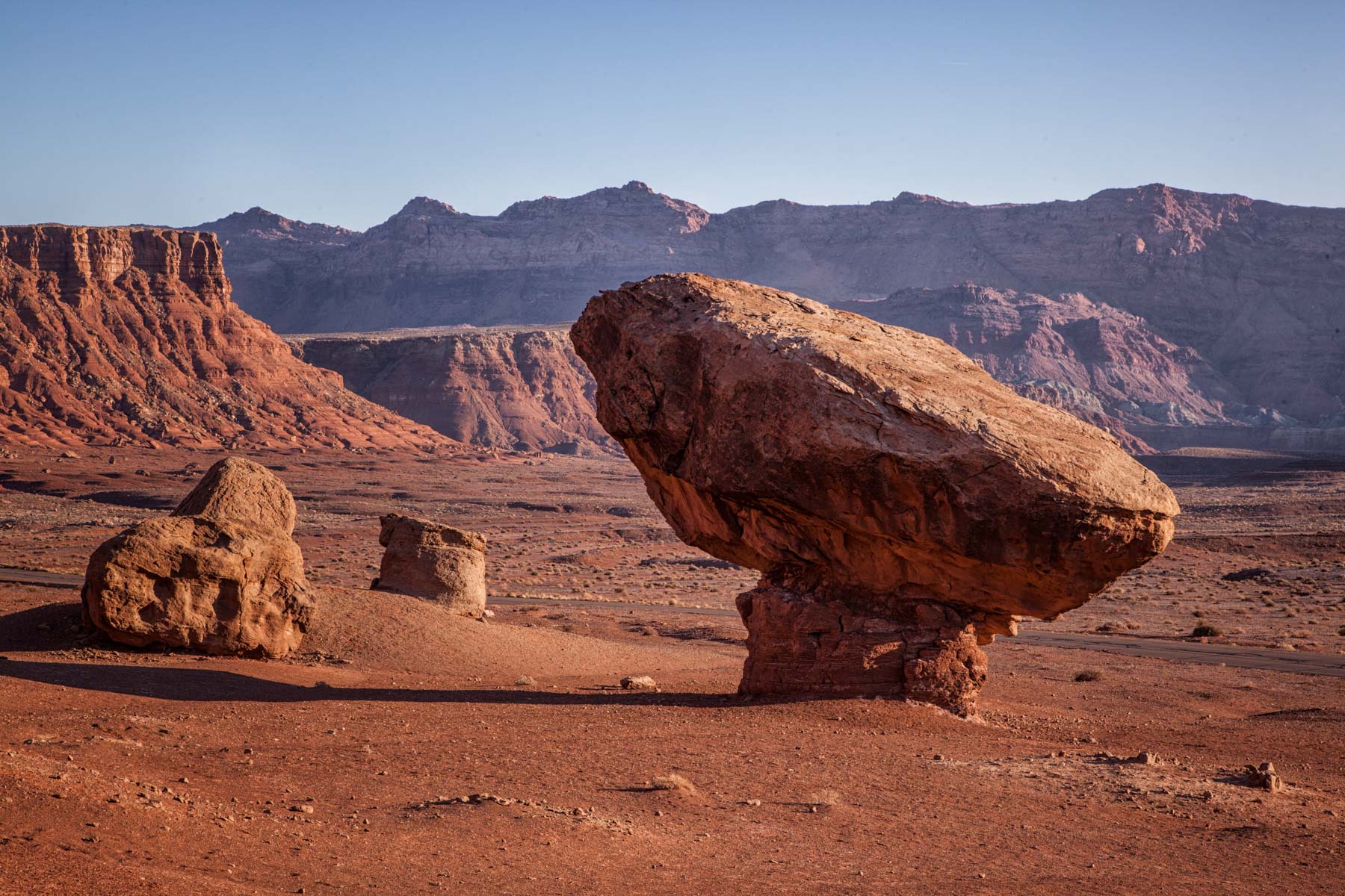
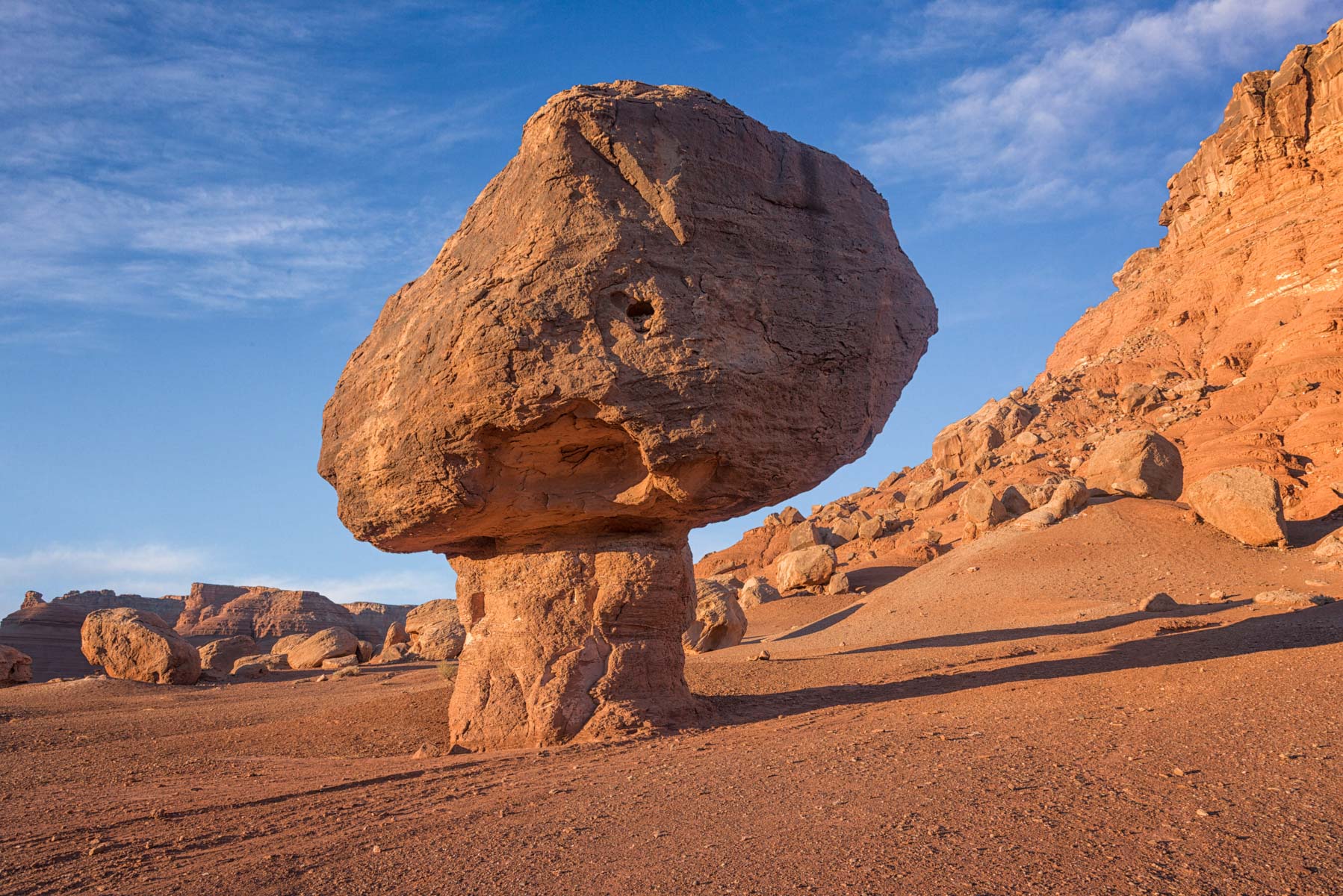
- Balanced Rocks - 2.1 miles from the park entrance on Highway 89A the is a pullout on the left side of the road, and many large balanced rocks just yards away. These are best photographed at sunrise, and a dramatic sky helps.
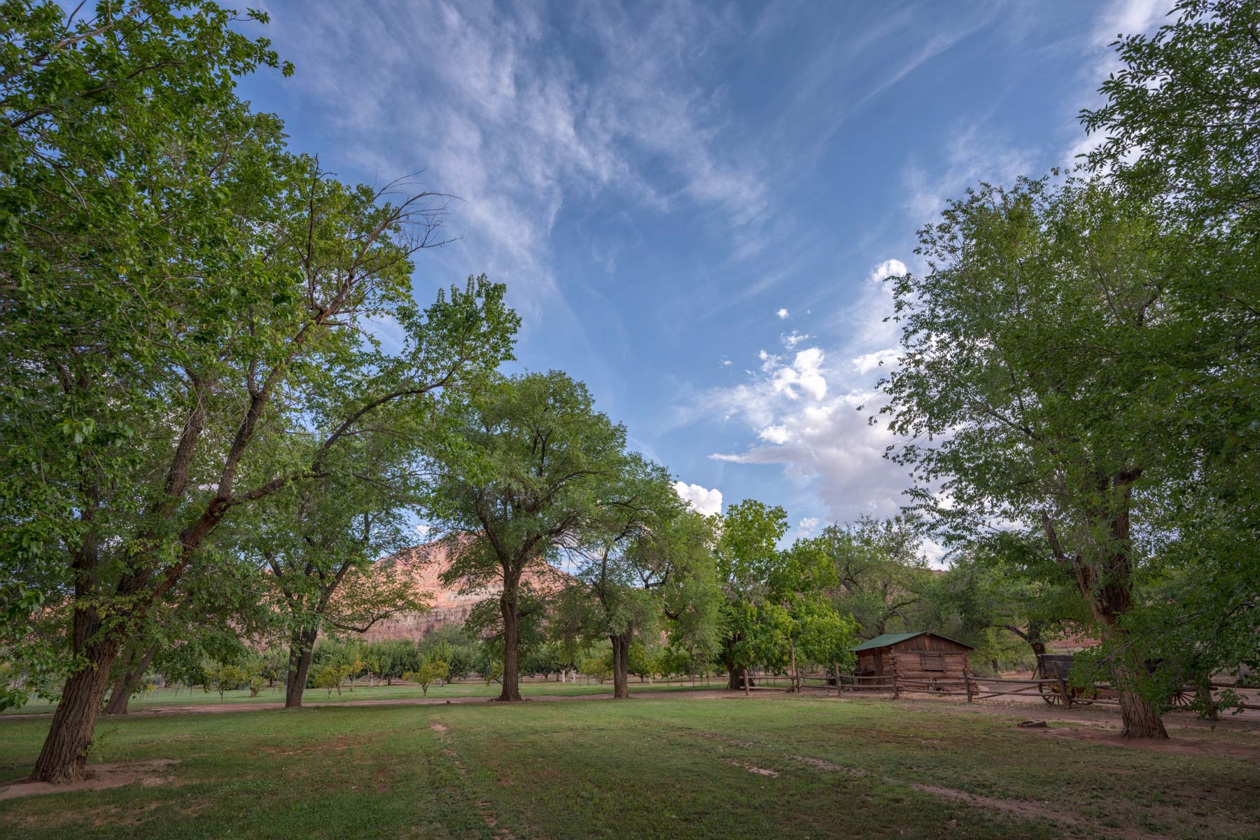
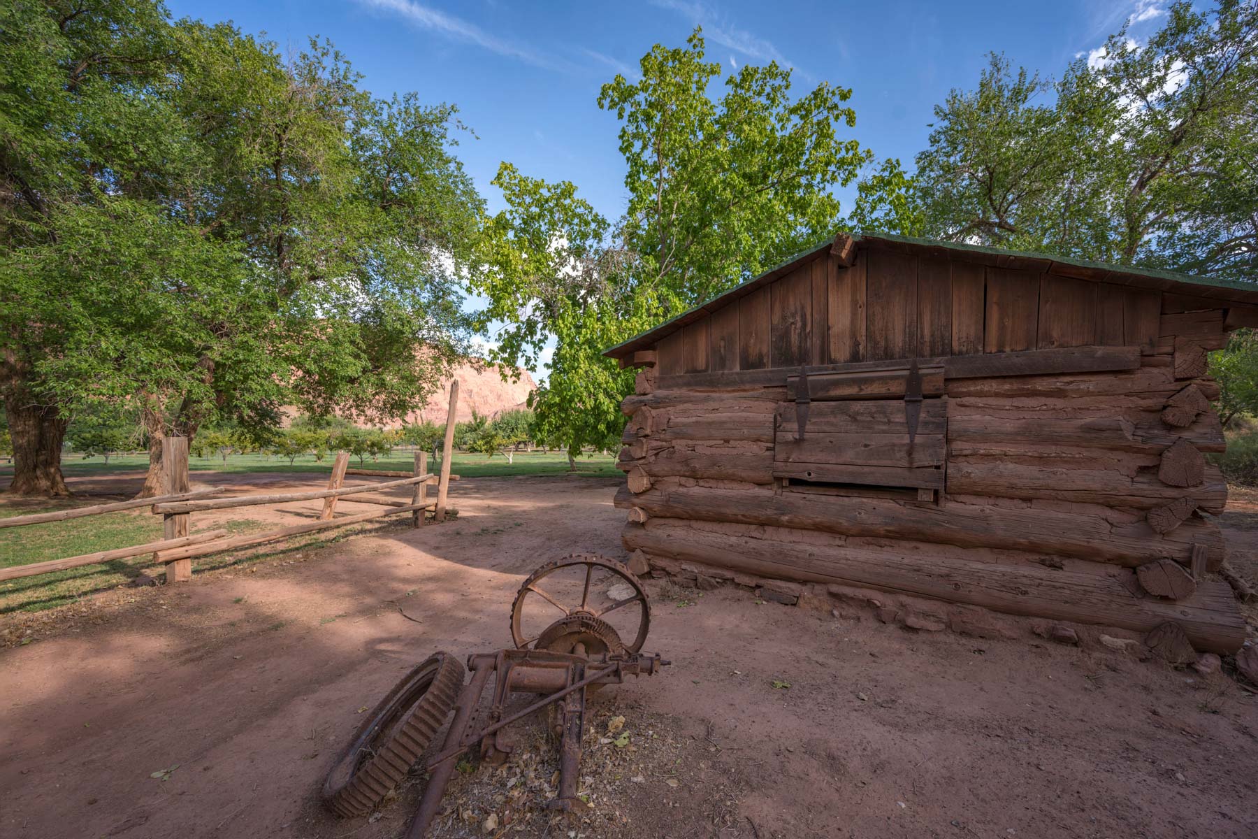
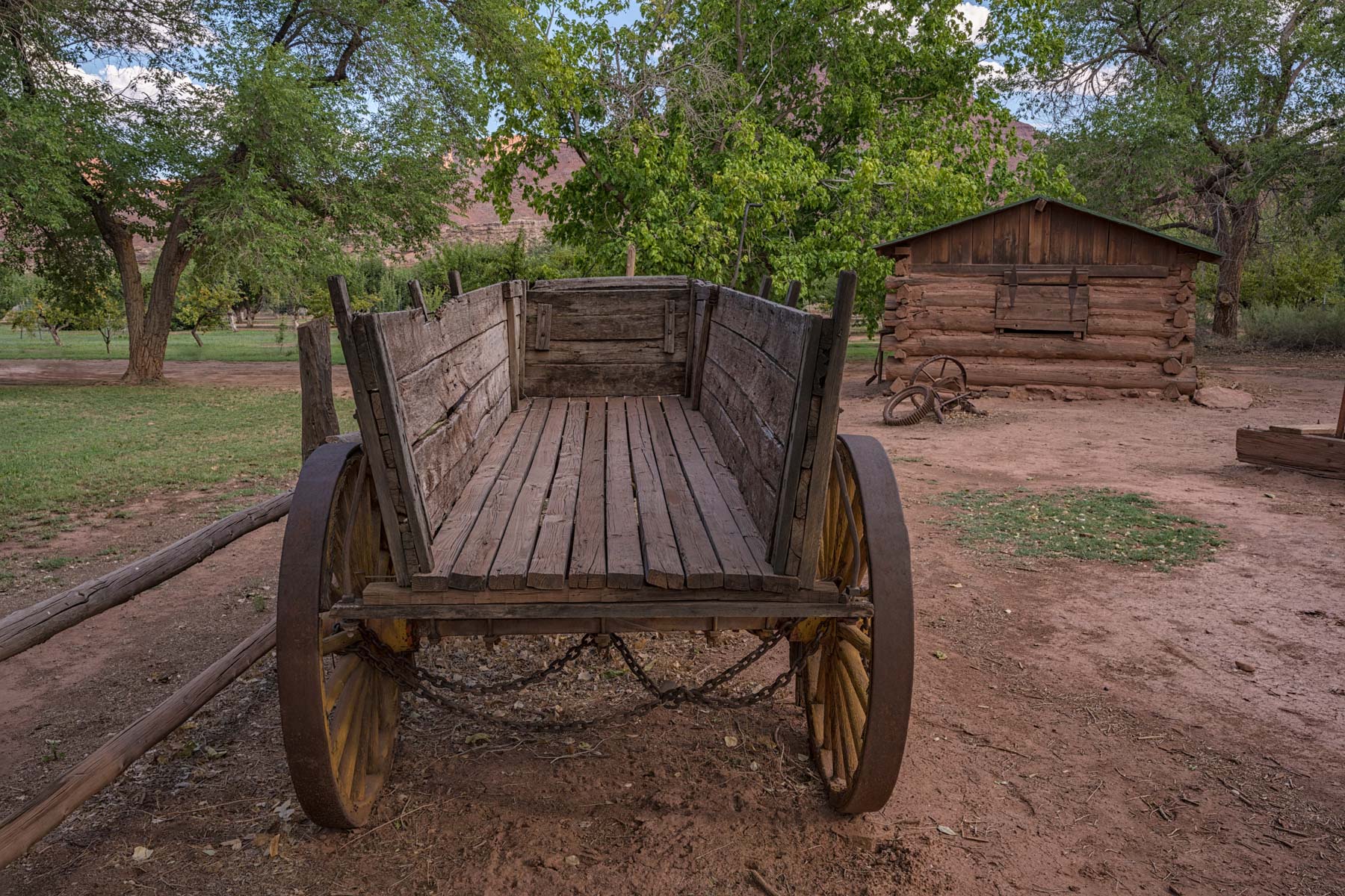
- Lonely Dell Ranch - John D. Lee, a polygamist, built two cabins at this site in 1871 to house two of his families. The buildings of the ranch are perhaps too well preserved to produce great images, but good images abound. The ranch can be accessed via the Lonely Dell Ranch trail. To access the trailhead take the main road 5.1 miles from 89A to the sign for Lonely Dell Ranch and turn left. Parking is on the right .2 miles away. In addition to Lonely Dell Ranch the orchard, old truck, and cemetery are also good subjects. Fruit can be freely picked from the trees in season.
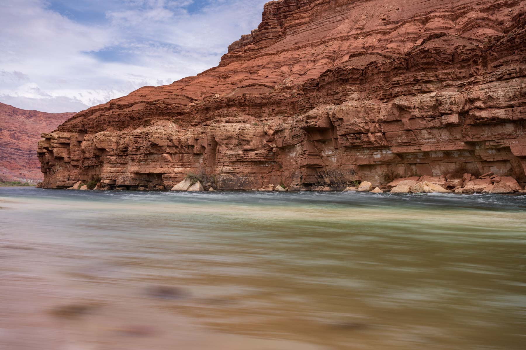
- The Colorado River - Good images of the Colorado can be taken all along the River Trail, and at the Paria Riffles. To access the Paria Riffles from 89A proceed 4.4 miles along Lees Ferry Road and make a right at the campground sign. In .2 miles you will reach a parking area from which it is but a very short hike to the river. Best images are late afternoon so that the cliffs to the east are well lit, ideally you want a day with little wind so that the red cliffs are reflected in the river.
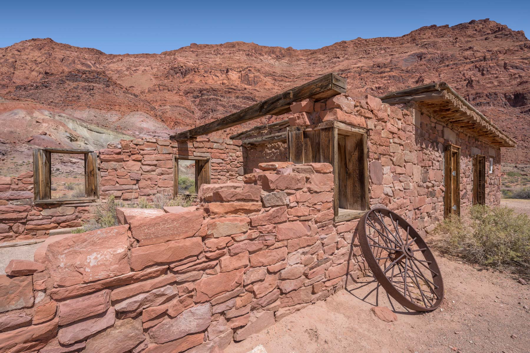
- Old Mormon Fort - The walls of this fort have collapsed in places but the windows largely remain, and there is an old wagon wheel lying against one of the remaining walls. Us the windows to frame each other and the cliffs in the background. It takes about an hour after sunrise for light to reach the walls of the fort.
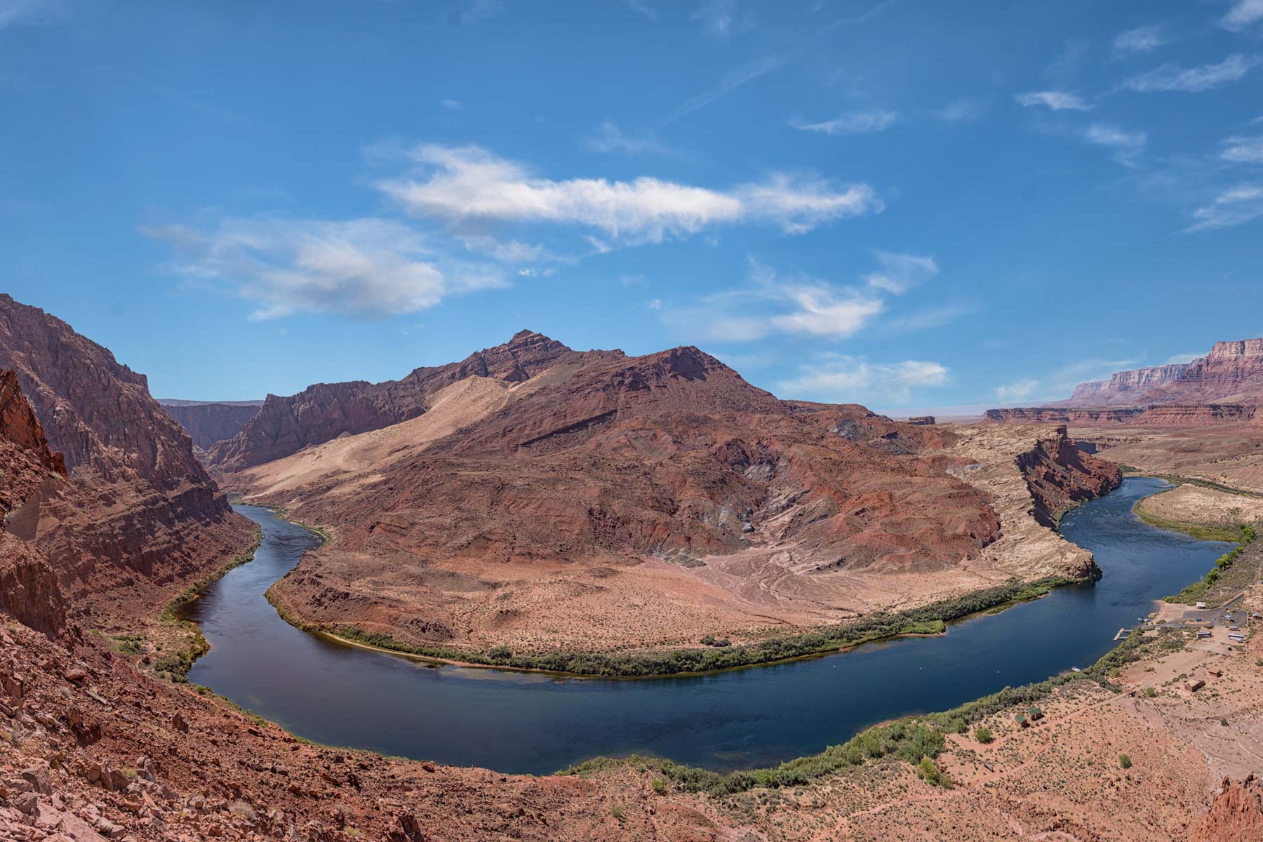
- Spencer Trail - good views abound along this trail of the last bend in the Colorado River in Glen Canyon. The bend, while not as spectacular as Horseshoe Bend, is still very good and you'll probably have the trail to yourself. When you reach the top you are rewarded with expansive views of Glen Canyon all the way to Navajo Mountain and the many curves of the Colorado River.
The Cliff Dwellers Stone House, aka the Blanche Russell House, in on US 89A which runs between Jacob Lake and Bitter Springs in Arizona. The unique house is built around a large fallen boulder. In good conditions, which are rare, the house is quite photogenic and worth an early morning stopover on your way to the North Rim of the Grand Canyon, or Coyote Buttes South.
I used to believe the house was built by the Navajo, but the truth is more interesting. In 1927 Blanche Russell's husband was diagnosed with tuberculosis and the two decided to move west from New York seeking drier climate. Blanche was reportedly a Ziegfield Follies dancer. About nine miles west of Lees Ferry their car broke down and they decided to camp amongst the boulders at Cliff Dwellers. Blanche loved the area and they decided to buy the land and build a house there, using a boulder as a start. They operated a roadside trading post where they sold food and gasoline and operated a restaurant. The trading post was quite successful and the area became known as House Rock Valley. It may well be that House Rock Road is named after the house Blanche built with her husband. They ran the trading post for about ten years and sold the property to Jack Church who three years later sold to the Greene family. The Greene's started the first guided trips down the Colorado, and built the Cliff Dwellers Lodge and restaurant.
The best side of the Stone House faces east so morning is the best time to photograph it. Normally there are Navajo craft stands interspersed among the balanced rocks so I suggest you arrive as early as possible before the stands are set up. Navajo businesses are currently closed due to the Covid-19 pandemic so now is a good time to visit. You will need to clone out graffiti and a porta potty from your images if you want a more natural look.
Hiking in Lees Ferry
There are several good hikes in the area. Short descriptions of several hikes follows below. Before undertaking the more difficult Cathedral Wash, Spencer, Dominguez Pass, and Hislop trails I suggest you read about them on the web. Good sites include the NPS website, gjhikes.com, and hikearizona.com.
- Lower Cathedral Wash - Cathedral wash is one of the only washes that leads into the Colorado River and is non-technical. The trailhead is 1.4 miles from Highway 89A on the left. The round-trip hike is only 3.5 miles long and is generally easy. There is one pour off that can be bypassed on the right. The hike can be muddy following a rain. I suggest you wait for dry weather. This is a popular hike and you may see other people. More details at hikearizona.com/decoder.php?ZTN=940
- River Trail - An easy two mile RT hike along the Colorado river. Start at the launch ramp parking lot at the end of Lees Ferry Road. The old Mormon fort can be seen immediately on the left and is very photogenic.
- Lonely Dell Trail - An easy one mile trail past the Lonely Dell Ranch.
- Spencer Trail - A moderately difficult 5 mile RT trail gaining 1,700 feet in elevation. I found the trail well marked and easy to follow but you should download the GPS track so that you do not miss turns at switchbacks. The trail is rated moderately difficult due to its high exposure and elevation gain. There are great views all along the trail and you should spend some time at the top exploring the plateau high above Glen Canyon. More information at hikearizona.com/decoder.php?ZTN=734 . The book 100 Hikes in Arizona also covers this trail.
- Dominguez Pass Loop - A great but difficult way to convert the Spencer Trail hike into a loop is to exit the plateau via Dominguez Pass. Dominguez Pass dates back to 1776 when the Dominguez Escalante expedition used it on their return to New Mexico. They found the crossing at Lees Ferry too difficult and ultimately used a second ford called "The Crossing of the Fathers". This crossing is now covered by the waters of Lake Powell.
To do the loop hike in a counter clockwise direction hike the Spencer Trail. At the end of the Spencer trail proceed cross-country in a north-northwest direction for about two miles to Dominguez Pass. I suggest you go slightly inland to avoid the ups and down near the cliffs edge. From here you will descend off the ridge and ultimately reach a path than runs parallel to the Paria River. An excellent description of the hike can be found at hikearizona.com/decoder.php?ZTN=15961. A longer alternate from Dominguez Pass ending at Lonely Dell Ranch via the Paria River is shown on the USGS topo maps.
Caution - this trail is difficult, download the track and maps from both this site and hikearizona. The track on my site is rough and has not been tested by me. You need good route finding skills to complete the hike. Bring plenty of water. If you do this hike in the warmer months start very early, there is no shade anywhere.
- Hislop Cave - Hislop Cave is a large natural alcove in the middle of Waterholes Bend. It is usually pointed out on float trips from Page to Lees Ferry. You'll need a raft, boat, or (inflatable) kayak to reach the trailhead for this hike which is on the east side of the Colorado River. Cross the river starting at the boat ramp. Downstream of the Glen Canyon dam the Colorado is at a constant 47° F year round so you don't want to end up in the water. Be careful crossing. You may be able to get to the trailhead via very faint unused Navajo roads starting off Highway 89. The roads probably require an ATV and very good route finding skills. The hike itself is about 6 miles RT and largely follows an old road. More details at hikearizona.com/decoder.php?ZTN=20149 .
Where to stay
Camping is available at the Lees Ferry Campground. 51 designated sites. No hookups. RV dump station. Grills provided, no ground fires outside grill. Quiet time 10 pm-6 am. Modern bathroom/comfort station. Potable water available. Launch ramp within 2 miles. Gas and supply store at Marble Canyon, about 5 miles away. No reservations. $20 per site per night in addition to the entrance fee.
In addition to the campground there are three motels in the area. From nearest to furthest they are Marble Canyon Lodge, Lees Ferry Lodge (3 miles), and Cliff Dwellers Lodge (9 miles). Marble Canyon Lodge has a good but pricey Chevron station, and there is a very good restaurant at Cliff Dwellers. There are some balanced rocks near Cliff Dwellers Lodge, and also an old house half under a rock built by Blanche Russell in the 1930s. Blanche was a Ziegfeld Follies dancer. Her husband was diagnosed with tuberculosis so the were moving to the drier climate of the southwest. Their car broke down in Marble Canyon and they loved the terrain so much that she and her husband turned a nearby boulder into a home. House Rock Valley Road is named after Blanche's home.
When to Go
At 3,100 feet elevation Lees Ferry runs about 6-10 degrees warmer than Page, AZ. Summers should be avoided with average high temperatures regularly exceeding 100° F in July. In you must go in the summer start your hikes early in the day and bring plenty of water. Winters are relatively mild with the average high exceeding 50%deg F.
Maps
Here is an overview map showing Lees Ferry, hikes in the vicinity, and several areas of photographic interest:
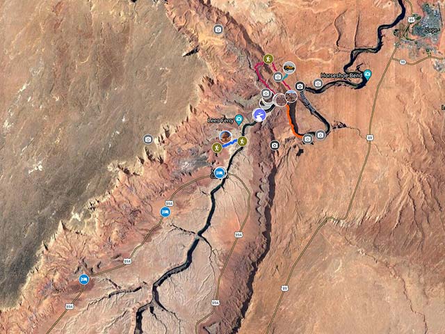
To view the map in Google Maps please click anywhere on the map above.
USGS 24K Topo Maps
The four maps below cover all of the Lees Ferry area. The topo map "Lees Ferry" covers all of the area except for part of the Dominguez P{ass Loop, the Cathedral Wash hike and the Balanced Rocks.
The table to the right contains the topo maps in a variety of formats. KMZ overlay files can be opened with Google Earth, and Oruxmap files can be opened with oruxmaps, a free mapping app for android phones and tablets. USGS topo maps contain a white border (called the collar) which contains information such as the map name, names of neighboring maps, date the map was created, latitude and longitude reference lines, ... While collars are very useful on printed maps, the information on the collar is much less useful for computer use. Maps with the collar removed can also be downloaded in the table to the right.
For reference here is an image showing the names of the four Lees Ferry topo maps and their location. The topo maps can be downloaded to the right of this image.
Lees Ferry Index Map

| Geo Tiff/Avenza | KMZ | Oruxmaps | KMZ Decollared | Oruxmap Decollared | Avenza Decollared |
| Ferry Swale | KMZ | Oruxmap | KMZ Decollared | Oruxmap Decollared | Avenza Decollared |
| Lees Ferry | KMZ | Oruxmap | KMZ Decollared | Oruxmap Decollared | Avenza Decollared |
| Navajo Bridge | KMZ | Oruxmap | KMZ Decollared | Oruxmap Decollared | Avenza Decollared |
| Water Pockets | KMZ | Oruxmap | KMZ Decollared | Oruxmap Decollared | Avenza Decollared |
| Lees Ferry Area | NA | NA | KMZ Decollared | Oruxmap Decollared | Avenza Decollared |