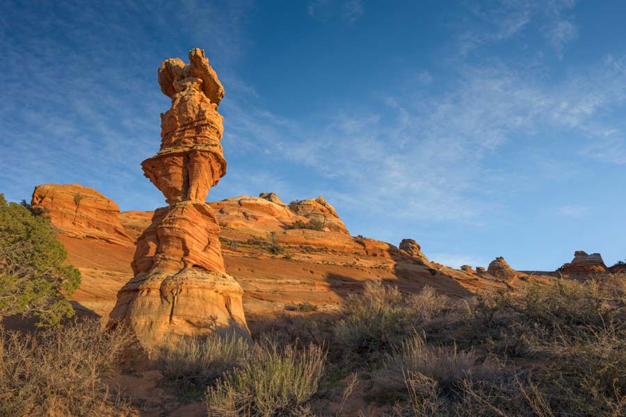
Coyote Buttes South
While Coyote Buttes South does not have the superb photographic opportunities of Coyote Buttes North, there are many good photos to be had, and you are far less likely to see other people.
Permits
A permit is required to visit Coyote Buttes South. You can obtain a permit three months in advance of the month you wish to hike in via the Coyote Buttes South Advanced Permit, or via the Daily Lottery held two days in advance of your desired date.
Advanced Permits
Reservations are accepted at noon (MT) on the 1st of each month for a permit during the third month ahead. Reservations are not accepted for trips beginning the day of or the next day. For example, permits for any day in August become available on May 1 at noon MDT. A permit for August 14 first becomes available on May 1; you need not wait until May 14. A permit fee of $5 per person is charged for the permit, and a reservation fee of $9 per group is charged. Reservation and permit fees for all applicants are charged at the time of reservation. You must bring a printed copy of the permit on your hike; digital copies on your phone are not accepted. You can print a copy using the "My Reservation" tab on your account profile at Recreation.gov. As of 2020, permits were readily obtainable online, provided you apply within a few hours or so of availability. In December, January, and February, Coyote Buttes South online permits rarely sell out quickly.
Ten people or four groups (whichever comes first) are awarded through the Coyote Buttes South advance permit calendar.
Daily Lottery
If you cannot get an Advanced permit for Coyote Buttes South and are in the Southern Utah / Northern Arizona area, consider getting a "Daily Permit." A geofence limits application submissions to the Coyote Buttes South Daily Lottery. To apply, a group member must be within the geofence (roughly the Page / Kanab area) during the application window of 6:00 AM to 6:00 PM, two days before the permit date. A non-refundable lottery fee of $9 per group is charged. If you are successful in the lottery, a permit fee of $5 per person is also charged.
Permits for ten people or four groups (whichever comes first) are awarded through the Coyote Buttes South Daily Lottery.
Alternate Permit Holders
Wave permits are non-transferable except for up to three specific people you list when applying for the lottery. These people are called "alternate permit holders." If you win a permit and are stopped by a ranger on your hike to The Wave, you or a listed alternate permit holder must be present with your group. If not, your group may be cited. Alternate permit holders must have an account on recreation.gov.
You may only apply once per month to the lottery. If you try to apply more than once, you will receive the message "You have excellent taste! However, you can only submit or be listed as an alternate permit holder on one lottery application or hold one active permit(s) reservation at a time." If you list someone as an alternate permit holder, they cannot apply for a permit that month.
Every member of your group can apply separately to the "Daily Lottery," except for alternate permit holders. Doing so maximizes your chance of success in the lottery for $9 per application. For example, if your group size is four and you did not name an alternate on the lottery application, four people could separately apply. The non-refundable cost to enter the lottery would be $36.
Directions
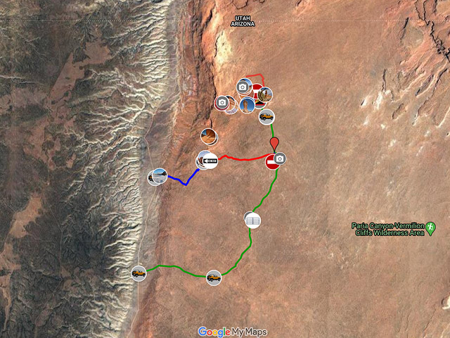
There are two trailheads for Coyote Buttes South: Pawhole and Cottonwood Cove. It is about 11.5 miles on jeep roads to the Cottonwood Cove trailhead versus 2.5 miles to Pawhole. 4WD is required for either trailhead. If you are going to the Pawhole area and do not have a 4WD vehicle, you can park at the Lone Tree reservoir. You would have to walk 2.3 miles from the reservoir to the Pawhole trailhead on a sandy, mostly uphill road. The walk is uninteresting and would make for a very long day.
If you have Coyote Buttes South permits for two consecutive days, camp at the Cottonwood trailhead the first day and drive directly to the Pawhole trailhead the next morning. The route is shown on the red line labeled "Shortcut from Pawhole" on the map below. This road has a steep, sandy hill now marked ONE WAY from Pawhole to Cottonwood Cove. Many people (myself included and a couple I "rescued") have been stuck going up the hill. Downhill is okay. Hence the recommendation - the first day at Cottonwood, then drive downhill to Pawhole on the second day. This road is 2.9 miles long.
If you only go to Cottonwood Cove, I strongly suggest you take the longer green road below instead of the road via Pawhole.
Pawhole
The route generally follows the blue line labeled "Road to Pawhole Trailhead" on the map below. The drive starts at the junction of House Rock Valley Road (HRVR) and Highway 89 in Utah. The HRVR turnoff is between mileposts 25 and 26 on Highway 89. House Rock Valley Road is normally okay for passenger cars. Do not take this road if it is wet. If your tires are kicking up a lot of mud/clay after the first mile on HRVR, or you are having trouble keeping your car straight, do not continue on the road. House Rock Valley Road runs north/south between Highway 89 in Utah and Highway 89A in Arizona. HRVR is renamed House Rock Road once you cross the Arizona state line, so you'll see the road referred to with both names.
To get to Pawhole from the north, take House Rock Valley Road 16.5 miles to BLM 1079 and turn left. If you are coming from 89A in the south, take House Rock Road 13.2 miles north to the intersection. There is a designated parking area at BLM 1079 and HRVR. If you do not have a high clearance 4WD, either park here or continue 0.2 miles to the Lone Tree Reservoir and park. If you have a true 4WD vehicle, continue 2.5 miles on BLM 1079 to the trailhead.
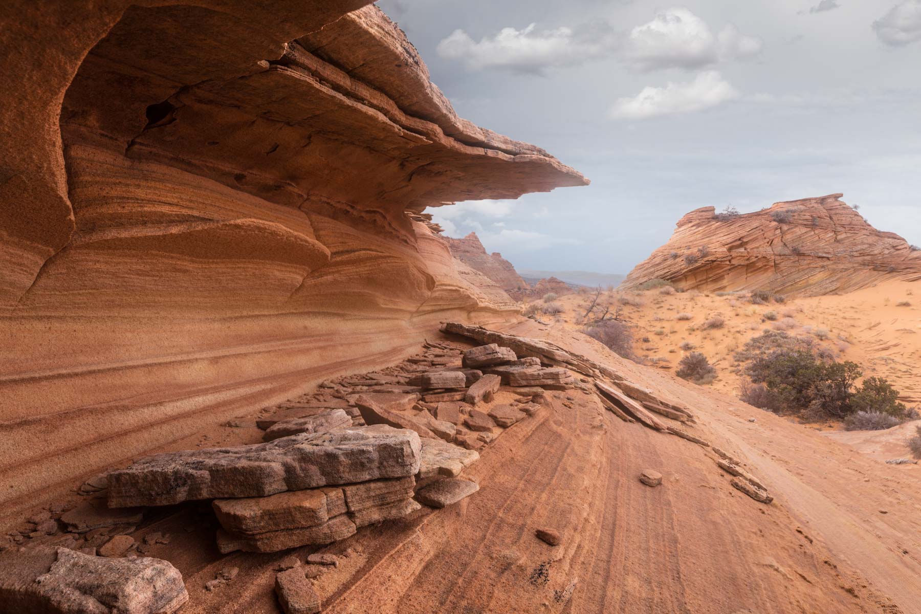
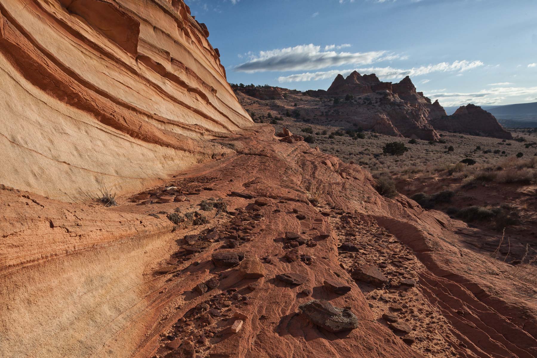
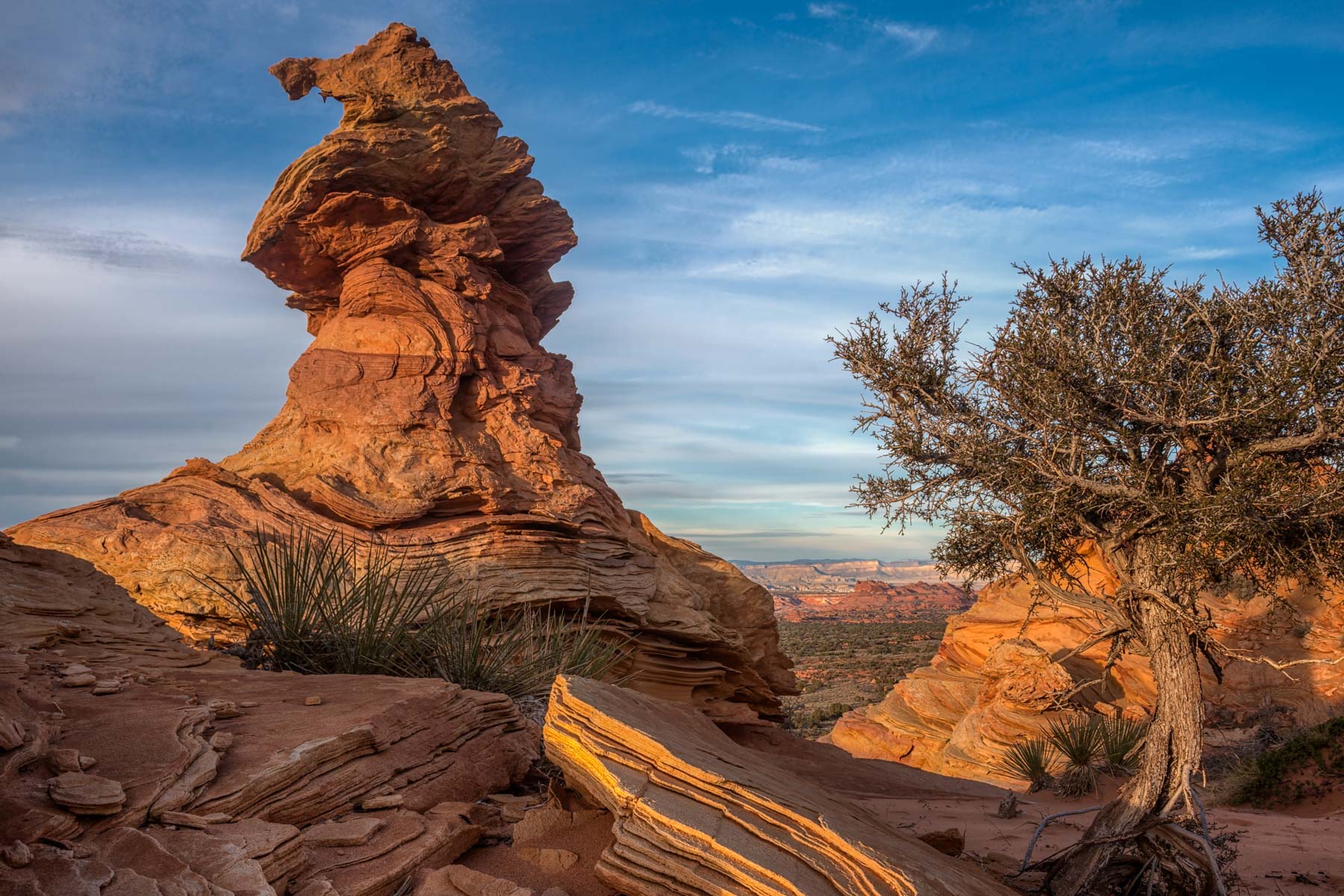
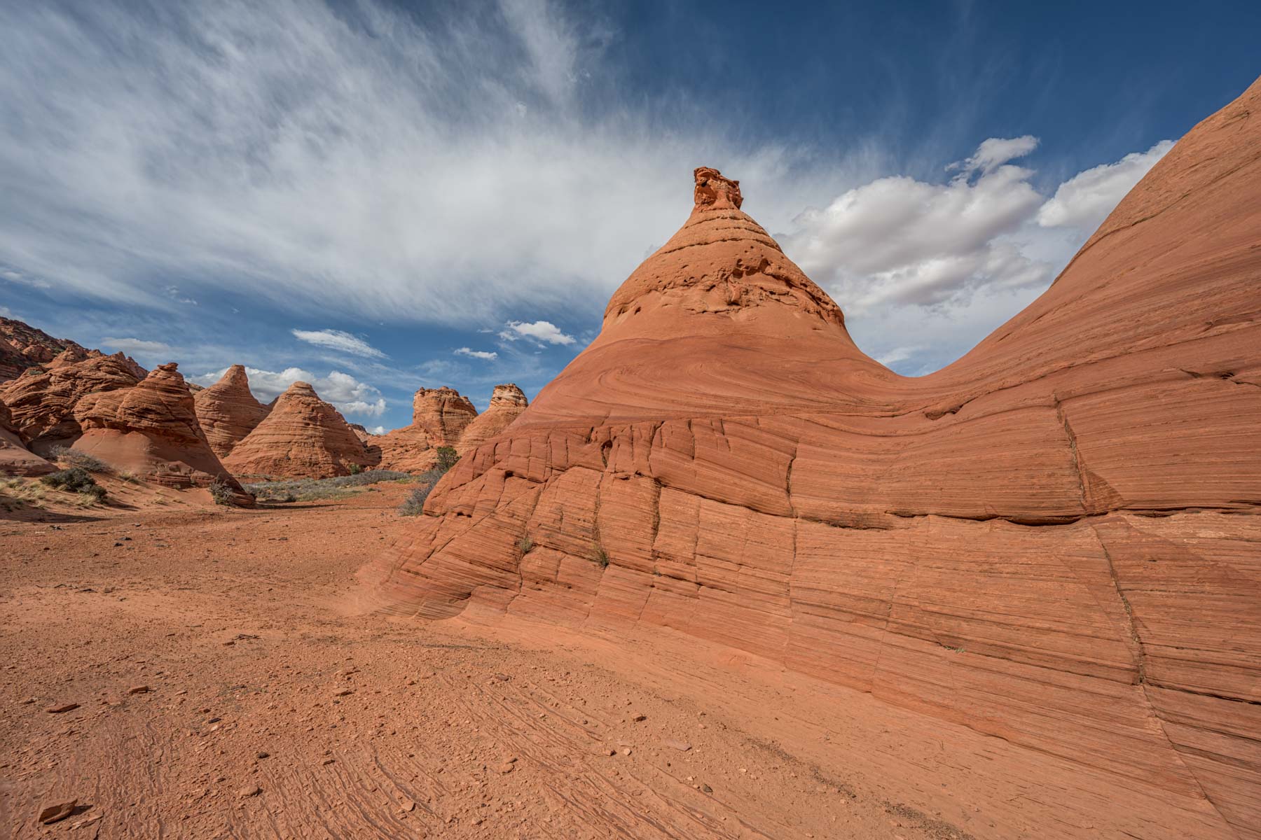
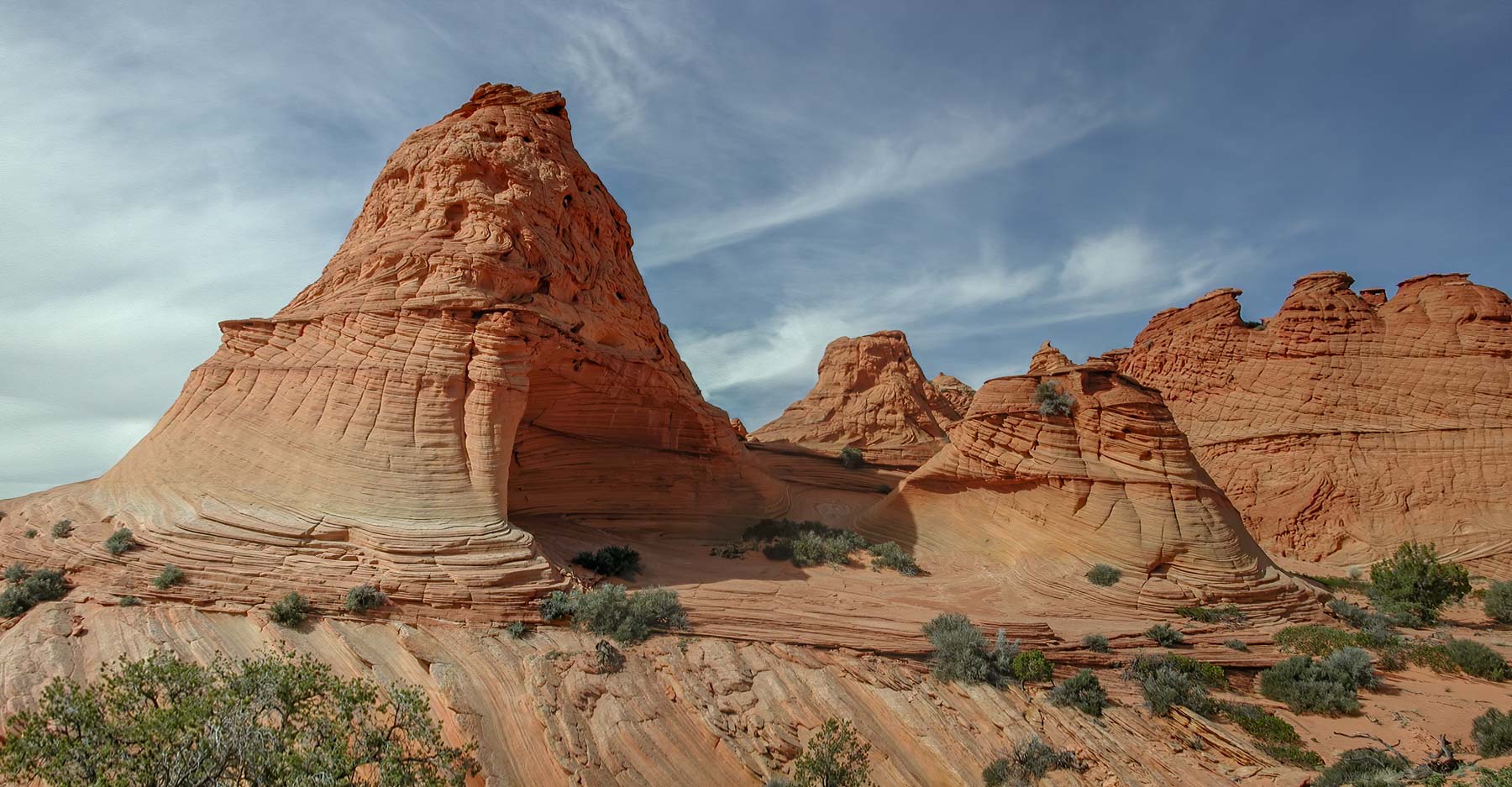
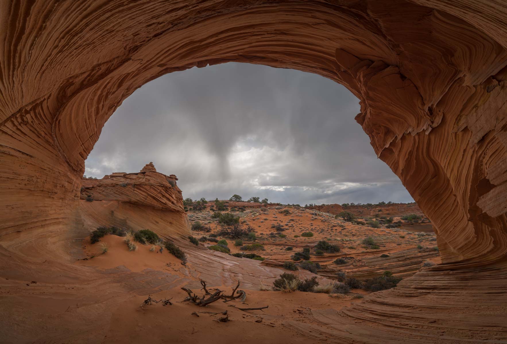
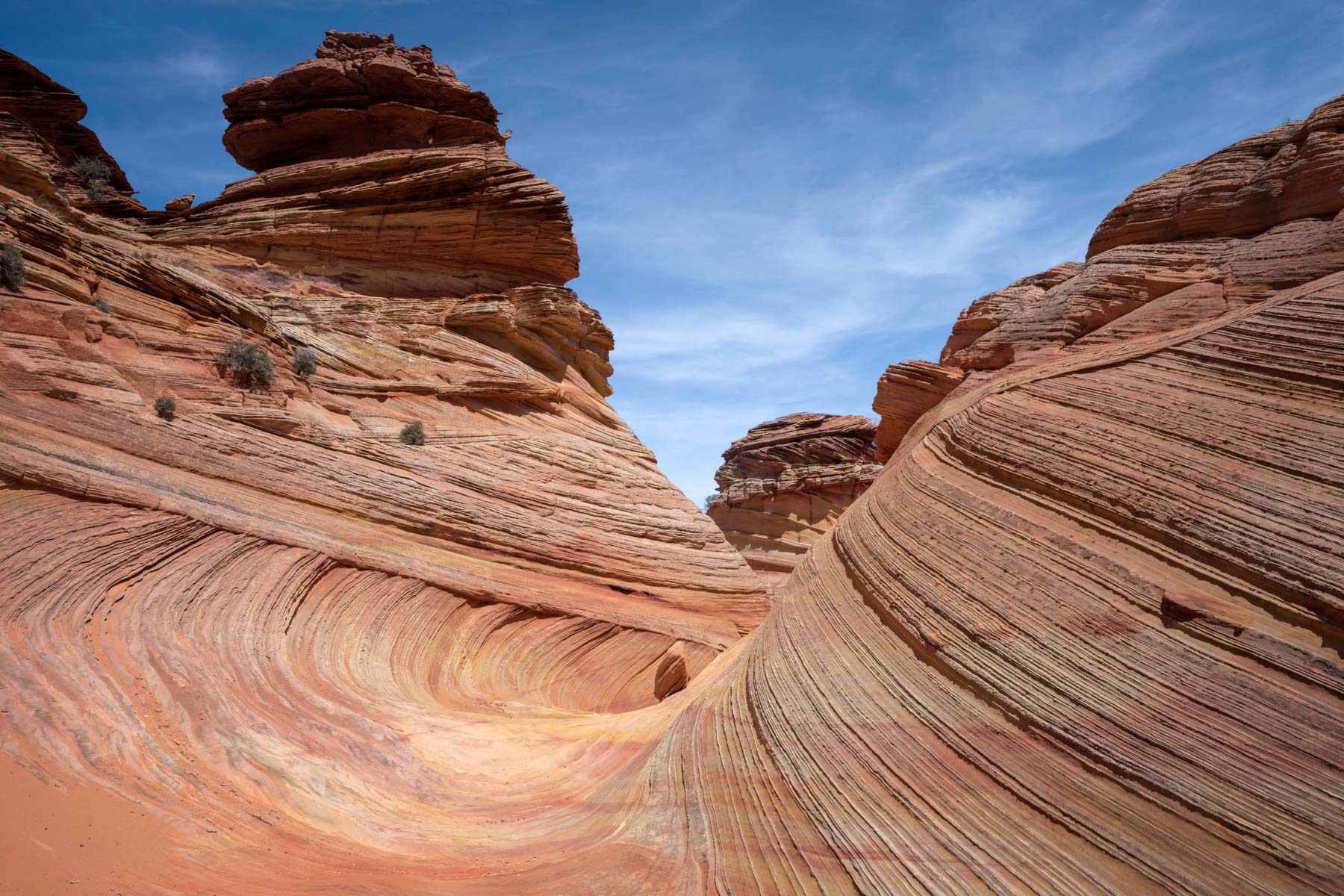
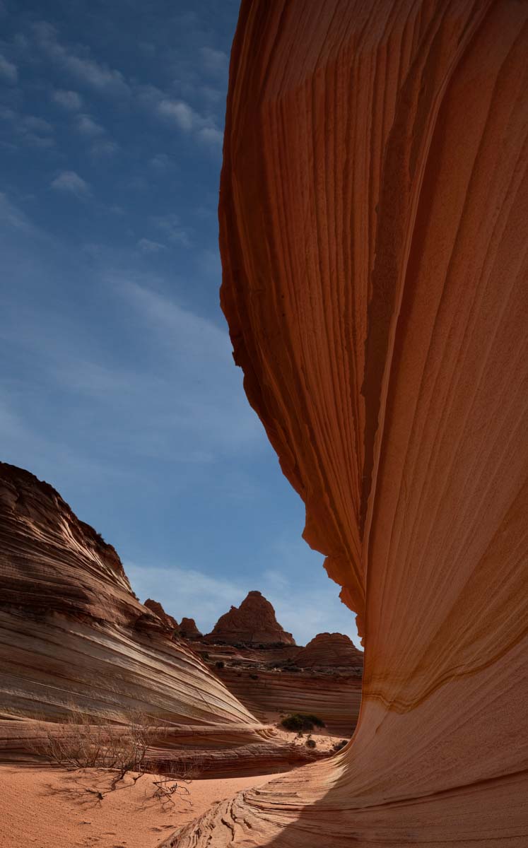
Mark your location with a GPS before starting your hike. I know of one person who got separated from his group and spent the night there in the cold. Once at the trailhead, walk northeast down the faded two-track to Pawhole. Late in the day, the red rock in the area gets excellent light, and you can get good pictures right from Pawhole, including images of red rock reflected in Pawhole. Pawhole itself is outside the permit area. In addition to exploring the buttes northeast of Pawhole, it is worth exploring the rocks further north in the "Southern Alcove" and "Yellow Stripe" areas. Capturing the entire "Southern Alcove" from its interior requires a 10mm lens or a panorama head. The "Yellow Stripe" is best photographed in the morning.
Drive to Pawhole
| Waypoint# | Waypoint | GPS Coordinates | Distance (miles) |
| 1 | House Rock Road and Hwy 89 | 37.126319, -111.976857 | 0 |
| 2 | Leave Utah/enter Arizona | 37.001100, -112.032593 | 9.7 |
| 3 | HRVR and BLM 1079 | 36.914580, -112.05152 | 6.7 |
| 4 | Lone tree - park here if PP car | 36.915680, -112.048343 | 0.2 |
| 5 | Turn left here (stay on 1079) | 36.910827, -112.030429 | 1.1 |
| 6 | Pawhole Parking | 36.923226, -112.018426 | 1.2 |
You can also get to Pawhole from Cottonwood Cove. The route starts at the Cottonwood trailhead. Follow the green line trill it intersects the Blue line at 36.92828, -111.96913. Continue 1 mile to the intersection with BLM 1079 (red line) and turn right. Continue on BLM 1079 3.1 miles to the Pawhole trailhead.


Cottonwood Cove
The drive to the Cottonwood trailhead follows the green line in the map below. Take House Rock Road south 20.2 miles to the intersection with "Pine Tree Pockets Road" (BLM 1017). If you're coming from the south, take House Rock Road 9.4 miles north to the intersection. There is a corral at the turnoff. Take BLM 1017 3.1 miles and turn left on Red Pockets Road. At 6.0 miles, you will come to a cattle gate; leave it in the same condition as you found it (open or closed). Continue straight. At 8.3 miles, bear right (the road on the left is now closed). At 8.7 miles, turn left onto Upper Pawhole Road. This area is called Poverty Flat. There is a corral and some old buildings; there used to be a windmill here, but it is gone. At 9.0 miles, stay to the right. At 10.7 miles, you will reach a closed gate with a Coyote Buttes Fee Area sign. At 11.4 miles, you have arrived. Park on the left-hand side of the road. Do not continue any further on the road (down the hill). If you do so, you will likely get stuck on your return up the hill. There is a warning sign before the hill.
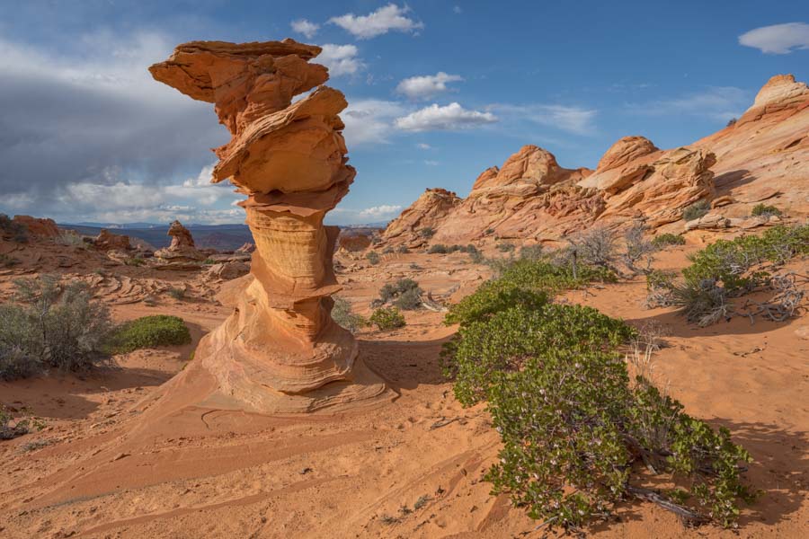
A good way to begin your hike is to head southwest west to the teepees, about .6 miles away. The hike is shown on the map in Blue and takes you to the Control Tower, a good morning (and evening) destination. The "Witches Hat" and "Half and Half" are nearby.
Drive to Cottonwood Cove Trailhead
| Waypoint# | Waypoint | GPS Coordinates | Distance (miles) |
| 1 | House Rock Road and Hwy 89 | 37.126319, -111.976857 | 0 |
| 2 | Leave Utah/enter Arizona | 37.001100, -112.032593 | 9.7 |
| 3 | HRVR and BLM 1017 | 36.861699,-112.06295 | 10.5 |
| 4 | Corral Valley-turn left on BLM 1081 | 36.859300, -112.01112 | 3.1 |
| 5 | Red Pockets - cattle gate | 36.890751, -111.984077 | 2.9 |
| 6 | Poverty Flat - turn left on BLM 1082 | 36.92374, -111.96451 | 2.7 |
| 7 | Bear right | 36.926095, -111.966176 | 0.3 |
| 8 | Continue straight at cattle gate | 36.94807, -111.97472 | 1.7 |
| 9 | Cottonwood Parking | 36.95663, -111.98003 | 0.7 |
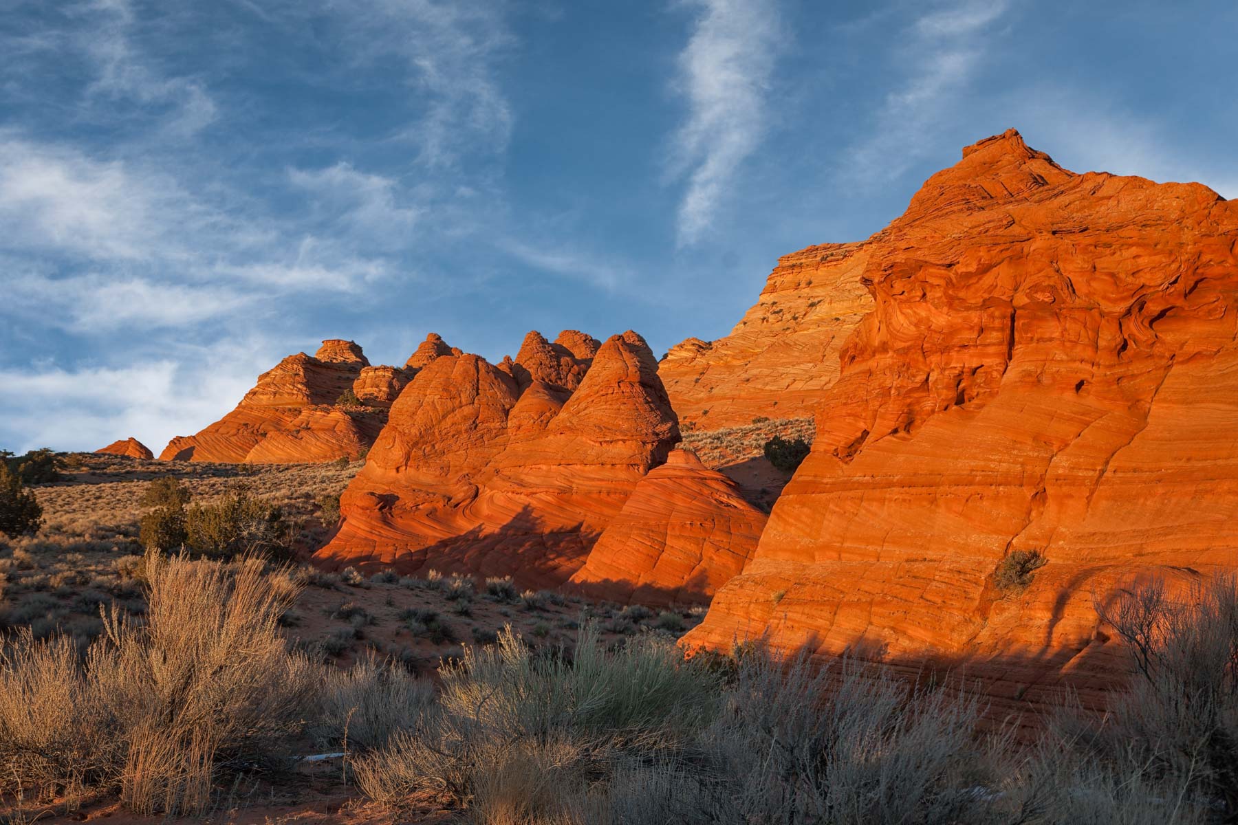
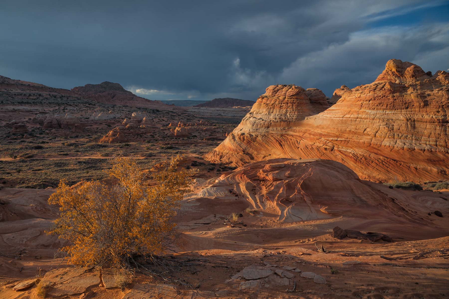
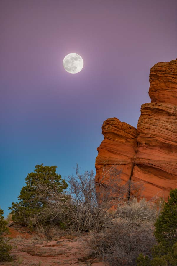
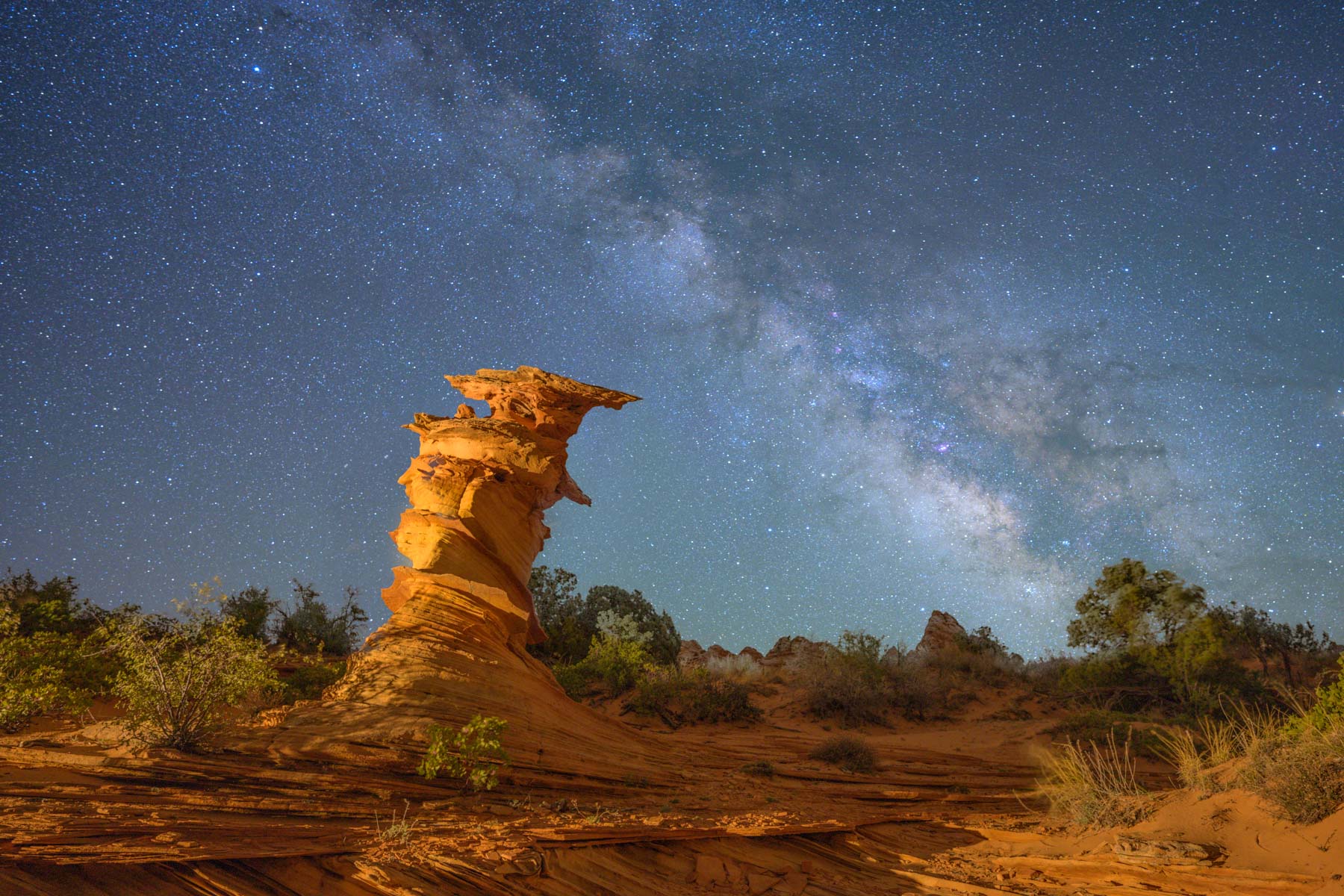
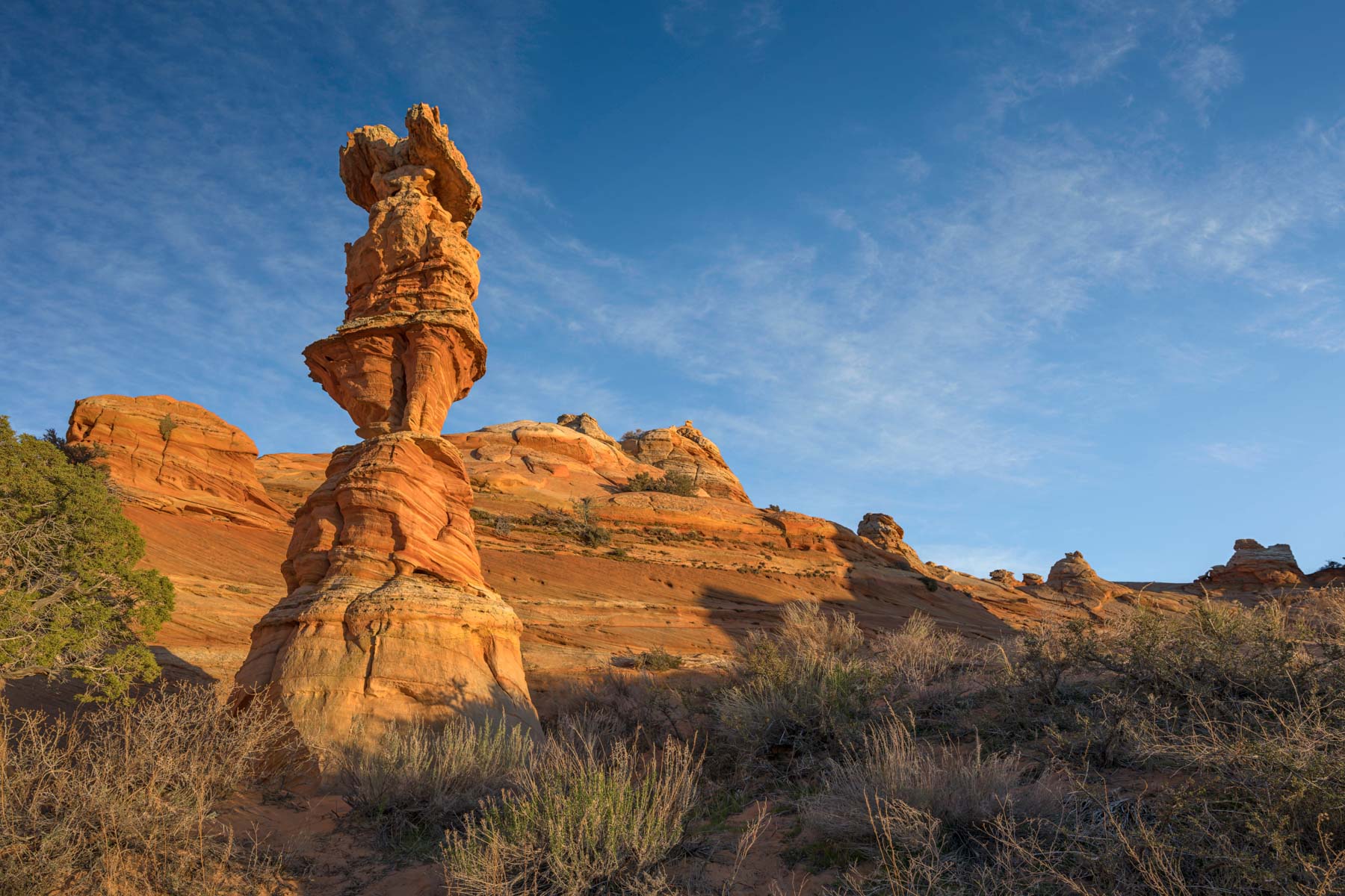
There are several good photographic sites in the Cottonwood Cove area. I especially like the Control Tower just before sunset in late Fall and early Winter. The best view of the Control Tower is from the south, making it an excellent foreground for star trails. You can also shoot it from its north side with The Milky Way in the background. The Control Tower is also the closest formation to the parking area, making it easy to shoot there late or into the night. Nearby formations "The Witches Hat" and "Half and Half". The "Hanging Head" rock formation near "Half and Half" has collapsed and is no more. A piece of "Half and Half" has broken off, and it is not as photogenic as it used to be, but it is still a reasonably good subject.
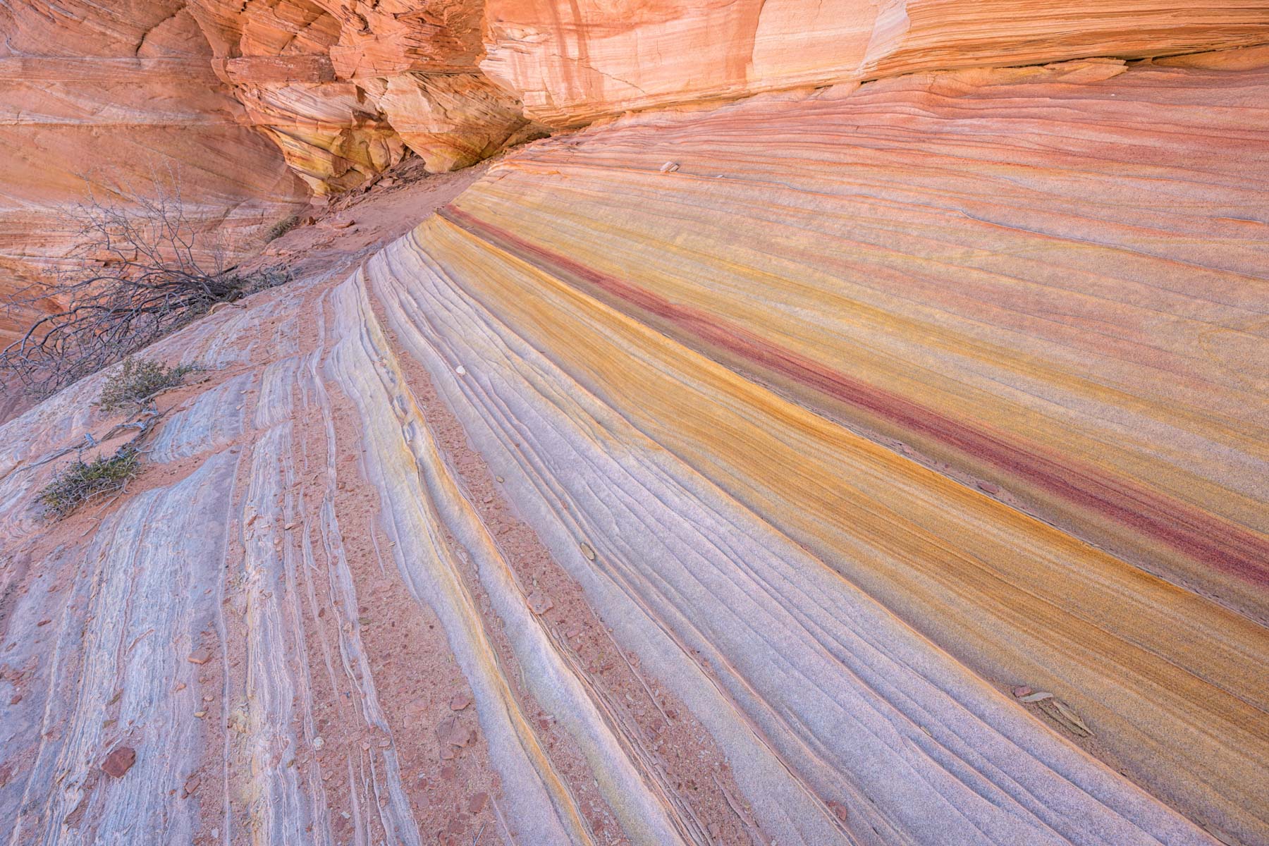
There are a few dinosaur tracks west of the Control Tower. Near the dinosaur tracks is a small formation reminiscent of The Wave. The west side of Cottonwood Cove is largely unexplored since it is quite far from the Pawhole and Cottonwood trailheads. This area almost certainly has some good images. Another good formation is a hoodoo named "The Chess Queen ."The Chess Queen is northeast of the Cottonwood Cove parking area on the right side of the road. It is outside the permit area and is best shot at sunset.
There are several other scenic areas accessible to hikers comfortable off-trail. These include The Hydra, the close-by Olympic Torch, and the south and west sides of Cottonwood Cove. This area contains Rainbow Cove, the Chocolate Swirl (also known as The Beauty), the Palace area, and Red Cove.


Map of Coyote Buttes South
To view the map in Google Maps please click anywhere on the map above.
- Click to download a KMZ file (Note - in IE Right Click and choose Save Target as)
- Click to download a KML file (Note - in IE Right Click and choose Save Target as)
- Click to download a GPX file (Note - in IE Right Click and choose Save Target as)
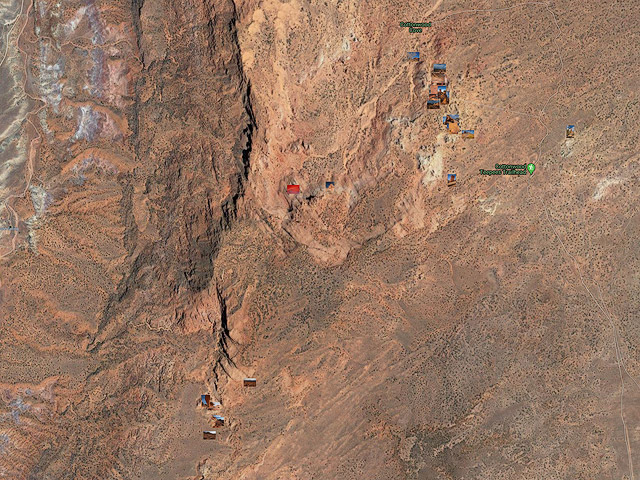
Photo Map
The following map shows the locations of all of the geocoded photos in my Coyote Buttes South Gallery. Click on any image to display a cropped thumbnail, the GPS coordinates, elevation, and focal length used when shooting the image. Click on the cropped thumbnail in the upper left corner to display a larger uncropped image.
Photo Map of Coyote Buttes South
To view the map in Google Maps please click anywhere on the map above.
The map can be downloaded by clicking here.
24K Topo Maps covering Coyote Buttes South
Two Topo Maps cover the south permit area. The Coyote Buttes map covers the area around the Pawhole trailhead,, and the Poverty Flat map covers the area around the Cottonwood trailhead. The individual topo maps that follow in the table below are high resolution and can be quite large (typically 5-10 megabytes). The merged maps are much larger.
| 24K Map (GeoTiff/Avenza) | KMZ | Oruxmaps | KMZ Decollared | Oruxmap Decollared | Avenza Decollared | Locations included |
| Coyote Buttes | KMZ | Oruxmap | KMZ Decollared | Oruxmap Decollared | Avenza Decollared | The Wave, The Second Wave, Sand Cove, Fatali's Boneyard, The Alcove, Melody Arch, The Grotto, Top Rock Arch, Pawhole Trailhead, Dinosaur Tracks |
| Poverty Flat | KMZ | Oruxmap | KMZ Decollared | Oruxmap Decollared | Avenza Decollared | Cottonwood Cove trailhead, the White Pocket, North and South Teepees |
| Coyote Buttes South Maps Merged | NA | NA | KMZ Decollared | Oruxmap Decollared | Avenza Decollared | All |