The Adeii Eichii Cliffs and Ward Terrace
Note- Navajo Parks and Recreation no longer offers permits to this area. You may be able to visit closed areas with the permission of local residents. There have been encounters in the past with local leaseholders in the area. I am including travel directions to the area for reference and in the hope that Adeii-Eichii will reopen in the future.
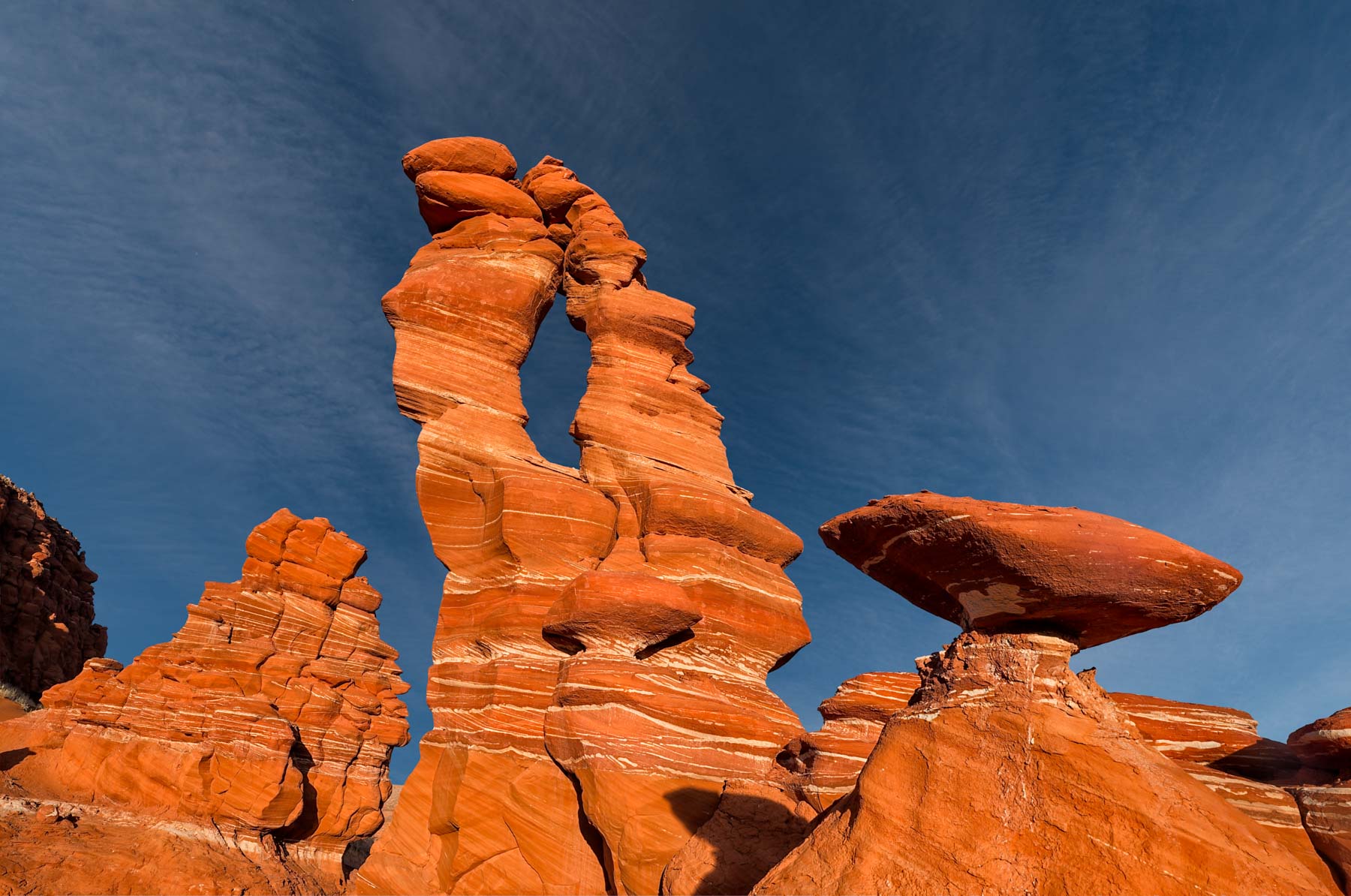
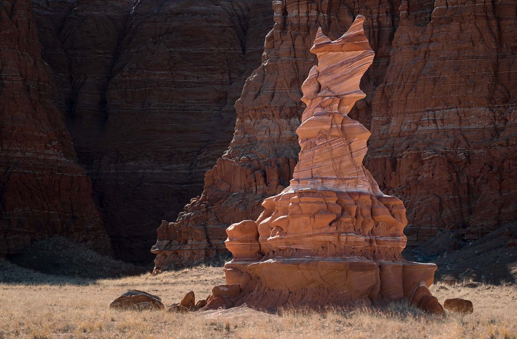
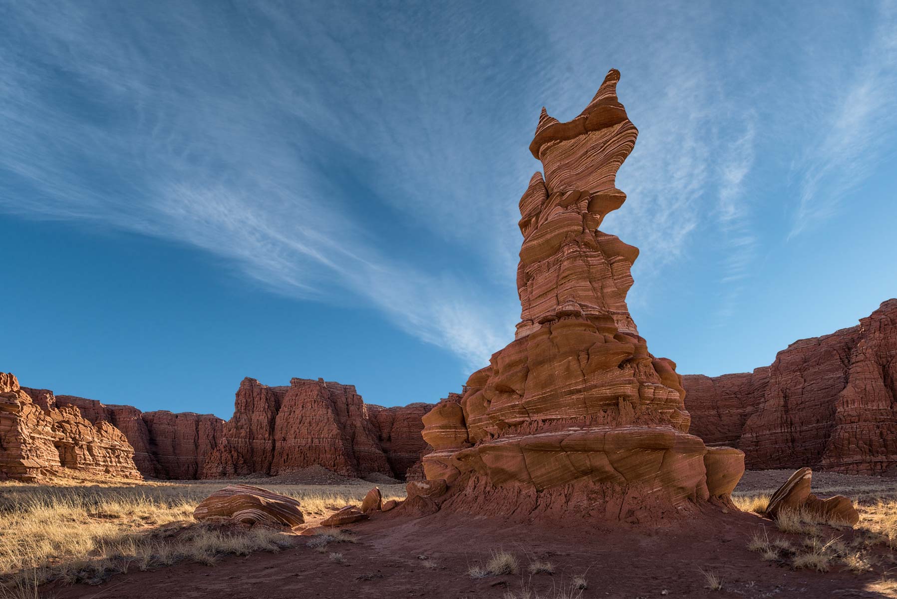
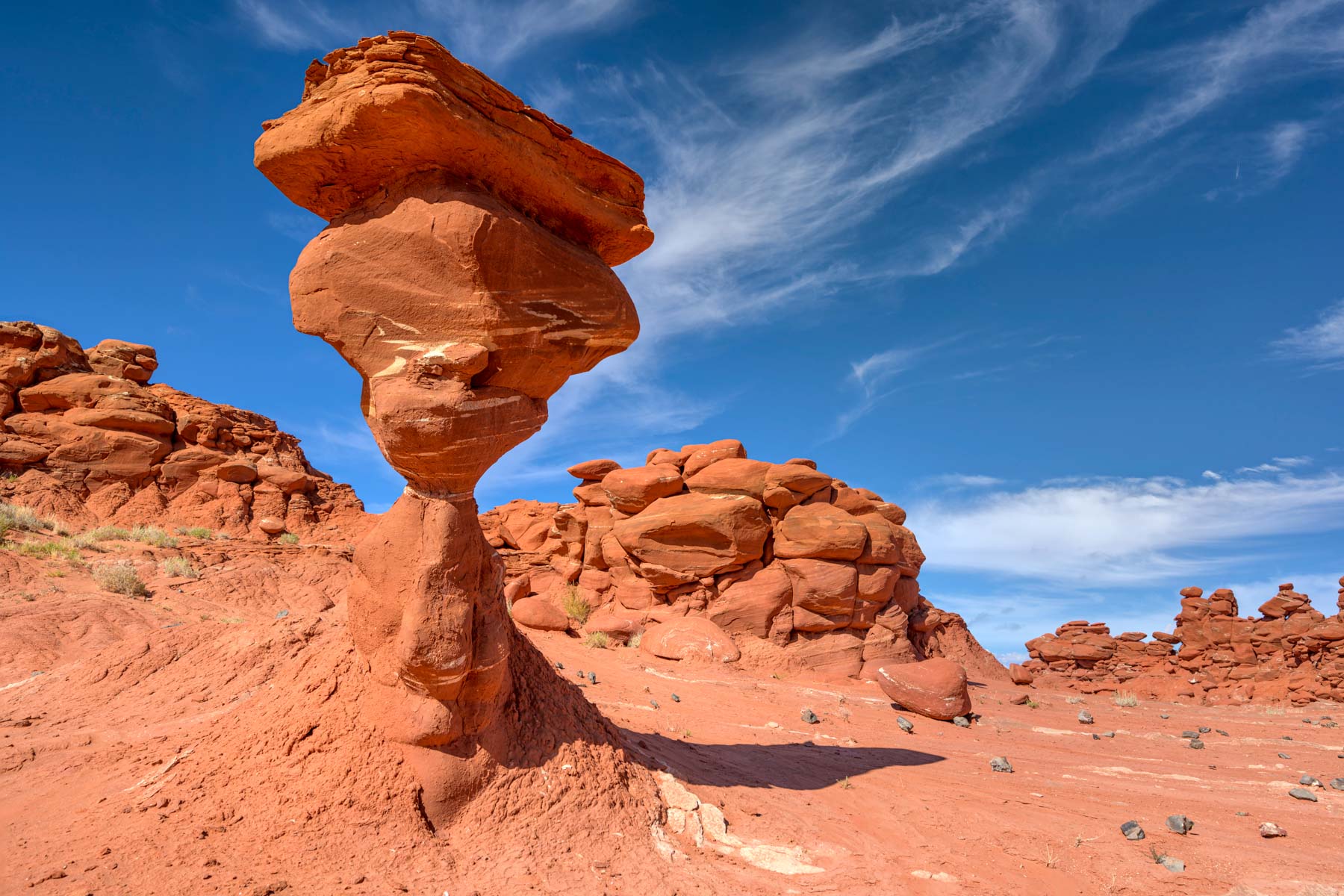
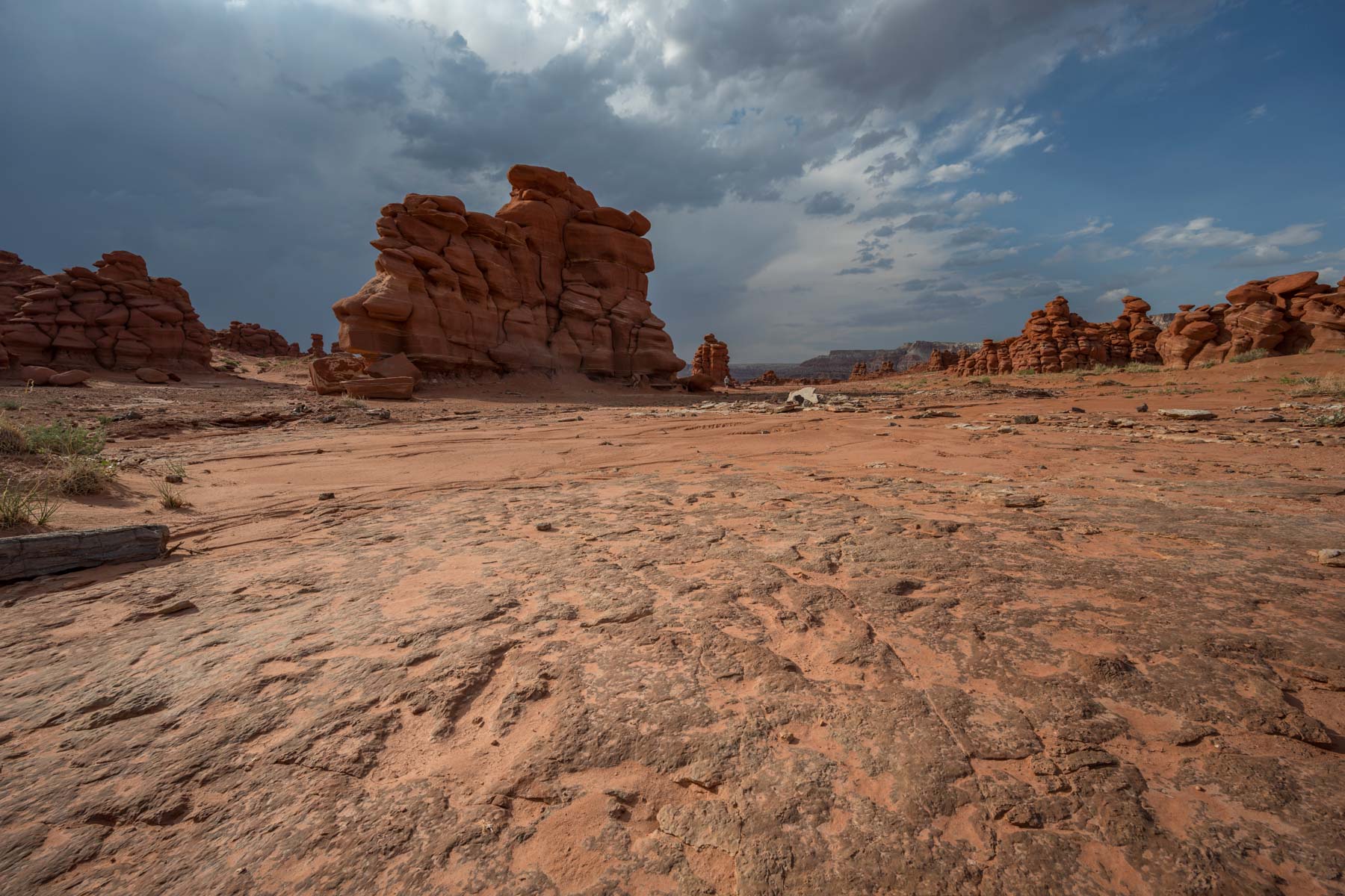
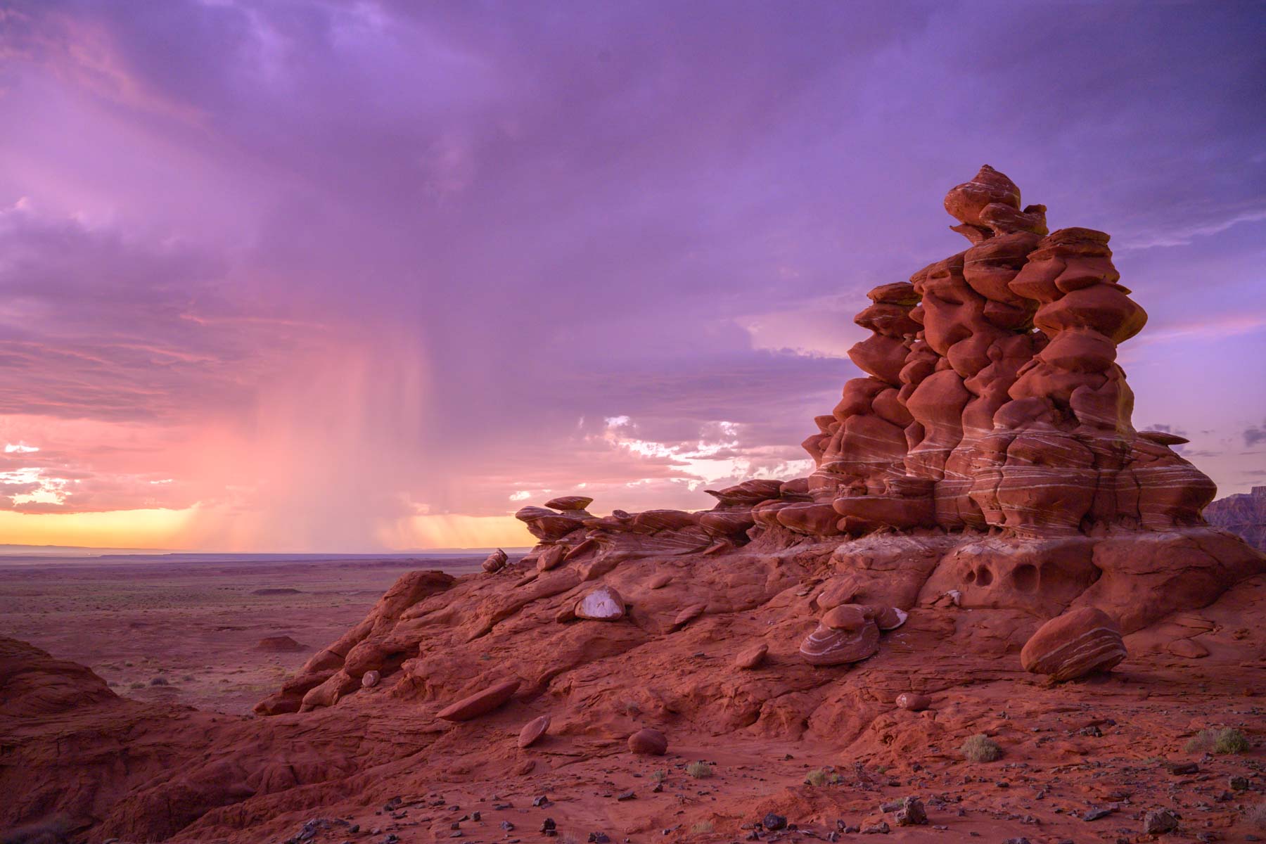
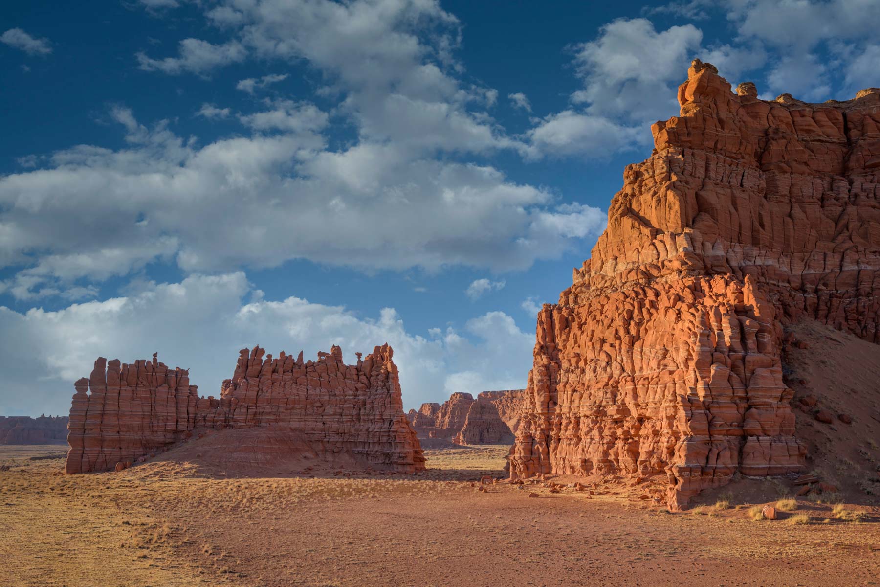
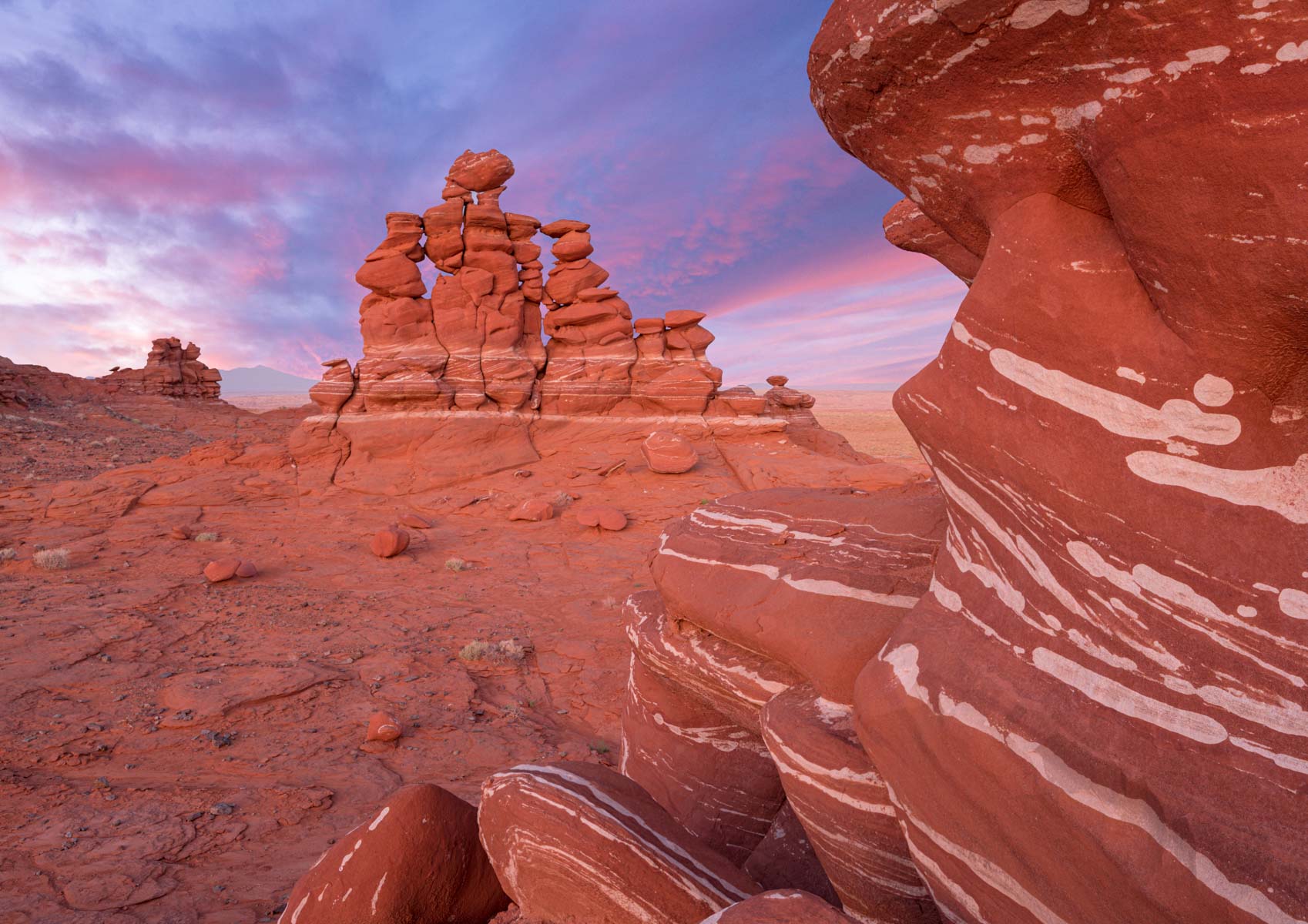
The Adeii Eichii Cliffs are about ten miles east of Cameron, AZ, and run in a north/south direction for nearly thirty miles. The southern end of the Adeii Eichii Cliffs is also known as the Red Rock Cliffs. The area below the Adeii Eichii Cliffs to the west is called Ward Terrace and is the area of photographic interest. Ward Terrace contains many red and white striped hoodoos similar to those in Blue Canyon.
As of 2024, permits are no longer available for the Ward Terrace and Hopi Clown areas. Should the areas be reopened, here is information on how to obtain a permit. You can get a permit in Cameron at the Cameron Visitor Center, located at the intersection of Highways 89 and 64 (SW corner). The visitor center is open five days a week from 8 AM to 5:30 PM during the winter. It is usually open seven days a week during the summer, but the schedule varies. If you plan to pick up a permit on the weekend during the summer, call +1 928 679-2303 to get their summer hours. Permits are also available by mail; apply well before your trip date. See the Navajo Nation Parks website for more details. Permits are $12.00 US per person per 24-hour period. The $12 pp fee includes camping at the trailhead since the permit is valid for 24 hours.
The Adeii Eichii Cliffs area is rarely visited. On my first visit, I found no evidence that someone had driven there in the past several months, and there were no directions to the area on English-language websites. On my last visit, I saw some tracks in The Ducks area, and travel directions are now available in Laurent Martre's excellent book' "Photographing the Southwest Volume 2 - Arizona, 3rd edition". T
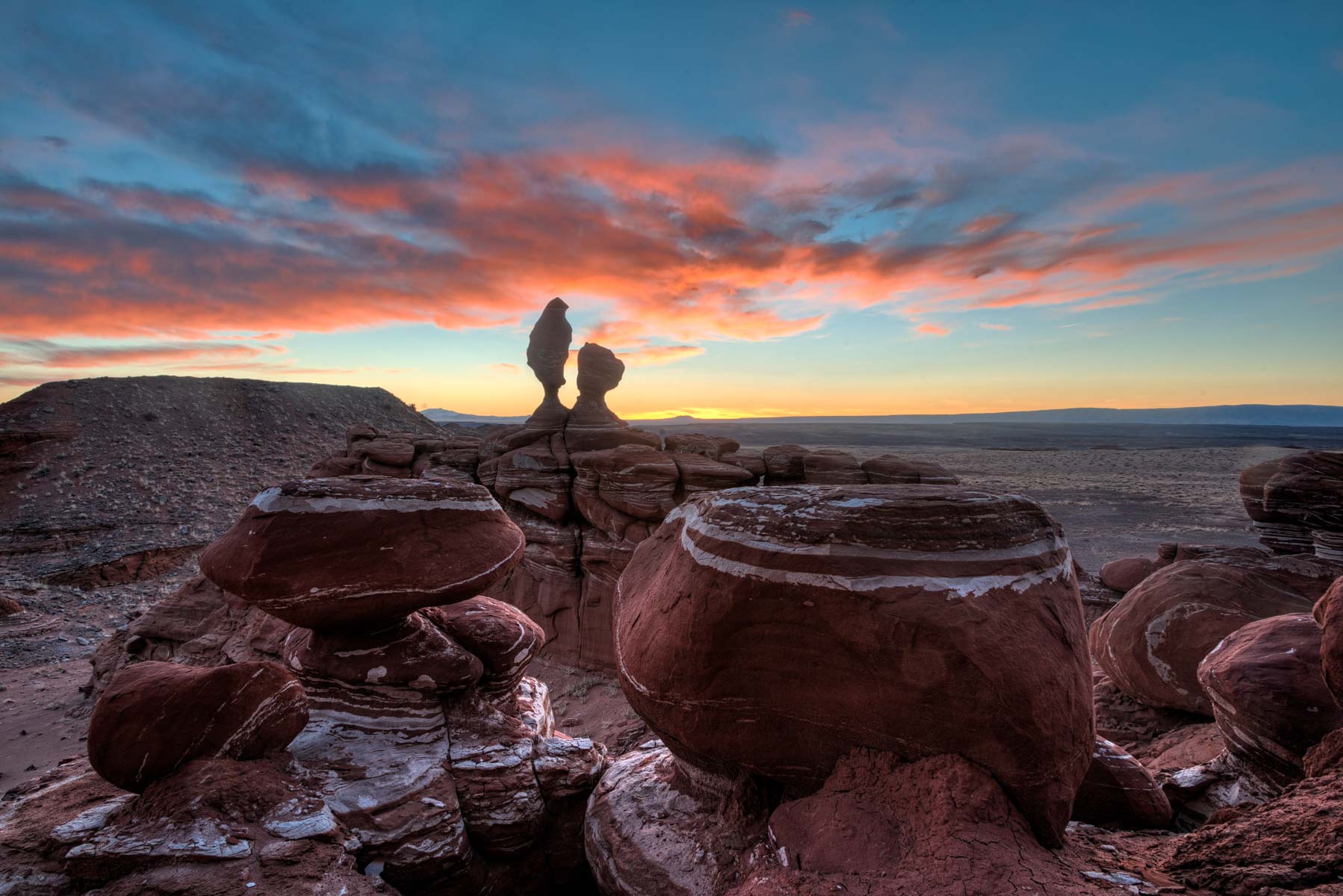
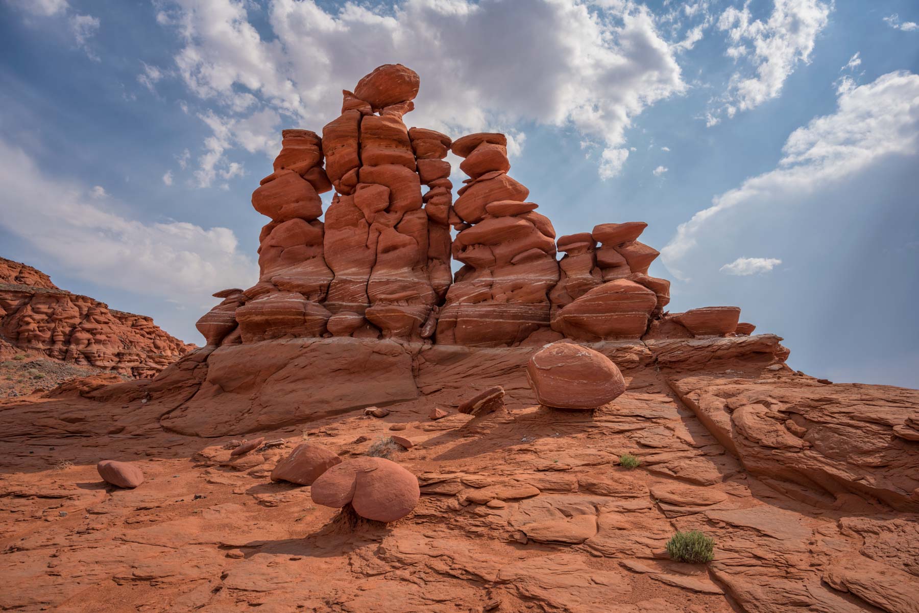
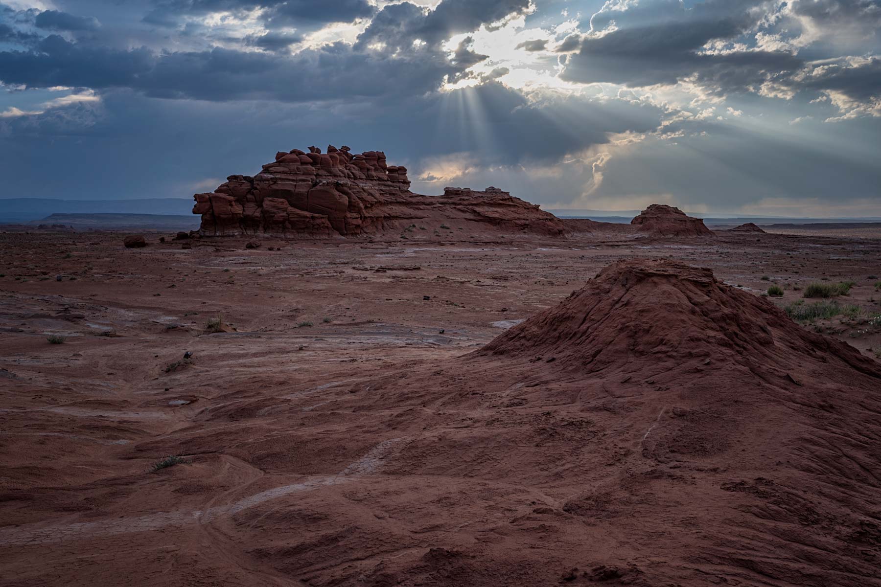
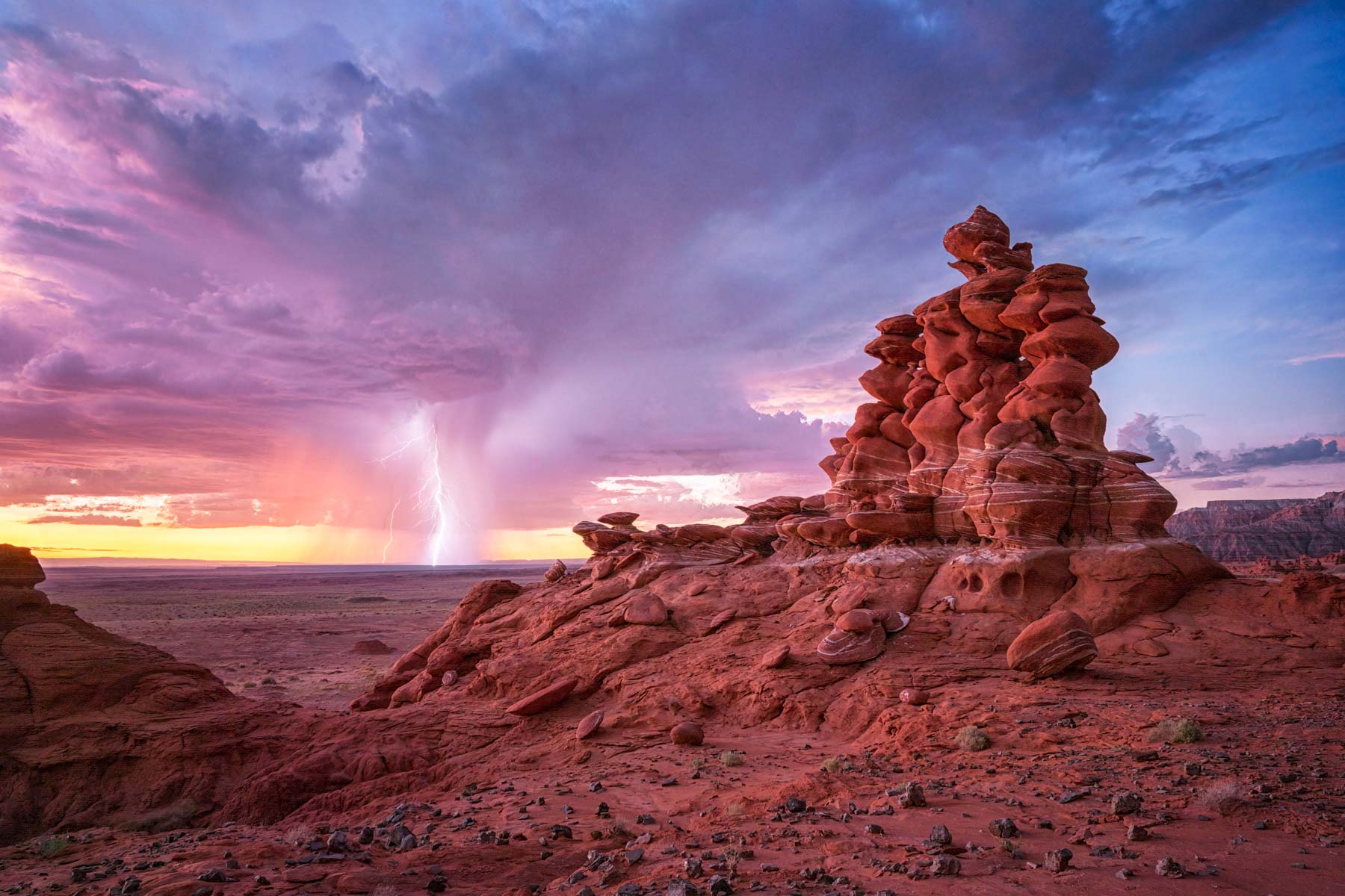
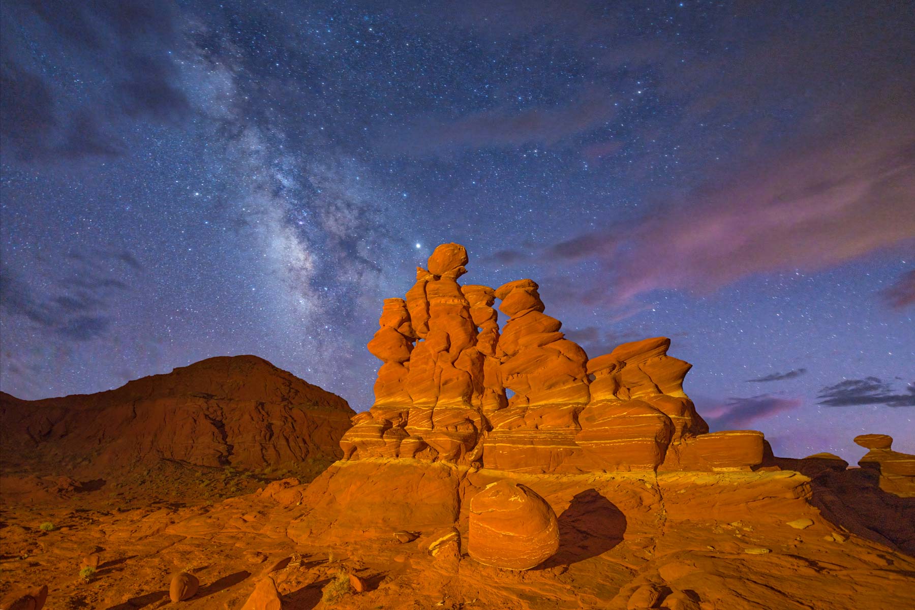
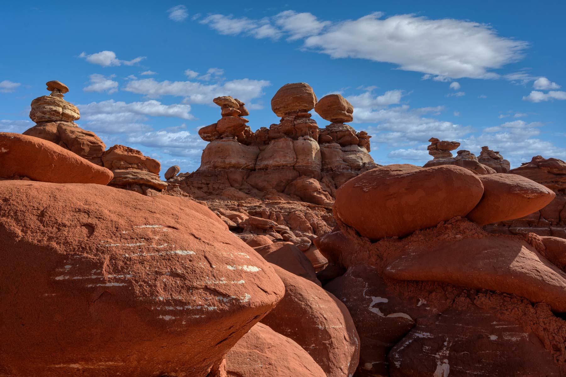
Within Ward Terrace, two main areas of interest exist. When driving in from the north, the first area contains "Sky City," an incredible rock formation with many holes. Sky City is about 1.5 miles from the nearest road. About .6 miles north of Sky City, there is an area containing some spectacular hoodoos in a beautiful setting and many more red and white striped rocks. Further south, at the end of the road, you can find The Eye of the Needle rock formation, London Bridge, and The Ducks. Unfortunately, Eye of the Needle collapsed sometime in early-mid 2019 and is no longer worth photographing. The Ducks and London Bridge are still worth visiting, however.
The rock formation known as The Hopi Clown is also in the Adeii Eichii Cliffs area. The roads are in bad disrepair, so I no longer include travel directions to The Hopi Clown on this site. If you manage to get to The Hopi Clown, here are some shooting recommendations. The best side of the Hopi Clown faces the northeast. Sunrise shots should work reasonably well starting in late March. Sunset shots work around the summer solstice. The formation known as the Moenave Candles should be best around the summer solstice as well.
Where to stay
In view of the long and difficult drive to the Adeii Eichii trailhead I suggest you car camp at the trailhead. Alternatively, the Cameron Trading Post has a good restaurant, room rates are reasonable, and the wifi works! Tuba City also has good lodging.
When to Go
The Adeii Eichii Cliffs area is at 4,500 feet elevation, about 300 feet higher than Cameron, AZ. Due to the elevation difference, Adeii Eichii's climate should be about 1-2° F colder than Cameron's. Historical temperature and rainfall data for Cameron can be found by clicking here.
Unlike many locations in Arizona, winters are reasonably mild, with average highs in January of about 50° F. Summers are hot, with average highs around 100°F, and should be avoided. Cameron and Tuba City are in a very windy area of Arizona, so March to May should generally be avoided, though there will certainly be days with low winds. Fall is probably the best time to visit.
Getting There
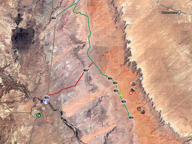
The Adeii Eichii Cliffs trailhead is about 15.4 miles from Highway 89 via a four-wheel drive road. The road is sandy and hard to follow, so I recommend you download the KML file attached below and drive the road with your GPS on and track. The road crosses several washes and is impassable when wet. It takes about 75 minutes to drive the road. The drive begins near Cameron. Coming from Cameron or the south, turn right (east) 0.4 miles north of the bridge over the Little Colorado River. After 0.1 miles, turn left after another .3 miles and bear right at the fork. Continue on the sandy road 6.4 miles to a "T" intersection. Update 2015 - locals have blocked off this road and unless you are in an ATV you cannot access the Adeii Eichii Cliffs via this route. At the T, turn right (southeast) onto an unmarked road. You need to follow this road about 8.5 miles to the trailhead. The road is more of a track than a road, and there will be places where it disappears, especially near washes. Again, you should download and follow the KML file on this site. The track on the file should be accurate to within ten feet. When you arrive at the trailhead park close to the cliffs to minimize the chance of being seen by locals.
Once in the area, I suggest you hike to both the "Eye of the Needle" arch and "The Ducks". Both are about two miles from parking. There are no trails, but the hiking is level and easy. Keep a GPS track to get back to your car after dusk. The Eye of the Needle is best at dawn in the winter months or at dusk in the summer. Update 4/15/2019 - The Eye of the Needle collapsed sometime in Winter 2019 and is no longer a good destination. The Ducks and London Bridge are still worth visiting. The Ducks area is best in the spring/summer at dusk. There are many other formations of interest in this region, but I still need to explore them. I have been told there are also dinosaur tracks in the area.
Maps
Here is an overview map showing the drive to the Adeii Eichii Cliffs and several areas of photographic interest:
To view the map in Google Maps please click anywhere on the map above.
- Click to download a KMZ file (Note - in IE Right Click and choose Save Target as)
- Click to download a KML file (Note - KML files do not include custom icons)
- Click to download a GPX file (Note - in IE Right Click and choose Save Target as)
Dark Sky Map of the Adeii-Eichii Cliffs Area
The following map from darksitefinder.com gives a rough idea of how dark the skies are in the Adeii-Eichii Cliffs area. Click on the map below to zoom in or out or change the base layer:

The map contains 15 colors. The Milky Way is invisible in the white, light gray, and red areas, visible but washed out in the yellow and orange areas, shows the Milky Way's structure in the green and blue areas, and in the black area, light from the Milky Way center casts shadows. Here's more information about how to interpret the colors on the map. This information comes from handprint.com:

USGS 24K Topo Maps
The maps below contain the entire Adeii Eichii Cliffs, including the Red Rock Cliffs area. The topo map "The Landmark" covers the area in Adeii Eichii that I photographed. It also contains the hike-in. The Gold Tooth map is just north of The Landmark. There are probably good photo opportunities in this region as well. Cameron NE and Cameron SE cover the drive-in.
The table to the right contains the topo maps in various formats. You can open KMZ overlay files in Google Earth, and Oruxmap files can be opened with Oruxmaps. Oruxmap is a free mapping app for Android phones and tablets. USGS topo maps contain a white border (called the collar), which contains information such as the map name, names of neighboring maps, the date the map was created, and latitude and longitude reference lines ... While collars are beneficial on printed maps, the information on the collar is much less useful for computer use. Maps with the collar removed can also be downloaded in the table to the right.
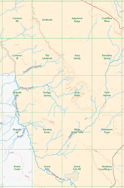
For reference, here is an image showing the names of all 20 topo maps and their location. The topo maps can be downloaded to the right of this image.
Adeii Eichii Cliffs Index Map