Northeast Arizona and Shiprock
If you're traveling between the Farmington area (Bisti Badlands, King of Wings) and Canyon de Chelly, think about visiting other destinations on the way. While Shiprock is often photographed, Royal, Hope, and Round Rock arches are rarely visited and are among the most photogenic arches in Arizona.
Shiprock
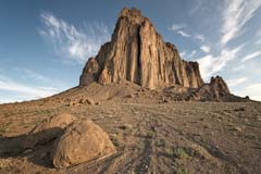
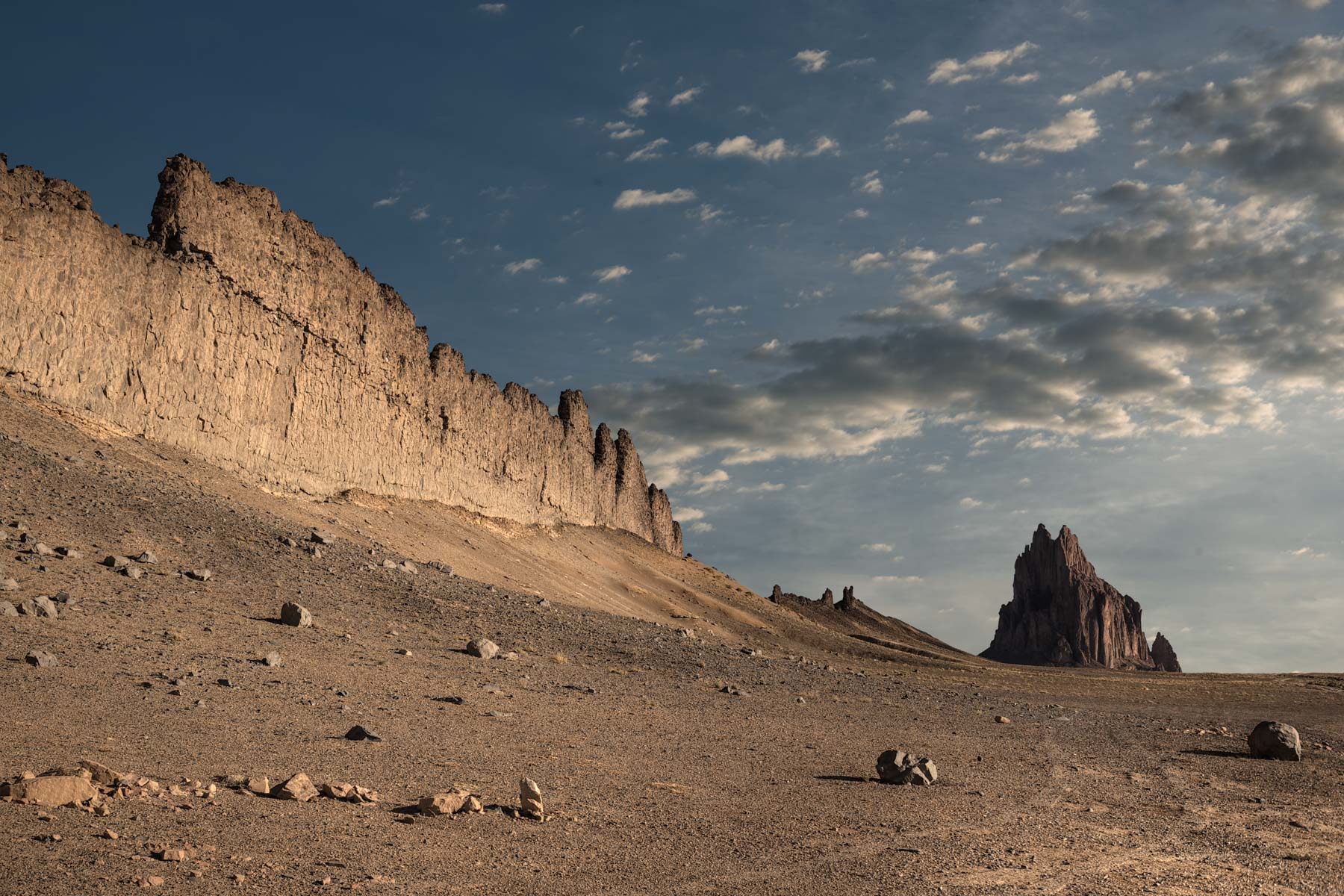
Shiprock is a black volcanic neck (aka volcanic plug) in northeast New Mexico. Shiprock rises 1,700 feet above the surrounding plains, and you can see it from fifty miles away. It was formed when cooling lava plugged a vent on a volcano that erupted thirty million years ago. Over time, the surrounding sandstone eroded, leaving only the harder volcanic plug exposed.
Shiprock is sacred to the Navajo people, and climbing it is strictly forbidden. Shiprock was first climbed by Sierra Club members David Brower, Raffi Bedayn, Bestor Robinson, and John Dyer on October 12, 1939. This climb was the first to use expansion bolts in addition to the then-usual pitons. The climb took four days, with only twelve feet of progress being made on one day. The Shiprock climb is still considered difficult.
There are several volcanic dykes (dikes) radiating from Shiprock, with the largest running due south. A volcanic dyke is formed when lava enters a crack and solidifies. Over time, the surrounding rock erodes, leaving only the dyke exposed.
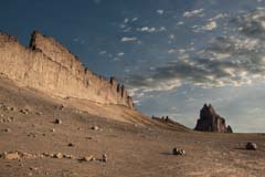
Shiprock photographs best near sunrise from the south. Sunset is also possible, but the volcanic dyke will not be lit. Include the volcanic dyke radiating to the south as a leading line. The dyke can be climbed in a few areas; the easiest is shown on the map below. Chartering an airplane and shooting aerials of the volcanic dyke and Shiprock will produce great images as well. Launching or operating a drone on Navrajo Nation land is not allowed.
The winter months generally bring better light than the summer, though wildflowers are present throughout June and provide good foreground.
Shiprock is best early morning, so I suggest you stay in Farmington, which is the nearest town with good lodging. Camping near Shiprock itself is forbidden. Allow at least one hour to get from Farmington to Shiprock. From Farmington, take US 64 west to Shiprock. Bear left at the intersection with US 491. Continue 7.1 miles on US 64, 491, and turn right (west) onto the paved Indian Service Route 13. Continue for 7.6 miles on IR 13, then turn right (north) onto IR 5010, a good dirt road. Follow IR 5010 north to Shiprock, which is about 3.5 miles away.
Royal Arch
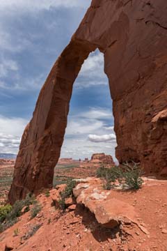
Royal Arch, also known as Cove Arch, is a superb, rarely visited destination in the Four Corners area. This free-standing arch sits at 7,100 feet, well above the surrounding terrain. Shiprock, 25 miles away, can be easily seen in the distance. Royal Arch is a free-standing arch with a span of 76 feet and a height of 170 feet.
Royal arch is most easily photographed at a distance from the east. Royal Arch gets very early light, and you can shoot it at dawn. You will need to camp near the arch if you wish to shoot at dawn, as the road to the arch is strictly high-clearance 4WD, five slow miles long, and heavily rutted. Royal Arch is on the Navajo Nation, and a guide, a hiking/camping permit, or permission from a local leaseholder is required to visit it. Information on permits can be found here.
You can shoot Royal Arch close-up with an ultra-wide-angle lens or a panorama head. Shooting from the arches' southwest corner from mid-afternoon on would work well. You can also shoot it at a distance from its west side. This would require a long hike around the formation the arch sits on.
Hope Arch


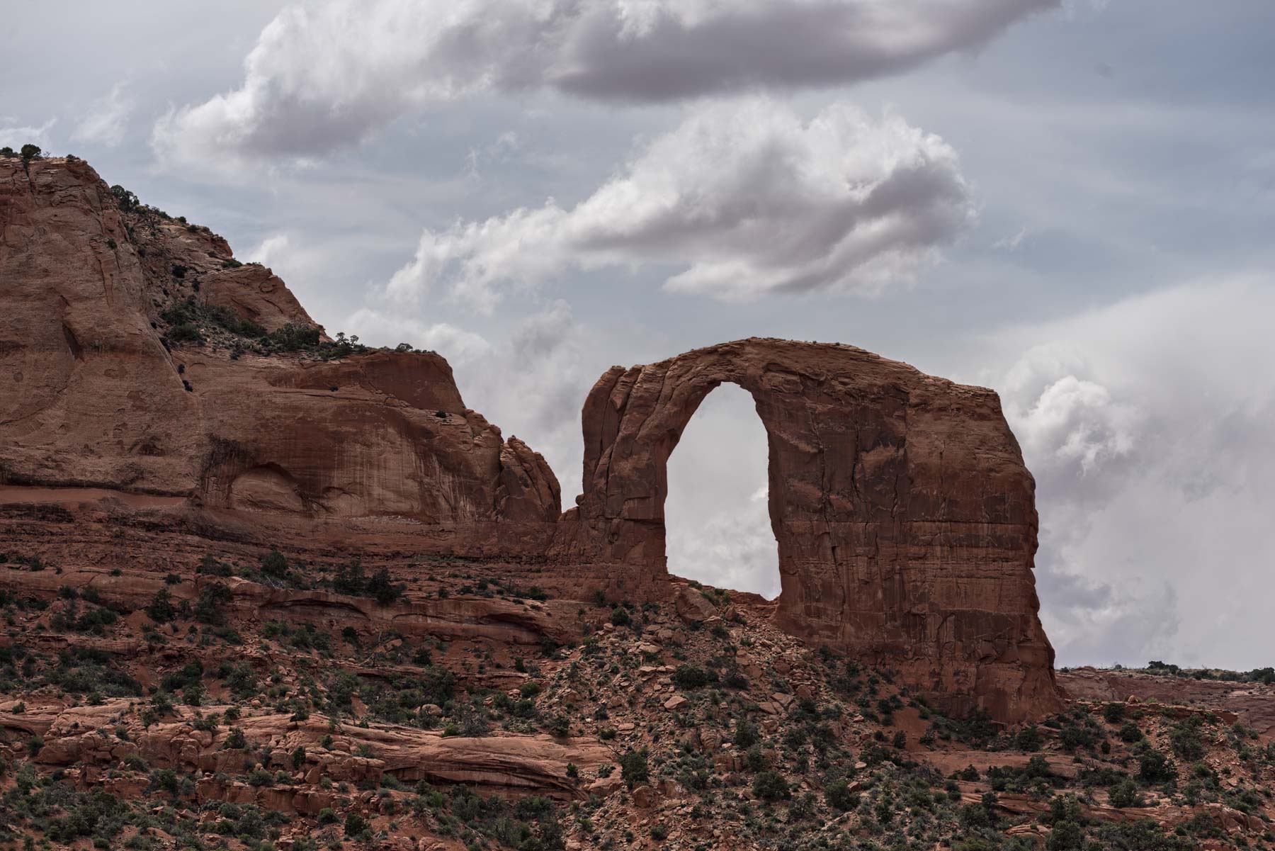
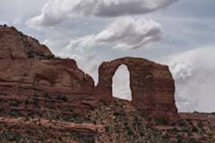
Hope Arch is a stunning natural arch in an area characterized by towering red-sandstone cliffs, buttes, spires, and fins. It's a fin natural arch eroded through De Chelly sandstone. De Chelly sandstone dates to the Permian period, 280 million years ago, and forms iconic buttes, spires, and mesas. De Chelly sandstone is associated with Canyon de Chelly and Monument Valley. Vreeland reported the span at 70 feet, the vertical opening at 65 feet. The lintel has a thickness and width of six feet, which accounts for its delicate appearance. Geologist Herbert Gregory first documented the arch in 1909 and named it for his wife Hope because of its beauty.
The arch is 8 miles west-northwest of the town of Chinle, Arizona. From the intersection of US 191 and Indian Rte 7 in Chinle, take US 191 2.3 miles north and turn left onto C669. Follow C669 3.05 miles and turn right onto BIA 8090. Take BIA 8090 2.2 miles to the first road on the right. Most of this 0.7-mile-long road can be driven carefully in a passenger car, but the last piece is strictly high-clearance 4x4 country with deep sand. Drive it as far as you are comfortable. The arch is only one hundred yards north of the road's end. Hope Arch is on the Navajo Nation, and a guide, a hiking/camping permit, or permission from a local leaseholder is required to visit it. Information on permits can be found here. You can usually find guides at Canyon de Chelly.
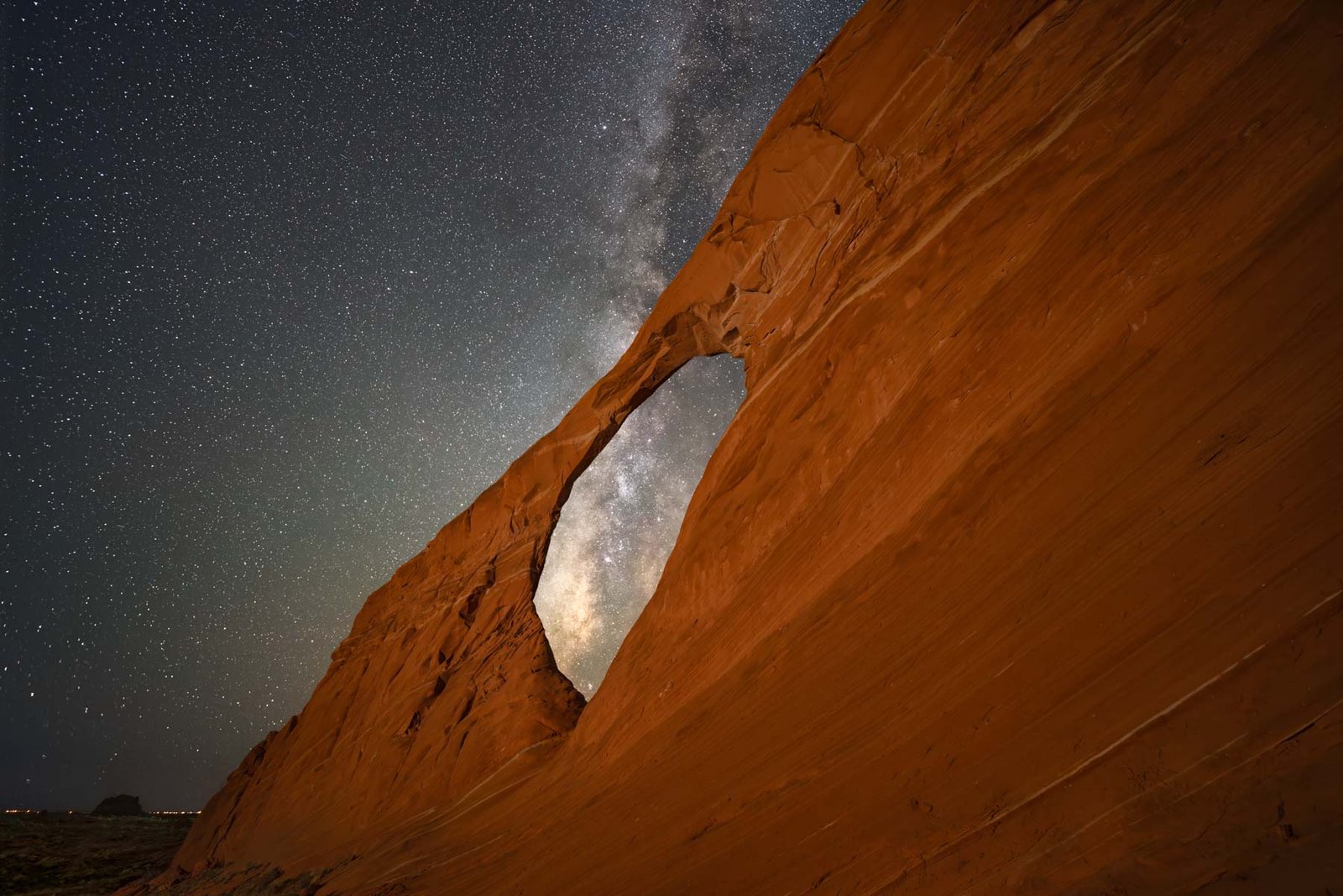
Hope Arch runs north-south and is front-lit at dawn and dusk, with dawn being the best time for photography. At sunset, a fin to its west blocks optimal light, casting ugly shadows. It is ideal for Milky Way photography year-round. Use tools like Photoephemeris and Photopills to plan Milky Way shots. The arch also offers a great view of the full moon as it passes through it. Climbing through Hope Arch is straightforward, allowing you to capture its shadow and interior shots.
While in the area, you should also photograph nearby "The Castle". If you are up for an adventure, consider hiking up or driving to Carson Mesa above it. The mesa has many potholes that should fill with water in the summer months. I have shown two possible routes up Carson's Mesa on the map below; both are untested and may not go. Try the blue route first.
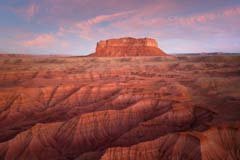
Round Rock

Round Rock is visible for many miles along US Highway 191. At two places along 191, you can see an opening in the rock. Per Vreeland, the official name for the opening is Window Rock II 11-9. I'll refer to it as Round Rock Arch. Round Rock Arch is a buttress-type natural arch eroded into a Wingate sandstone ridge extending south from the mesa. The arch has a span of 20 feet, a height of 60 feet, a thickness of over 100 feet, and a width of 25 feet. The arch photographs well from both sides, but you'll need a long telephoto lens if shooting from US 191. You cannot fly a drone over the Navajo Nation unless you can launch and operate from outside the nation. I thought launching from US 191 would be okay. US 191, while under joint US and Navajo jurisdiction, remains on Navajo land. If you wish to fly a drone near Round Rock, I suggest you go to the chapter house and ask for permission. Alternatively, you may be able to get a permit from the Navajo Department of Transportation. You will need to provide proof of liability insurance, an FAA license (you'll need to pass part 107), your flight plan, your drone registration, and information about the drone. Even with permission, I suggest you be discreet and avoid flying when others are present, as most Navajo are unaware of the legalities.
There are two groups of spires emanating from the mesa; the first formation is named "The Pope", and the second is "Chinle Spires". Both are on the west side of Round Rock. If you fly a drone, you can frame "The Pope" inside Round Rock Arch. Round Rock is surrounded by Chinle badlands, which provide excellent foreground. At the base of the mesa, there are many rocks with intriguing shapes that also offer good foreground.
Round Rock is part of the Navajo Nation, and a permit or permission of a local leaseholder is required if you wish to shoot it close-up. When I went, I stopped at the Round Rock Chapter House and asked if I could visit it. They indicated that, as long as I stayed on the "roads," no one would care. When I turned off Highway 191, I stopped and asked a local if visitation was okay. He said no one had leased the land and that it was unused, and gave me directions. The 4x4 road to the butte is very rough, with deep ruts and washed-out sections; a high-clearance vehicle with good tires is needed. I've shown the track to the mesa on the map below. The "road" circles Round Rock. I came in and left via the west side since that is where the spires are.
Other points of interest in the immediate Round Rock area include the Dancing Rocks, the Rock Window, and Little Round Rock. Little Round Rock provides an excellent background to Round Rock.
Google map of Northeast Arizona, Shiprock
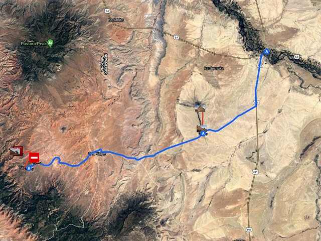
To view the map in Google Maps please click anywhere on the map above.
- Click to download a KMZ file (Note - in IE Right Click and choose Save Target as).
- Click to download a KML file (Note - KML Files do not include custom icons).
- Click to download a GPX file (Note - in IE Right Click and choose Save Target as).
USGS 24K Topo Maps
Shiprock is covered by the Ship Rock USGS 24K map. Caution - there are two USGS 24K maps with similar names, Shiprock is covered by the "Ship Rock" map, and the town of Shiprock by the "Shiprock" map. The "Ship Rock" map can be downloaded in a variety of formats below:
| Geo Tiff/Avenza | KMZ | Oruxmaps | KMZ Decollared | Oruxmap Decollared | Avenza Decollared |
| Ship Rock | KMZ | Oruxmap | KMZ Decollared | Oruxmap Decollared | Avenza Decollared |
Royal Arch is covered by the Cove USGS 24K map. If you wish to visit the area to the west below the arch you'll also need the Mexican Cry Mesa topo map. Both maps and a merge of the two can be downloaded below:
| Geo Tiff/Avenza | KMZ | Oruxmaps | KMZ Decollared | Oruxmap Decollared | Avenza Decollared |
| Cove | KMZ | Oruxmap | KMZ Decollared | Oruxmap Decollared | Avenza Decollared |
| Mexican Cry Mesa | KMZ | Oruxmap | KMZ Decollared | Oruxmap Decollared | Avenza Decollared |
| Merge of both maps | NA | NA | KMZ Decollared | Oruxmap Decollared | Avenza Decollared |