The Upper White Rocks, Sidestep Canyon, and the West Fork of Wahweap Creek
The White Rocks
The White Rocks are about three miles North of Churchwell in South Central Utah. Churchwell is a small community (shown as a trailer park on the topo map) at milepost 13 on Highway 89.
The White Rocks have two sections, the Upper White Rocks, and the Lower White Rocks. The Lower White Rocks are accessible from Churchwell, and the Upper White Rocks can be reached from Churchwell, or illegally via Cottonwood Canyon Road and BLM 431. Both White Rock areas are close to each other but there is a cliff between them. This makes it difficult but not impossible to traverse from one to the other. To see both areas you should plan on at least two days. Recent (within the last few years) road closures make access to the White Rocks considerably more difficult than it was in the past.
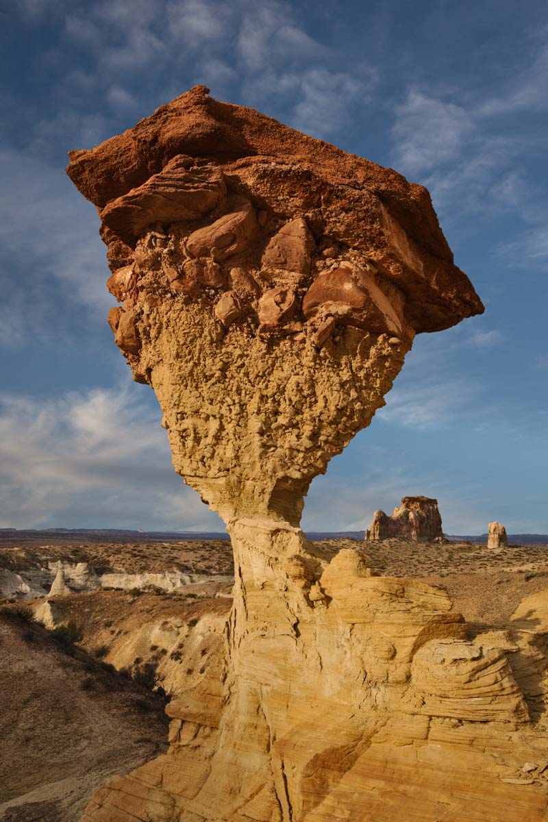
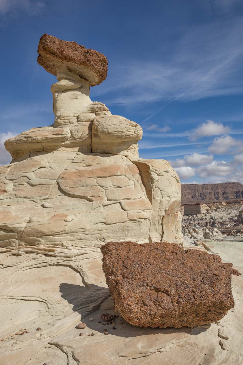
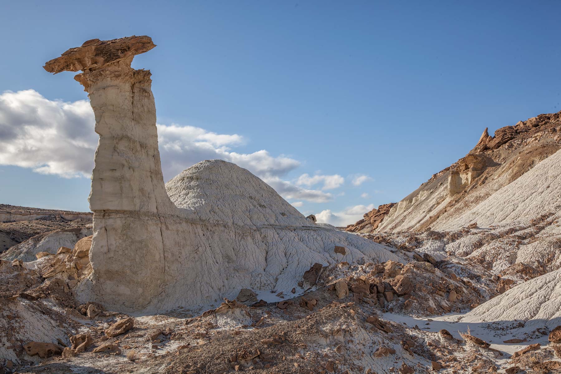
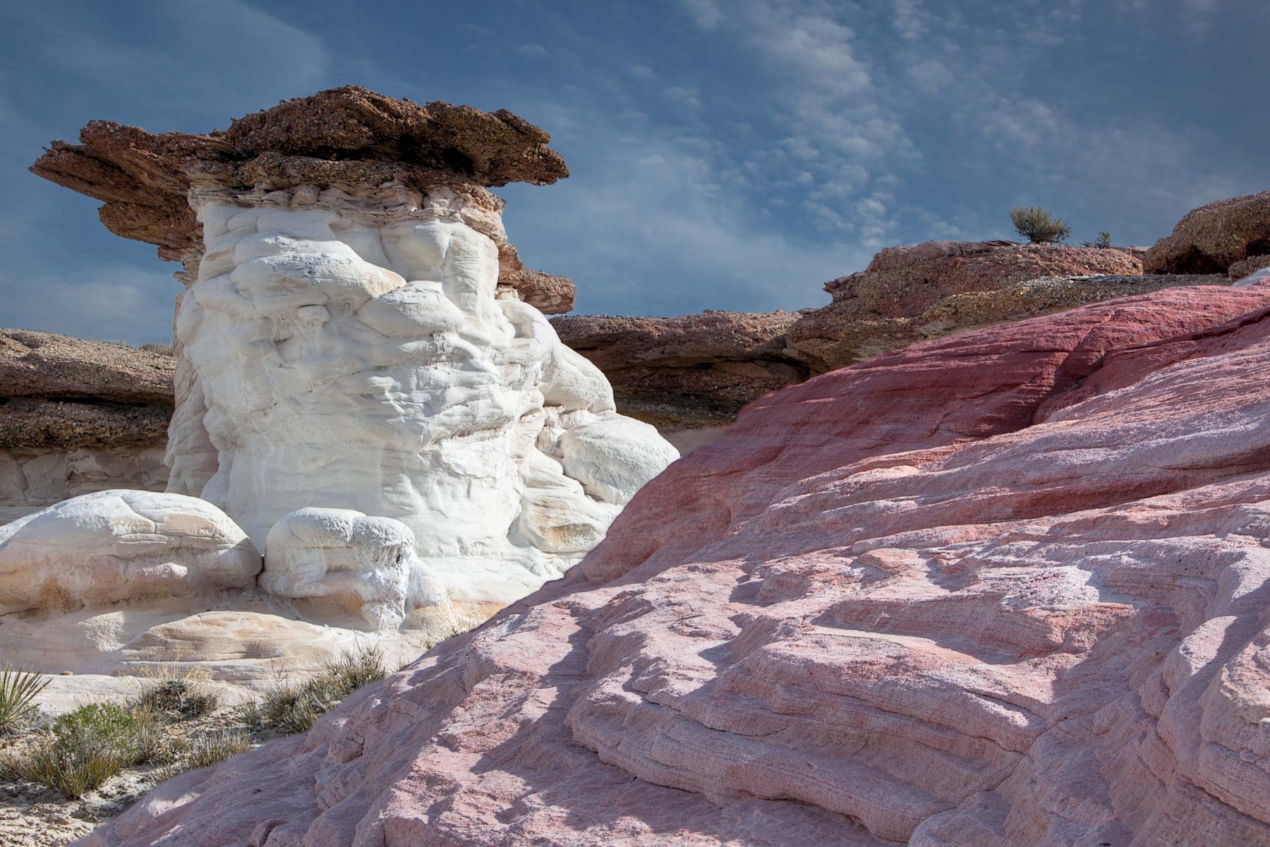
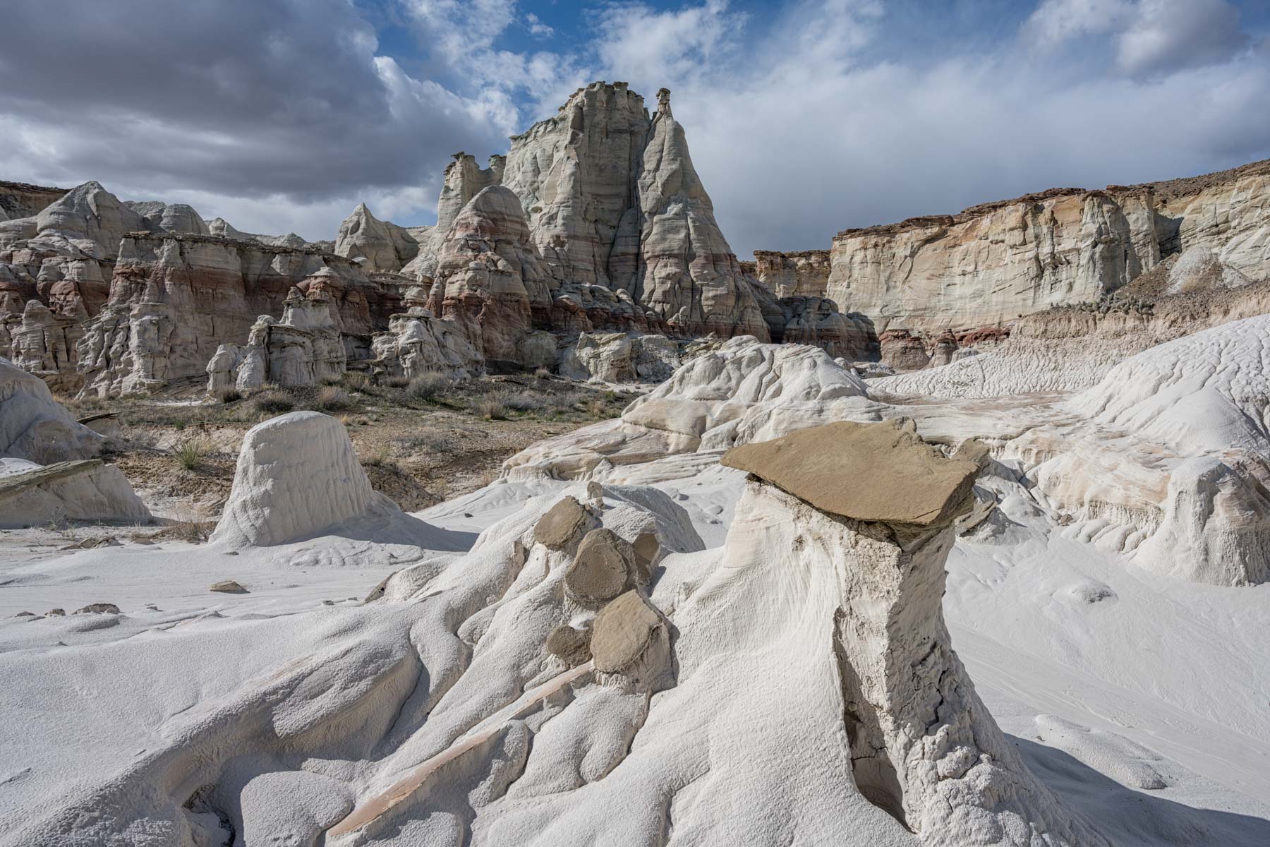
I have only been to the Upper White Rocks so I will concentrate on the route to this area. There are three good locations in the Upper White Rocks: the Twisted Hoodoo area, Colorful Canyon, and the rim of Sidestep Canyon. All three areas can be reached via two different routes, one of which is officially closed now.
Recommended Route
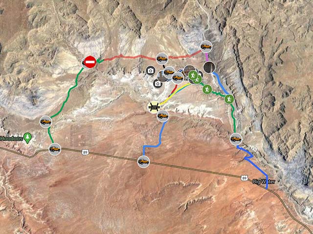
Legal access to the Upper White Rocks via an easy hike is available via BLM 435. BLM 435 is signed and starts on "Wells Street" in Churchwell. BLM 435 is a 4WD road. It used to end a short distance from the Lower White Rocks. BLM 435 now ends .2 miles beyond the reservoir shown on the map below. If you wish to access the Lower White Rocks you will now need to hike two miles north following the wash at the roads end.
In addition to providing access to the Lower White Rocks BLM 435 also can be used to access the Upper White Rocks. To get to the Upper White Rocks take BLM 435 and park just after the reservoir. There is a barbed wire fence that is easily crossed at 37.13469, -111.76027. After crossing the fence you'll see a canyon running ENE from the reservoir. Take the small cattle trail (or perhaps an old two track?) running up the hill paralleling the right side of the canyon. Continue a bit less than one mile till you can easily cross to the other side of the canyon and do so. Then turn slightly left (head NNE) and continue for a bit over a mile on the flat trail-less terrain to reach the parking area for Colorful Canyon and Sidestep Canyon. The total hike is only about two miles (one way) and is fairly easy. A large portion of the hike is off trail. You should know how to use a Compass/GPS before attempting it. The route is shown in red on the map below and can be downloaded as a KMZ, KML or GPX file by clicking on the links below. Most GPS devices can import GPX files. When I did this hike (September 2011) I had to add on an extra .5 miles each way since BLM 435 was washed out where it crosses Coyote Creek. As of my last visit in April 2019 the wash-out was repaired. To get to the "trailhead" I walked up BLM 435 to the reservoir before beginning my hike.
Old route (via a now closed road)
This is the route given in the Second Edition of Laurent Martres' excellent book "Photographing the Southwest: Volume 1 - Southern Utah. Take Highway 89 to Cottonwood Canyon Road (mile marker 17.7). Go North on Cottonwood Canyon Road 1.4 miles and turn right onto BLM 431. After 3.9 miles on BLM 431 bear right, there is a sign that says "Administrative Road". This road is closed for all but administrative and other permitted uses. In the map below this closed section is shown in "Red".
If you go to the White Rocks via this road you may be subject to a fine should you encounter a BLM law enforcement ranger. Cameras have been installed on the closed sections and are being used to ticket violators. People have been ticketed on this road in the past. Take this road at your own risk. Continue 4.0 miles on BLM 431 till you reach a small jeep road on the right going south. To get to Twisted Hoodoo continue on this road .7 miles till just before a very small hill with a rock outcrop, park there. Twisted Hoodoo is in the canyon a few hundred yards east of where you parked.
To get to either Colorful Canyon or the rim of Sidestep Canyon after visiting Twisted Hoodoo continue on the jeep road another .5 miles, there is a flat area on the left where you can park just before the road goes downhill. You can also park on the right side of the road. Colorful Canyon is just a few yards from the left (West) side of the road, and Sidestep Canyon is a few hundred yards to the east. Note - this route also provides excellent access to the "Tower of Silence" which is only a two mile RT hike from the trailhead at the end of the road. See the map below for directions.
Lower Sidestep Canyon and the West Fork of Wahweap Creek
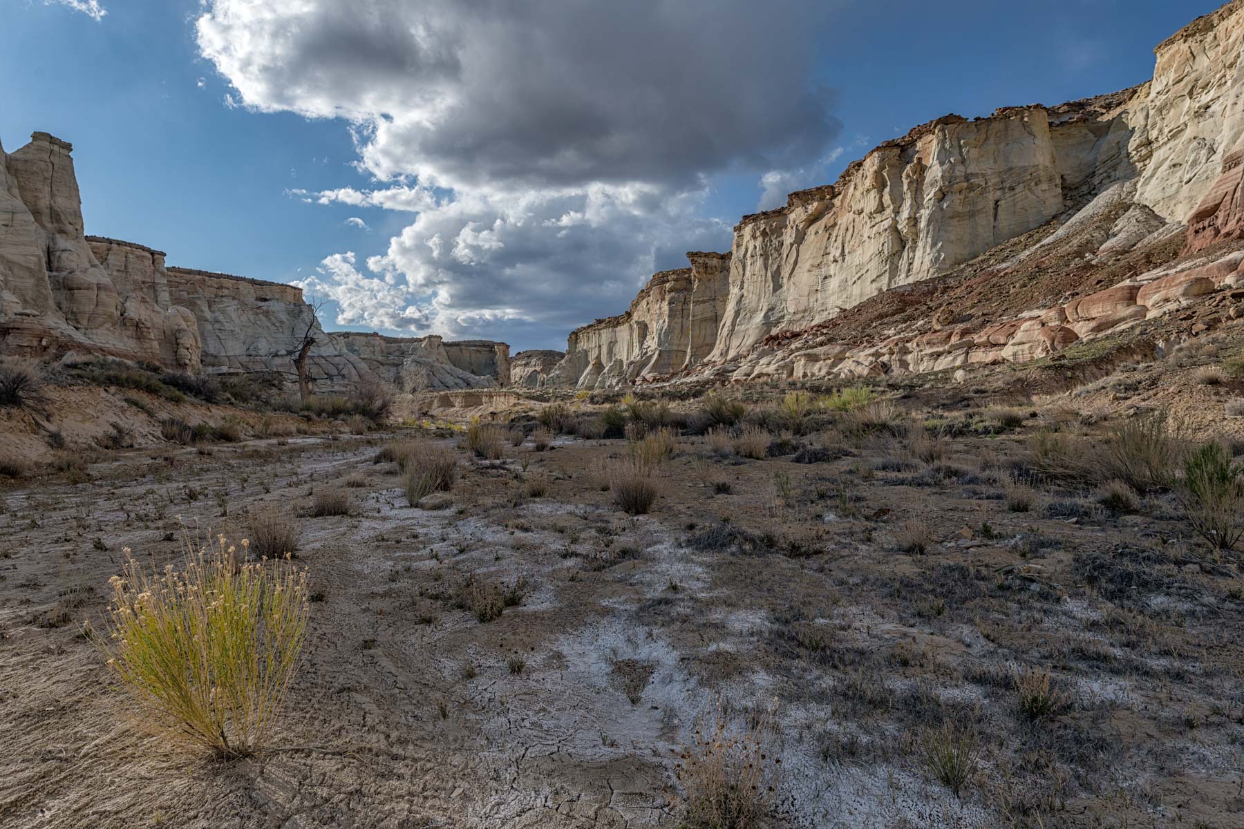
Sidestep Canyon, like the rest of The White Rocks, has two sections, an upper and a lower. The upper part of Sidestep Canyon is best reached via the recommended route above. The lower part of Sidestep contains several narrow slot canyons and many good hoodoos and is largely unexplored. Michael Kelsey in his book "Hiking and Exploring the Paria River 6th edition" indicates that you can access the lower part of Sidestep via the West Fork of Wahweap Creek just southeast of the canyon. Kelsey shows some recommended access points on page 168. Readers Mark Fredrickson and his son Tanner recently dropped into the west fork in two different locations and have kindly provided me with their track. Thank you Mark and Tanner, I would not have gotten there without your advice. A simplified version of this track as well as my own actual track (in yellow) can be found on the map below. The hike from Churchwell is a real slog with little to see when crossing the cowed-up sagebrush flat until you get to the drop-in point. Once in the West Fork there is plenty to see.
Lower Sidestep can also be accessed by hiking up Wahweap Creek until the confluence with the West Fork and then hiking up the West Fork. This route is long and generally uninteresting until you reach the upper section of the West Fork. The route is 10-11 sandy but flat miles round trip from the Wahweap Creek trailhead. The 10-11 miles does not include any room for exploration.
Photography Tips
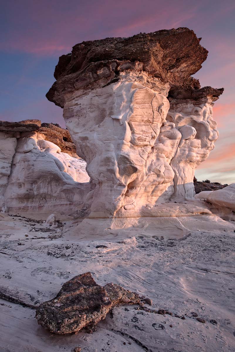
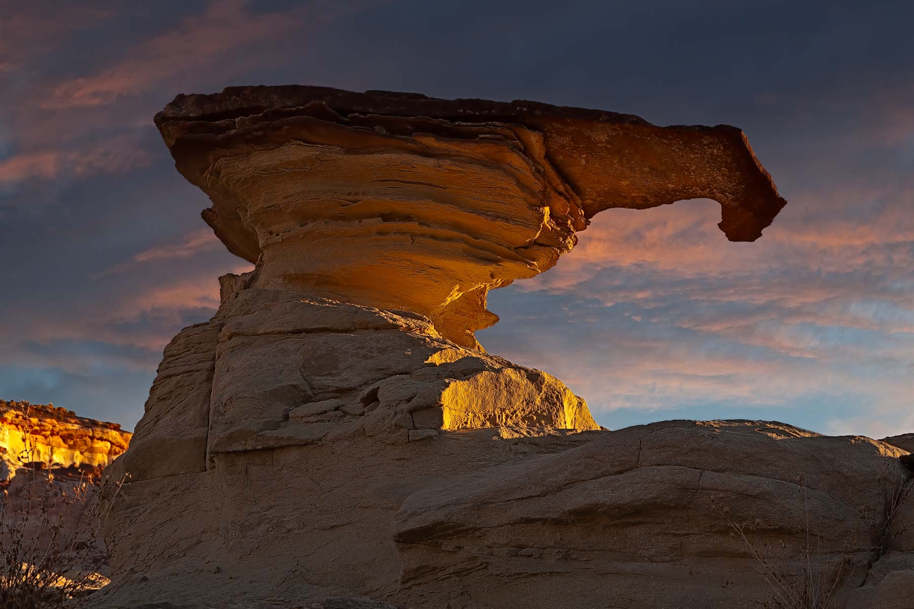
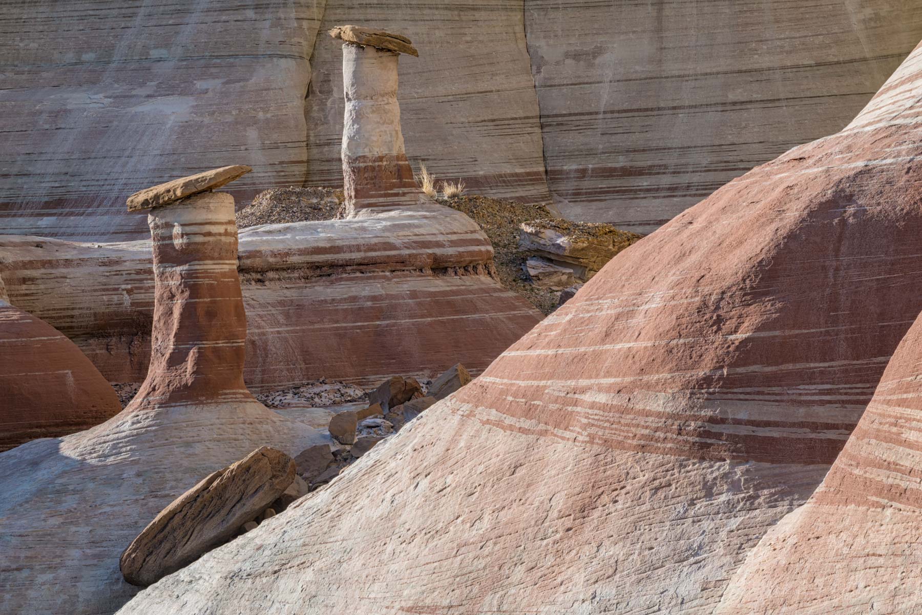
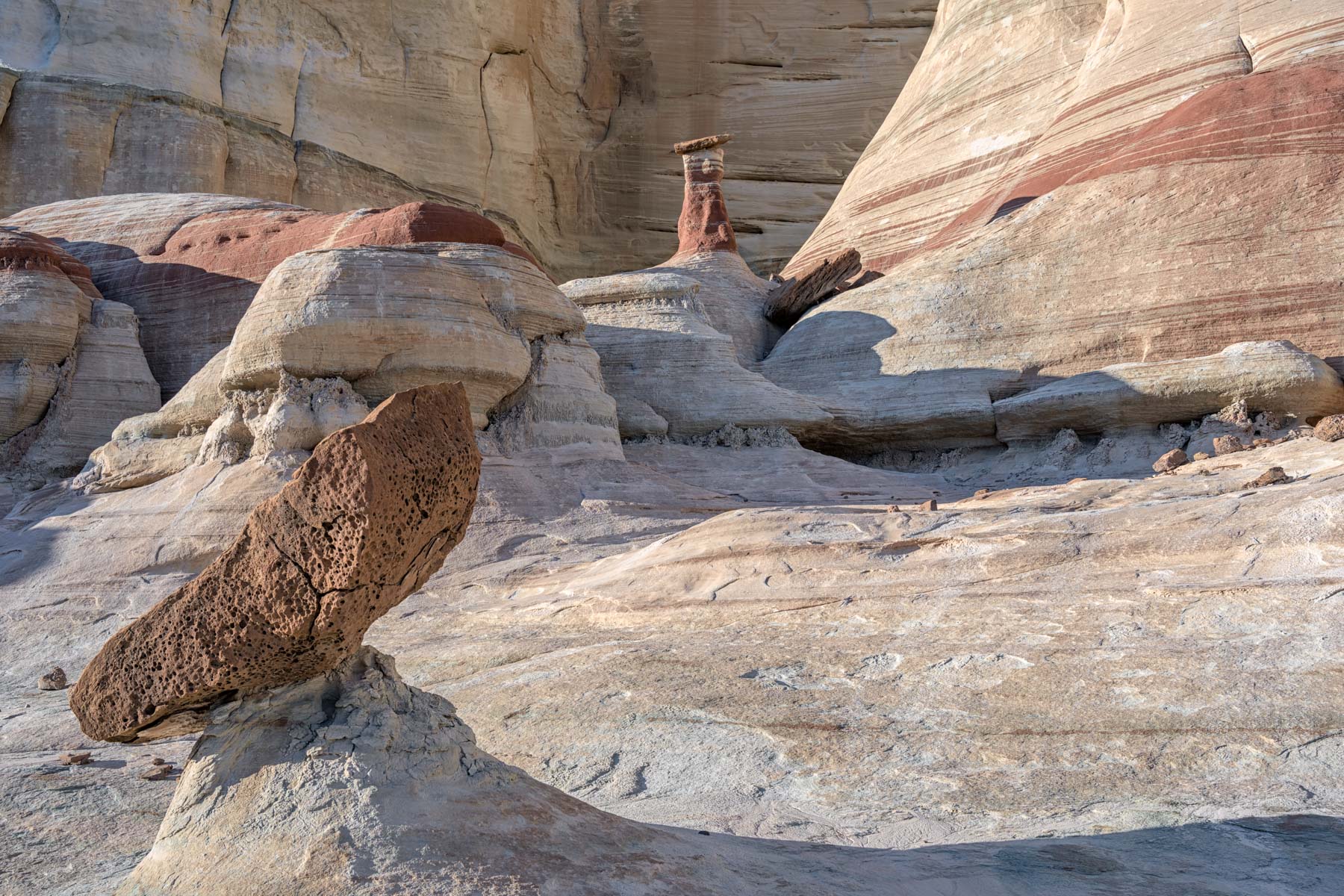
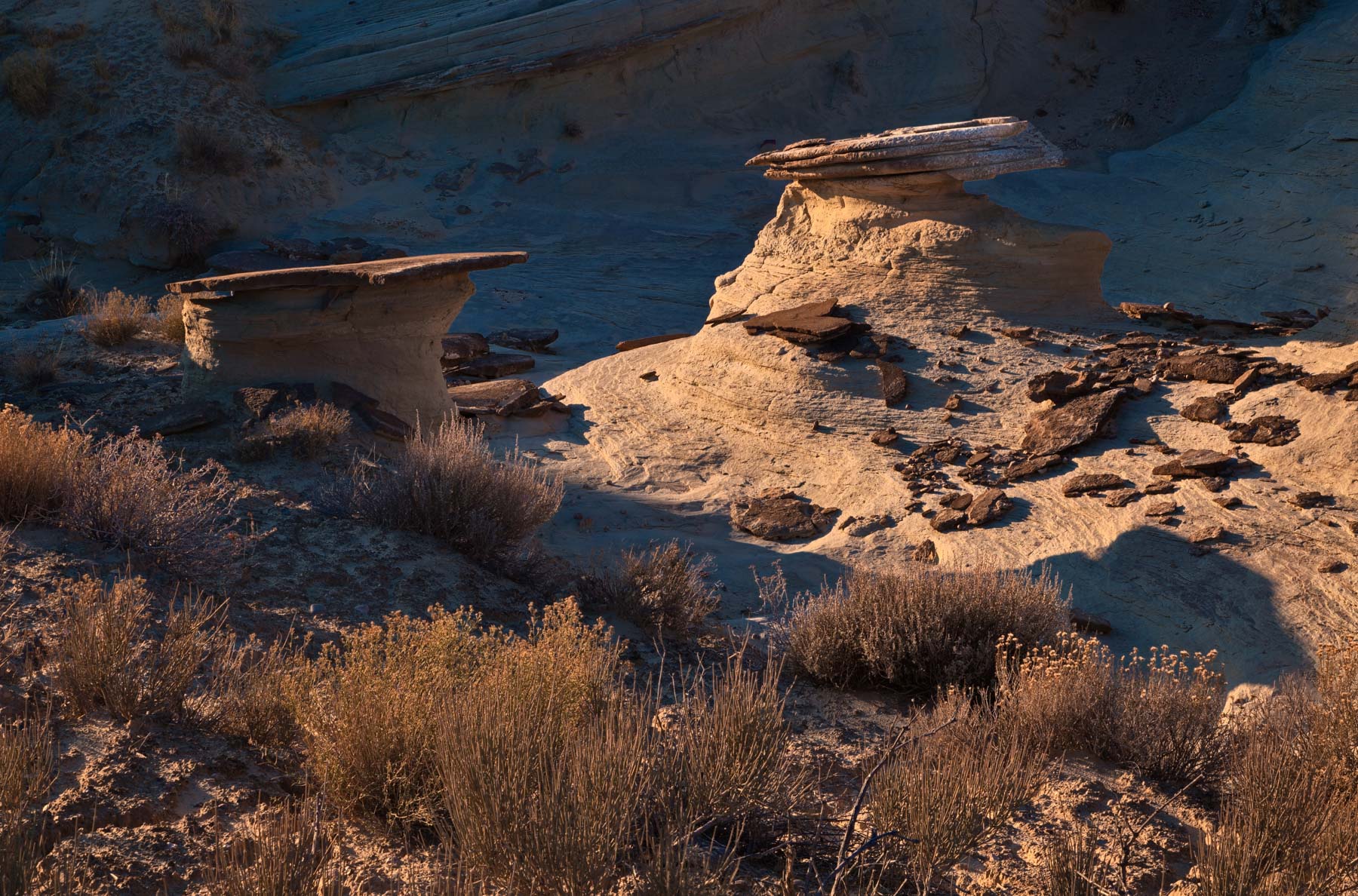
Both Colorful Canyon and the Twisted Hoodoo area open to the West / SW and get excellent light at sunset. The best photographs of Colorful Canyon should be right at sunset. Twisted Hoodoo itself goes into shadow an hour or so before sunset . Twisted Hoodoo's best sides are the south and east sides so sunrise works best. There are cliffs to the east of Twisted Hoodoo so you need not be there right at sunrise. Most of the photos in the gallery were taken about an hour or so after sunrise. With the closure of BLM 431 it is difficult to photograph the Upper White Rocks at sunrise/sunset if you are not comfortable hiking in low light.
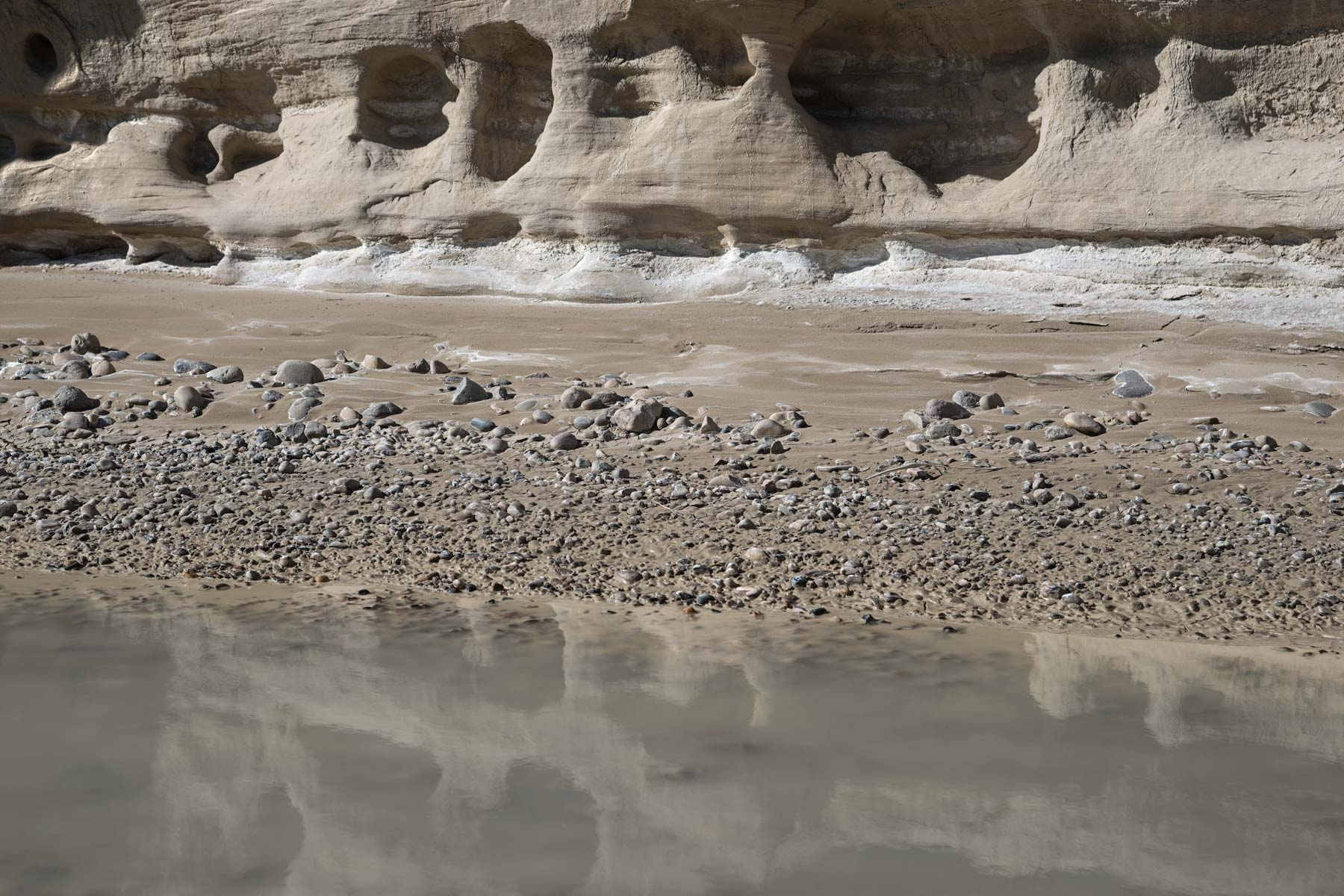
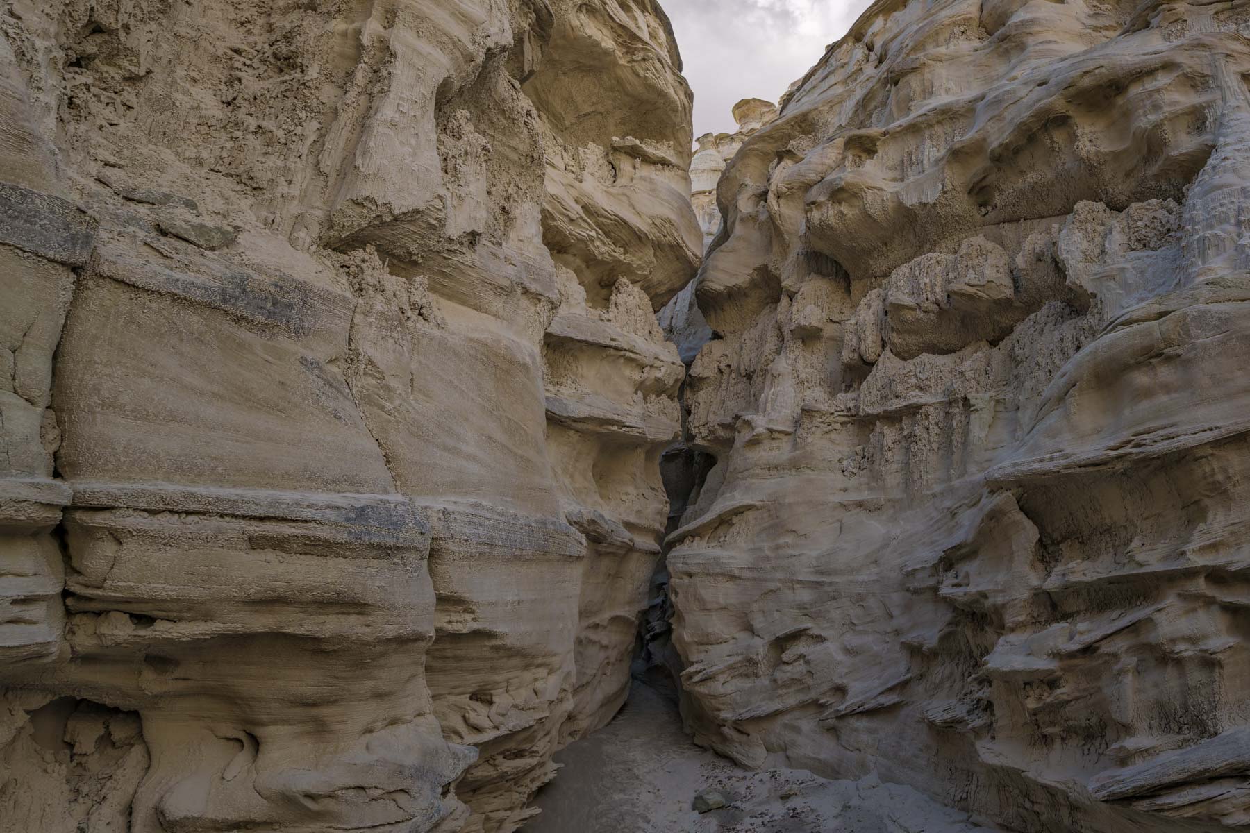
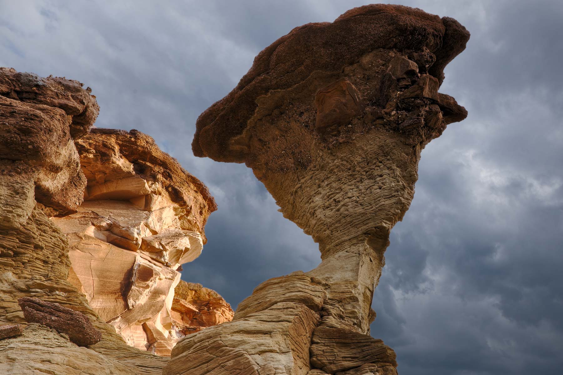
Upper Sidestep canyon opens to the east and should get its best light at sunrise. Lower Sidestep Canyon probably gets its best light late afternoon before the sun goes behind the cliffs to the west, however it is very convoluted so other times of day may work just as well. If you plan to shoot Sidestep seriously you should explore it the previous day. The best part of Lower Sidestep Canyon is a very narrow slot. You will need to remove your pack to get through some sections, and there may be a little water, so be prepared to get a little wet. I had to sidestep through some of the narrow sections; perhaps that is how the canyon got its name? I only had time to visit some of the slot on my last trip, I plan to return and see how far in you can go before it becomes impassable. A wide-angle lens is needed for the slot, and a tripod. You might want to leave your pack behind before you enter the slot's narrow section.
The upper part of the West Fork of Wahweap Canyon is also very scenic. I've marked a few locations with photogenic hoodoos on the map below. Most of the hoodoos are on the east side of the canyon so sunset works best.
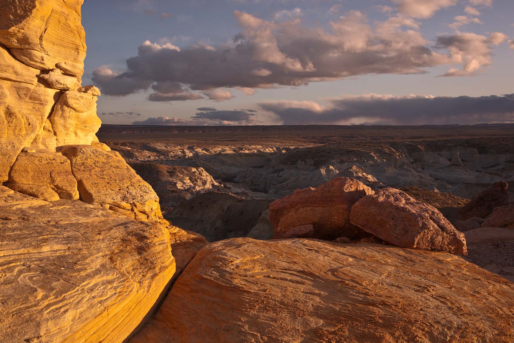
BLM 431 also provides access to the "Tower of Silence" in Wahweap Creek. The Tower of Silence is photographed best during spring and summer a bit after sunrise. Near the summer solstice an hour or so after sunrise the Tower of Silence will be side lit and the cliffs behind it will be in shadow. A few months from the solstice The Tower will be lit right at sunrise. In the winter months the Tower of Silence will not see good light.
Map of the White Rocks Area
To view the map in Google Maps please click anywhere on the map above.
USGS 24K Topo Maps
Four topo maps cover the entire area of interest as well as the access roads. The Big Water and Bridger Point maps cover the roads leading into the area, and Nipple Butte and Lower Coyote Springs cover the areas of photographic interest. Sidestep Canyon, Wahweap Creek and the Tower of Silence are on the Nipple Butte topo map. Most of the Upper White Rocks area is on the Lower Coyote Springs map. The maps can be downloaded in a variety of formats by clicking or right-clicking below:
| Geo Tiff/Avenza | KMZ | Oruxmaps | KMZ Decollared | Oruxmap Decollared | Avenza Decollared |
| Big Water | KMZ | Oruxmap | KMZ Decollared | Oruxmap Decollared | Avenza Decollared |
| Bridger Point | KMZ | Oruxmap | KMZ Decollared | Oruxmap Decollared | Avenza Decollared |
| Lower Coyote Spring | KMZ | Oruxmap | KMZ Decollared | Oruxmap Decollared | Avenza Decollared |
| Nipple Butte | KMZ | Oruxmap | KMZ Decollared | Oruxmap Decollared | Avenza Decollared |
| Merge of all four maps | NA | NA | KMZ Decollared | Oruxmap Decollared | Avenza Decollared |