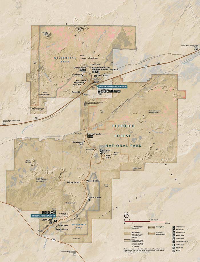
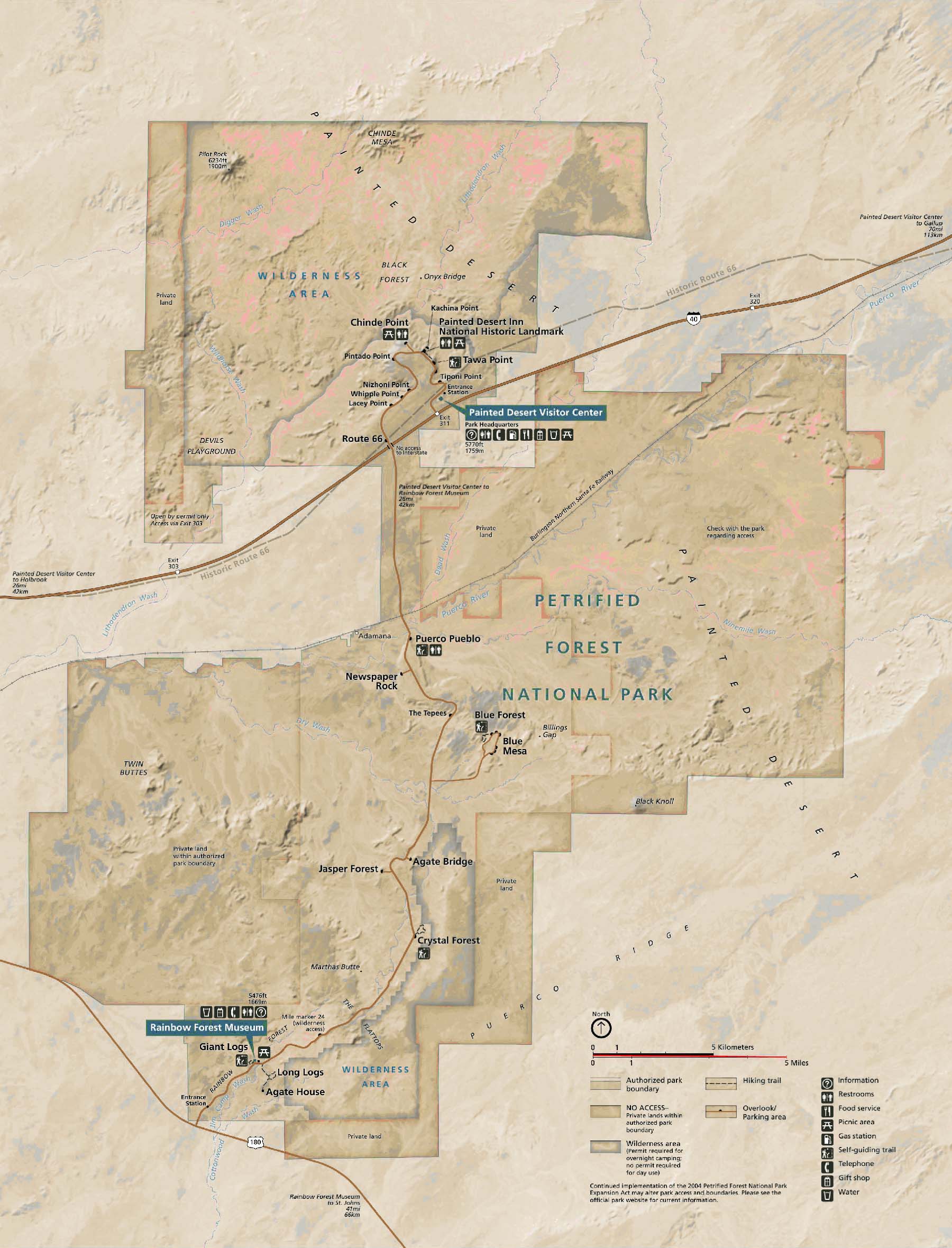
Petrified Forest National Park and surrounding area
Official Park Map
Below is the official Petrified Forest National Park map as a jpeg and in three geocoded formats, as a GeoTiff, as a KMZ file, and in Oruxmaps format. The official park map as a Geo PDF can be found here. The jpeg image below displays in low resolution, however if you download it you will get a full resolution 300dpi image. To download the full resolution jpeg right click on the image and choose Save Image As.