Dance Hall Rock and surrounding area
Dance Hall Rock is an underrated destination in the Grand Staircase Escalante National Monument. Seen from the parking area it is unimposing, but if you take the time to explore the top of the rock you will find many good places to shoot. Dance Hall Rock has many deep potholes, some of which contain cottonwood trees, and all contain water after a rain. They are quite deep and retain their water for some time after rainfall. The well known landscape photographer Guy Tal has produced many excellent images of Dance Hall Rock.
There are three nearby arches that are worth photographing - Sunset Arch, Moonrise Arch, and Broken Bow Arch.
Photography Tips
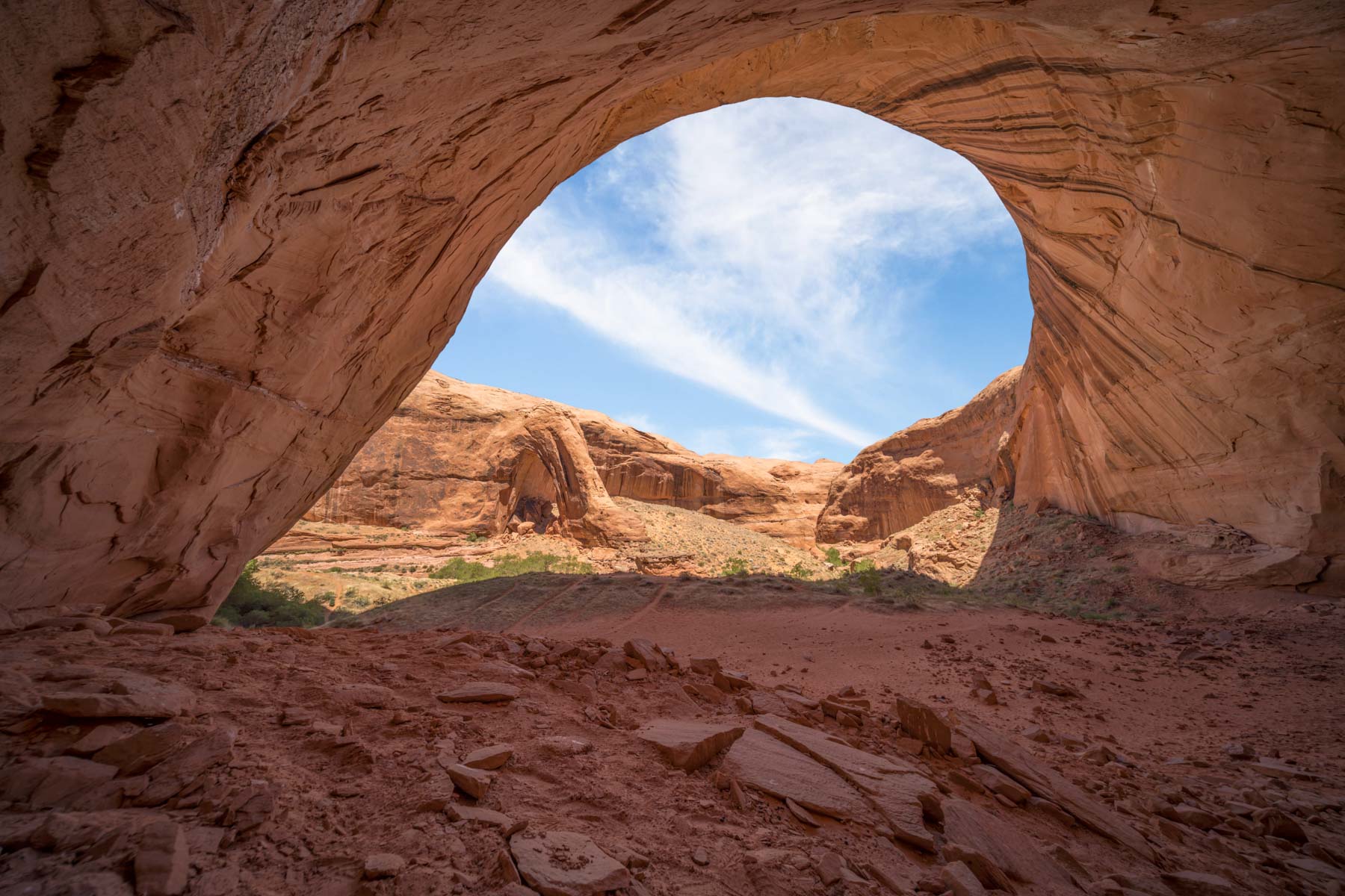
Moonrise Arch

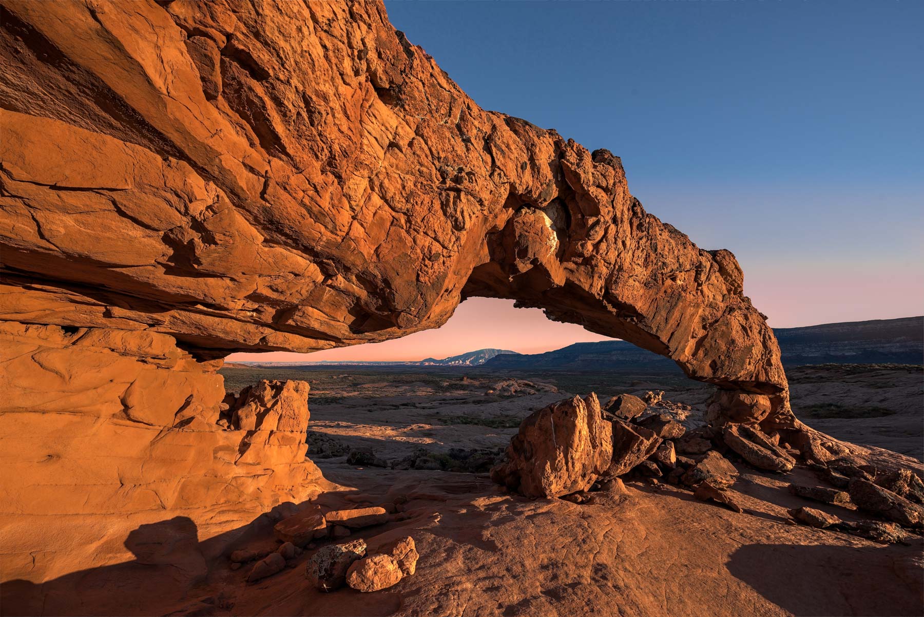
Sunset Arch at Sunset
Dance Hall Rock is brownish in color and contains many fine edges which can be used as leading lines. A warming and/or red enhancing filter (glass or digital) will greatly improve the color of the rock. Use potholes and trees as centers of interest and the fine edges to draw you into them. Try to capture the trees well lit with the background rock in shadow, or show the cottonwoods immersed in water. The shadows made by the rim of the potholes add interest, as do shadows of the cottonwood trees and bushes.
Sunset and Moonrise arches are just a few miles away and are best at sunset. Sunset arch is best shot from its NW corner with an ultrawide angle lens (14-20 mm) framing Navajo Mountain. It can also be shot from its NE corner to capture a sunburst. Use an aperture of f/22. Other apertures work but the sunburst will not be as large. When shooting from the NE you will also capture a nice glow under the arch. The glow can easily be enhanced in the digital darkroom. Sunset arch is good foreground for the Milky Way, especially in April and May when the Milky Way presents itself as an arc.
Moonrise arch is best shot near sunset when the moon is nearly full and the sun is still above the horizon. This occurs one to two days before the full moon. Shoot the full moon through the arch using a normal focal length lens, or shoot the full moon above the arch with a normal to short telephoto. It may be possible to shoot the moon above the arch with a long telephoto from the hillside to the arches west. This needs verification.

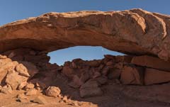
Broken Bow Arch from Alcove
Broken Bow Arch presents lots of possibilities. The most obvious is from the bench across from it on the other side of Willow Creek. On this bench there is also is a large alcove that you can use to frame the arch, a panorama head or very wide lens will be needed. You should be able to shoot reflections of the arch in Willow Creek, a possibility is shown the map below. It is not possible to access the arch from its approach side, but you can make your way up the back side. Early morning works best when shooting from the back. The hike to Broken Bow is quite spectacular in its own right, especially in late October when the cottonwoods are changing.
When to go
April through late October are optimal as the cottonwood trees will have leaves on them. I prefer October for the fall color present throughout the monument and in Capitol Reef NP. The cottonwoods start losing their leaves in mid October. In 2013 I visited Dance Hall Rock the last week of October, fall color was a bit past peak. In 2014 I visited on October 3rd, the Cottonwoods were still largely green. Visiting after a rainfall is ideal as the smaller potholes will be full of water. Dance Hall Rock is also a good summer destination as the hiking is short and you will be close to your car, water in the potholes is likely, and dramatic weather is possible. Temperatures will be high, especially with the reflected heat from the rocks, so carry plenty of water.
The potholes on the top of Dance Hall Rock are best shot a few hours after sunrise or before sunset. The Straight Cliffs lie to the west of Dance Hall Rock and will block off light at sunset. The impact of the cliffs is minimized when the sun is furthest north, i.e. near the summer solstice. At sunrise the light is partially blocked by Dance Hall Rock itself, as the rock slopes generally downward from east to west.
I recommend spending most of a day exploring Dance Hall Rock. It takes time to have a look at the many potholes present. You'll also need to wait for sunlight to illuminate the trees, or to cast just the right shadows on the rocks. It's a long drive back to Escalante so I suggest you car or tent camp after shooting. Camping is forbidden at Dance Hall Rock itself, but you can camp near the Sooner rocks which are four miles further south off Hole in the Rock road. You need a free permit available at the GSENM Visitor Center in Escalante to camp at the Sooner Rocks. The Sooner Rocks themselves are a good destination, the area is similar to Dance Hall Rock and also has deep potholes. In Google Earth it appears some of the potholes have trees in them.
A good itinerary for a visit would be to photograph nearby Sunset Arch in the evening, camp at the Sooner Rocks, and explore Dance Hall Rock the next day. Alternatively photograph Dance Hall Rock early to mid afternoon and then go to Sunset Arch for sunset. Broken Bow Arch is also in the area and worth shooting.
Getting There
Dance Hall Rock
From the Grand Staircase Escalante NM Visitor Center in Escalante proceed east on Main Street (Highway 12) 5.8 miles to the intersection of Hole in the Rock Road and Highway 12 and turn right. Dance Hall Rock is 36.9 miles down Hole in the Rock Road on the left (east) side of the road.. Hole in the Rock Road is a mostly good wash boarded gravel road and gets occasional traffic. When the road is freshly graded the grader occasionally turns over rocks at the edges of the road which can cause flat tires, so I suggest that if you drive the road after grading you drive in the center.
After parking a short hike is need to get to the top of Dance Hall Rock. Hike northeast from the parking area and proceed up the wash about .25 miles to a ramp which provides easy access on the right. There is an even easier access a bit further up the wash. Both access points are shown on the map below with this symbol: ![]()
Free camping is available at the Sooner Rocks which are 40.9 miles down Hole in the Rock Road on the right.
Sunset Arch
Take Hole in the Rock road 36.1 miles to BLM 270 and make a left. Continue on BLM270 3.5 miles to a very small pullout on the right and park. GPS coordinates are 37.386749°, -111.060001°. From the parking area Sunset Arch is a bit over a mile away. There are no trails and the terrain is largely feature less so mark the location of your car. Start hiking SSE (heading 149) .5 miles and cross the wash. From the wash continue SE (heading 132) a bit over .5 miles to the arch.
Moonrise Arch is about 1/4 mile south (heading 162) of Sunset Arch and can be easily seen from the latter.
| Latitude | Longitude | TPE | USGS 24K Map | |
|---|---|---|---|---|
| Dance Hall Rock Parking | 37.356544° | -111.101402° | Sooner Bench | |
| Sooner Rocks Parking | 37.327778° | -111.058586° | Sooner Bench | |
| Sunset Arch | 37.375901° | -111.048497° | King Mesa | |
| Moonrise Arch | 37.372937° | -111.047348° | King Mesa, Sooner Bench |
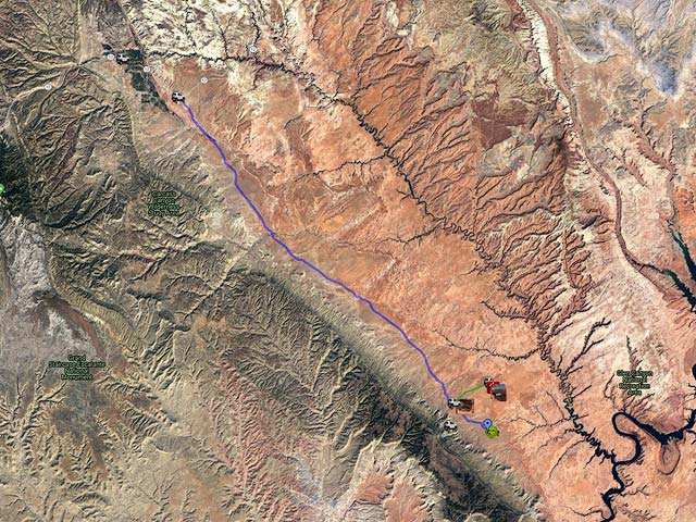
Here is an overview map showing Dance Hall Rock, the Sooner Rocks, and Sunset and Moonrise arches together with some possible shooting locations:
- Click to download a KMZ file (Note - in IE Right Click and choose Save Target as)
- Click to download a KML file (Note - KML files do not include custom icons)
- Click to download a GPX file (Note - in IE Right Click and choose Save Target as)
USGS 24K Topo Maps
The USGS Sooner Bench map covers Dance Hall Rock, the Sooner Rocks, and Moonrise Arch. The trailhead for Broken Bow Arch and Willow Gulch is also on this map. Broken Bow Arch is on the Davis Gulch topo map. The King Mesa map covers Sunset Arch and the trail to it. If you are going to Moonrise Arch you should download both the Sooner Bench and King Mesa topos. A merge of the Sooner Bench, King Mesa, Davis Gulch, and Stevens Canyon South maps is also available below. Maps can be downloaded in a variety of formats by clicking or right-clicking below:
| Geo Tiff/Avenza | KMZ | Oruxmaps | KMZ Decollared | Oruxmap Decollared | Avenza Decollared |
| Davis Gulch | KMZ | Oruxmap | KMZ Decollared | Oruxmap Decollared | Avenza Decollared |
| King Mesa | KMZ | Oruxmap | KMZ Decollared | Oruxmap Decollared | Avenza Decollared |
| Sooner Bench | KMZ | Oruxmap | KMZ Decollared | Oruxmap Decollared | Avenza Decollared |
| Stevens Canyon South | KMZ | Oruxmap | KMZ Decollared | Oruxmap Decollared | Avenza Decollared |
| Merge of all four maps | NA | NA | KMZ Decollared | Oruxmap Decollared | Avenza Decollared |