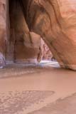
Buckskin Gulch and the Paria River Narrows
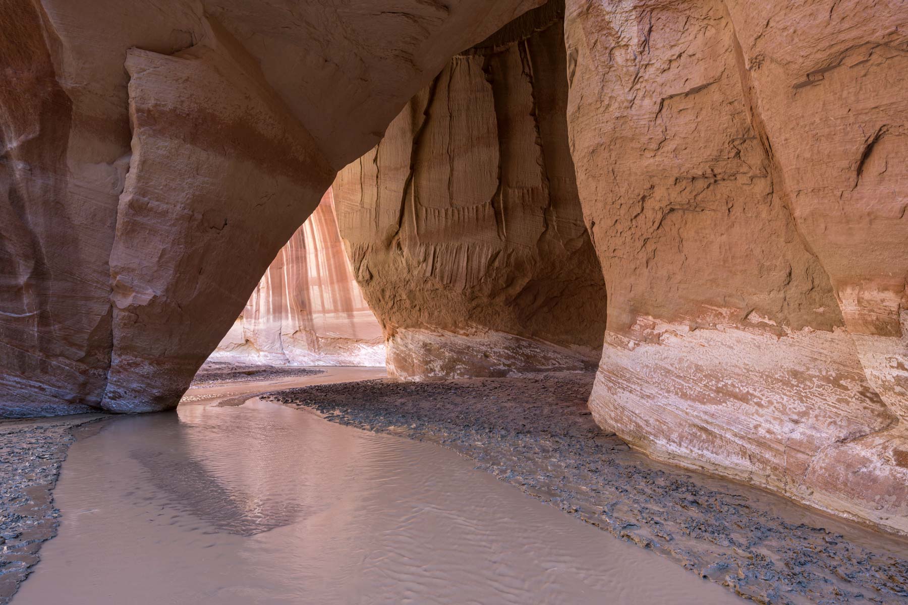
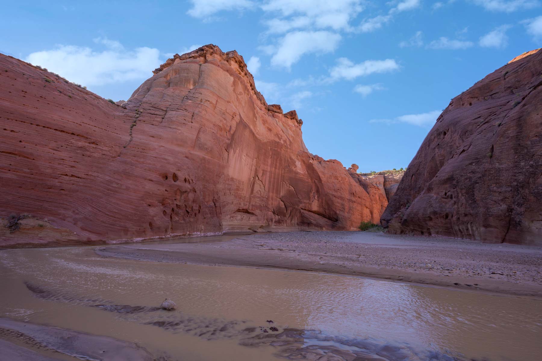
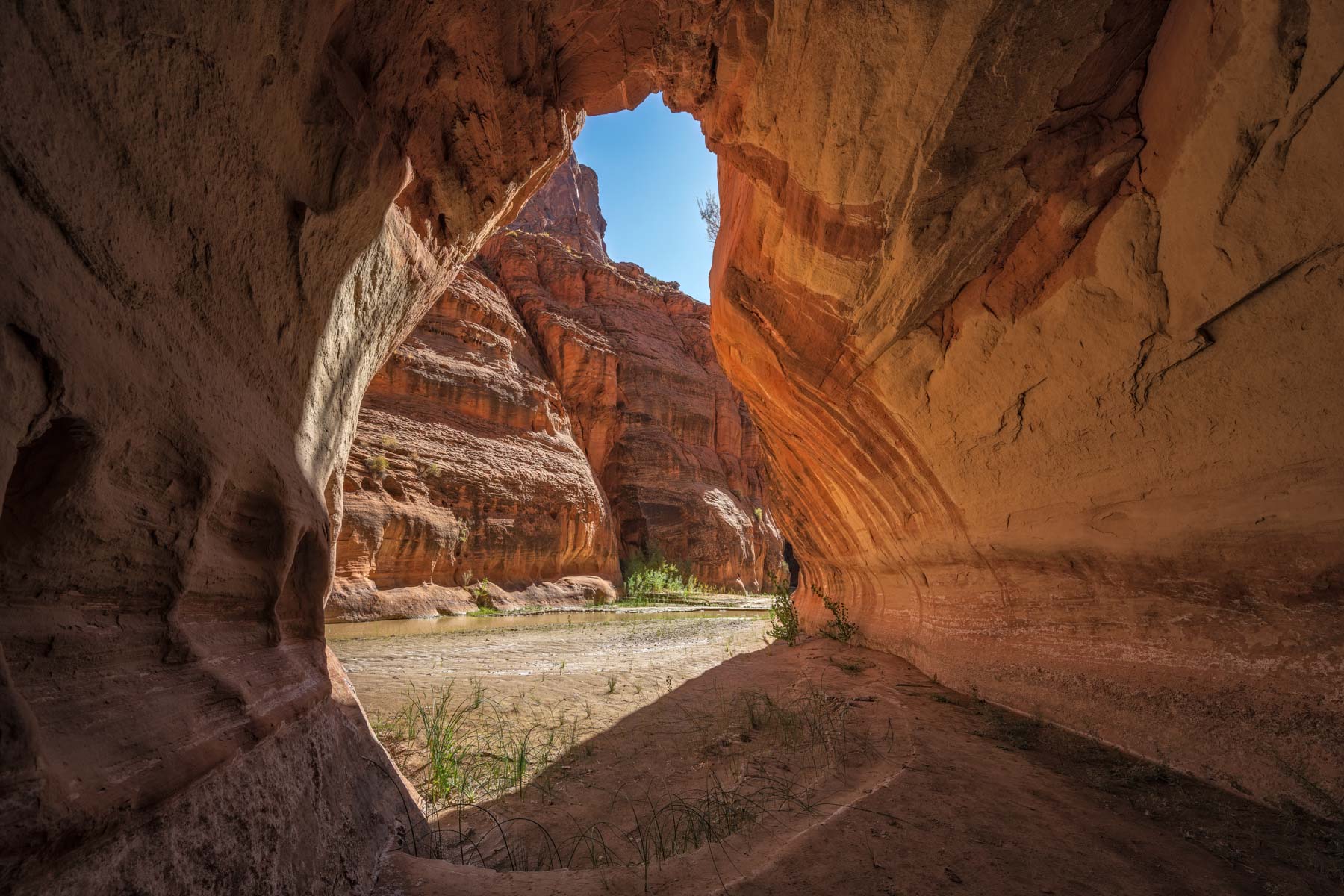
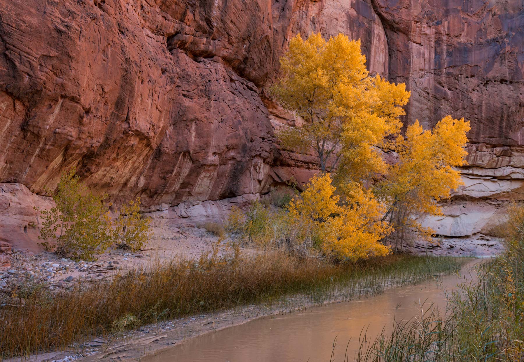
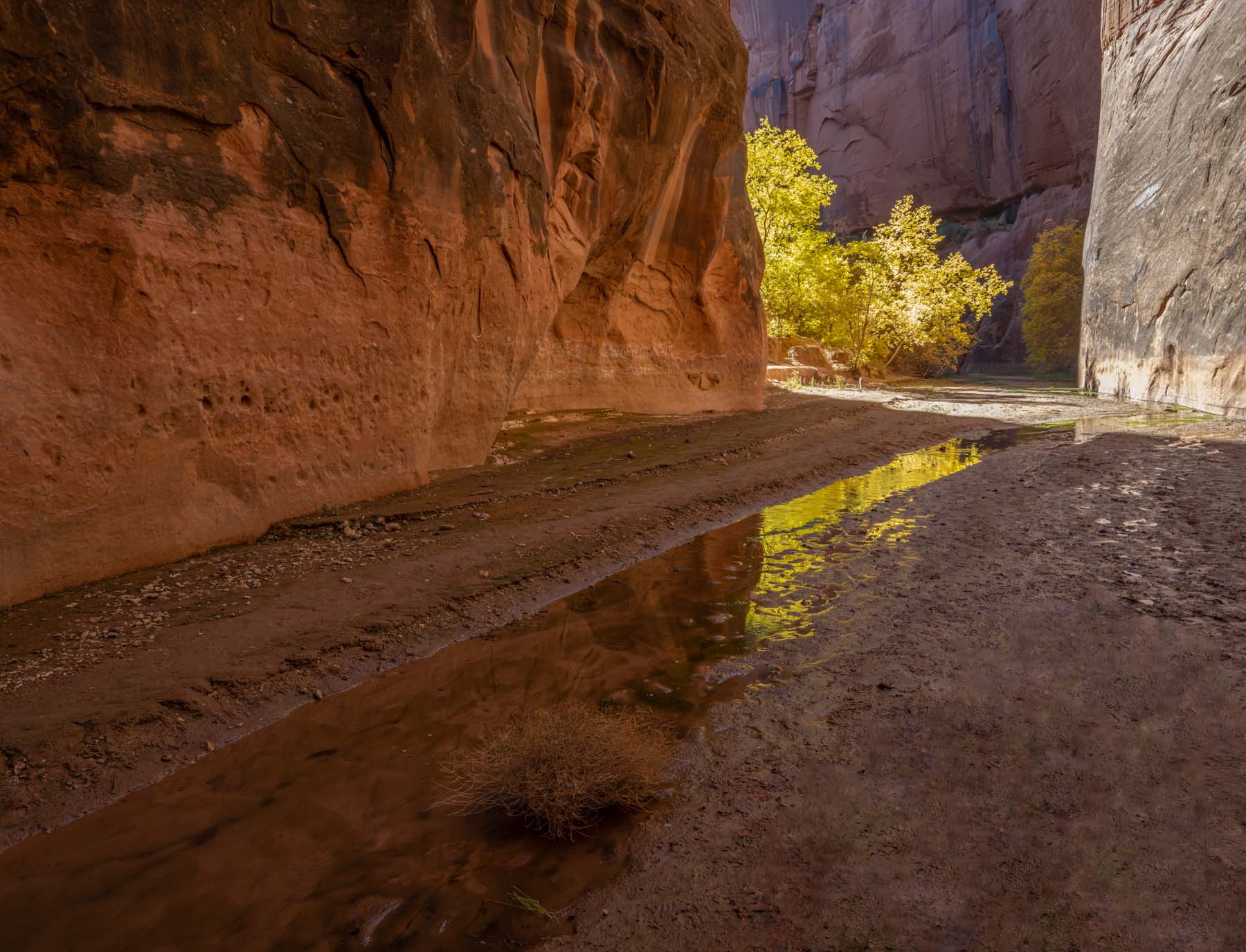
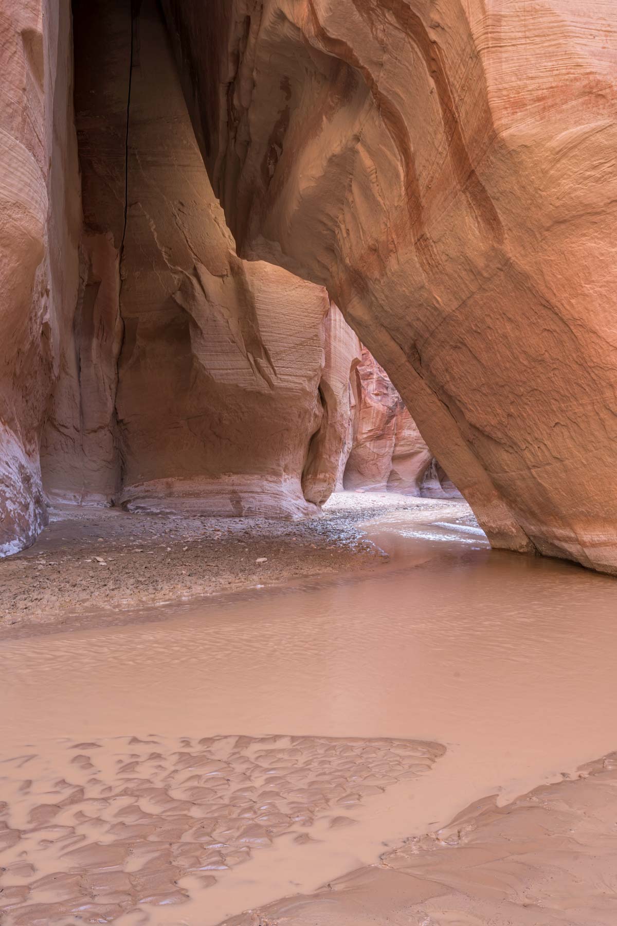
Hiking through Buckskin Gulch and along the Paria River is the ultimate southwest backpacking experience. In both Buckskin Gulch and the Paria Narrows Navajo sandstone soars hundreds of feet above the canyon floor sometimes reflected in the coffee colored river below. While Buckskin Gulch and a good part of the narrows can be seen by strong hikers in one very long day (20 miles) most people will choose to spread the trip over several days. Here are several options for visiting the area:
- Start at the Wire Pass TH, continue to Buckskin Gulch, hike down Buckskin to its confluence with the Paria, and head upstream on the Paria to the White House TH. Roughly 21 miles. A car shuttle or mountain bike will be needed to get from the White House TH to the Wire Pass TH. This trip can be done as a day hike or overnight; camp close to the confluence. Due to the risk of flash flood there are no good campsites in Buckskin Gulch until you get to the confluence with the Paria. The Buckskin Gulch part of the hike is 13 miles long which makes for a lengthy first day. There is a downclimb of 15 feet close to the confluence. Usually a rope is in place to help with the downclimb. Verify this with the BLM in Kanab before your trip and bring a knotted 30 to 50 foot rope. The Wire Pass trail has a few short drops in the 5 to 8 foot range but my understanding is that the BLM has crude ladders in place to help with these.
- Same as 1. but spend an extra day or two exploring the Paria Narrows downstream. I suggest going at least as far as the "Big Spring".
- Start at the White House TH, camp near the confluence, and do day hikes in the Paria Narrows and up Buckskin Gulch from there. Return to the White House TH. 14 miles. This is the option I took on a recent trip.
- Similar to 1. but start at the Buckskin Gulch TH instead of the Wire Pass TH. 24 miles. This adds about 2.5 miles to your hike to the Narrows. From the Buckskin Gulch TH to its confluence with Wire Pass confluence is 4.2 miles, and from the Wire Pass TH to the confluence is 1.7 miles. Buckskin Gulch does not "slot up" until 3.2 miles in whereas Wire Pass slots up after 1.3 miles. Starting at the Buckskin Gulch TH instead of Wire Pass is not recommended and few choose this option.
- Hike the Paria River from the White House TH to Lees Ferry. 38 miles. The Paria Narrows ends roughly 23 miles into the hike. After that the river deepens and widens and you will be hiking on the shore on the river rather than in the water and the photography suffers. A car shuttle from Lees Ferry to the White House TH is needed. Plan on at least 3 long days in the Paria canyon, with 4 or 5 being better if you wish to explore the lower part of Buckskin Gulch and Wrather Arch. If you start at the Buckskin Gulch TH be sure to see Slide Rock Arch just upstream form the confluence.
- Same as 5 but start at the Wire Pass TH. 44 miles. This is the best option if you wish to go all the way to Lees Ferry. 4 days minimum recommended. Optionally start at the Buckskin Gulch TH, this adds about 3 miles and makes for a very long first day.
- Buckskin Gulch can be entered / exited via the Middle Trail. The Middle Trail starts at the Cobra Arch TH. The route is shown on the map below. You'll be walking over steep slickrock with exposure, and the route down is very difficult. A good description can be found on summitpost. Unless you climb I do not recommend this route. The Middle trail can also be used as an emergency exit from Buckskin Gulch.
Logistics
A permit is required both for day and overnight trips into Wire Pass, Buckskin Gulch, and the Paria River south of the White House TH. Day use permits are available at self-pay stations at the four trailheads (Wire Pass, Buckskin Gulch, White House, and Lees Ferry) and are $6 per person. Overnight permits must be purchased on the web prior to your hike. Only 20 people are allowed in per day for all four trailheads combined. When you make your reservation you must specify the number of days you will be in the canyon. Fees are a $9 reservation fee, and a fee of $5 per person per day. Permits can be obtained at hhttps://www.recreation.gov/permits/74984.
Paria River backpacking permits can be hard to get in the better months of March through mid-June and mid-September through November. Reservations are accepted at 12:00 noon (MDT) on the 1st of each month for a permit during the third month ahead. For example for a November permit apply starting on August 1st at noon. You cannot hold more than one permit per permit area at the same time.
Permits must be picked up in person within ten days of the start of your trip in either St. George or the BLM Kanab Visitor Center. When you pick up your permit you will receive a WAG (Waste Alleviation and Gelling) bag for human waste disposal and information about hiking in the Paria Canyon area. Only one WAG bag is normally issued by the BLM. You may want to bring an extra one for a multi-day trip.
There is a campground at the White House trailhead. The campground is open year-round. The fee is $5 per night. A redesign and expansion of the campground was completed in 2019. The campground now has seven drive-up and five walk-in campsites. All campsites are for individual groups. The campground does not offer group sites. Amenities include two vault toilets, fire rings and grills, picnic tables, tent pads, and a sand/gravel access road. Drinking water and trash disposal are available at the Paria Contact Station at the northern end of the campground access road. The campground is not suited for vehicles or trailers longer than 25 feet.
Do not backpack in Buckskin Gulch when there is a forecast or threat of rain. Rain and thunderstorms in the area are not uncommon from late June to mid-September so if you plan to use the Wirepass or Buckskin Gulch trailheads do so outside of this period. Buckskin Gulch is listed by Backpacker magazine as one of the ten most dangerous hikes in America. Buckskin Gulch drains a very large area within Utah and it can be clear in Kanab while pouring in the Buckskin Gulch drainage elsewhere. There are no campsites available within Buckskin Gulch until you are close to the confluence, 13 miles away. Do not camp elsewhere in Buckskin Gulch. For a story of some who did, and were lucky enough to survive, see https://www.sunews.net/article.cfm?articleID=2215.
Due to cold temperatures and ice few people choose to hike the Paria in the winter. By late December overnight lows are typically in the teens and daytime highs in the mid forties. By mid March temperatures are near freezing at night and daytime highs near 60. Climb-Utah has a great story of two strong hikers who quickly got into trouble hiking Buckskin Gulch and the Paria in the winter. They had the skills to survive in circumstances where most would have died.
From mid-May through September high temperatures near Lees Ferry are 90 or above. The last thirteen miles of the hike to Lees Ferry are dry and there is little shade so be sure to fill up at the last spring near mile 25 before continuing on. A gallon of water or more will be needed for this section in hot weather.
Horse flies and biting gnats / no-see-ums are common from late May through mid-July. I recommend long pants and long sleeve shirts if hiking then.
Buckskin Gulch often has some chest deep pools of water, you may need a dry bag for your camera gear. Ask about conditions at the Kanab visitor center before starting your hike.
Buckskin Gulch normally flows only near its end just before the confluence. Start your hike with all the water you'll need to reach the confluence. If the water is clear near the confluence you may be able to fill up there. The water must be filtered. I use the Sawyer products Squeeze filter system. A 3/4 inch pipe screen filter fits perfectly on one end and can be used as a prefilter to remove most silt. Or use a coffee filter. Letting water sit overnight will also remove most silt.
The Paria River below the confluence flows all year. The section between the White House trailhead and the confluence is often dry in late Spring and early summer. If you see water at the bridge passing over the Paria on Highway 89 you should expect water through to the confluence. The Paria contact station or the BLM visitor center in Kanab should have current information on water flow. Conditions can change quickly however. On a recent trip we were told to expect only occassional clear pools of water up to the confluence. The reality was heavily silted ankle deep water all the way to the confluence, and lots of mud. Unless you want to prefilter and filter water from the Paria I suggest carrying enough water to get you to Big Spring about 12 miles from the White House TH. This spring always flows.
You should bring good water shoes for the hike as you will be crossing the Paria River many times. Closed toe shoes work best to keep mud and silt out. Neoprene or water socks will keep your feet largely dry and warm. I used the well regarded Adidas Terrex A.ARDY Voyager shoes and Bridgedale StormSock three layer socks; the combination kept my feet warm and dry. Shoes should be purchased a size or so larger than usual so there is room for thicker than normal socks.
Photography
The Paria Narrows and Buckskin Gulch are dark so bring a tripod or be prepared to shoot at high ISOs. I used my tripod as a walking stick. Leave the bottom section of the tripod legs partly open at all times to keep mud out of the joints. After a good cleaning when I got home my tripod was no worse for wear. I also carried a trekking pole to help with balance in the muddy conditions and to check water depth and mud solidity.
I suggest bringing both wide angle and normal zoom lenses. If you only bring one lens a 24-70 or 24-105 should work well. A polarizer and a three or six stop ND will help remove reflections from wet rocks and will smooth out ripples in the water. My favorite shots of the river were shot with exposures in the one second range.
The light in Buckskin Gulch and the Paria Narrows is best late morning to early afternoon, as it is in most slot canyons.
The Paria Windows
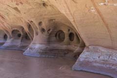
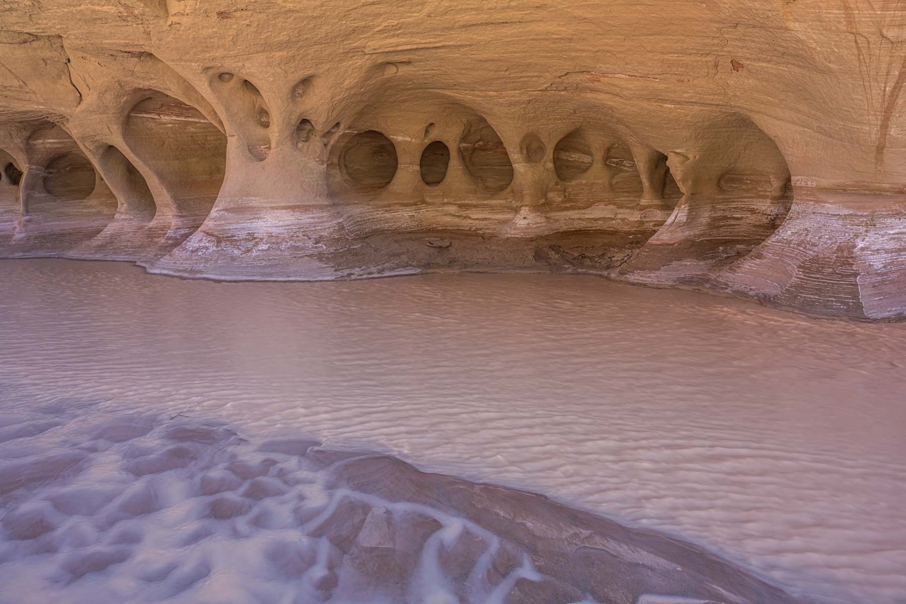
The term Paria Windows refers to the tafoni along the shore of the Paria River. Tafoni is also called honeycomb weathering and consists of small smooth edged round cavity features on granular rock. There are several groupings of tafoni on the shore of the Paria River two miles downstream of the White House Trailhead. The best groupings are on the east side of the river. The Paria Windows should be photographed when entirely in shadow ideally with reflected light falling on them from the canyon wails across the river. In early May the sun starts hitting the windows by 10AM so be sure to be there well before then. Depending on river levels water may lap at the feet of the windows, or the shore may be entirely dry. If you are very lucky you may find cracked earth close to the windows. Cracked earth makes for great foreground.
To access the Windows start your hike at the White House trailhead. The trailhead is accessible to 2WD vehicles unless it has rained heavily. Take US89 to the road going to the Paria Contact Station at milepost 20.8 and turn south. After 400 feet turn left onto White House Trailhead Road and drive south two miles to the trailhead. A $6 per person day use fee for hiking is charged by the BLM, cash or check only. The two mile hike downstream follows the Paria River. This easy hike normally requires several crossings of the river. In hot weather the crossings are very refreshing. The Paria is usually only a few inches deep and the crossings are easy. You will find side trails just downstream of the White House trailhead. I recommend you do not take them unless the river flow is substantial; most lead to dead ends high on the cliffs above the Paria. There is a flow gauge where the Paria River crosses Highway 89 between Page and Kanab. When the gauge height is less than 7.6 feet there will be minimal flow, or you could read the discharge which should show at red line at the bottom when the river is dry. The Paria is often dry during late May and June. Once Monsoon season starts the Paria begins flowing again. Here is a summary by month of Paria River water flow in cubic feet per second under the bridge at Highway 89:
| Month | Paria River flow(cfs) |
| January | 23.2 |
| February | 28.7 |
| March | 31.0 |
| April | 15.6 |
| May | 9.6 |
| June | 4.9 |
| July | 9.2 |
| August | 34.8 |
| September | 25.4 |
| October | 22.4 |
| November | 15.3 |
| December | 17.2 |
| Annual | 19.8 |
Slide Rock Arch
Slide Rock Arch is also known as Slide Rock and is not a true arch. Slide Rock is a piece of rock that separated from the canyon wall creating a tunnel. The "arch" is very photogenic when seen from either side, and gets good reflected light during the hours around mid-day. An ND filter is useful to smooth out the water below it. Consider adding a person for scale.
Wrather Arch
Once considered one of the world's longest arches, it has been remeasured and has a span of 180 feet at most. 180 Feet would make it number 22 in length in the world. Wrather is the 9th longest arch in the US. The arch photographs best from its level so hike up the hillside into a large alcove. In Google Earth you can see a clear trail leading to the arch. An ultrawide will be useful and you may want to include a person for scale. It is possible to hike under the arch and shoot from there. Note that camping is not allowed in Wrather Canyon. There is goods camping left (east) of the mouth of Wrather Canyon.
Google Map of Buckskin Gulch and the Paria River Narrows
Here is an Google overview map showing some of the campsites, water sources, and access routes along the Paria River and Buckskin Gulch.
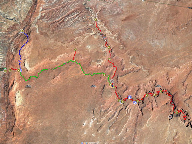
To view the map in Google Maps please click anywhere on the map above.
- Click to download a KMZ file (Note - in IE Right Click and choose Save Target as).
- Click to download a KML file (Note - KML Files do not include custom icons).
- Click to download a GPX file (Note - in IE Right Click and choose Save Target as).
Caltopo Map showing various Points of Interest
In addition to the Google Map of the Paria Narrows I have added a Caltopo Map that can be accessed by clicking on the next icon. ![]() Caltopo maps have several advantages over Google maps and a few disadvantages. For most purposes Google Maps are more than adequate, but if you plan to do off-trail hiking Caltopo maps are preferable.
Caltopo maps have several advantages over Google maps and a few disadvantages. For most purposes Google Maps are more than adequate, but if you plan to do off-trail hiking Caltopo maps are preferable.
Caltopo Advantages
- Unlimited Folders, Google Maps are limited to ten
- Multiple map layers can be shown at once, for example you can display a satellite image overlaid with a topographic map
- Multiple line types such as solid, dashed, or dotted. This makes it easy to distinguish between road and hiking trails and between paved roads and dirt roads
- Many more layer types
- Land ownership (BLM/BOR, NPS, USFS, Local, State, FWS, private) is shown
- Parcel data (name of person owing land) is available on some annual plans
- 10 Foot contour intervals
- Slope angle shading - anything over 30° makes most people uncomfortable
- Ability to print up to 48 inches by 48 inches and to export maps
- Latitude and longitude are displayed as is elevation
- Elevation profiles are available for routes and trails
Disadvantages
- Caltopo can display Google satellite maps but cannot export or print them. Caltopo's built in aerial maps are not as detailed as Google satellite maps
- Photos cannot be attached to points of interest
- The items in a Caltopo folder are sorted alphabetically, custom order is not supported
- Some features of Caltopo are only available in paid plans
USGS 24K Topo Maps
Six maps cover Wire Pass, Buckskin Gulch, and the Paria River between the White House TH and Wrather Arch. Wire Pass is covered by the Pine Hollow Canyon map; Buckskin Gulch by the West Clark Bench map; and the Paria River by the West Clark Bench, Bridger Point, and Wrather Arch maps. If you are going to hike in the area I suggest you download these maps and the waypoints above or have other maps available on your phone or GPS. While its hard to get lost in a narrow canyon you will need to find campsites and springs. While the mileages provided by the BLM and other sources are accurate, the mileages reported by your GPS may be inaccurate in Buckskin Gulch and the Paria Narrows. GPS reported mileages will probably be overstated due to random swings in position and should not be relied upon to find springs and campsites.
| 24K Map (GeoTiff/Avenza) | KMZ | Oruxmaps | KMZ Decollared | Oruxmap Decollared | Avenza Decollared |
| Bridger Point | KMZ | Oruxmap | KMZ Decollared | Oruxmap Decollared | Avenza Decollared |
| Coyote Buttes | KMZ | Oruxmap | KMZ Decollared | Oruxmap Decollared | Avenza Decollared |
| Pine Hollow Canyon | KMZ | Oruxmap | KMZ Decollared | Oruxmap Decollared | Avenza Decollared |
| Poverty Flat | KMZ | Oruxmap | KMZ Decollared | Oruxmap Decollared | Avenza Decollared |
| West Clark Bench | KMZ | Oruxmap | KMZ Decollared | Oruxmap Decollared | Avenza Decollared |
| Wrather Arch | KMZ | Oruxmap | KMZ Decollared | Oruxmap Decollared | Avenza Decollared |