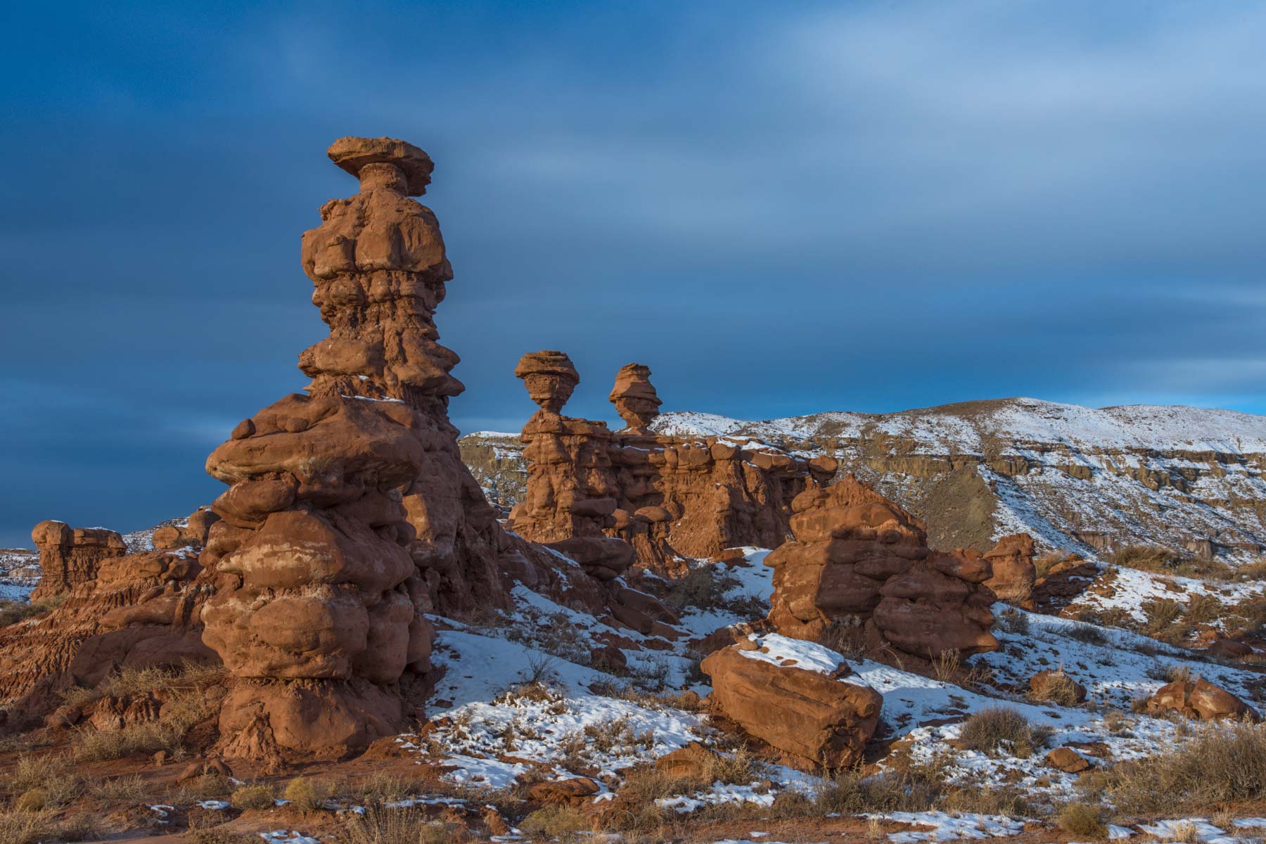
Southeast Utah
Southeast Utah includes many of the best locations for finding and photographing Ancient Puebloan rock art and ruins. There are hundreds, perhaps thousands, of petroglyphs, granaries, and ruins in the area, some of which have yet to be discovered. Landscape photo opportunities abound as well. Southeast Utah is largely managed by the BLM and there are few restrictions to travel, other than those imposed by the land, the climate and your skills.
Visitation
Based on 2018 fee collections at Cedar Mesa trailheads about 80% of the roughly 18,000 visitors to the ruins on Cedar Mesa are day hikers, and 20% backpackers. The majority of the backpackers are on trails leading into the Grand Gulch with its many ruins. The majority of the day hikers are going to well known photogenic sites such as House on Fire, Fallen Roof Ruin, Moon House, and The Citadel.
In addition to the 18,000 visitors on Cedar Mesa trails in 2018 there were about 20,000 day hikers going to the myriad ruins on Comb Ridge. Many of these visitors car camp at sites along South Butler Wash Road.
Where to stay
Car camping is common in the area and encouraged. Most of the backcountry roads have sidetracks. No fee is charged to camp at these areas on the mesa top. Camping is primitive and often requires a high clearance vehicle for access. Use established campsites. Bring your own water. Established campsites are also available along Comb Wash Road.
There is a campground at Natural Bridges National Monument with 13 sites. Sites are first come first served. Sites have a fire grill and picnic table but no water, electricity, or hookups. RVs are limited to 26 feet in length. Cost is $15 per night, $7 with a senior pass.
There is a 31 site campground at Hovenweep, first come first served. No hookups. Fees are $15 per night, $7 with a senior pass.
Lodging is available in Bluff, Blanding, and Monticello. These small town have gas stations and a few restaurants most of which are closed on Sunday. There are no restaurants in Blanding open for breakfast on Sunday mornings. All three towns are far from most of the ruins.
When to Go
Climate generally determines when you should visit Cedar Mesa. Much of Cedar Mesa is at above 6,000 feet in elevation so winters are cold and most precipitation will be in the form of snow. Snow and ice will make the roads and trails slick and dangerous and often impassable. Cold temperatures imply that when snow falls it tends to stick around. Services in the winter are cut back and the only visitor center in the area, Kane Gulch ranger station, is closed from November 1st to March 1st. Comb Ridge sites may well be accessible during the winter however.
The period from March 1 to June 15 is high season for backpackers. Even during April and May backpacking trails will not be crowded as only twenty people per day can use each trailhead. Twelve backpacking permits are awarded on-line between 5 and 90 days in advance, and eight are awarded at the Kane Gulch Ranger Station on the day of the hike, first come first served. If you are planning a backpack or hike in early March I suggest you call for conditions in advance as some roads may still be closed due to mud or snow. Late May / early June is no-see-um (biting gnats, aka midges or sand flies) season in the Southwest and should perhaps be avoided. If you do got out then wear long sleeved light-colored shirts and pants and a hat with a mesh netting. Bring insect repellent. Conversely late May and June is the driest period in the year, most days are clear, and the Milky Way stretches across the sky.
Summers on Cedar Mesa are hot, especially in the bottom of the canyons, making this a poor time for backpacking. Most springs are dry during the summer months. You may need to pack in all your drinking water. Hiking is fine provided you begin early in the day to avoid the heat. The summer is "monsoon season" in the southwest so roads may become impassable and flash floods are possible. Be sure to check the weather forecast before entering the canyons. Visitation on the shorter trails and in towns can be high, especially over the July 4 and Labor day weekends. The Kane Gulch ranger station is closed from June 15th to September 1st.
Fall is a great time to visit the area with moderate temperatures. If you are planning a backpack I suggest you do it on-line 90 days in advance so as to be sure to get the trailhead and dates you want. In late September / early October the Aspen trees found on the high elevations of Bear Ears are changing color, and during the third and fourth weeks of October the Cottonwoods along creeks and in canyons are changing.
The Kane Gulch ranger station is open from September 1 to October 31.Fees
Effective 2020 backpacking fees were raised to $15 per person per trip and day use fees to $5 per person per day. Fees are payable at the Kane Gulch Ranger station or at trailhead kiosks. A week-long day pass is $10 per person, and an annual pass is $40 per person. Provided you reserve on-line well in advance you should be able to get the dates and the trailhead you desire. The group size limit for backpacking is twelve.
The fee to enter Natural Bridges National Monument is $20 per vehicle and is good for seven days. Annual permits are available.
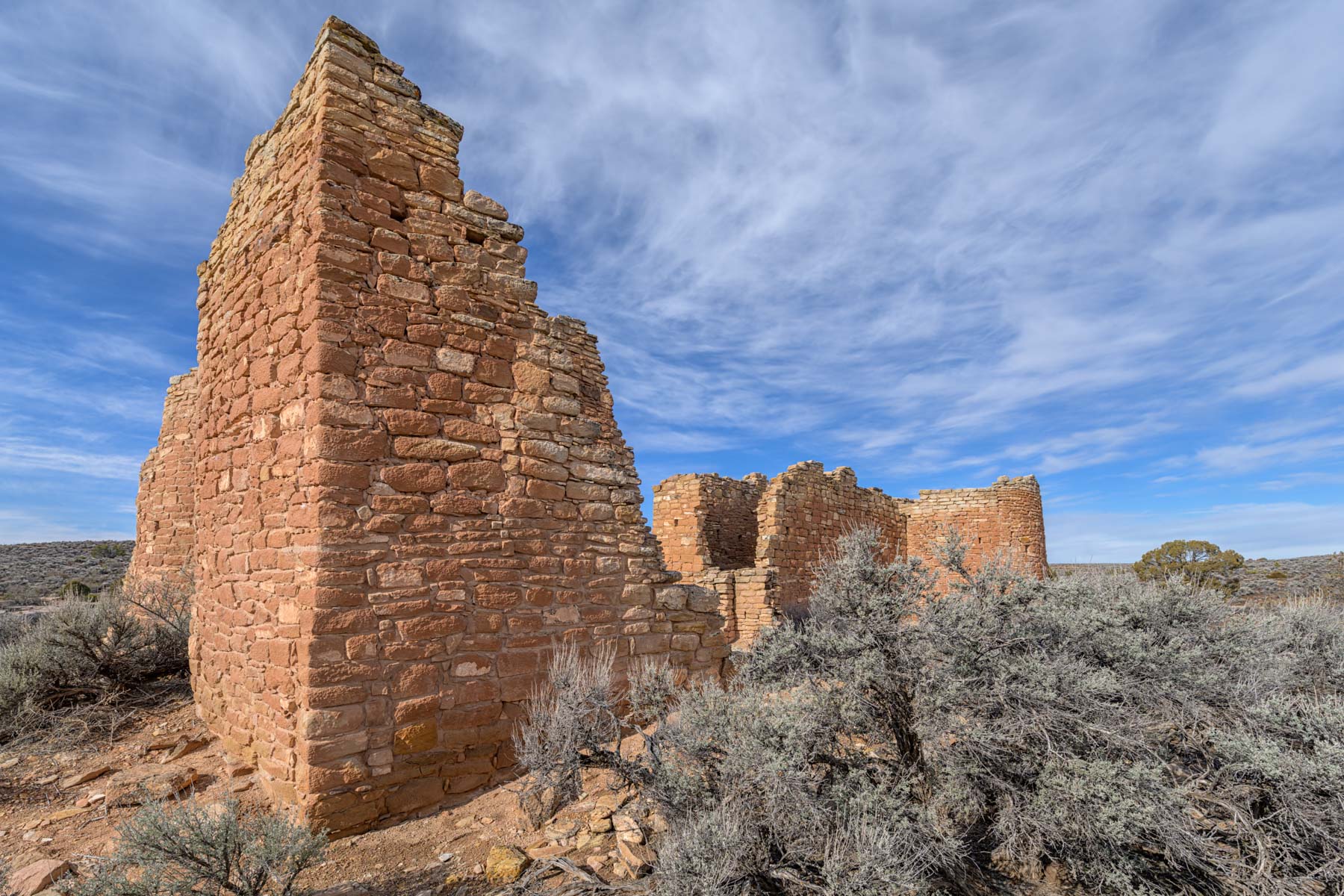
There is no entrance fee at Hovenweep National Monument.
Site Etiquette
Please respect the archaeological sites in Southeast Utah:
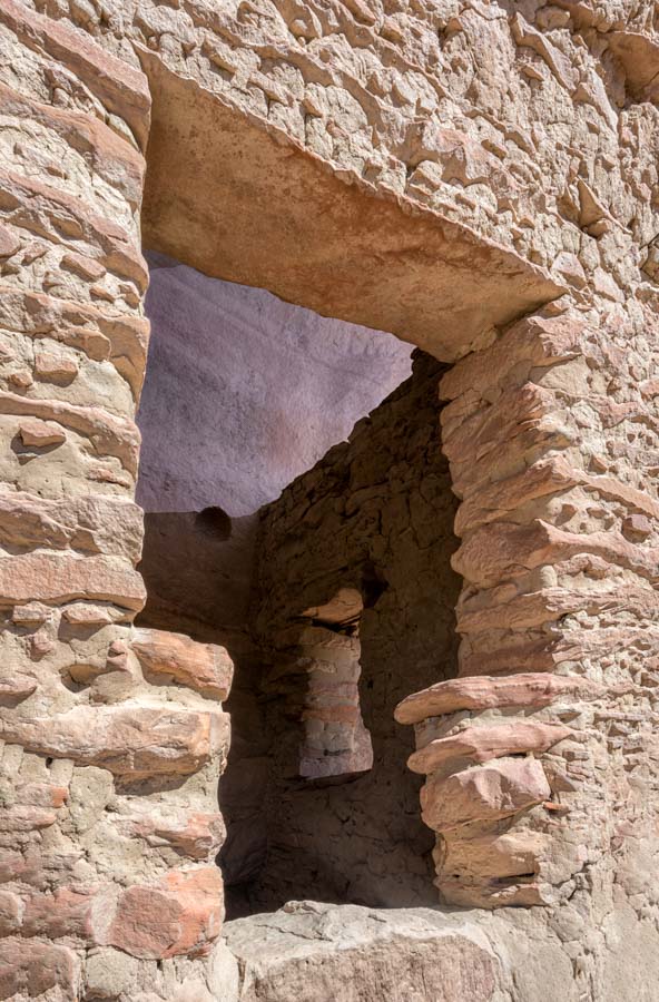
- Walls are fragile and continue to deteriorate - that is why they're called ruins. Climbing, sitting, standing on walls, or picking up and moving rocks compromises these sites. Do not lean on walls or enter rooms.
- Removing artifacts destroys the story they can tell. Excavating or removing artifacts is illegal. Penalties include substantial fees and possible imprisonment.
- Do not rearrange items such as pottery fragments.
- Do not chalk, trace, or touch rock art. Graffiti is illegal.
- Keep pets leashed and away from ruins.
- Do not litter.
- No fires, candles, smudging or smoking in sites. Camping is not allowed at archaeological sites.
- Archaeological and historical sites are protected by the Antiquities Act of 1906 and the Archaeological Resources Protection Act of 1979 (ARPA). It is illegal to damage or disturb any site or to remove anything from the site. If you discover any illegal activity please notify the Bureau of Land Management or the San Juan County Sheriffs Office.
Shooting Locations
I have provided location information for all but two of the sites below. GPS coordinates and/or directions for all but these two sites are available in books or on the web and I have ruin into other people at most of these sites during my many trips to the area. The two sites I have not provided coordinates for are Doll House ruin and Three Story ruin. Both are in northern Bear Ears. Please do not ask me to provide their locations.
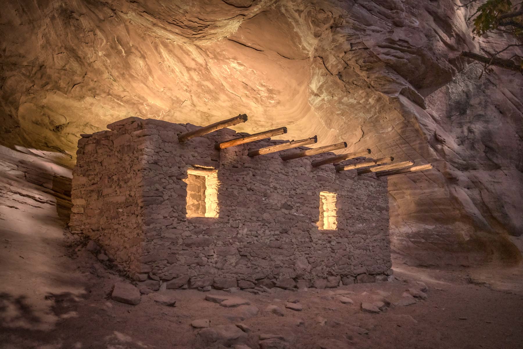
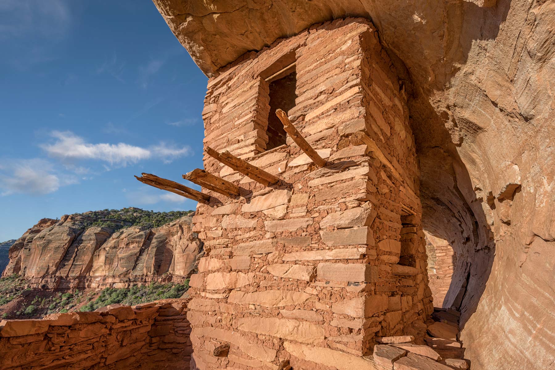
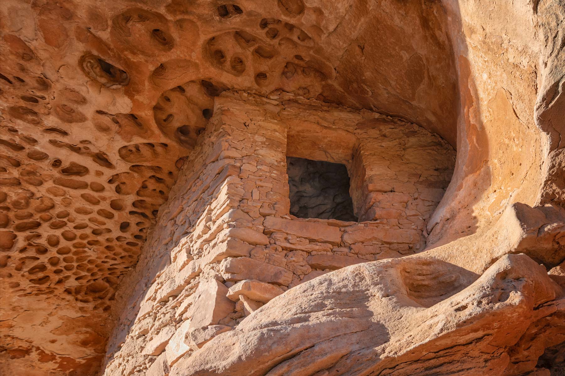
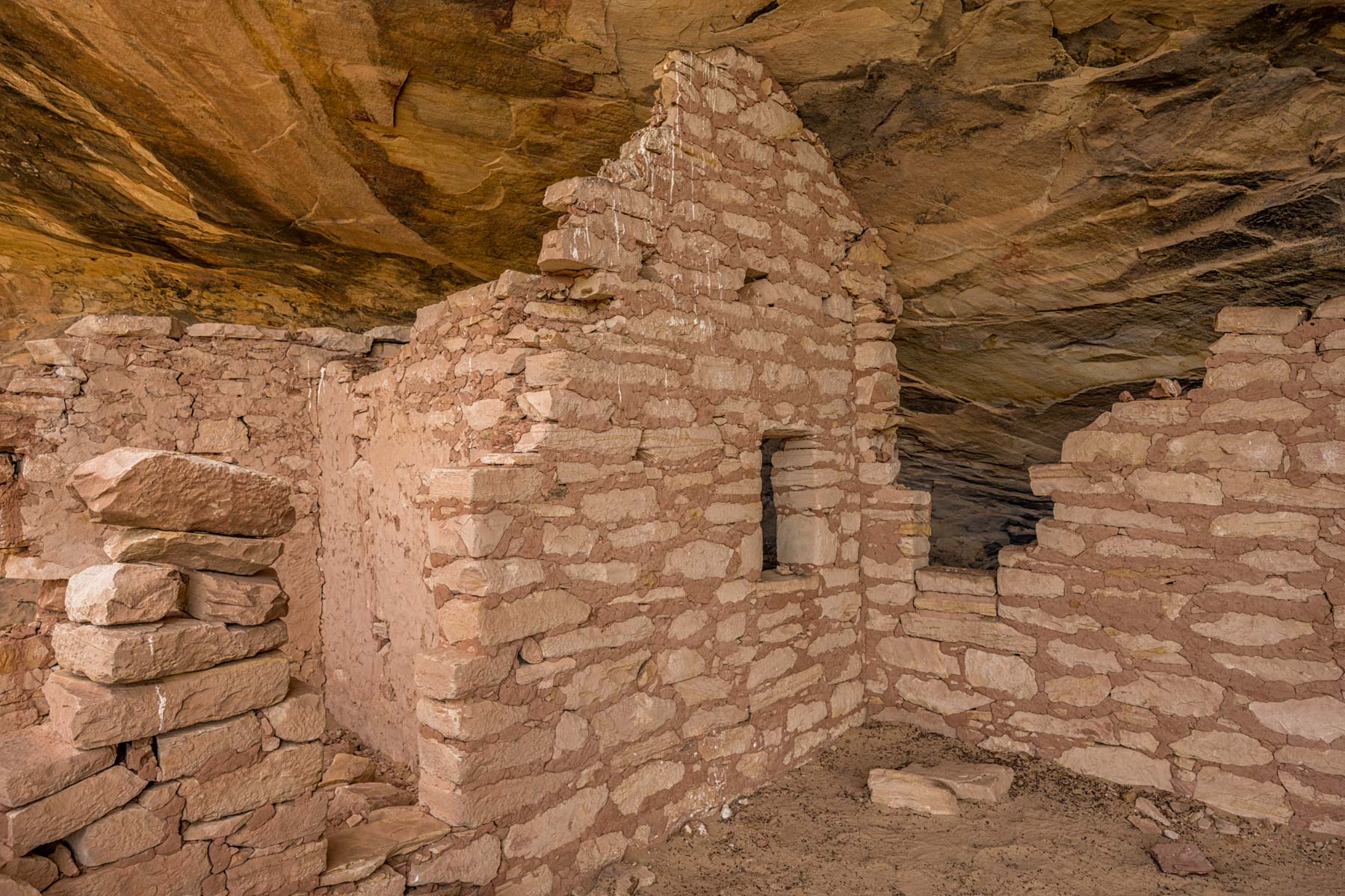
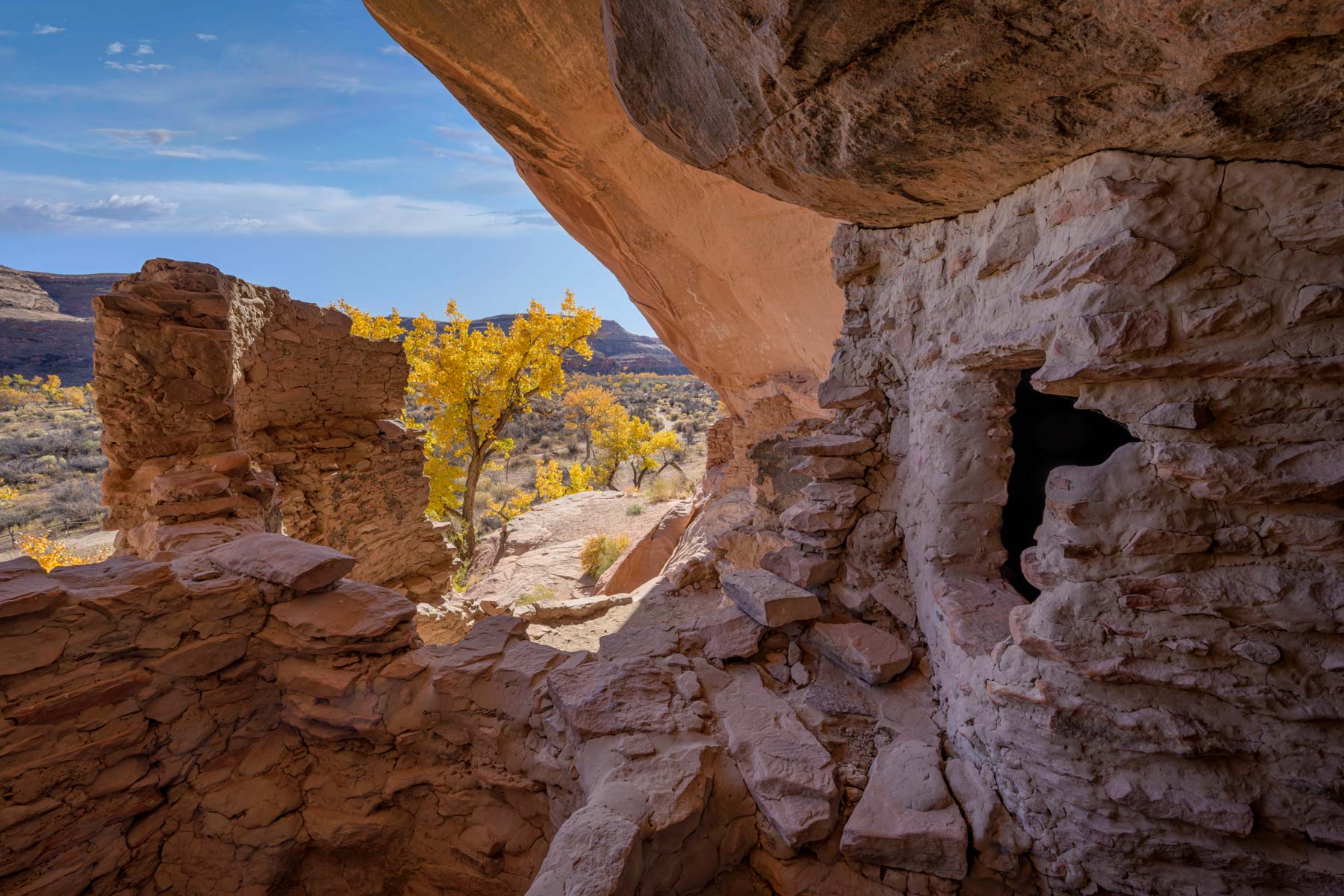
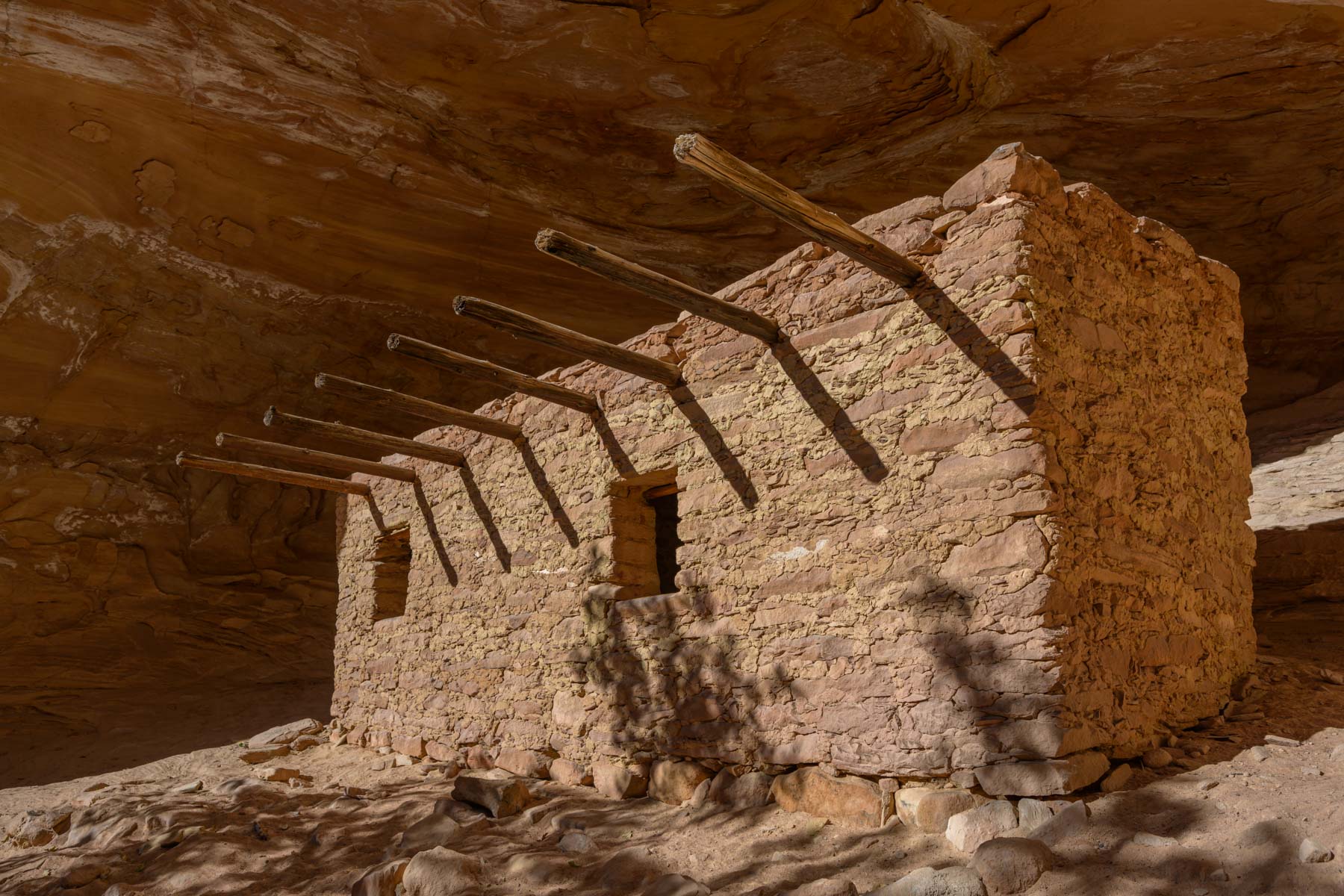
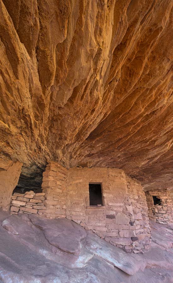
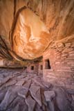
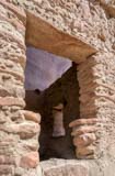
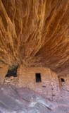
East of Highway 261Fallen Roof Ruin is a spectacular ruin located in Road Canyon. The hike to Fallen Roof Ruin is about 3 miles round trip. The hike is easy to moderate with one scramble about half way in. At about .8 miles you may encounter a pool of water in the stream bed, if so you can bypass it. Follow the cairns on the bench to the north side of the canyon. Fallen Roof Ruin is best photographed in late morning when it gets good reflected light. A panorama head or a wide angle lens will help to capture the full beauty of both the roof and the ruin. My best images were taken with a full-frame 10mm lens. Be sure to shoot the Ancestral Puebloan hand prints on the ceiling.
The bench just below the ruin contains two more photogenic granaries. They are about .25 miles downstream. Additional ruins can be found if you drop down to the canyon bed and continue following it downstream. Like most ruins they are on the south facing wall. Seven Kivas ruin is also in Road Canyon. Best access is via the Citadel trailhead, see the map below. If you have two cars for a shuttle you might be able to do both Fallen Roof and Seven Kivas as a day hike by continuing down Road Canyon.
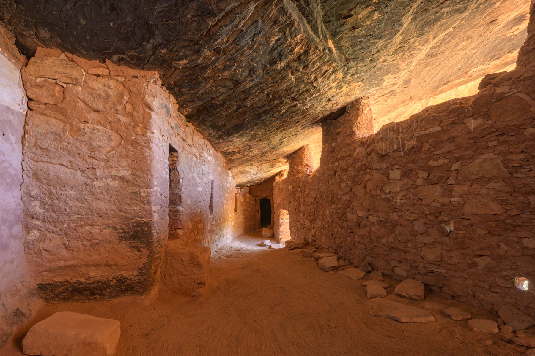
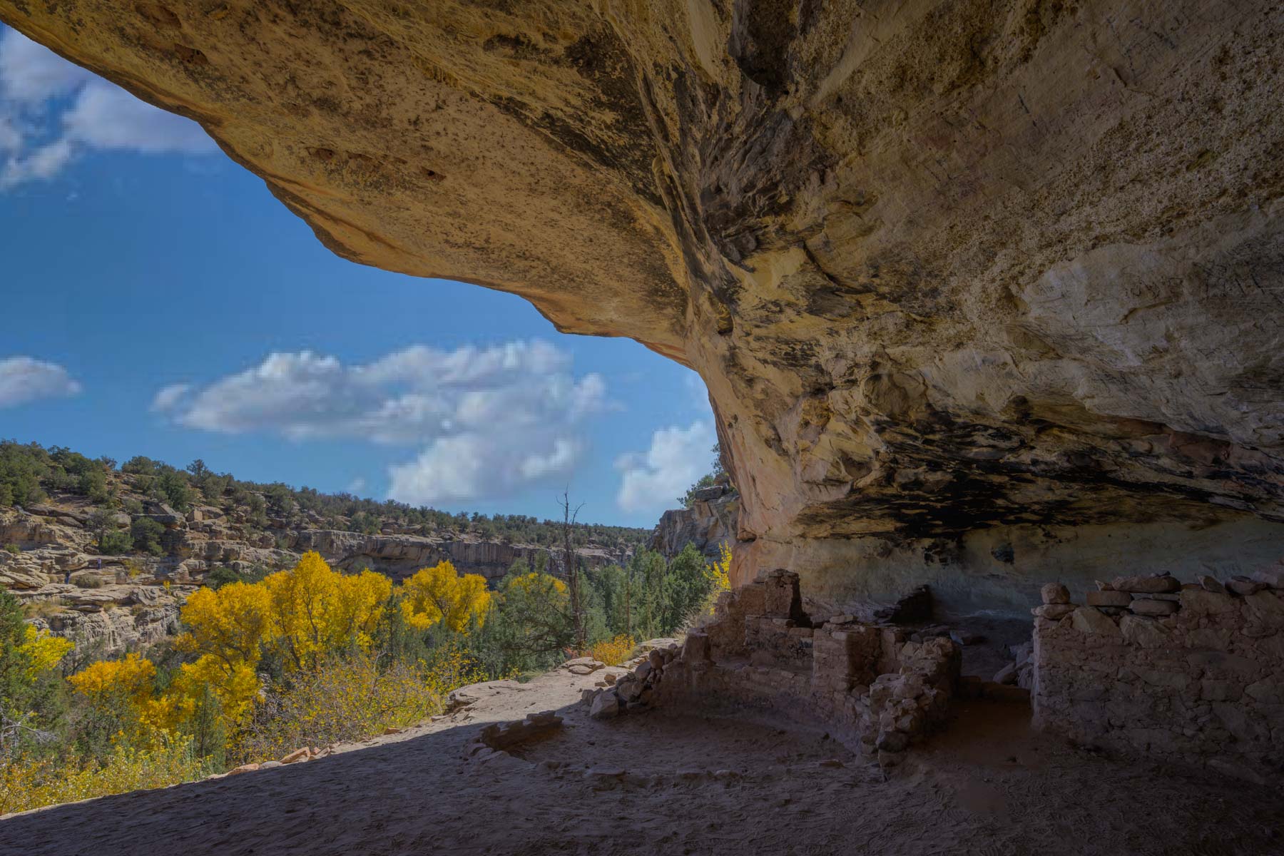
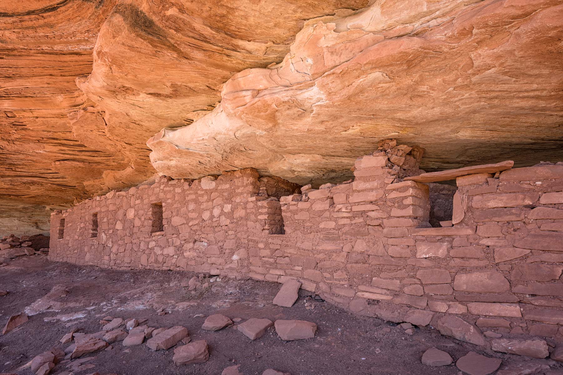
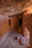
Moon House is perhaps the most photogenic ruin on Cedar Mesa. A permit is required to visit Moon House. Twenty permits per day are issued with twelve available on line 90 to five days in advance of your hike, and eight on the day of the hike. Moonhouse is a popular location and permits do sell out so I suggest you reserve one on-line when they become available 90 days in advance. If you plan on getting a walk-in permit arrive at the Kane Gulch station well before they open. When the Kane Gulch Ranger Station is closed during the winter and summer months Moon House permits can be purchased at the trailhead.
The hike to Moon House is only one mile round trip but it is strenuous. There is a drop of about four feet early in the hike. There is a rock pile at the bottom of the drop to help with the climb back up.
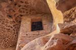
Moon House is best photographed mid-morning or so before the suns rays hit its interior walls. A wide angle lens will help capture the interior corridor. The rooms off the corridor are very dark and a tripod is needed to photograph them. There are several other ruins in the vicinity of Moon House. Well preserved Square Condo Ruin is on the same bench as Moonhouse about .25 miles to the east. Shoot it while it is still in shade. The suns rays hit Square Condo earlier than they do Moon House. About .25 miles to the north (left) of Moon House one level below is another ruin. To access the ruin follow the trail from Moonhouse to the left. After 100 yards or look for a drop down to the bench on the left side of the trail. This ruin is roped off and there is a lot of rubble in front of it making photography difficult.
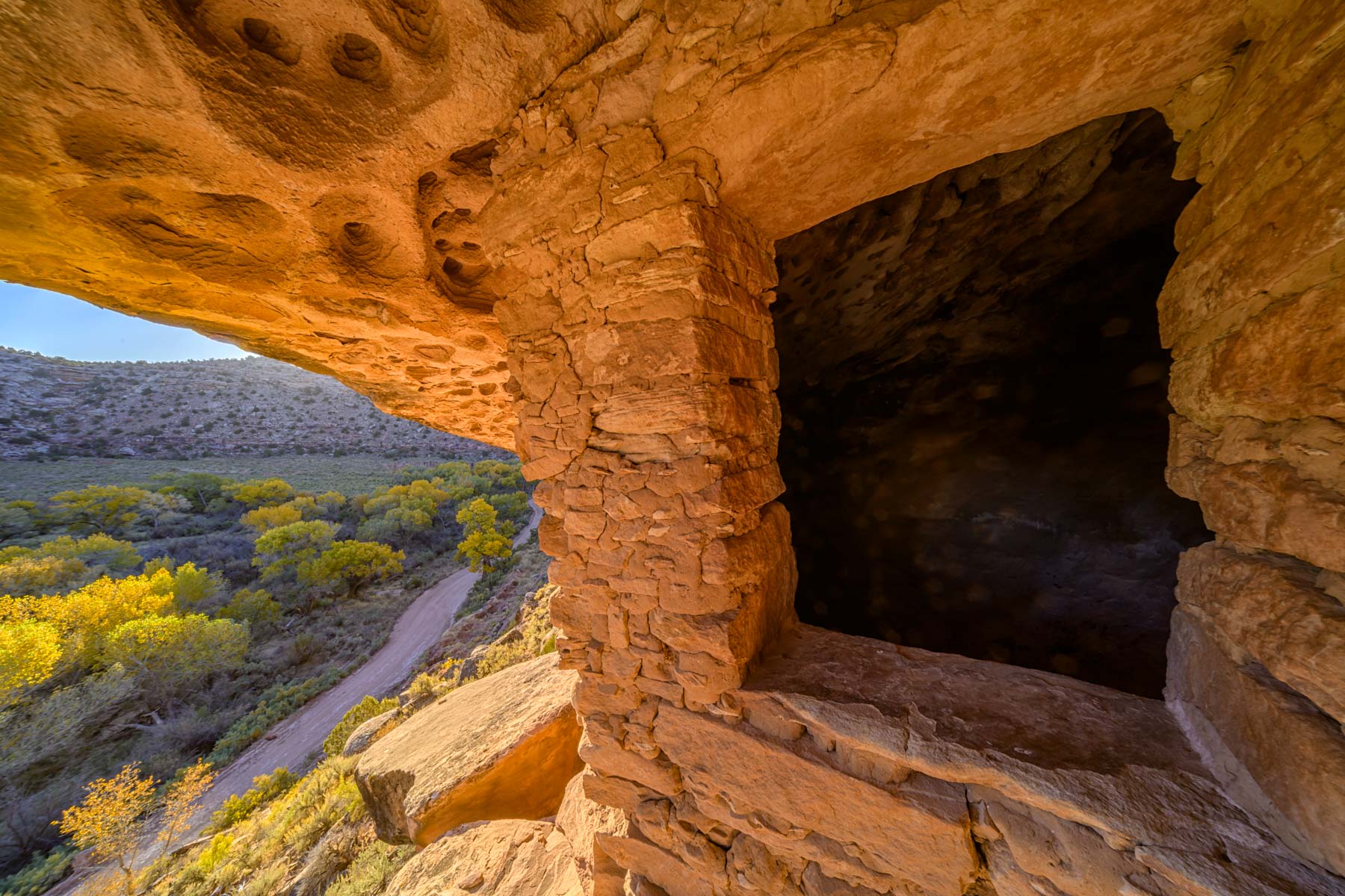
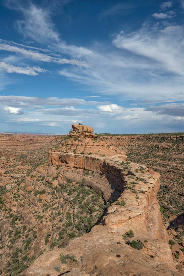
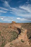
The hike to The Citadel is one of my favorite hikes on Cedar Mesa. The Citadel lies at the end of a spectacular land bridge seen in the image to the right. The hike is about 2.3 miles long one way and is not for those afraid of heights. The hike is largely level for the first 1.7 miles or so. After 1.7 miles you need to drop down to the bench below the trail on its right. The drop-down should be cairned but I had trouble finding it the first time I went to The Citadel. Mark it with your GPS so you can find it on the way back, especially if you stay at The Citadel until sunset. Follow the slickrock east until you reach the land bridge. The slickrock is off-camber and friends have told me this is the scariest part of the hike. I did not find it difficult. The land bridge itself is a few yards wide and hiking across it is easy. There is a short scramble up the side of a boulder just before you reach The Citadel; pushing off the edge of the opposite boulder with your left foot helps.
The Citadel faces slightly west of south and seems to be in mixed light most of the afternoon. I have not been there at sunrise but I believe this is the best time to visit to avoid shadows. May and June should work better than the rest of the year. Shooting in the blue hour with LED lighting should work well, but be sure you can find your way out in the dark.
West of Highway 261
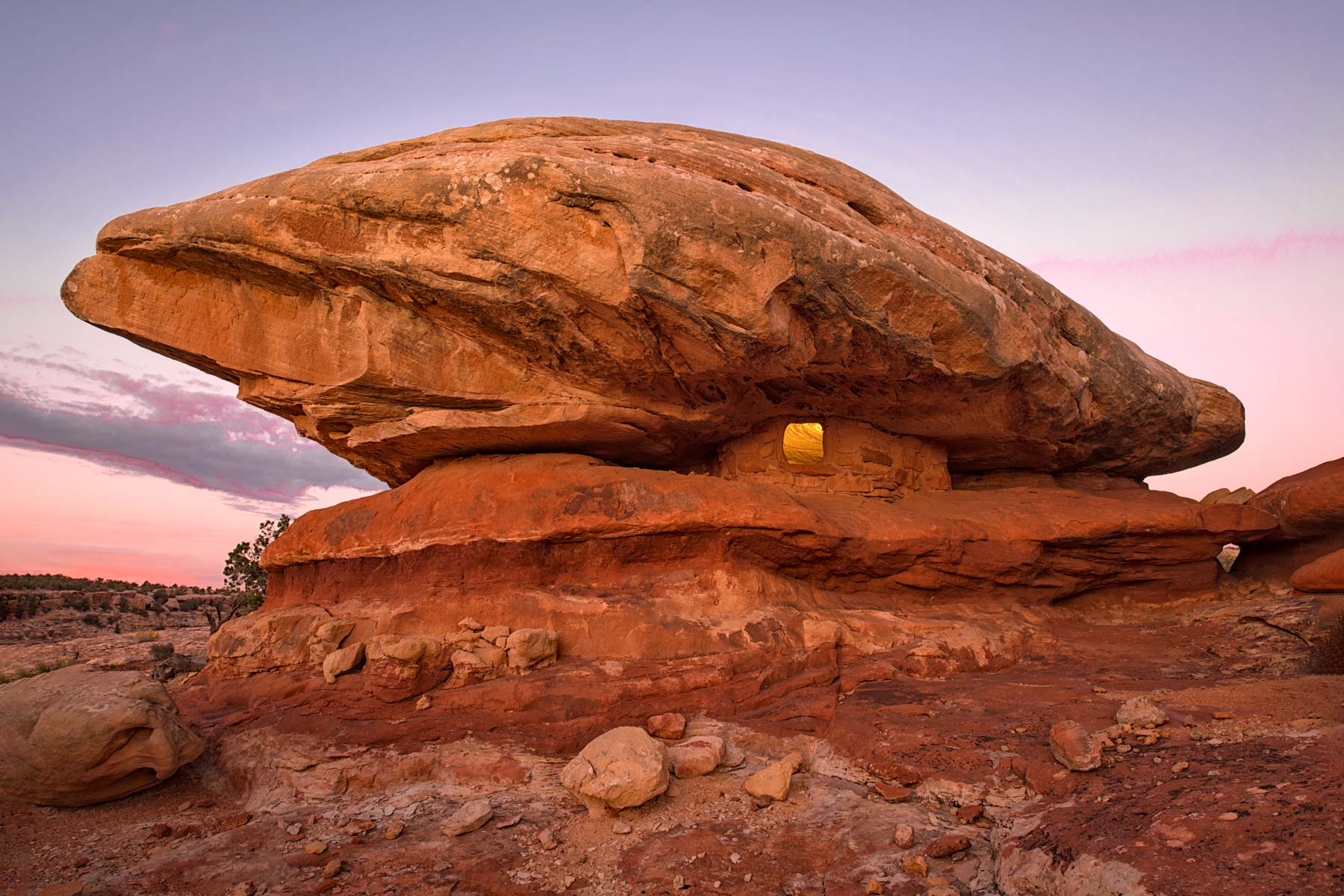
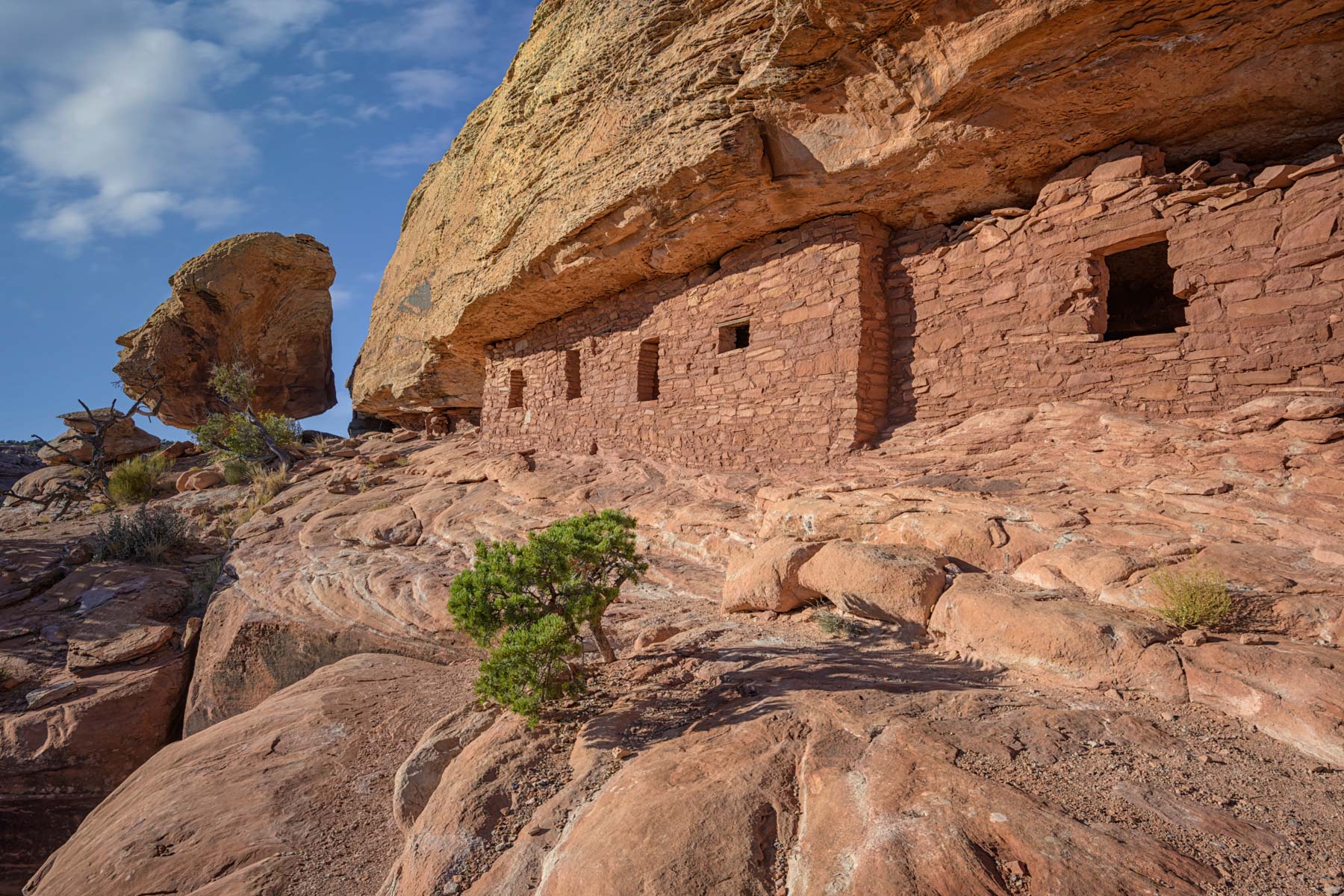
This area has the highest concentration of ruins on Cedar Mesa. Most are only accessible to backpackers or strong hikers. The Google map below shows the location of the better known ruins in Grand Gulch. The most accessible ruin is a small granary called Caprock ruin. Caprock is accessed via a long drive on Point Lookout Road followed by a short 0.3 mile one way hike. Point Lookout Road is rough in places and high clearance 4x4 is recommended. Caprock Ruin faces west is best photographed in sunlight mid-afternoon before the shadows from nearby rocks impact it. Alternatively the blue hour works well with artificial lighting. Camping along Point Lookout Road is recommended to avoid the long drive back to town in the dark.
The Bluff Area and Comb Ridge
Southwest of Bluff there are several good archaeological sites. I have not yet visited the Sand Island Petroglyphs or 17 room ruin so I cannot make recommendations as to photography. River House is well known and normally accessed via boat from the San Juan River. 4x4 access is possible via a sandy road starting just after the Comb Ridge cut on Highway US 163. From the Twin Rocks Trading Post in Bluff take US 191 4.7 miles south and continue straight onto US 163. Take US 163 3.1 miles to the bottom of the cut-through and turn left. River House is 4.8 miles from the turnoff. The 4x4 road to River House is very sandy and crosses a wash many times. When the wash is running, as often occurs in the winter and summer, the road can be difficult. In dry conditions the road is not bad but a 4x4 is definitely needed. I suggest you download the track from the map below and follow it as the road has many twists and alternates and can be hard to follow. River House does get traffic from rafters on the San Juan so I suggest you visit it early in the day to avoid others. It faces slightly southeast and is in shadow at sunset.
Almost every drainage on the east side of Comb Ridge contains one or more ruins and petroglyphs. These ruins can be accessed via short hikes starting on Lower Butler Wash Road which parallels the ridge. The map below contains the GPS locations of the trailheads. I have only provided a track to Fish Mouth Cave. GPS tracks to the other ruins can be found on other websites such as http://www.hikingwalking.com, https://www.roadtripryan.com/go/, and https://www.gjhikes.com/.
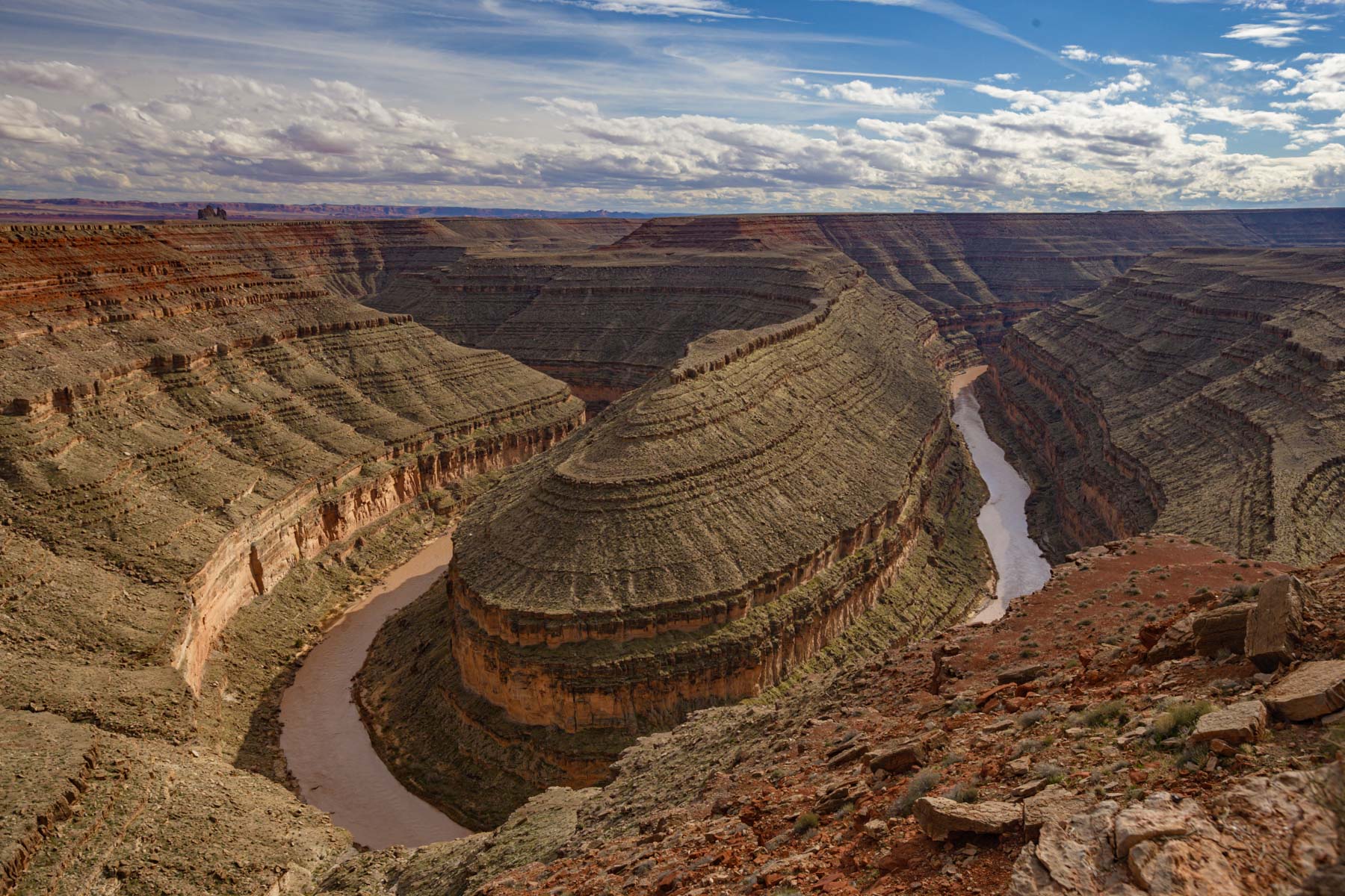
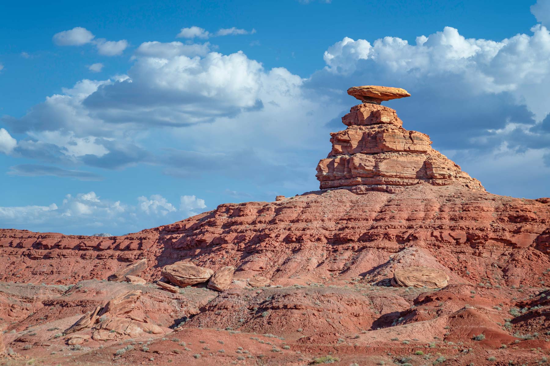
There are also several good sites for landscape photography near Bluff. These include the Recapture Pockets, Valley of the Gods, and Mexican Hat.
Blanding and Highway 95
The town of Blanding contains two sites which should be seen if you are in the area. The first is the Edge of the Cedars State Park Museum which contains a museum and a partially reconstructed Ancestral Puebloan village behind the museum. The museum contains the largest collection of puebloan pottery in the four corners area and the village contains a kiva which can be explored. Entrance to the museum is $5 as of early 2020.
Five Kiva Pueblo is a photogenic ruin just outside Blanding. The hike to Five Kivas is less than .5 miles RT. Because it is close to town and only a short hike is involved means that it can be crowded making photography difficult. There will also be many footprints to be cloned out in your images.
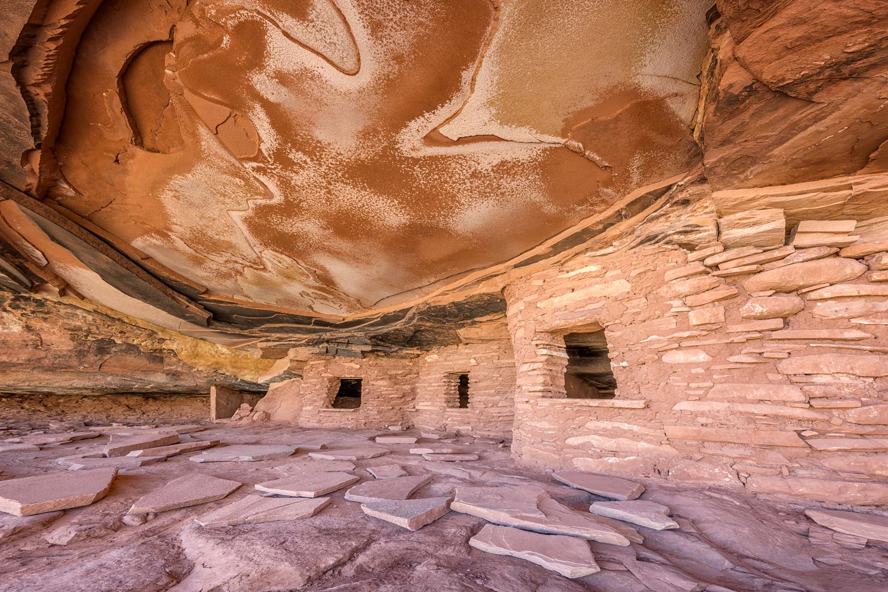
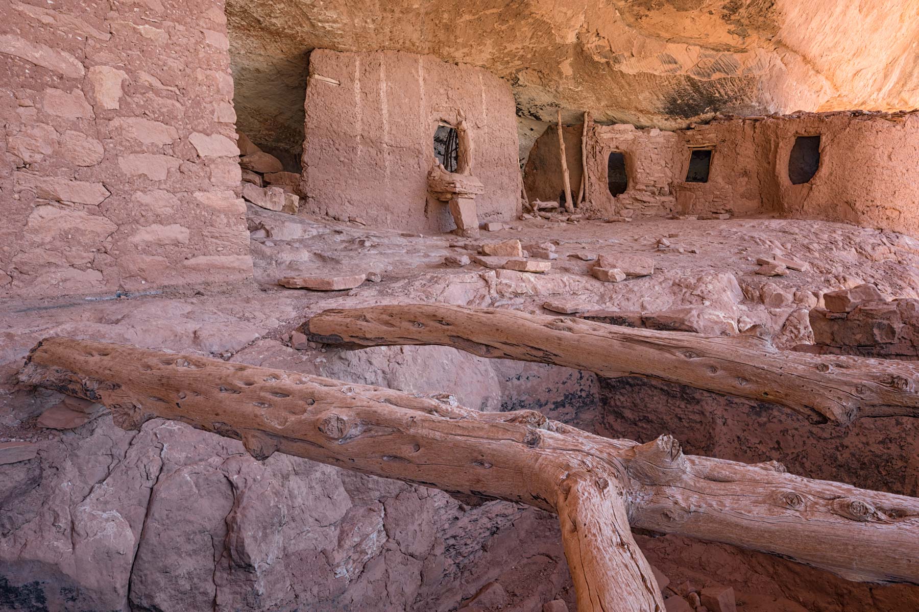
There are many ruins whose trailheads are short drives from Highway 95. The best known is House on Fire which is best shot mid-late morning when the slickrock above the ruin gets a red glow and the ruin is fully in shade. House on Fire can be accessed via an easy two mile round trip hike. Like Five Kivas the shortness of the hike and easy paved drive from town means that House on Fire is likely to be crowded and you will need the cooperation of others to get a good image. There are additional ruins downstream from House on Fire.
Montezuma Creek Road
Honeycomb is a small ruin on the north side of Montezuma Creek Road (County Road 146). There is a social trail leading to the ruin starting on Montezuma Creek Road. The hike is only about 50 yards long. It is steep and loose with one easy scramble. If you are coming from Blanding I recommend you do not follow your car GPS' directions to the trailhead which will take you on rough 4x4 roads which may be impassable. Instead either drive either north to the intersection of Montezuma Creek Road with US191 at 37.79982, -109.33842, or south to US 262. Montezuma Creek Road crosses a few washes south of Honeycomb and may be impassable during the winter and during spring runoff. Much of the land along the road is private so I suggest you do not car camp in pull-offs. Camping at Hovenweep is a good alternative to staying in Blanding. Honeycomb is best shot at first light shortly after sunrise. I suggest going in late October when the many Cottonwoods along Montezuma Creek will be changing.
There are many other ruins and petroglyphs along Montezuma Creek Road. Three Kiva Pueblo is 3.6 road miles south of Honeycomb on the right side of the road. Only one kiva has been excavated / reconstructed but it still makes for an excellent image. From the kiva more ruins can be seen on the ridge to the northwest. You are unlikely to see others at Three Kivas.
Google Map of Southeast Utah
Here is an Google overview map showing the main points of interest in Southeast Utah:
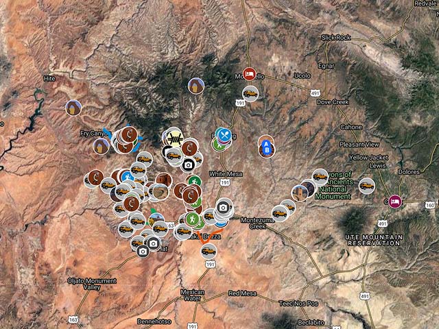
To view the map in Google Maps please click anywhere on the map above.
- Click to download a KMZ file (Note - in IE Right Click and choose Save Target as)
- Click to download a KML file (Note - KML files do not include custom icons)
- Click to download a GPX file (Note - in IE Right Click and choose Save Target as)
Bureau of Land Management Maps
The BLM provides geocoded PDF maps for eleven western states at https://www.blm.gov/maps/georeferenced-PDFs. None of the maps include the locations of ruins, even the better known ones. Here are the relevant BLM maps for Southeast Utah in a variety of formats:
| GeoPDF | KMZ | Oruxmaps | GeoTiff |
| Bear Ears | KMZ | Oruxmap | GeoTiff |
| Fish Owl Canyon | KMZ | Oruxmap | GeoTiff |
| Grand Gulch | KMZ | Oruxmap | GeoTiff |
| SanJuanRiver | KMZ | Oruxmap | GeoTiff |
| Valley of the Gods | KMZ | Oruxmap | GeoTiff |