Lake Mead National Recreation Area


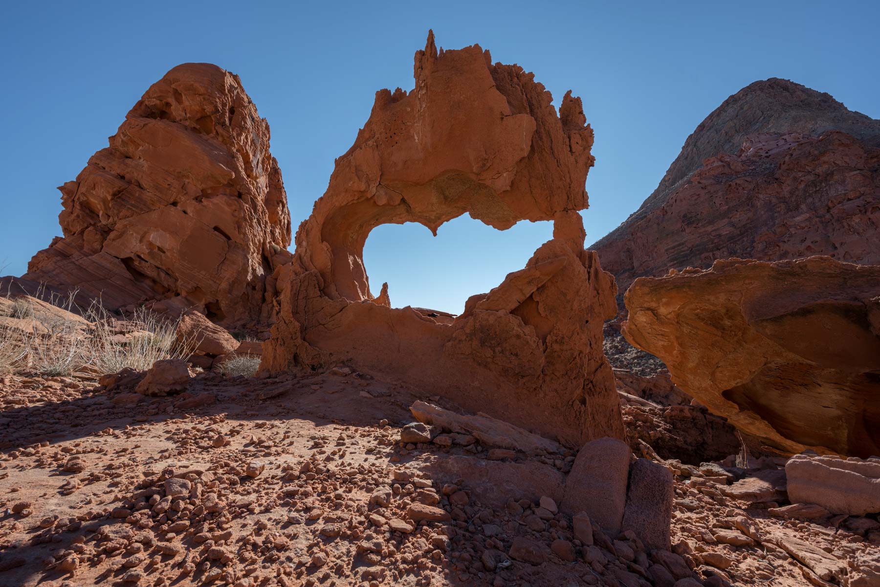
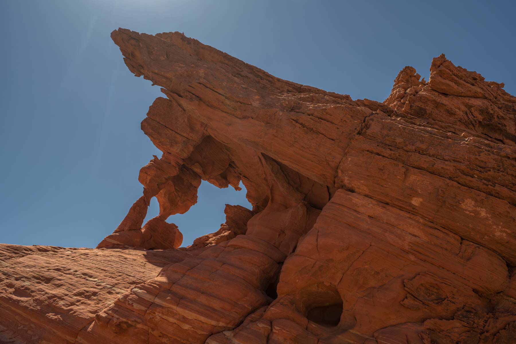
While the Lake Mead National Recreation Area is best known for its boating, it is also a great destination for landscape photographers. Within its boundaries one can find spectacularly eroded red rock formations, hundreds of arches, abandoned mines, and several slot canyons. Most arches are found in the Bowl of Fire and Pinto Valley areas. The red rock arches within the Bowl of Fire are located in two groupings, the Lower (south) Bowl of Fire and the Upper (north) Bowl of Fire. The "trailheads" for both are on Callville Wash N Road. A 4x4 is needed to access either trailhead with the most difficult part of the road right at its beginning.
The Lower Bowl of Fire is the better known of the two areas. The trailhead for Lower Bowl of Fire is just two miles from Northshore Road (Highway 167). The Upper Bowl of Fire trailhead is 5.6 miles from Northshore Road just before Callville Wash N Road ends. I prefer the Upper Bowl of Fire to the Lower as it has more arches, fewer trails, and a greater chance for solitude. You will usually see other hikers at the Lower Bowl. On my one trip to the Upper Bowl I didn't see anyone else. Most of the Upper Bowl of Fire is outside the Lake Mead NRA on BLM land. It "may" be legal to car camp at the end of the Callville Washington N Road. I am not sure if it is legal to car camp at the trailhead for the Lower Bowl of Fire. Hiking in both areas is moderately difficult. The few trails are mainly social and are hard to follow, and the terrain has many ridges and outcroppings that impede progress. Allow plenty of time to route find and photograph the many arches in the area.
The Pinto Valley area also contains many arches and is significantly easier to explore than the Bowl of Fire. There are two trails into Pinto Valley, the first is the Redstone Discovery trail, and the second is the Redstone Dune trail.
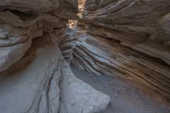
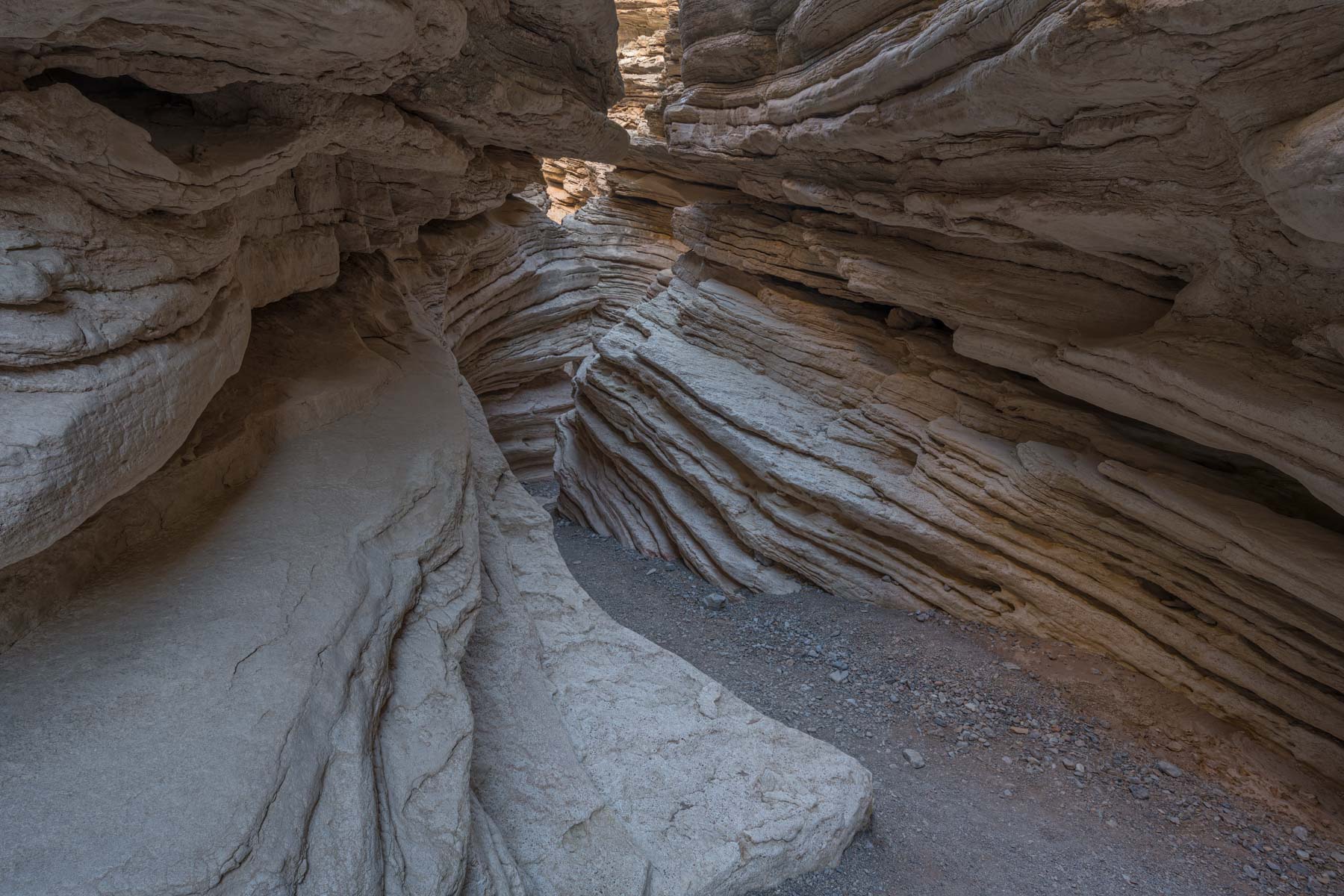
The Lake Mead NRA also contains two slot canyons. Anniversary Narrows is the better known of the two. It gets best light after 10AM. I was too early on my one trip there and my photos suffered. The slot cantains several short dryfalls which are easily climbed. Children will love this part of the hike. The narrows section is quite short and once you reach its end the canyon does not slot up again. If you have a 4x4 easiest access is to take Callville Wash N Road 0.2 miles to Anniversary Mine Road. Continue 1.8 miles on Anniversary Mine Road to the trailhead. From the trailhead drop down into the wash and hike north for about one mile to the end of the slot canyon.
White Owl Canyon (aka Owl Canyon) is a short slot canyon on the western shore of Las Vegas Bay. The trailhead is at 33 Hole Overlook. From the trailhead continue northwest 0.15 miles and drop down into White Owl Canyon. The trail can be done as a loop (not shown on the map below) or as an out and back. One way distance to the end of the slot where the canyon meets Lakeshore Road is one mile.
Below is the official Lake Mead NRA map as a jpeg and in five geocoded formats: GeoTIFF, KMZ, Oruxmaps RMAP, GaiaGPS Pro Mbtiles, and Locus Sqlitedb format.
- Click to download a Jpeg file, the file is not geocoded
- Click to download a GeoTiff file viewable in PDF Maps
- Click to download a KMZ file viewable in Google Earth
- Click to download an RMap Oruxmap file
- Click to download a Sqlitedb Locus file
- Click to download an Mbtiles GaiaGPS file
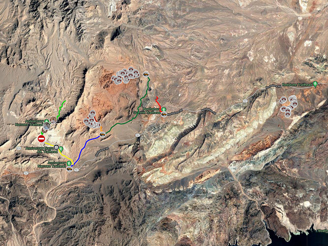
Here is an overview map showing the locations of many of the arches and other attractions in the Lake Mead area. Click on the map to open a larger version of the map in a new window.
- Click to download a KMZ file (Note - in IE Right Click and choose Save Target as)
- Click to download a KML file (Note - KML files do not include custom icons)
- Click to download a GPX file (Note - in IE Right Click and choose Save Target as)
Arches whose name is followed by an asterisk I consider photogenic. This rating is based on the small number of photographs I have seen on the web and needs verification in the field.
USGS 24K Topo Maps
The USGS Callville Bay map covers the Anniversary Narrows slot canyon and the Lower Bowl of Fire. The Upper Bowl of Fire is covered by the Callville Bay and Muddy Peak maps. Pinto Valley is covered by the Boulder Canyon map. Decollared maps can be downloaded in a variety of formats by clicking or right-clicking below. Note that GaiaGPS Premium members can only mport up to 4gb of mbtiles and 1 GB of GeoTIFF, but files over 100mb will not sync to the cloud.
| Geo Tiff/Avenza | KMZ/Google Earth | RMap/Oruxmaps | Sqlitedb/Locus | Mbtiles/GaiaGPS |
| Bitter Springs | KMZ | RMap | Sqlitedb | Mbtiles |
| Boulder Canyon | KMZ | RMap | Sqlitedb | Mbtiles |
| Callville Bay | KMZ | RMap | Sqlitedb | Mbtiles |
| Muddy Peak | KMZ | RMap | Sqlitedb | Mbtiles |
| Merged Map | KMZ | RMap | Sqlitedb | Mbtiles |