Little Finland and Gold Butte National Monument
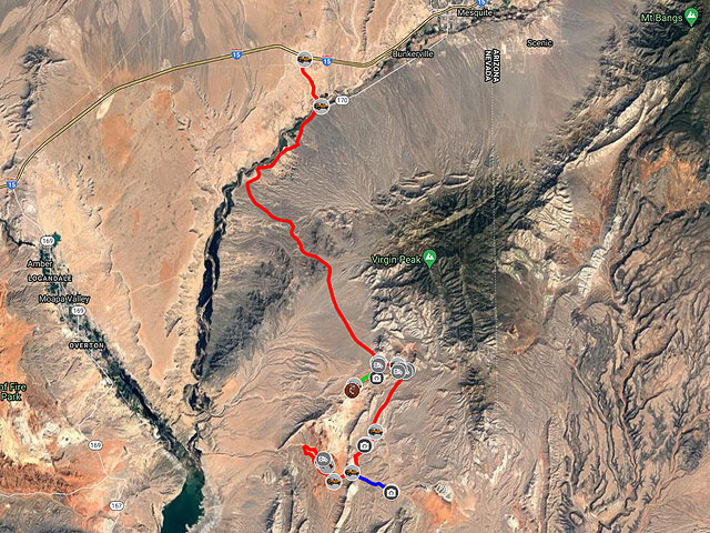
Little Finland is a little visited area of strangely eroded Aztec Sandstone in Gold Butte National Monument, Nevada. The area is not named after the country Finland but rather after the many small fins of rock throughout the area. Little Finland is also known as Devil's Fire. Mesquite, Nevada is the closest town to Little Finland with good services. The drive to Little Finland from Mesquite requires a high clearance 4WD vehicle and takes about two hours. From Mesquite, take I15 South to exit 112 and continue 3.1 miles on NV-170 / Riverside Rd. Turn right onto the good gravel Gold Butte Road and proceed 21.1 miles to Whitney Pockets. The rock formations, the CC dam, and the storage room are worth a brief stop here. At Whitney Pockets bear right staying on Gold Butte Road. Continue 3.9 miles to the heavily washboarded Mud Wash N Road. A sign indicates the turnoff to Little Finland at this otherwise easily missed turnoff. Take Mud Wash N Rd 4.4 miles and bear right onto Mud Wash Road. You might want to stop at Devil's Nostril 1.1 miles along the way. Devil's Nostril is a sinkhole formed when the roof of a limestone cave collapsed. Take Mud Wash Rd 2.7 miles and turn right onto Little Finland Rd. Continue on Little Finland Rd about 1.5 miles to its end at the Little Finland plateau on the cliffs to the left.
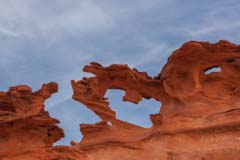
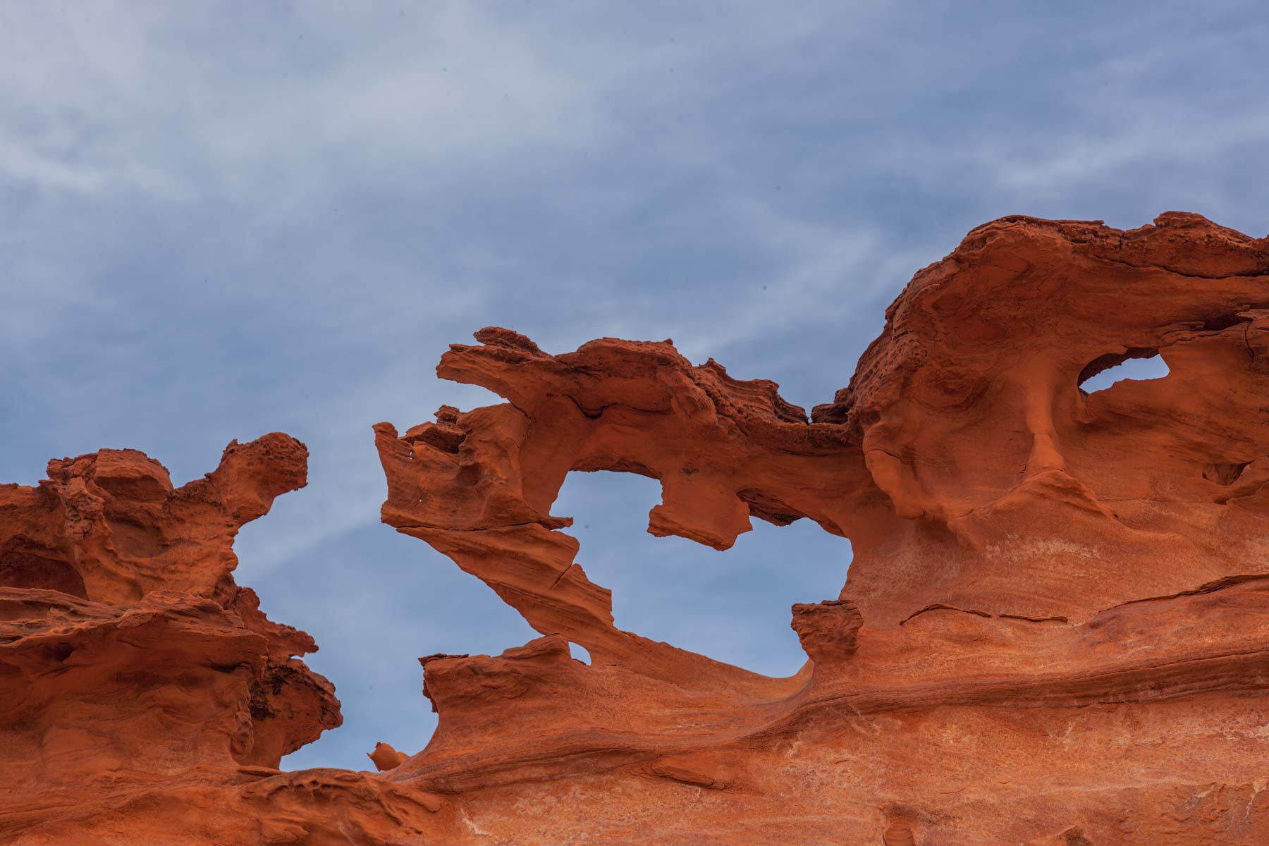
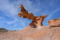
The Little Finland tableland can be accessed by hiking up the cliffs' sand dune to the left (north side). Shooting close with a wide-angle lens will emphasize the oddly shaped formations. The white patterns on the floor of the plateau make good leading lines. The white areas are formed by water leaching out the iron from the Aztec sandstone. Good photos can also be shot from the parking area with a telephoto lens. The Heart Arch image to the right was taken from the parking area with a 300mm lens. Hills block early light to the east of Little Finland, so photography is best at sunset when the Aztec Sandstone takes on a rich red glow. Rather than drive Mud Wash Rd in the dark, I suggest you camp in the parking area.
Google Map of Little Finland and Gold Butte National Monument
The following map shows the route to Little Finland, a few of the attractions in the area, and the location of a few of the many campsites in Gold Butte National Monument.
To view the map in Google Maps please click anywhere on the map above.
- Click to download a KMZ file (Note - in IE Right Click and choose Save Target as)
- Click to download a KML file (Note - in IE Right Click and choose Save Target as)
- Click to download a GPX file (Note - in IE Right Click and choose Save Target as)
Caltopo Map showing various Points of Interest
In addition to the Google Map of Little Finland I have added a Caltopo Map. Caltopo maps show land ownership which is very important if you plan to boondock. You do not want to camp on private land, and US Forest Service and BLM camping regulations are often different. Caltopo maps are also preferable for off-trail hiking since they show ten feet elevation contours and terrain slope shading.
USGS 24K Topo Maps
Little Finland and Gold Butte National Monument are covered by two USGS 24K topographic maps.
| GeoTiff/Avenza | KMZ | Oruxmaps | KMZ Decollared | Oruxmap Decollared | Avenza Decollared |
| Devils Throat | KMZ | Oruxmap | KMZ Decollared | Oruxmap Decollared | Avenza Decollared |
| Whitney Pocket | KMZ | Oruxmap | KMZ Decollared | Oruxmap Decollared | Avenza Decollared |
| Map of the entire area | NA | NA | KMZ Decollared | Oruxmap Decollared | Avenza Decollared |