Joshua Tree National Park and surrounding area
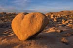
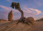
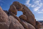
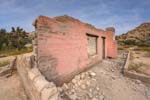
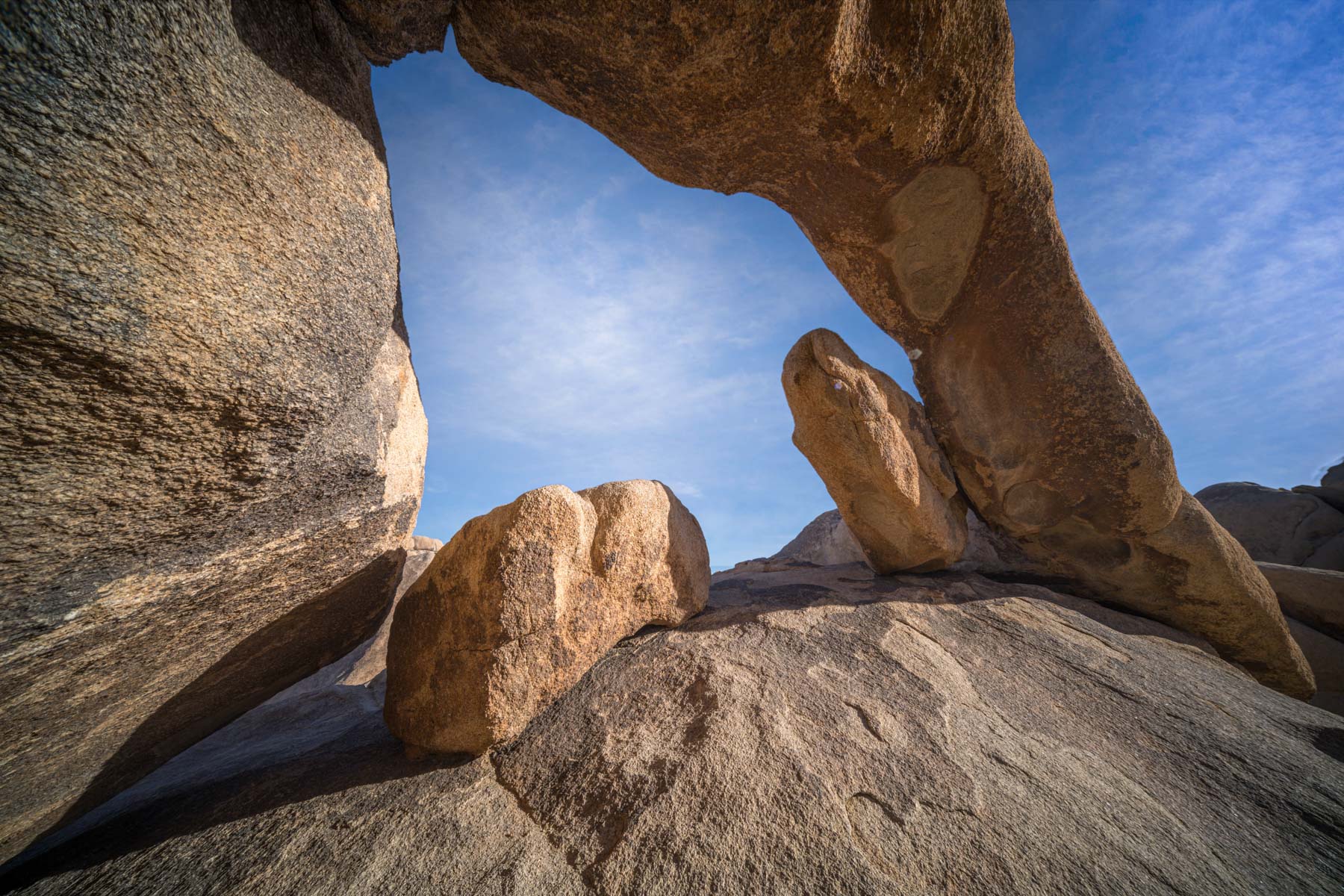
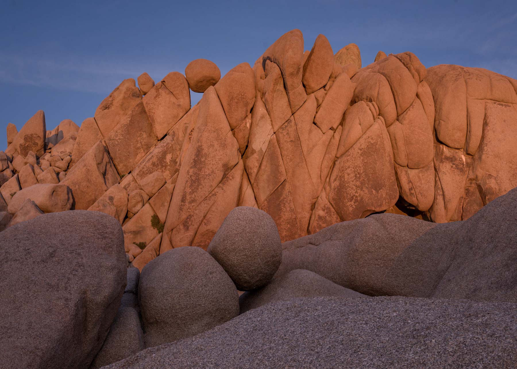
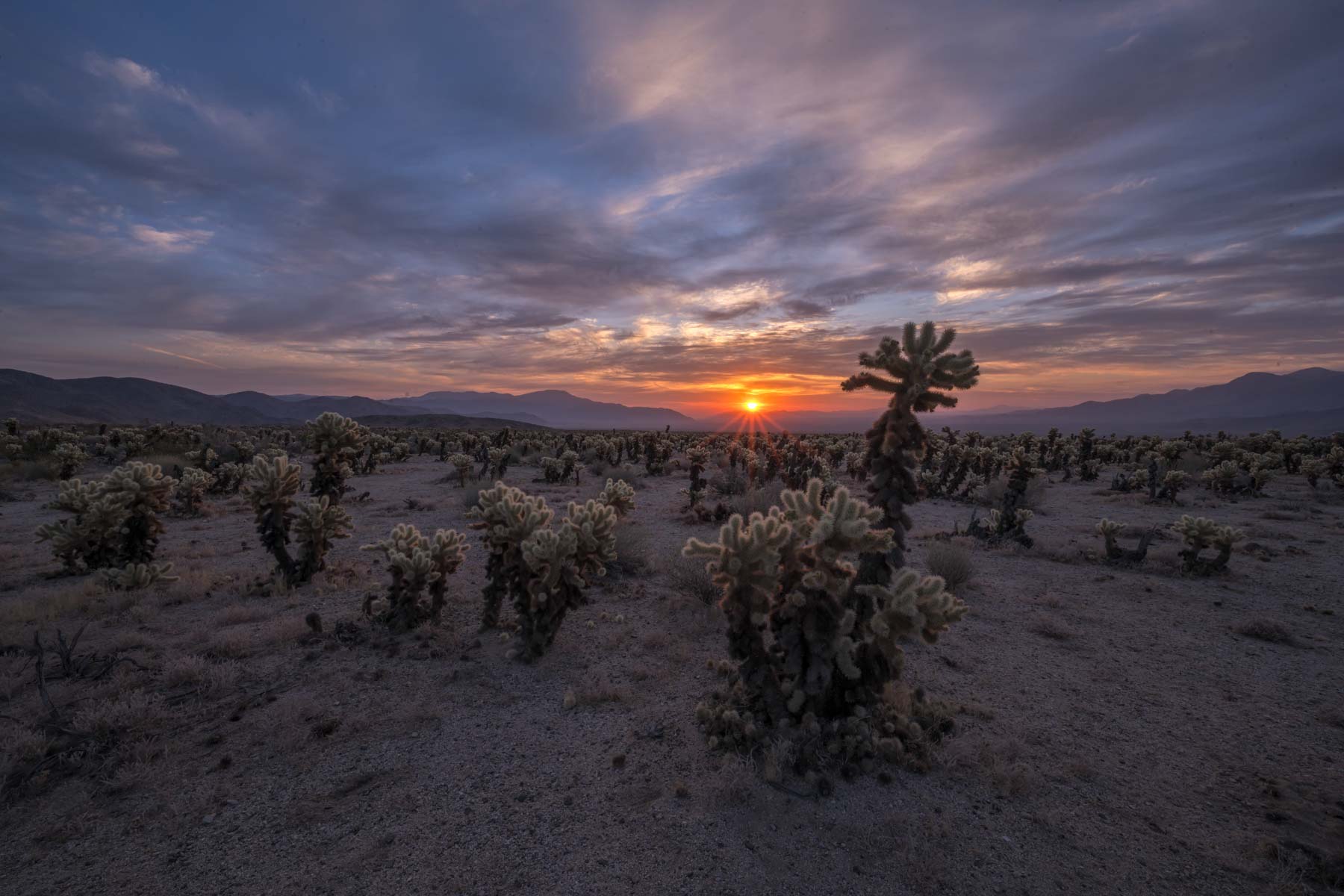
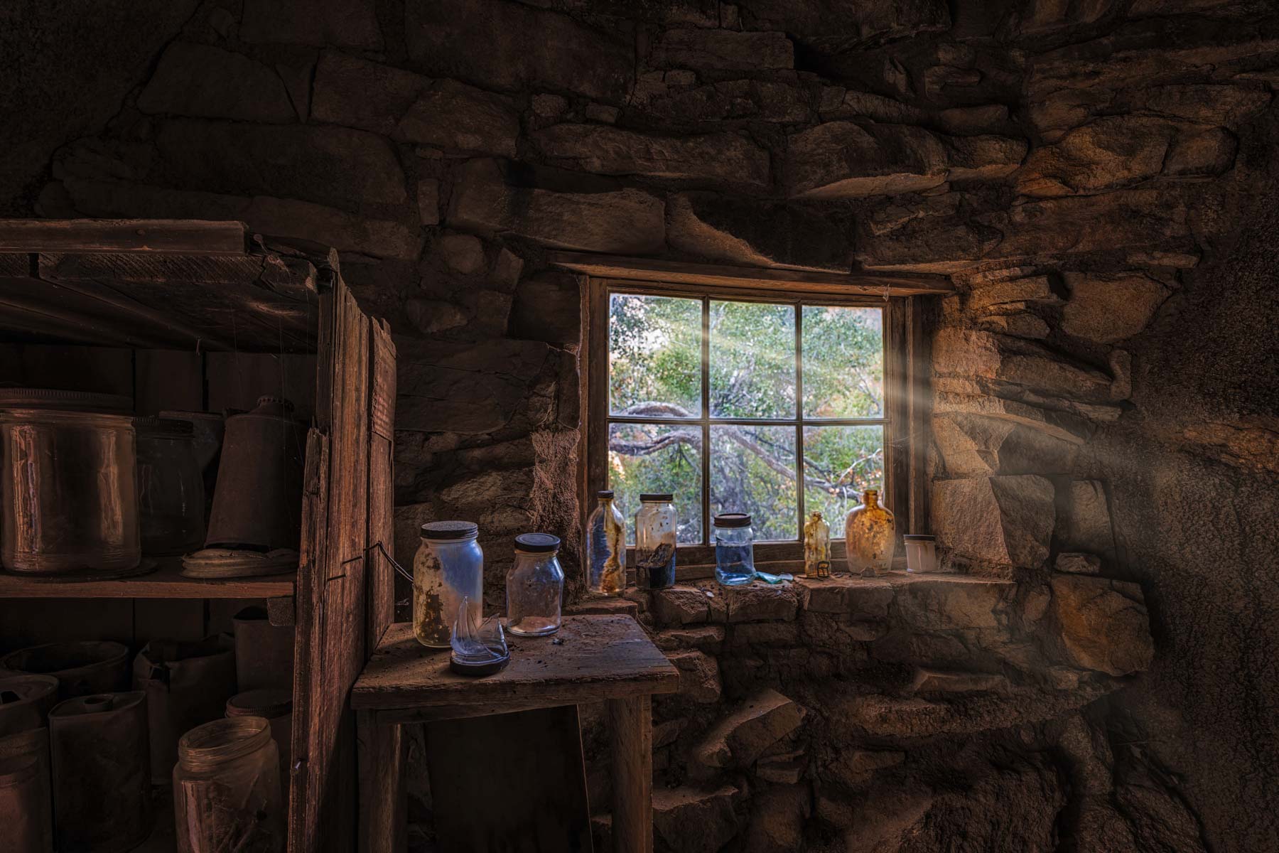
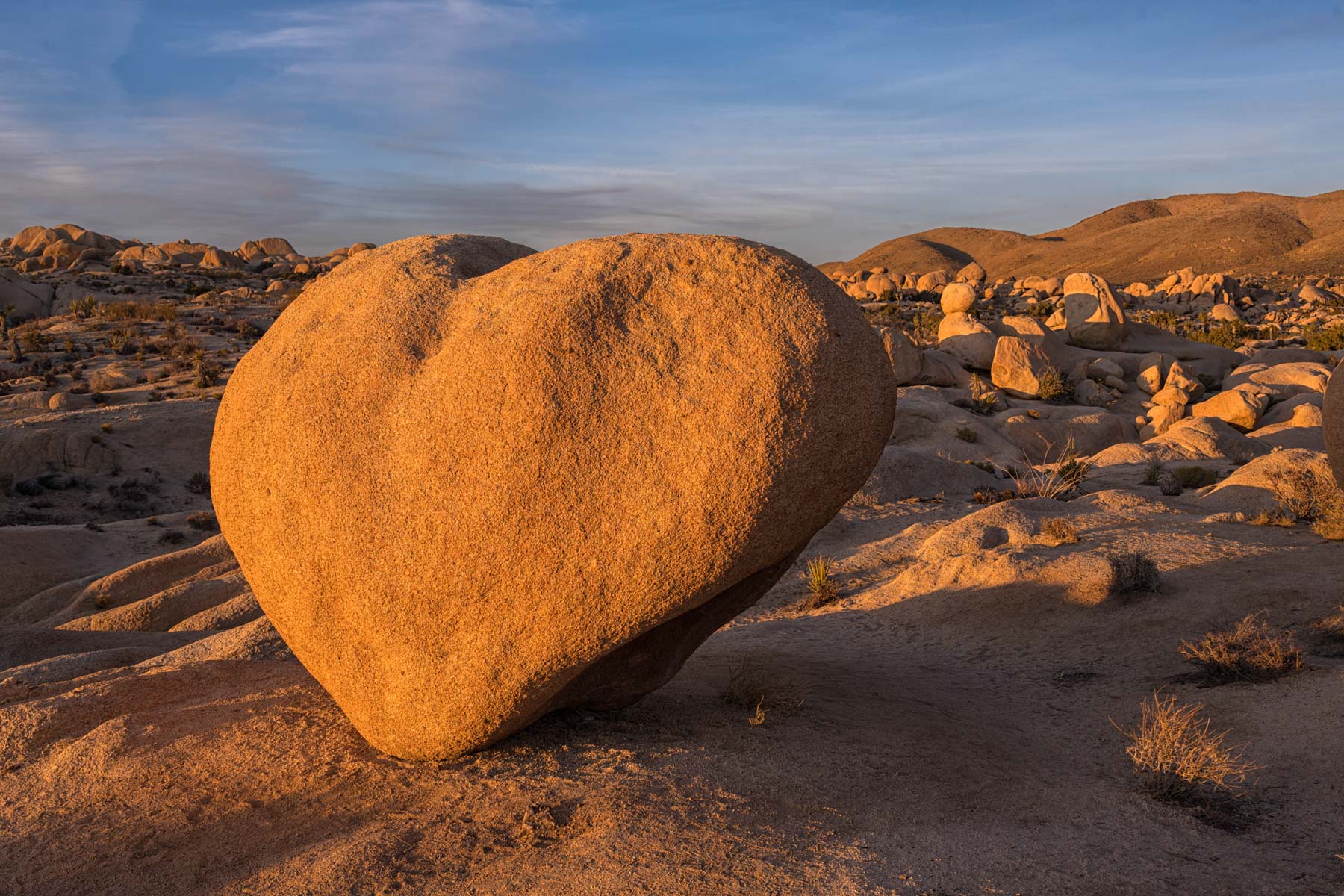
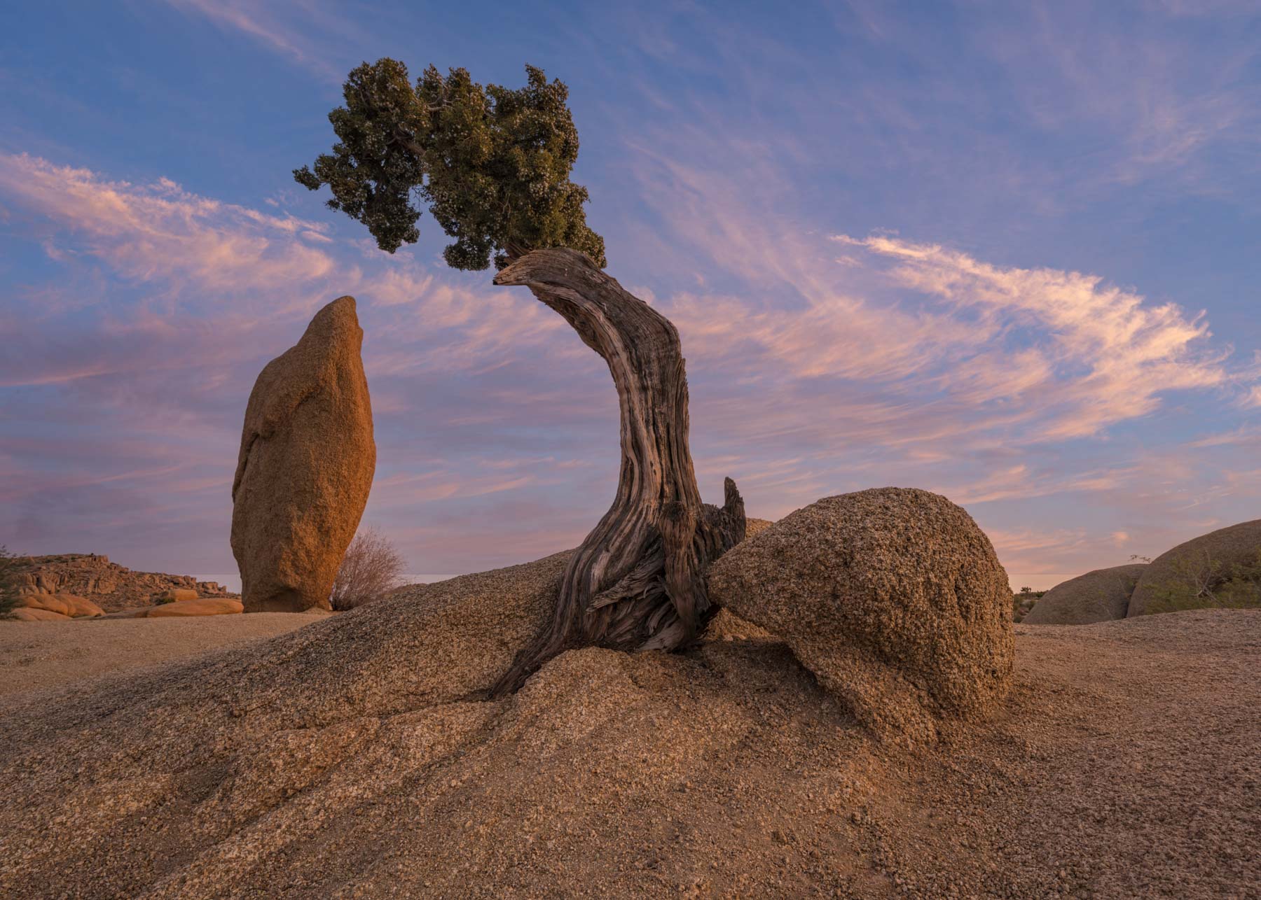
While Joshua Tree National Park is best known as a rock climbers utopia it is also a great destination for photographers and hikers. Its many Joshua Trees, cholla cactus, and varied shaped granite boulders are great subjects in themselves or as foreground for a striking sky or the Milky Way. Other subjects include boulderers and the many abandoned ranches and ruins in the park. Although Joshua Tree lacks the major icons of the much more photographed Death Valley there are some areas in the park you simply must shoot. Most of the these require only short hikes such as the Juniper and Spire, Peach Rock, Arch Rock, Heart Rock, Balanced Rock, and the Ryan Ranch.
There are ten campgrounds within the park making it easy to stay within Joshua Tree most of the year. The nearby town of Twentynine Palms has many motels, gas stations, and good internet service and is only twenty minutes from the Jumbo Rocks trailhead. Getting a campground reservation can be difficult for weekends and holidays outside the summer and should be made early. Reservations can be made at recreation.gov starting exactly six months ahead of your camping start date. Free dispersed camping is available outside the park on BLM land.
Internet and cell service are scarce to non-existent in the park. Good cell service is available twenty minutes from the Skull Rock trailhead in the town of Twentynine Palms. Summers in Joshua Tree should be avoided. They are incredibly hot. Joshua Tree's clear skies and haze sometimes make photography difficult.
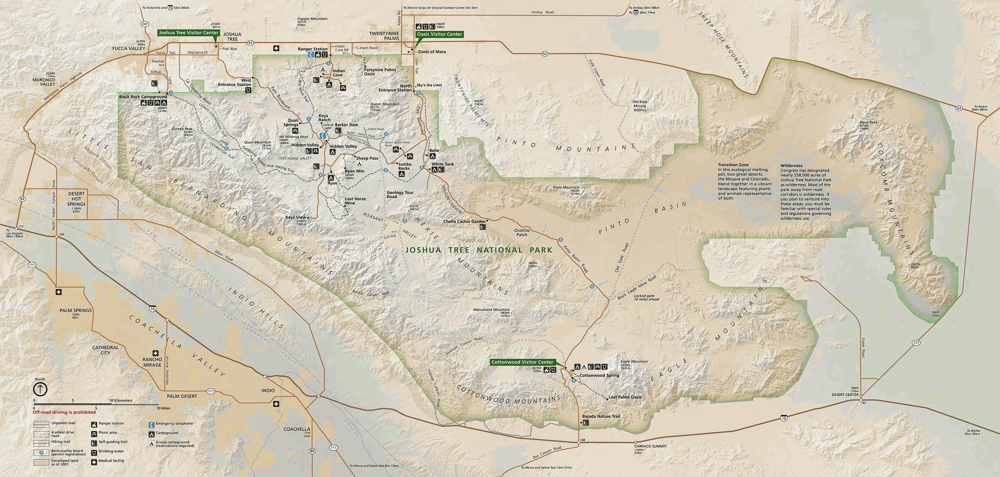
Official Park Map
Below is the official Joshua Tree National Park map as a jpeg and in three geocoded formats, as a GeoTiff, as a KMZ file, and in Oruxmaps format. The official park map as a Geo PDF can be found here. The jpeg image below displays in low resolution, however if you download it you will get a full resolution 300dpi image. To download the full resolution jpeg right click on the image and choose Save Image As.

- Click to download a high resolution Jpeg file. File is not geocoded.
- Click to download a GeoTiff file viewable in PDF Maps
- Click to download a KMZ file viewable in Google Earth
- Click to download an Oruxmap file (Note - in IE Right Click and choose Save Target as)
When to Go
Joshua Tree is open every day of the year. Some campgrounds are closed from June through September. The period from mid-October through April is the best time to visit the park. Visitation peaks over holiday weekends and camping may be unavailable then. Avoid Thanksgiving, Christmas and New Year's, Martin Luther King Day, and President's Day if you wish to dodge the crowds. The National Park Service maintains visitor statistics on their website here.
Overnight stays by month - 2019
Joshua Tree Climate (°F)
Joshua Tree National Park ranges in elevation from 536 feet (163 m) in the park's extreme southeast corner to 5,814 feet (1,773 m) atop Quail Mountain. Conditions may vary greatly depending on your exact location within the park. Expect temperatures exceeding 95°F from early June through mid-September. Winters are quite nice with overnight lows around 40° and daytime highs over 60°. Historical temperature and rainfall data for the town of Twentynine Palms at 2,000 feet can be found on Weatherspark.com.
Landmarks and Shooting Locations
| Location | Latitude | Longitude | 24K Topo Map | Rating | Comments |
| 33.9862 | -116.0155 | Malapai Hill | *** | Difficult to photograph. Likely best between mid-morning and mid-afternoon. In shadow at sunset. Shoot Heart Rock and Vulture Arch while in the White Tanks area. | |
| 33.9929 | 116.0612 | Malapai Hill | ***** | Best late afternoon to sunset. Front-lit in December, the rest of the year would work better. The best viewpoint is 50 yards off of Skull Rock trail. The closest Skull Rock trailhead is in the Jumbo Rocks campground near campsite 93. There is also a very small parking area area across from the Jumbo Rocks campground trailhead. Alternatively you can start your hike at the pullout across from Skull Rock. | |
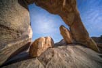
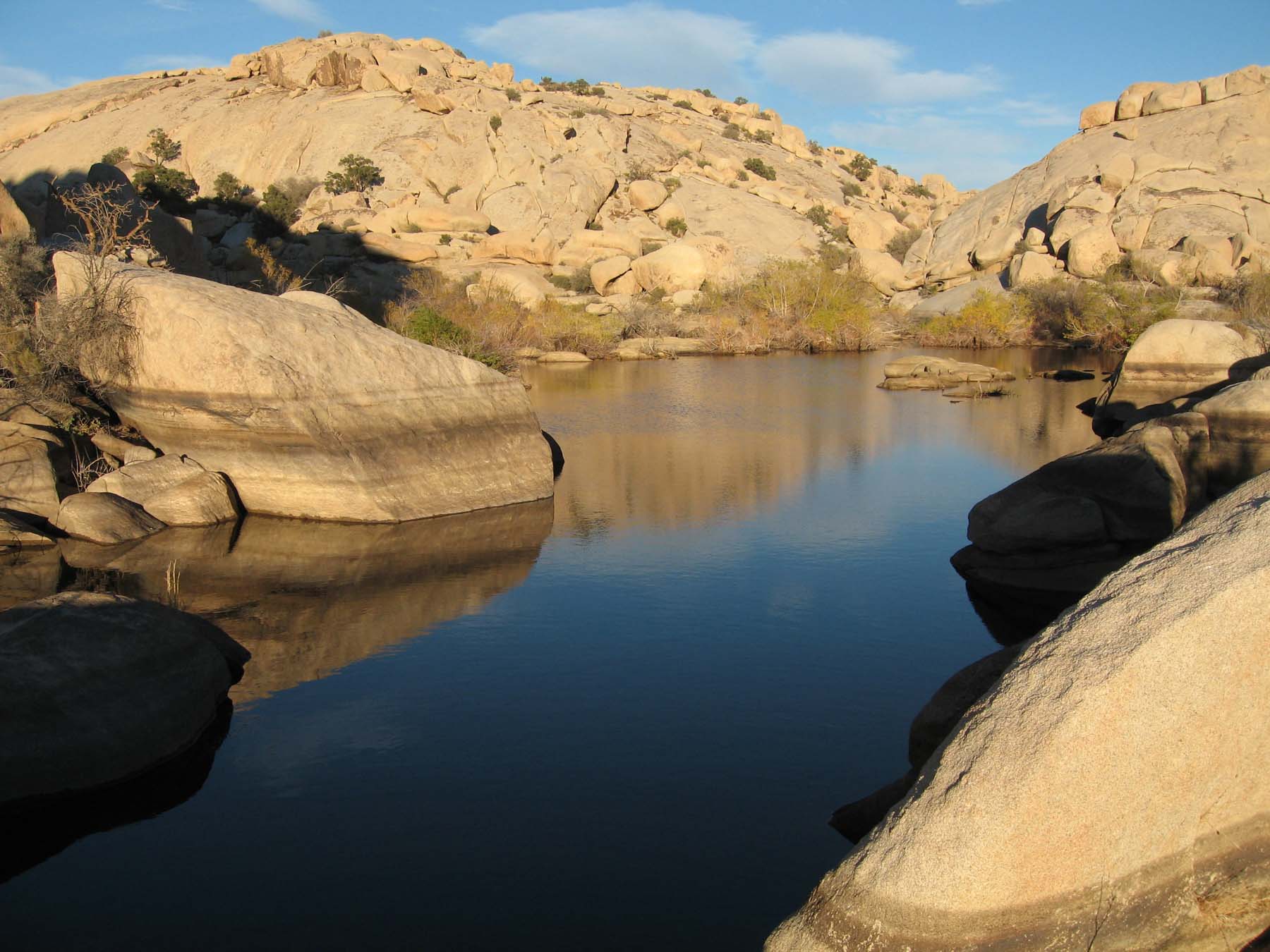
| 34.0308 | -116.1463 | Indian Cove | **** | Excellent when water is present after a rainfall. | |
| 33.9253 | -115.9287 | Fried Liver Wash | **** | Excellent at sunrise and sunset and during the blue hour. Shoot towards the sun so the cholla are back-lit. During the blue hour consider lighting the cactus with your car's headlights. | |
| 34.0225 | -116.052 | Queen Mountain | **** | Best access is via the Desert Queen Mine Trail. Stop at the Desert Queen and Eagle Cliffs Mines along the way. Hike is about four miles RT with 500 feet of elevation gain. The well preserved cabin can also be accessed via the Split Rock trail which is a bit more strenuous. | |
| 33.9882 | -116.0133 | Malapai Hill | **** | Excellent early light at both sunrise and sunset and in the blue hour. I recommend sunrise as the rock is becoming popular and there will be fewer people present then. | |
| 33.9912 | -116.0642 | Malapai Hill | **** | Best at sunset. Good Milky Way shot in the Spring? Access is via campsite 17 in the Jumbo Rocks campground. | |
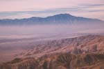
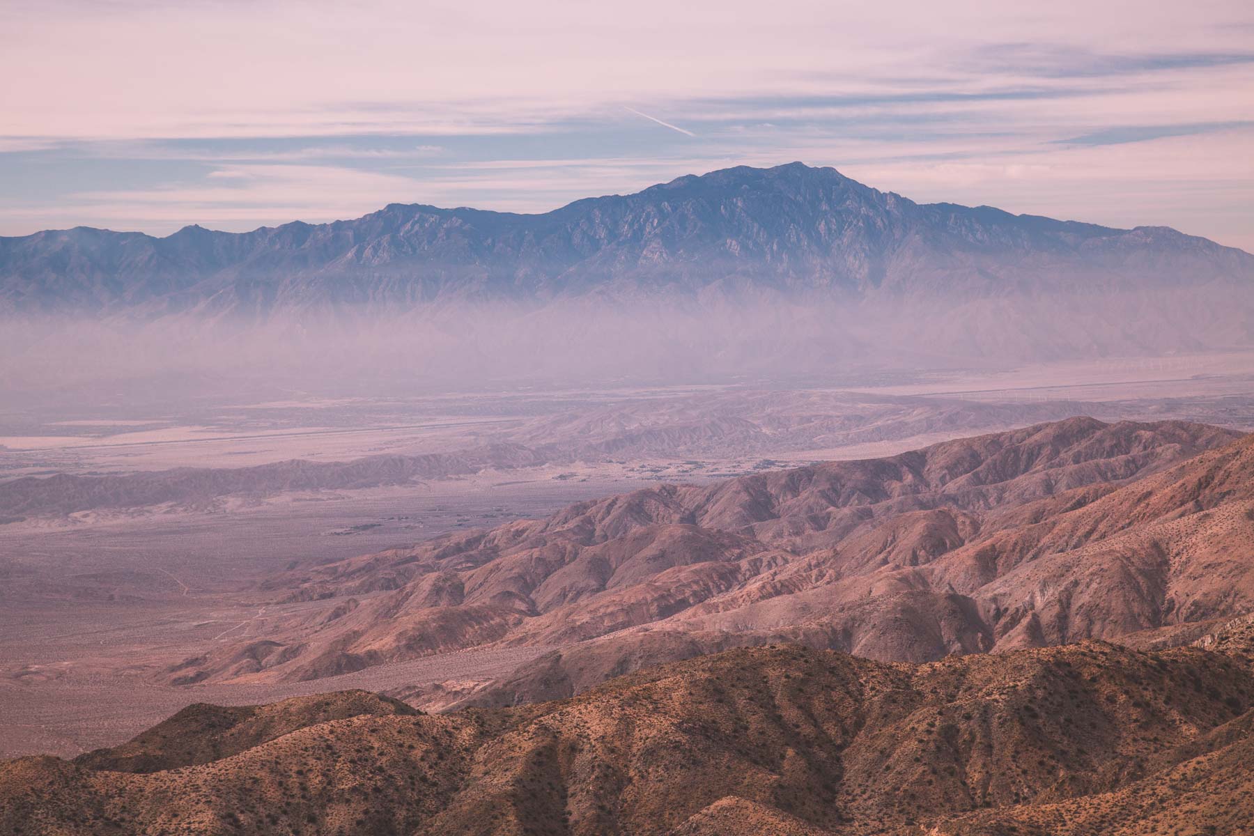
| 33.9264 | -116.1875 | Keys View | **** | Provides panoramic views of the Coachella Valley and is well worth the 20-minute drive from Park Boulevard down Keys View Road. The view includes the Salton Sea and the San Andreas Fault. Bring a polarizer to cut the haze which seems to be always present. | |
| 33.9967 | -116.0632 | Malapai Hill | **** | Made famous by the image "Sunkissed" by Michael Fatali. Best at sunrise or light painted in the hour before sunrise. The small tree on the top of Peach Rock is gone. Easy access via trail from the Skull Rock pullout. Even quicker off-trail access from a pullout at 33.9957, -116.0627. From the pullout head northwest. Look for the small "Carved Face" on the other side of Peach. | |
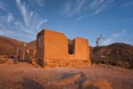
| 33.9844 | -116.1492 | Keys View | **** | Best at sunset. When the ranch house was constructed tailings from the nearby gold mine were mixed in with clay and sand to create the adobe walls. The result is the golden glow the ranch takes on at sunset. Lots of graffiti; I laboriously removed most of it in Photoshop. | |
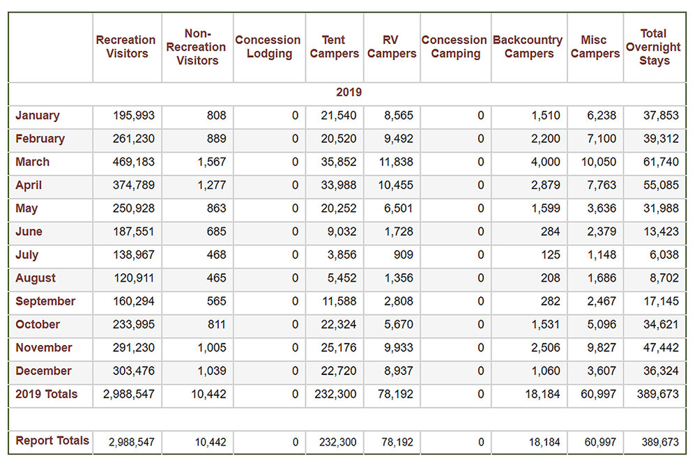
| 33.9857 | -116.0138 | Malapai Hill | **** | Little known but very attractive small arch. Roughly seven foot span. Best mid-day to late-afternoon. In shadow at sunrise. Shoot Arch Rock and Heart Rock while in the area. | |
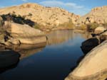
| 34.0304 | -116.1388 | Indian Cove | *** | The remains of the main house are heavily covered in graffiti. The small cave 220 meters north-northwest of the ranch is worth visiting. It is well hidden by foliage and hard to find. The cave was probably used as cold storage by the ranch. There are metates carved into the rock just before the caves opening. The old car 180 meters east of the ranch is also photogenic. |


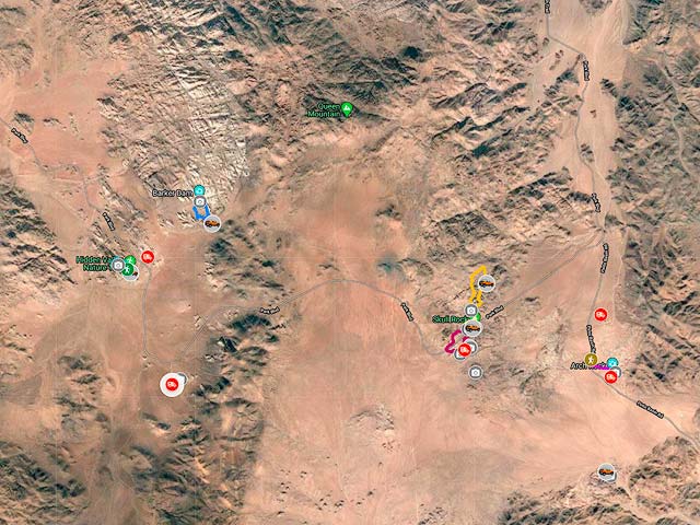
Google Map of Joshua Tree National Park
Here is an Google overview map of Joshua Tree showing some of the photo opportunities, trails, and campgrounds :
To view the map in Google Maps please click anywhere on the map above.
- Click to download a KMZ file (Note - in IE Right Click and choose Save Target as).
- Click to download a KML file (Note - KML Files do not include custom icons).
- Click to download a GPX file (Note - in IE Right Click and choose Save Target as).
Caltopo Map showing various Points of Interest
In addition to a Google Map of Joshua Tree National Park I have also added a Caltopo Map that can be accessed by clicking on the next icon. ![]() Caltopo maps have several advantages over Google maps and a few disadvantages. For most purposes Google Maps are more than adequate, but if you plan to do off-trail hiking Caltopo maps are preferable.
Caltopo maps have several advantages over Google maps and a few disadvantages. For most purposes Google Maps are more than adequate, but if you plan to do off-trail hiking Caltopo maps are preferable.
USGS 24K Topo Maps
Joshua Tree NP is covered by forty 24K topo maps. I've divided Joshua Tree into two sections, East and West, each containing twenty topo maps. For reference here is an image showing the names of all forty topo maps and their location. Individual topo maps can be downloaded from the table following this image, as can two merge maps covering the east and west sections.


