City of Rocks National Reserve
City of Rocks National Reserve is a rock climbing destination in the northwest. It is only about three hours from Salt Lake City making it the closest major rock climbing location to that city. Although it has been largely overlooked by photographers it is a worthy destination, especially in late October when the aspen are changing. It has a great many arches two of which are quite beautiful - Window Rock, and Turtle Rock Arch. The closest town is Almo which has limited services, just one motel and gas station, and two restaurants. Most people choose to camp within the park.
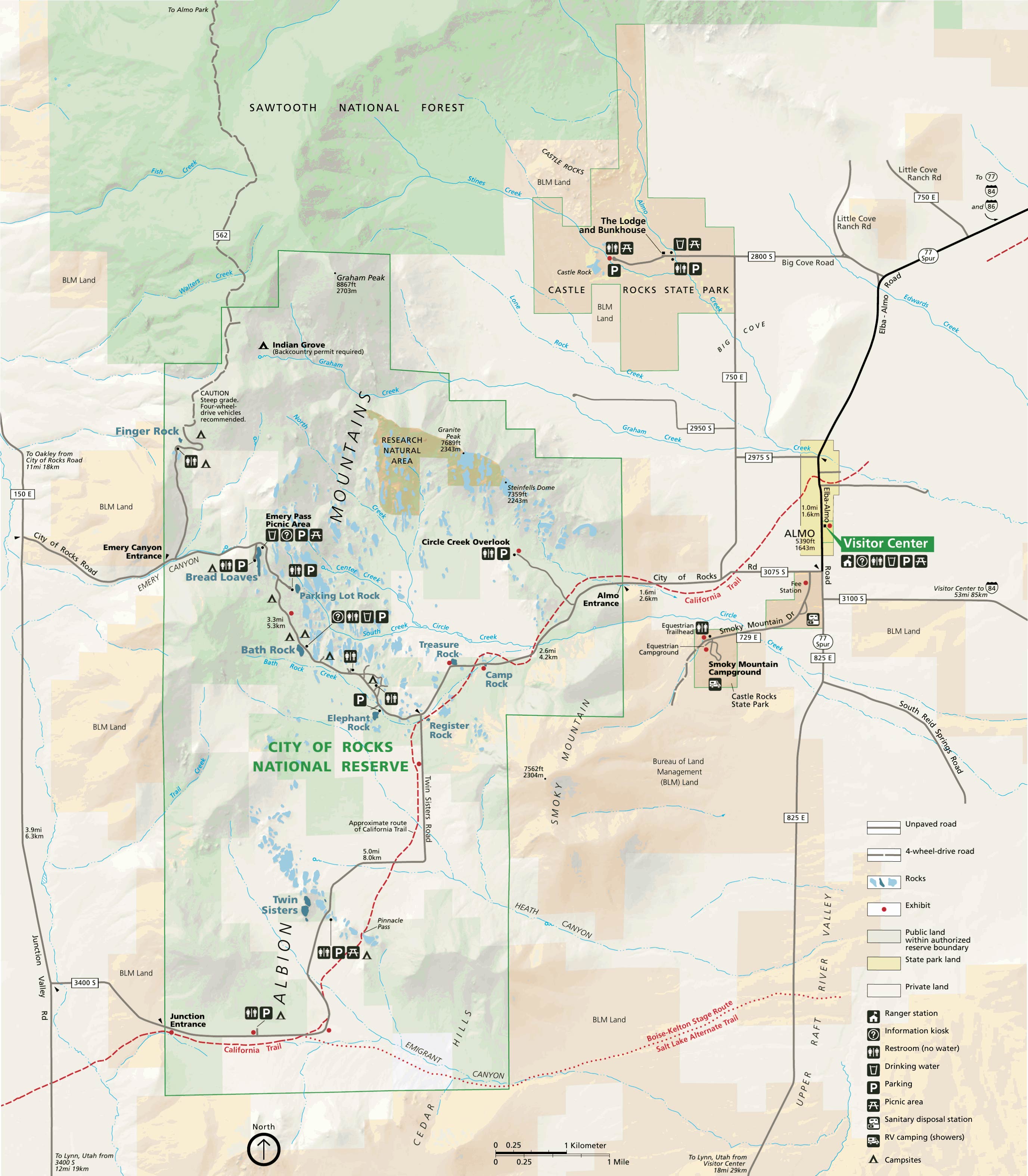
Below is the official City of Rocks National Reserve map as a jpeg and in three geocoded formats, as a GeoTIFF, as a KMZ file, and in Oruxmaps format. The official park map as a Geo PDF can be found here.
- Click to download a GeoTiff file viewable in PDF Maps
- Click to download a KMZ file viewable in Google Earth
- Click to download an Oruxmap file (Note - in IE Right Click and choose Save Target as)
A trail map of the park can be found at the Idaho Parks and Recreation website. The map is not geocoded.
When to Go
City of Rocks is primarily a rock climbing destination but there are also many trails for hiking. With its many arches and spires it is also a very good but largely overlooked destination for photography. City of Rocks is open every day of the year but many services are closed in the winter months. The visitor center is open seven days a week except during the winter when it is open Tuesday through Saturday. The visitor center is closed on federal holidays during the winter. The months of May through October are the busiest in the park with visitation peaking in May.
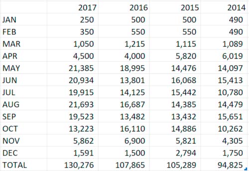
Monthly visitor counts for the last four years
City of Rocks Climate (°F)
September and October are perhaps the best months for photography with moderate temperatures, clear skies, and the fewest overcast days. October brings cooler temperatures and, more importantly, in the latter part of the month the aspens change color.
City of Rocks climate data can be found at the following websites:
Landmarks and Shooting Locations
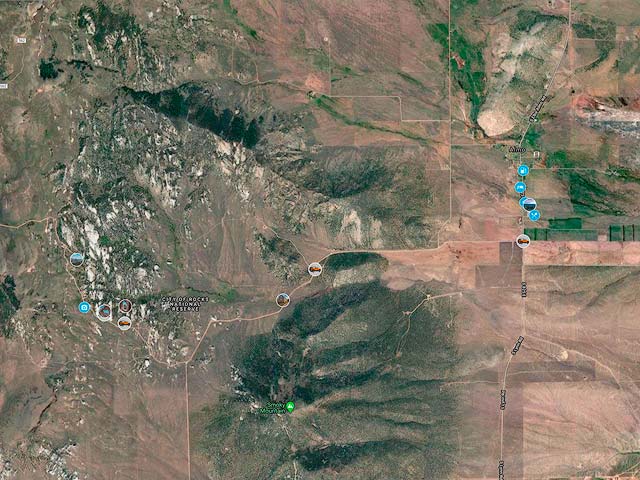
To view the map in Google Maps please click anywhere on the map above.
USGS 24K Topo Maps
City of Rocks is largely covered by the Almo USGS 24K topo map. For completeness I have also included topo maps for the surrounding area to the west.
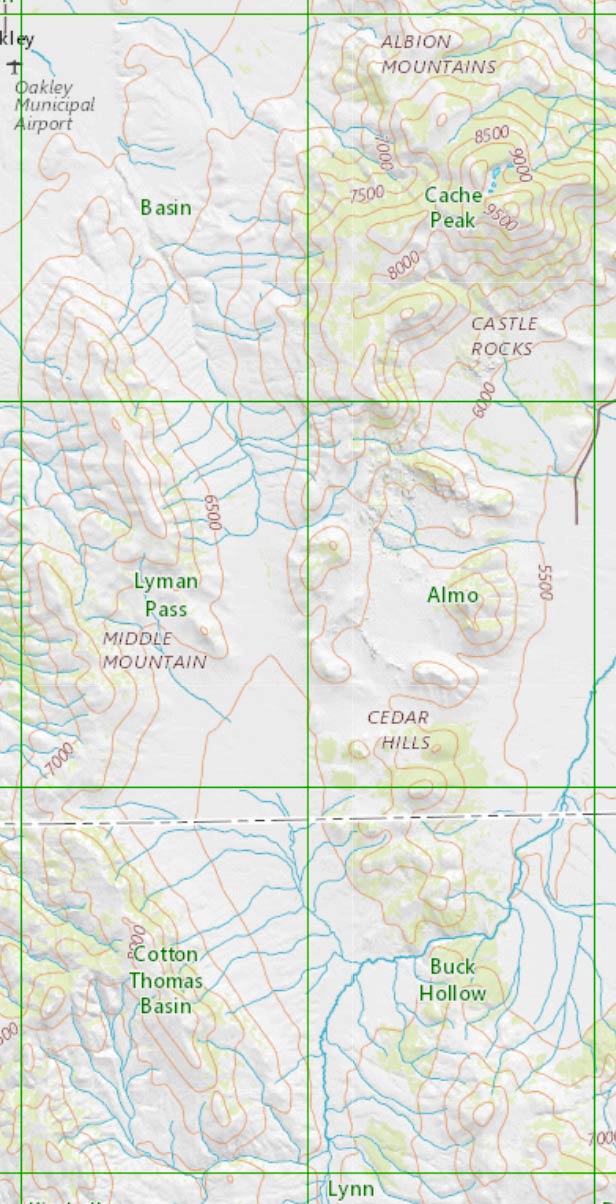
These maps together with a merged map can be downloaded in a variety of formats by clicking or right-clicking below:
| Geo Tiff/Avenza | KMZ | Oruxmaps | KMZ Decollared | Oruxmap Decollared | Avenza Decollared |
| Almo | KMZ | Oruxmap | KMZ Decollared | Oruxmap Decollared | Avenza Decollared |
| Basin | KMZ | Oruxmap | KMZ Decollared | Oruxmap Decollared | Avenza Decollared |
| Buck Hollow | KMZ | Oruxmap | KMZ Decollared | Oruxmap Decollared | Avenza Decollared |
| Cache Peak | KMZ | Oruxmap | KMZ Decollared | Oruxmap Decollared | Avenza Decollared |
| Cotton Thomas Basin | KMZ | Oruxmap | KMZ Decollared | Oruxmap Decollared | Avenza Decollared |
| Lyman Pass | KMZ | Oruxmap | KMZ Decollared | Oruxmap Decollared | Avenza Decollared |
| Merge of all six maps | NA | NA | KMZ Decollared | Oruxmap Decollared | Avenza Decollared |